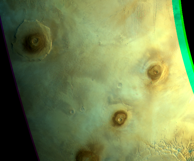
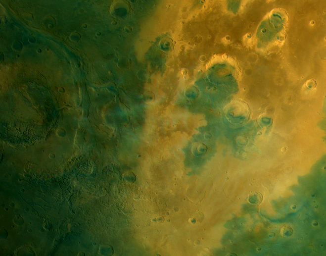
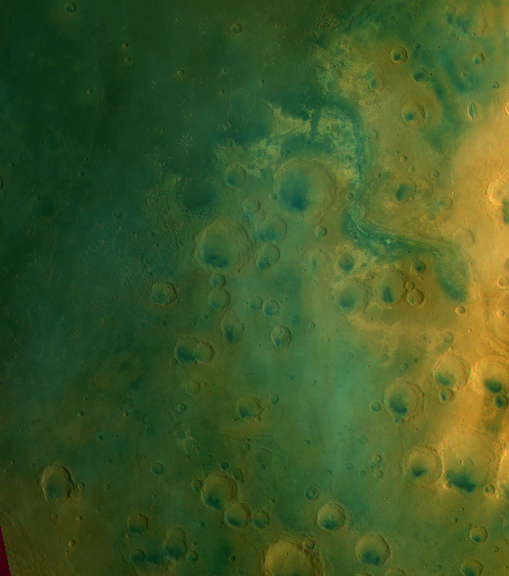
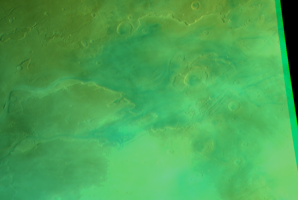
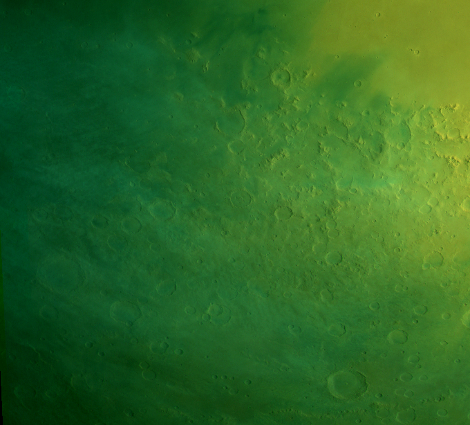
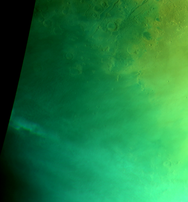
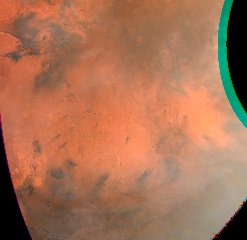
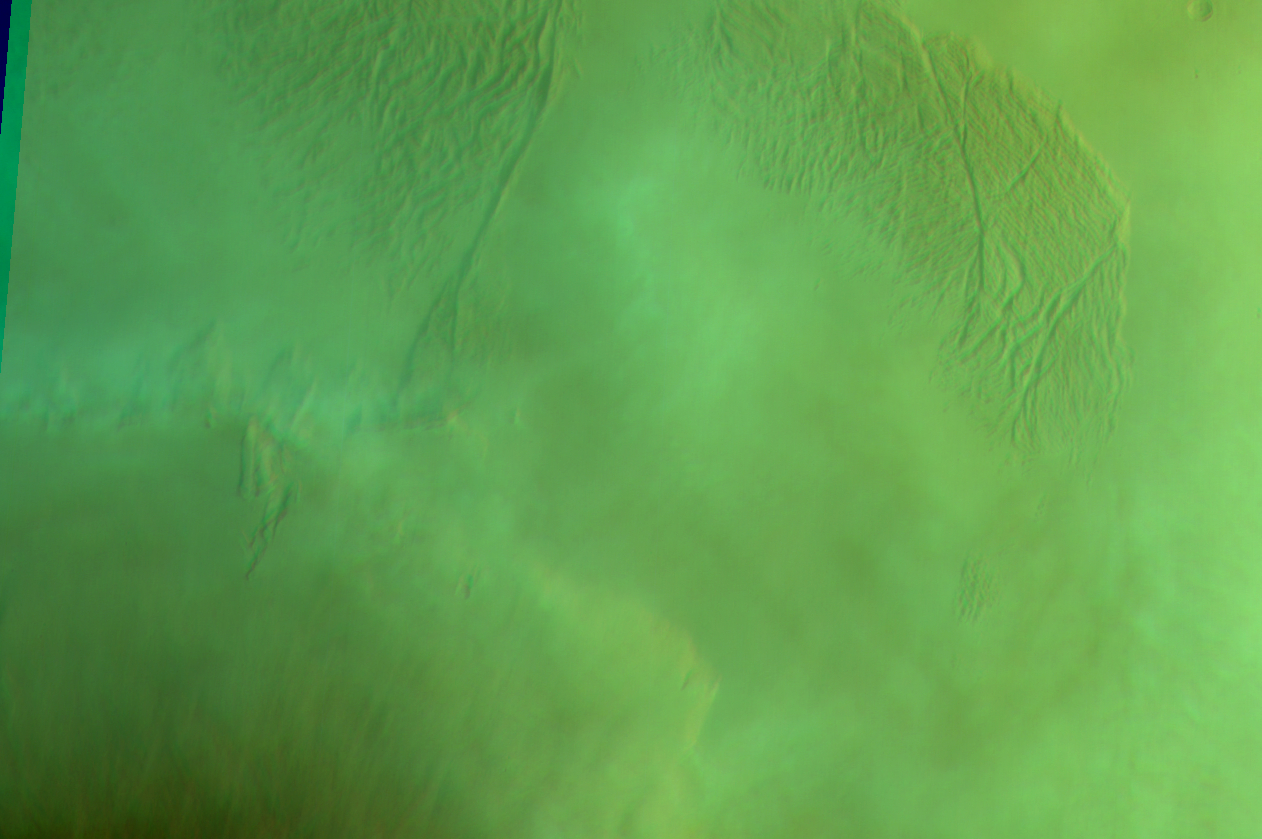
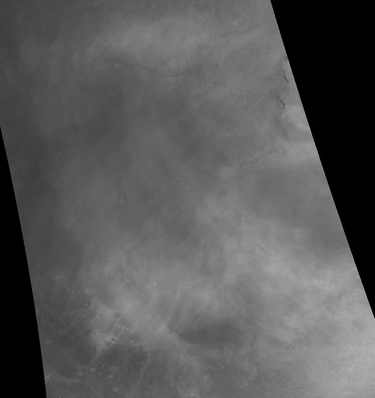
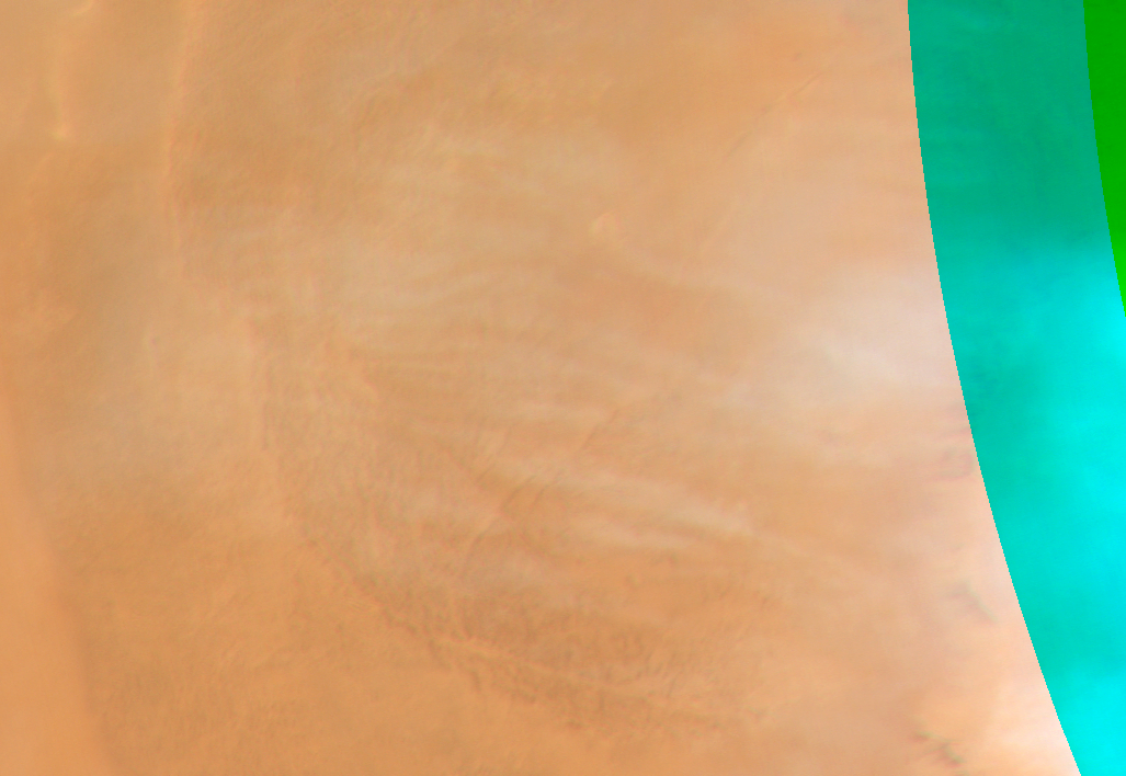
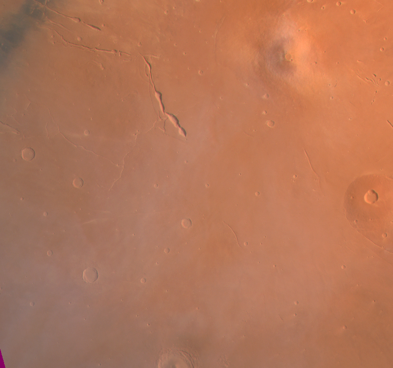
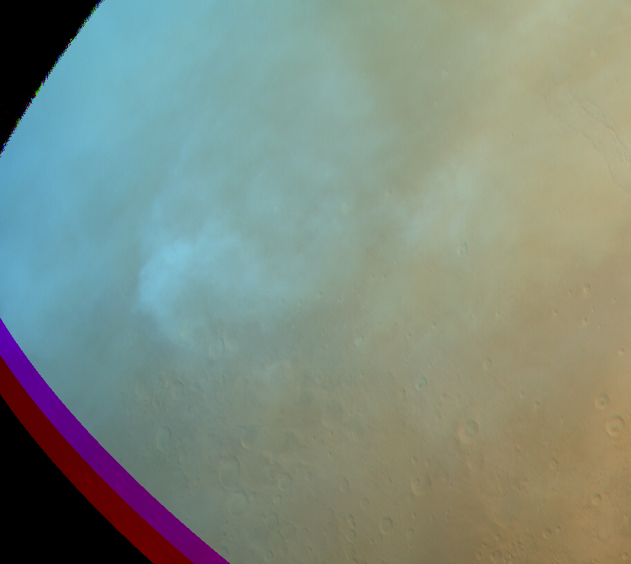
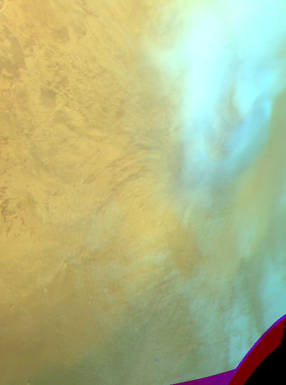
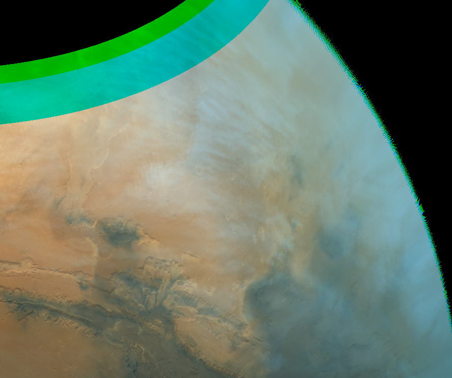
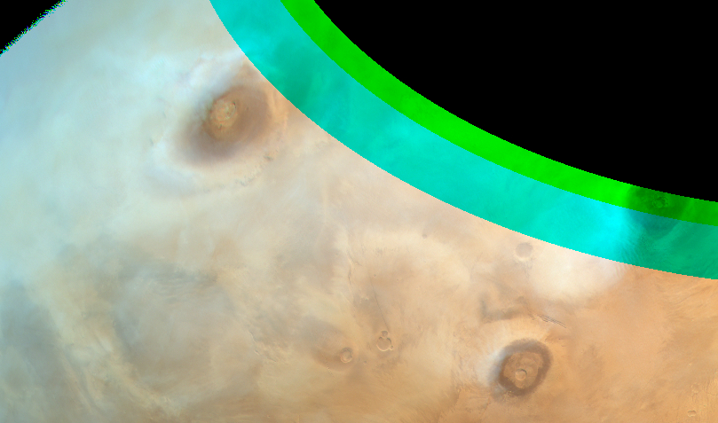
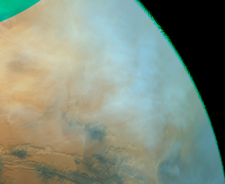
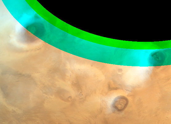
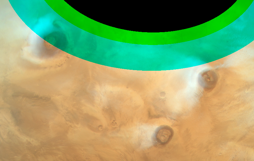
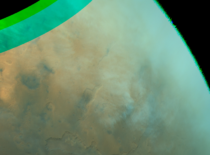
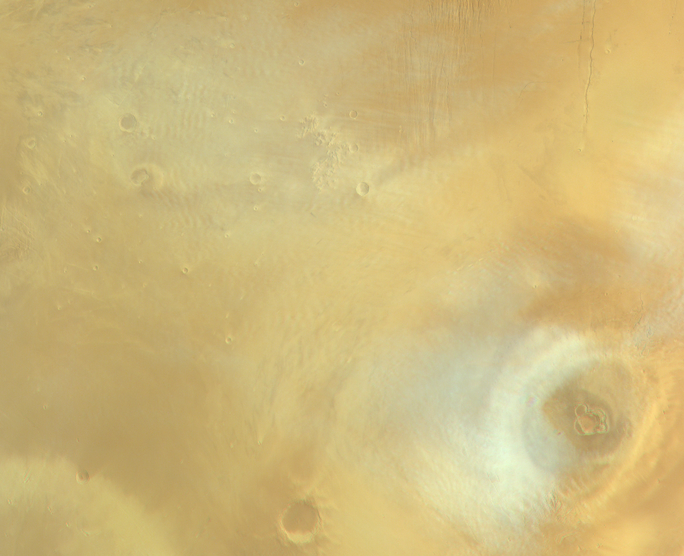
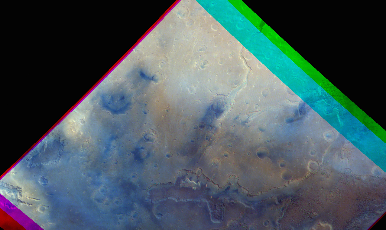
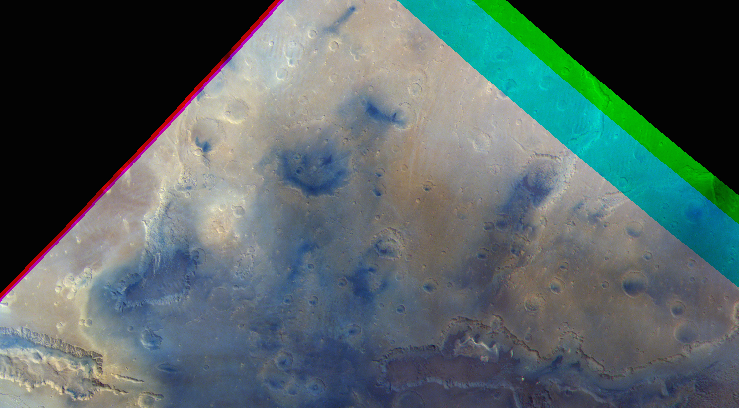
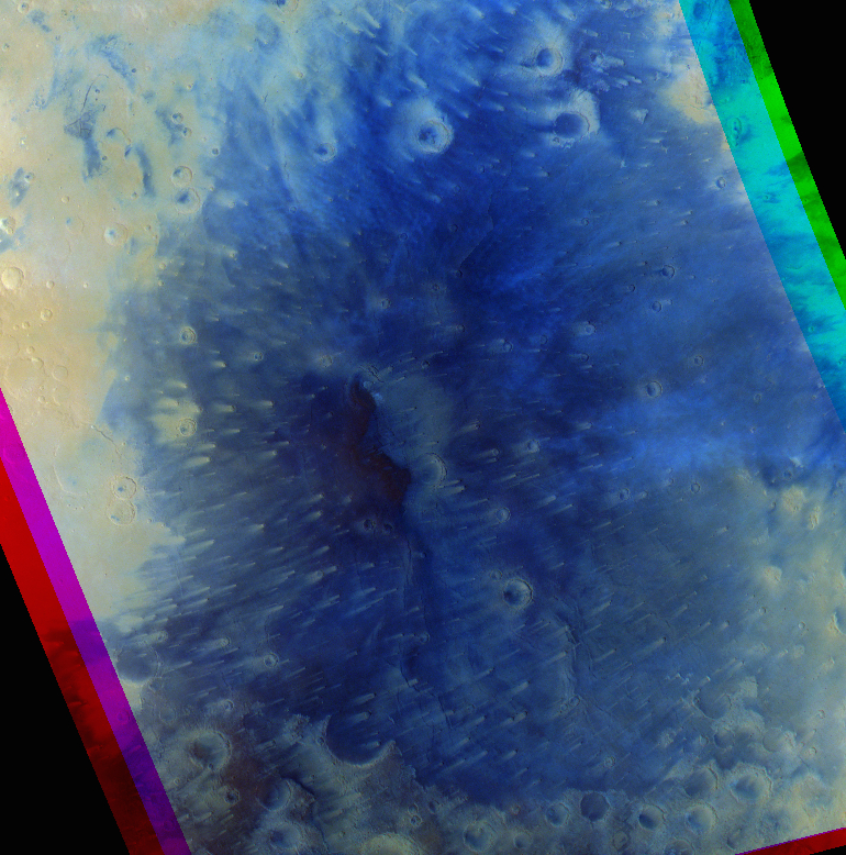
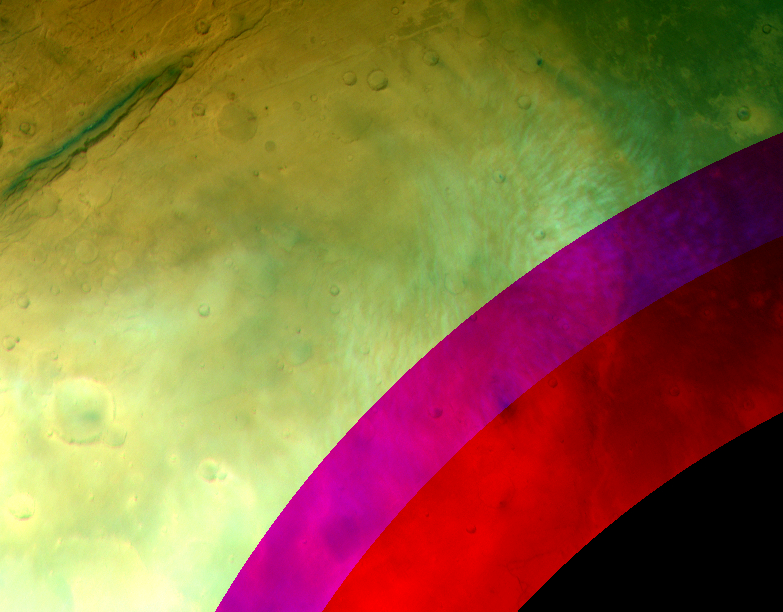
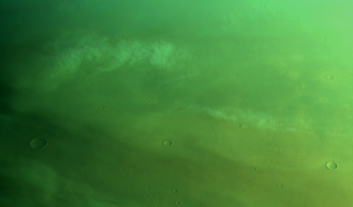
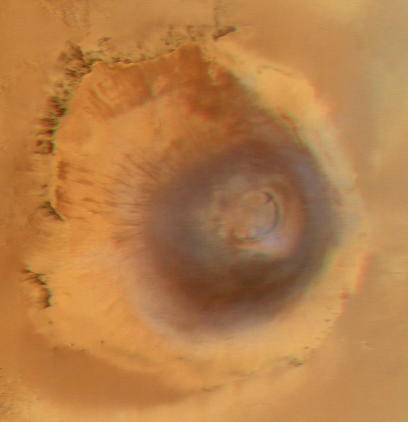
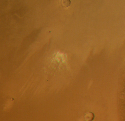
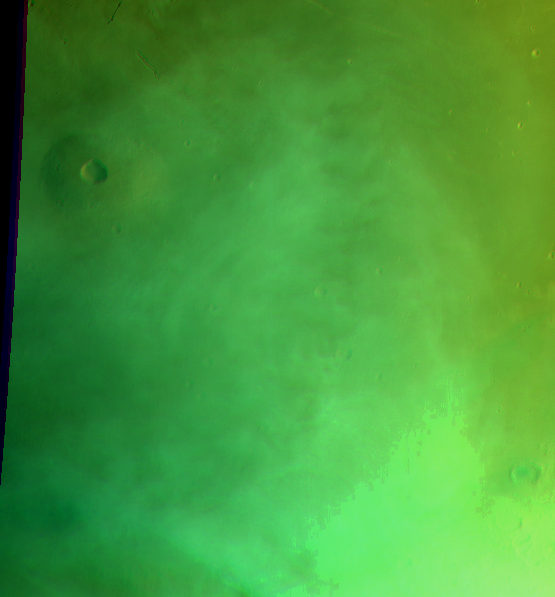
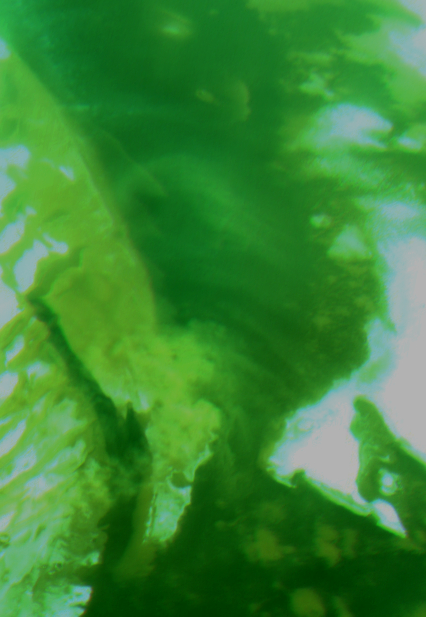
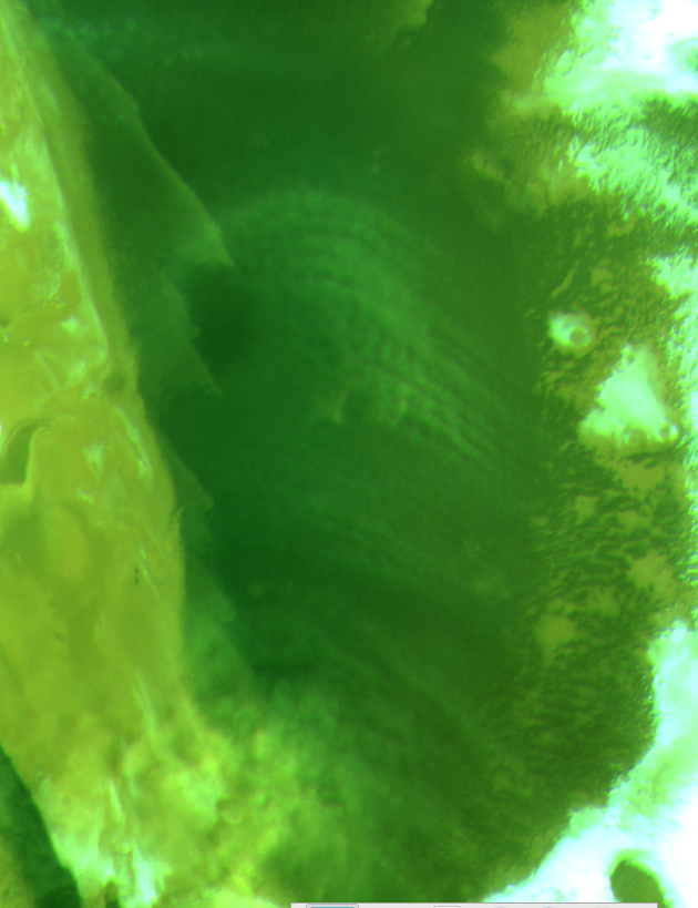
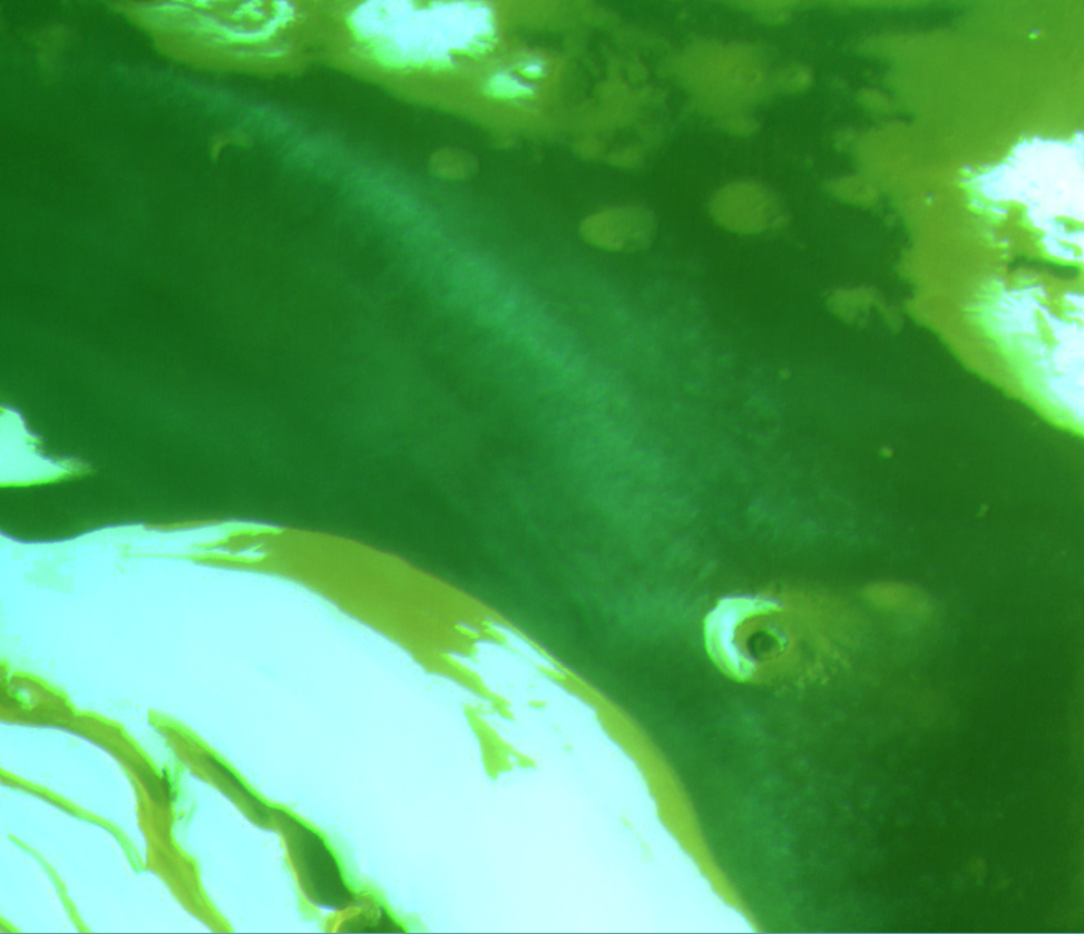
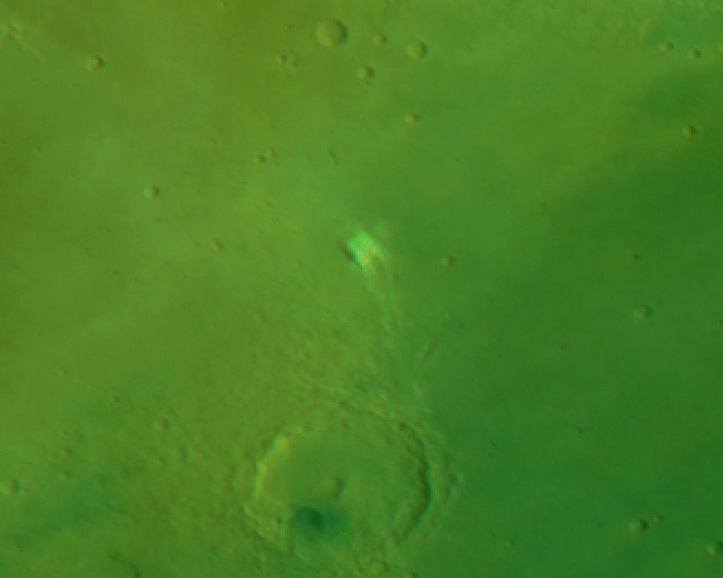
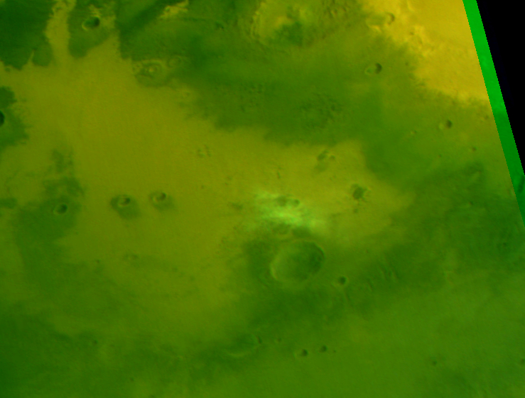
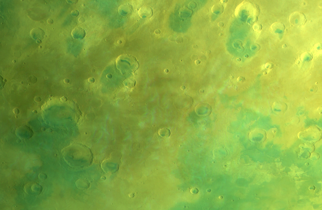
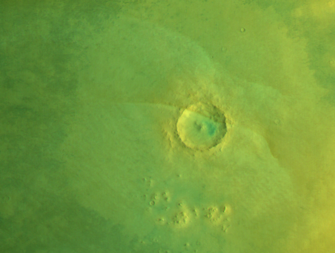
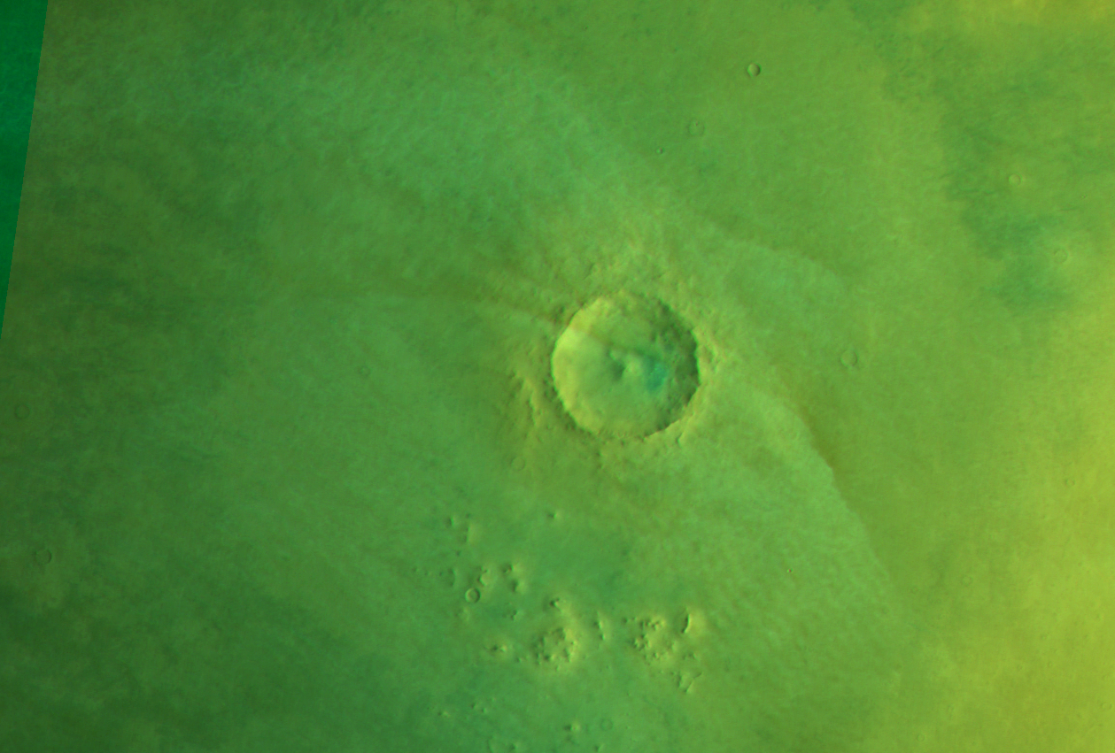
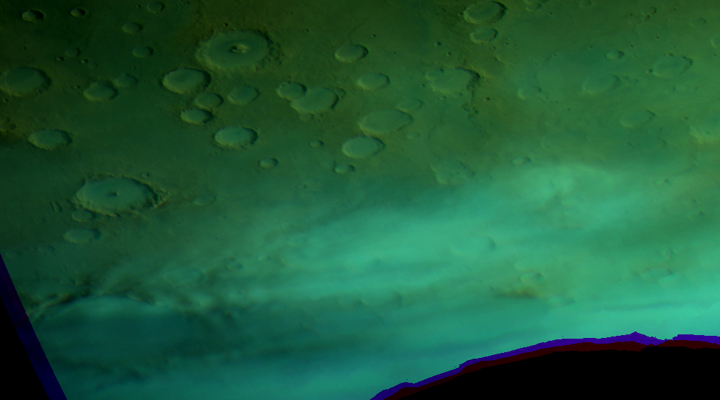
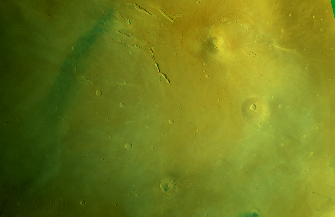
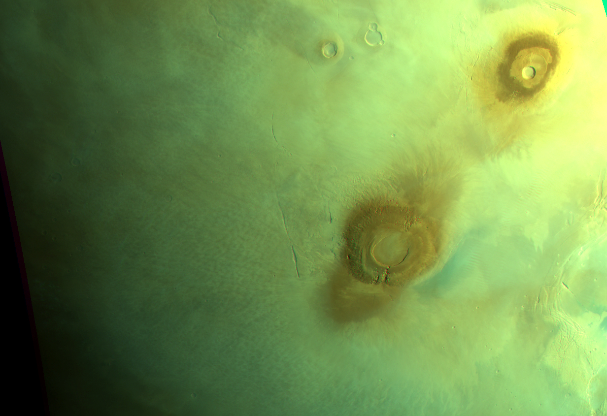
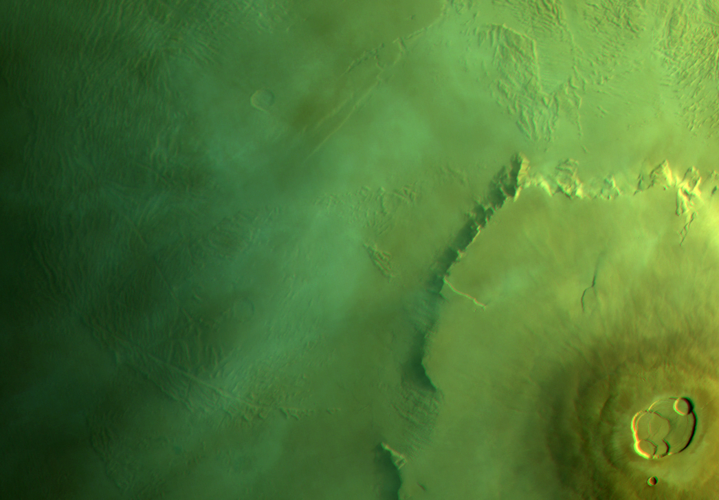
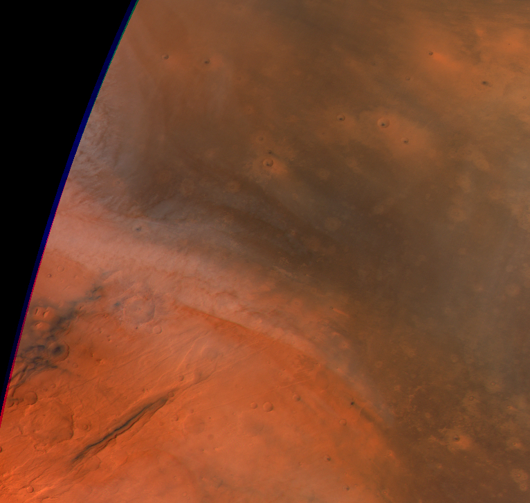
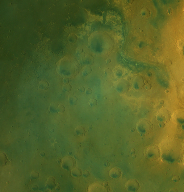
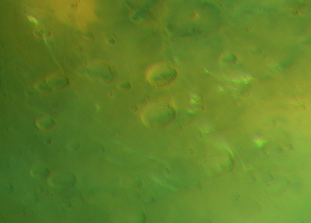
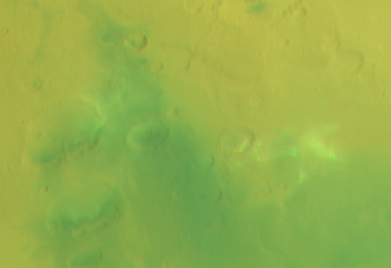
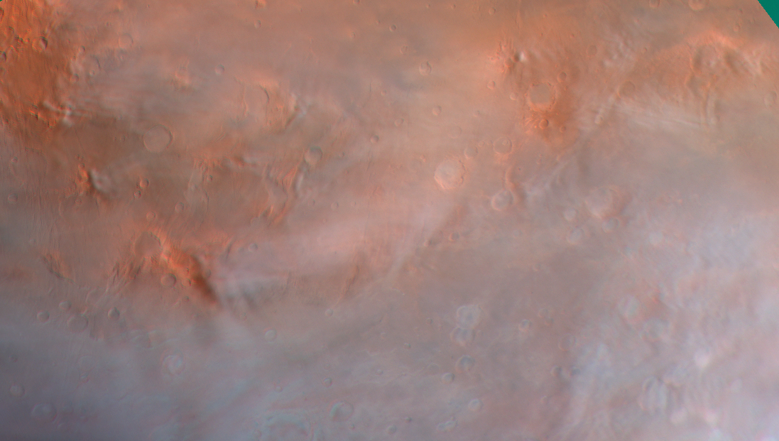
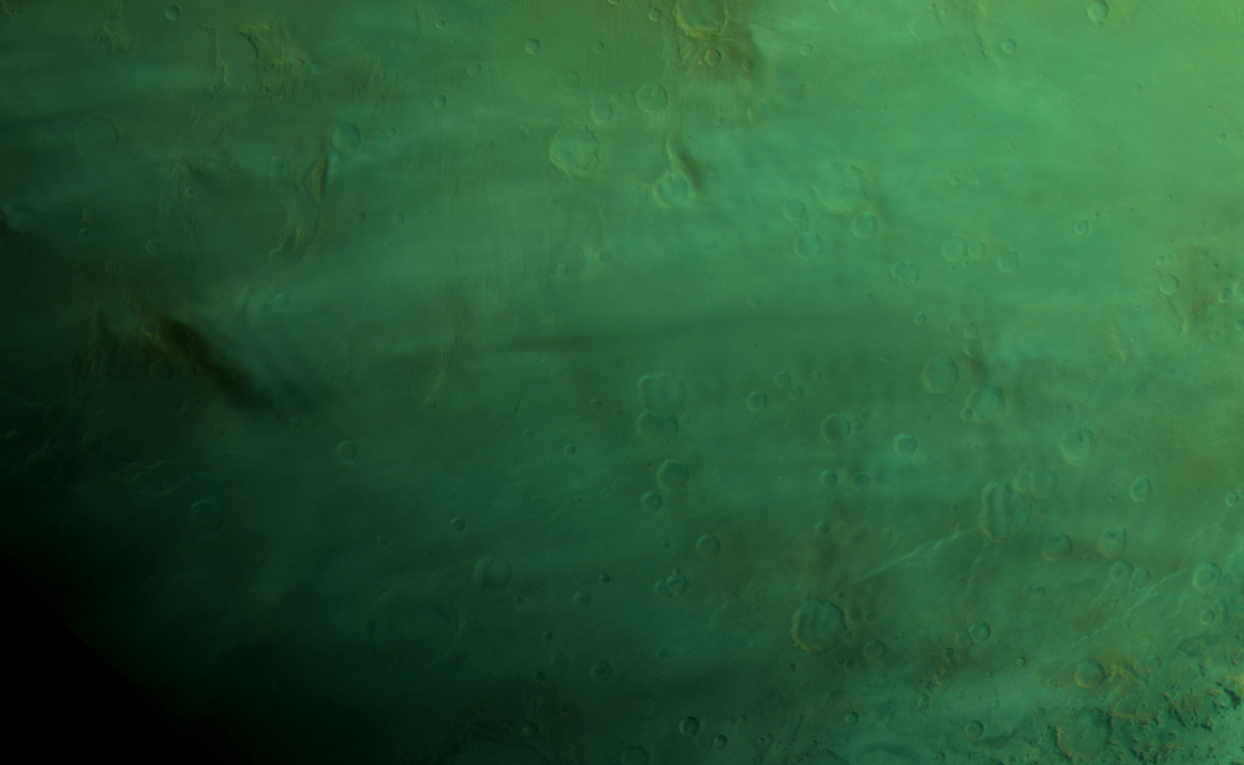
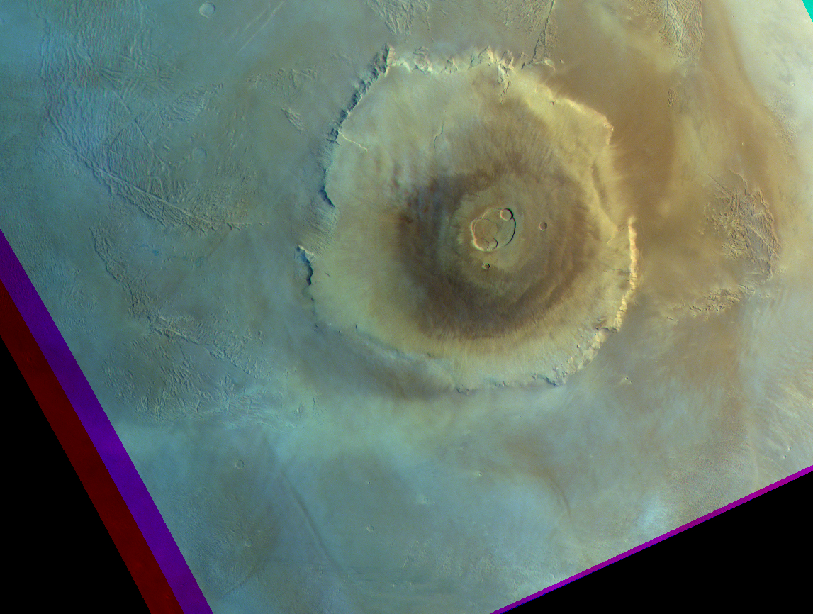
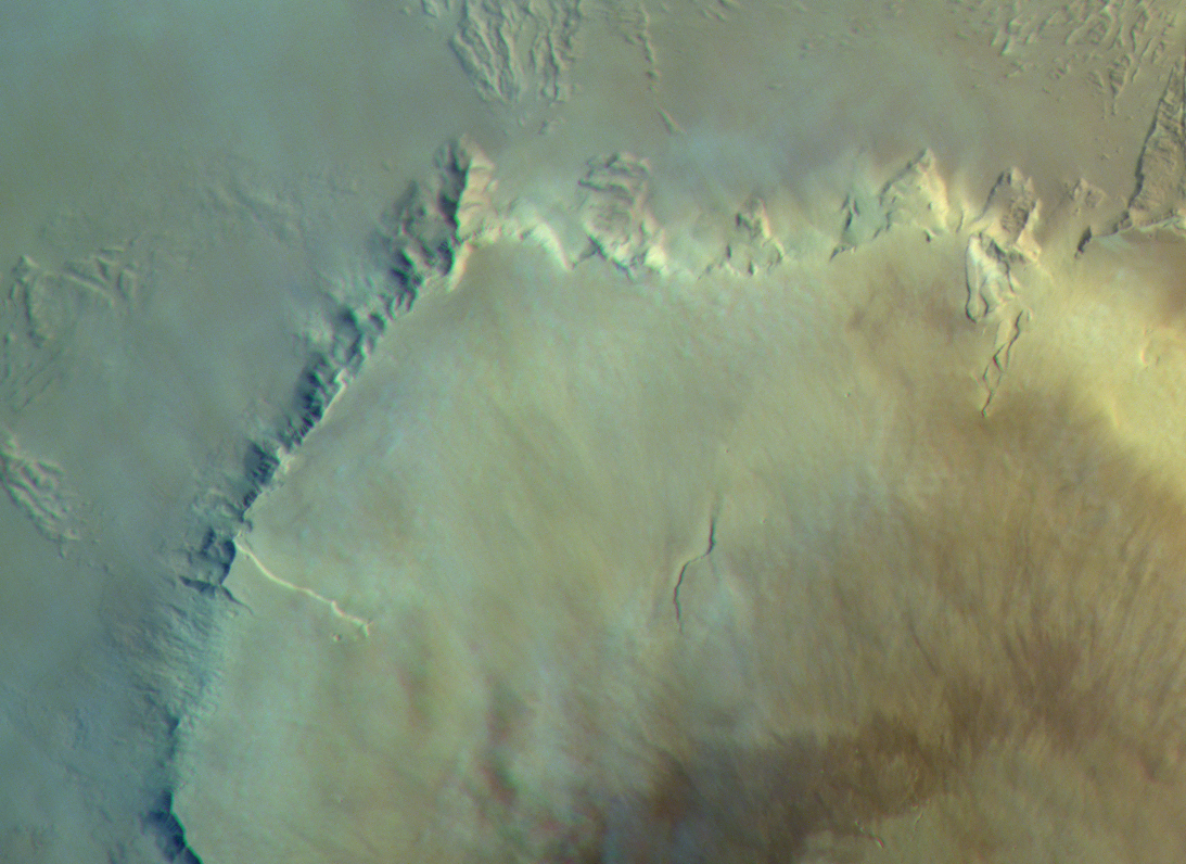
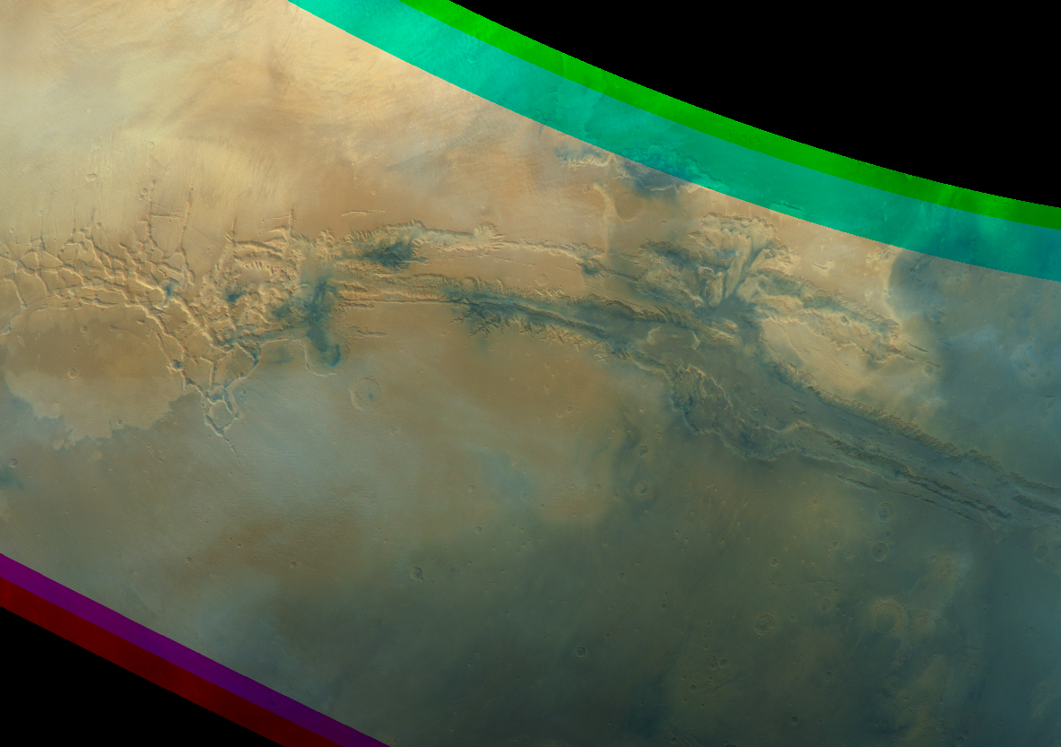
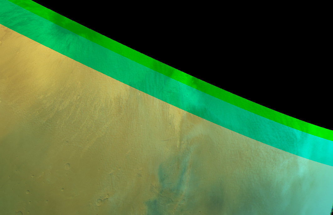
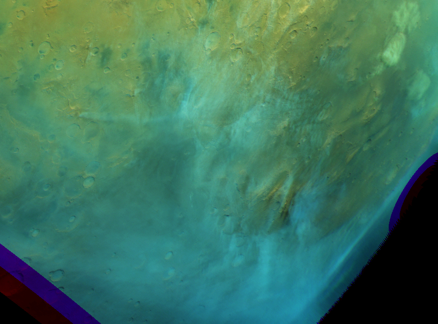
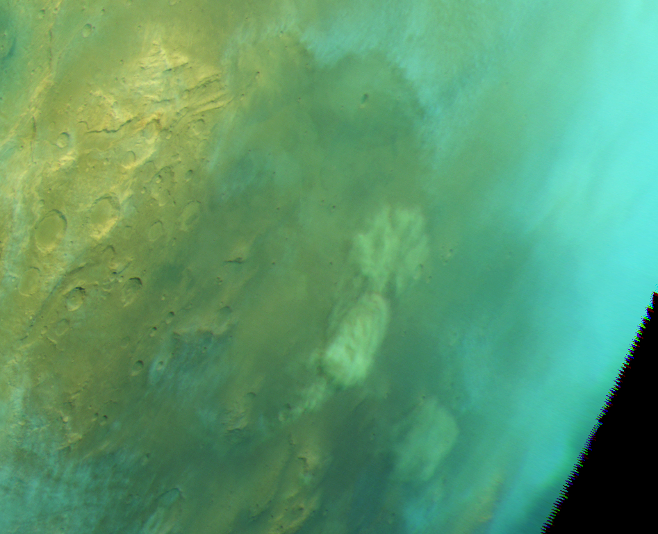
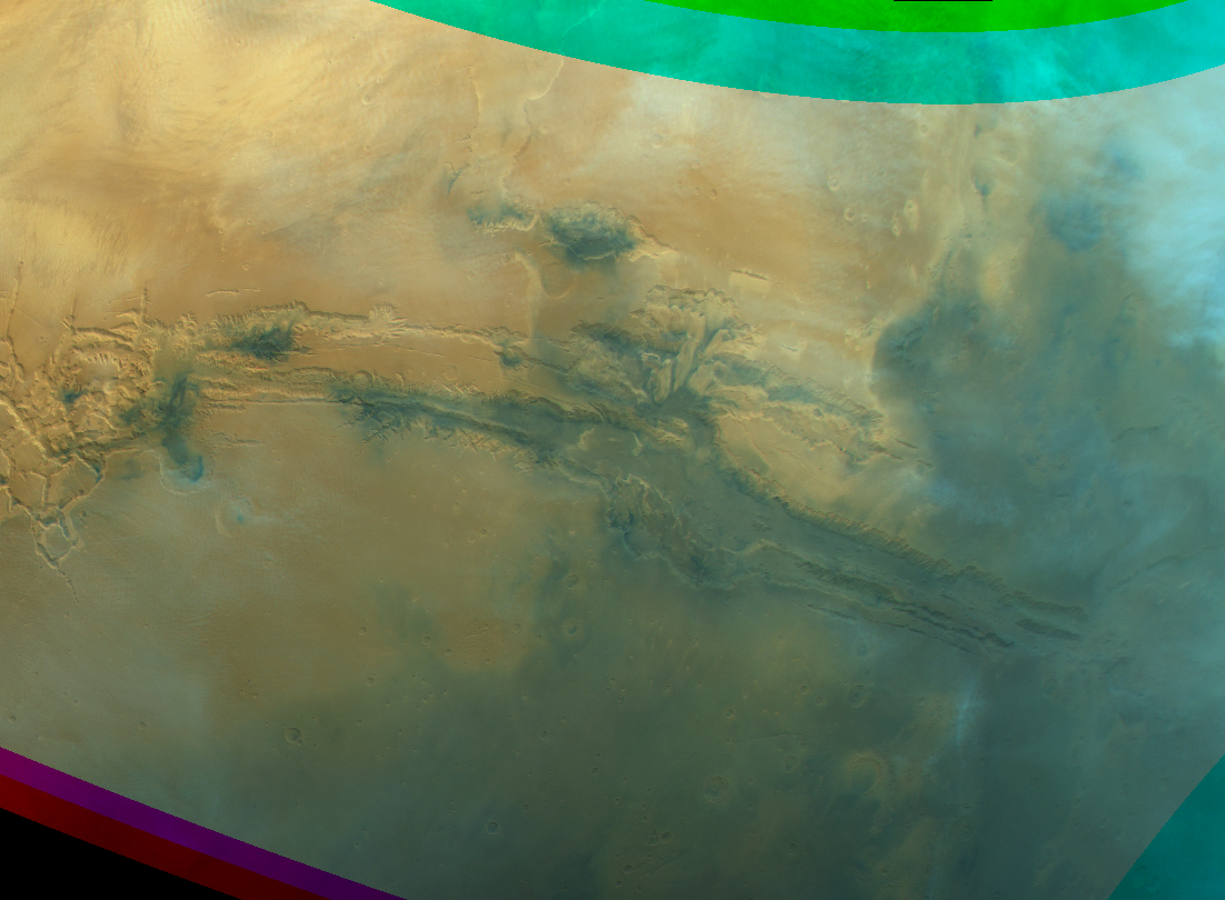
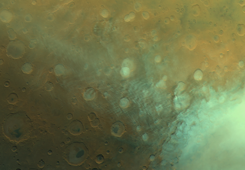
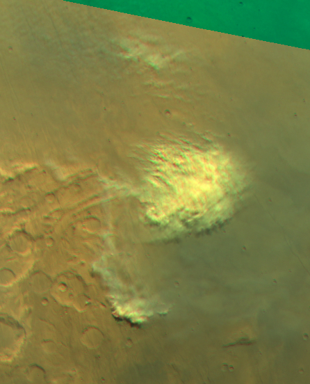
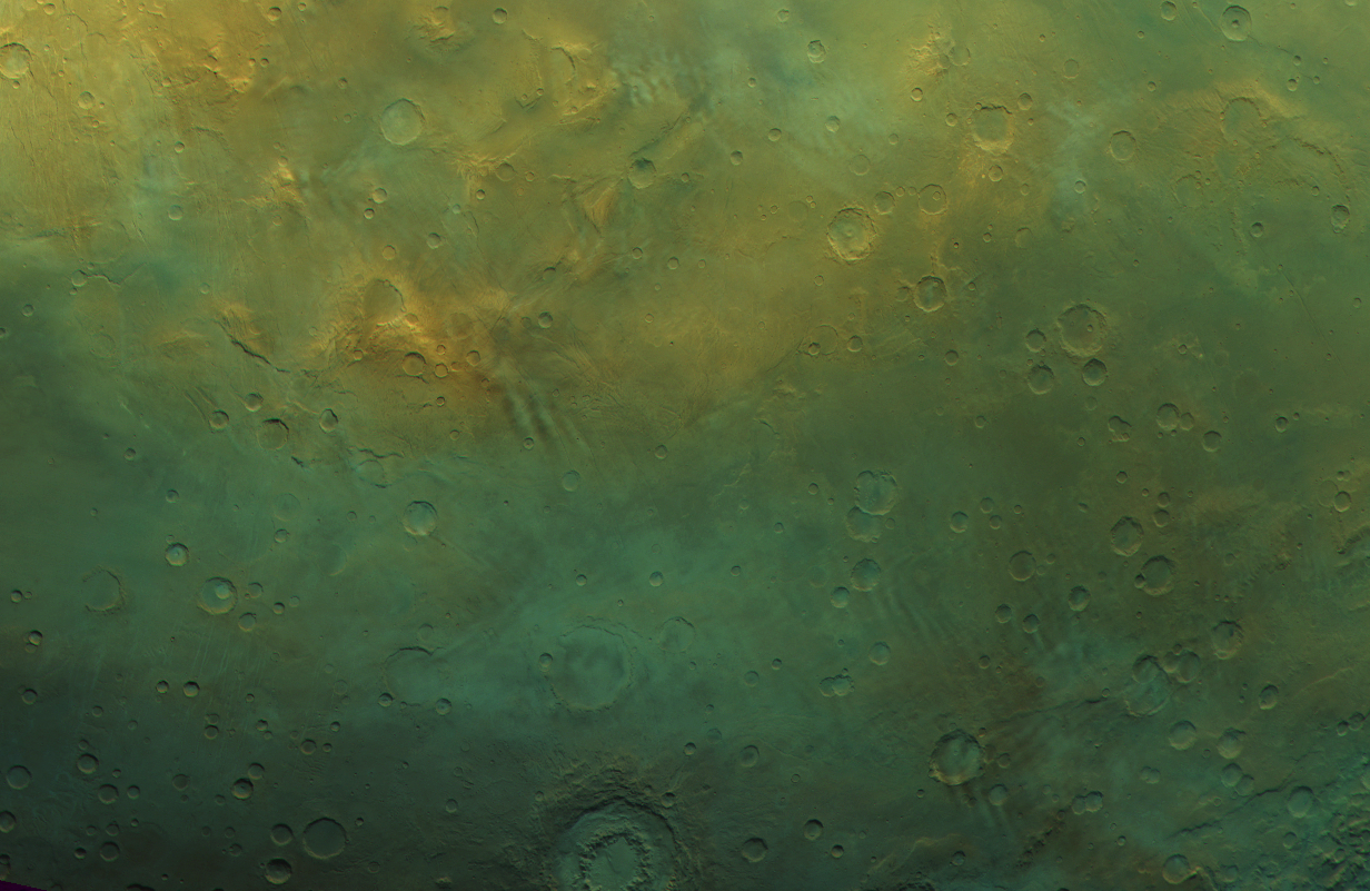
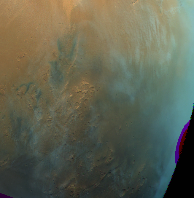
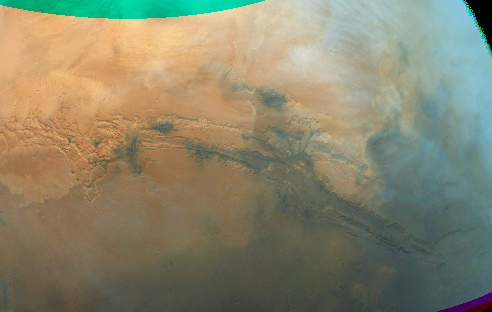
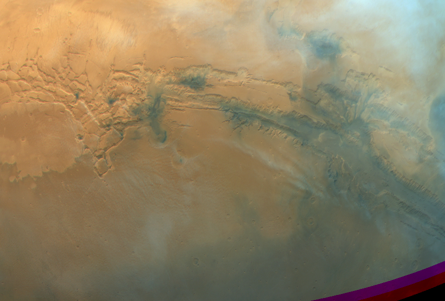
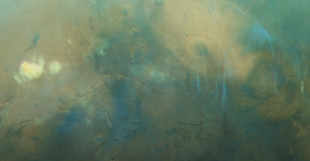
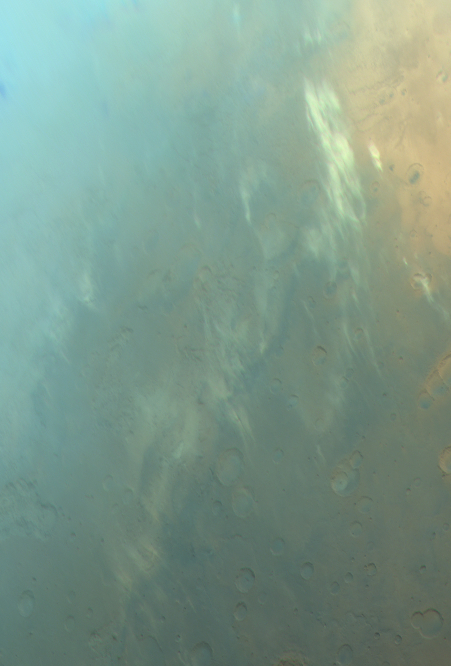
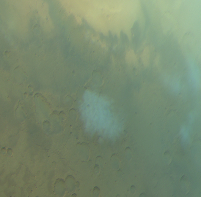
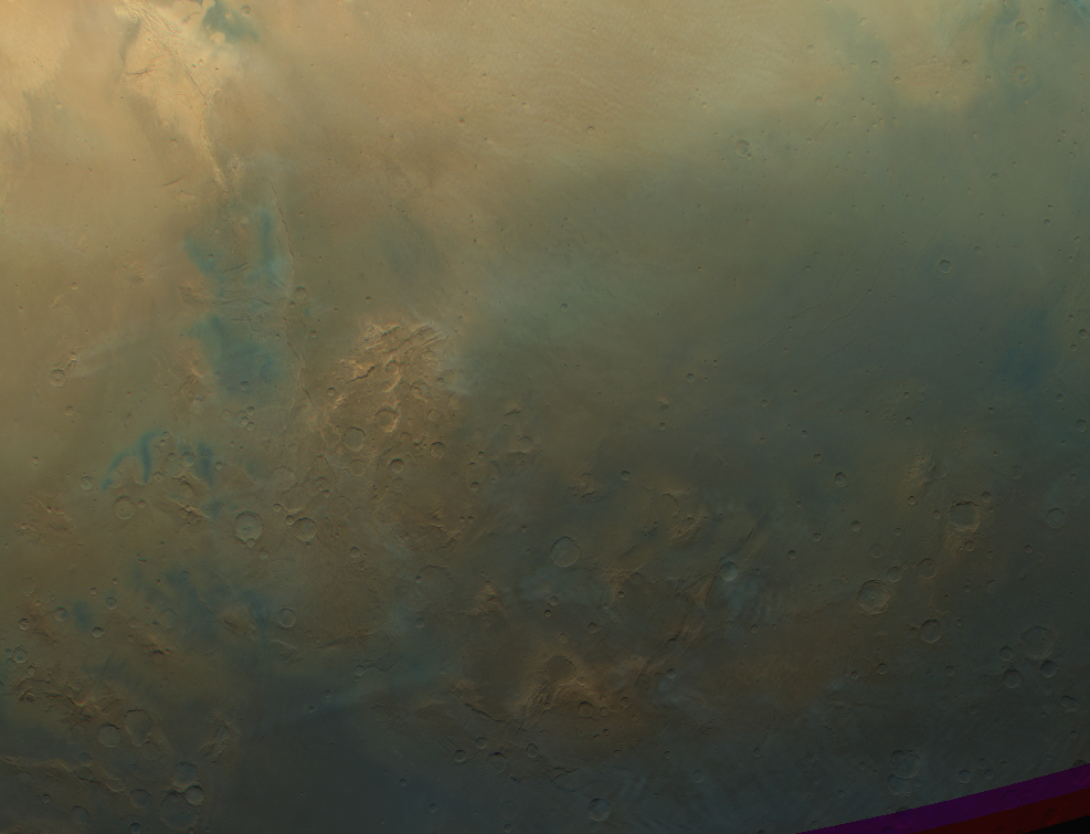
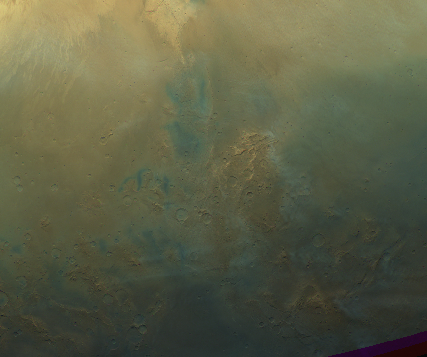
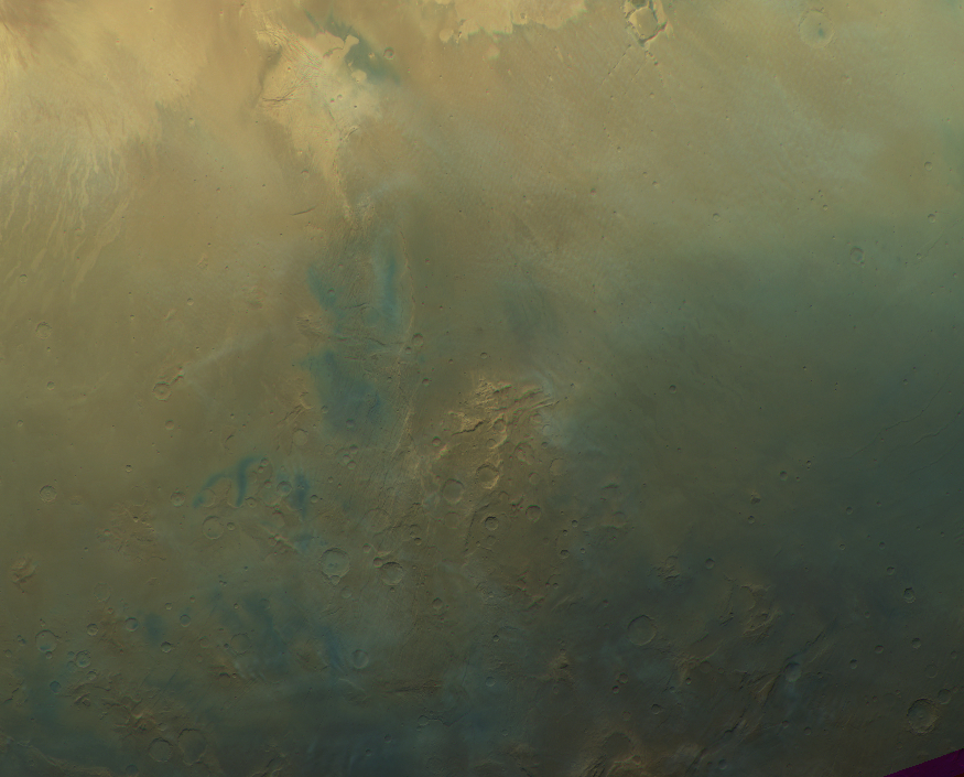
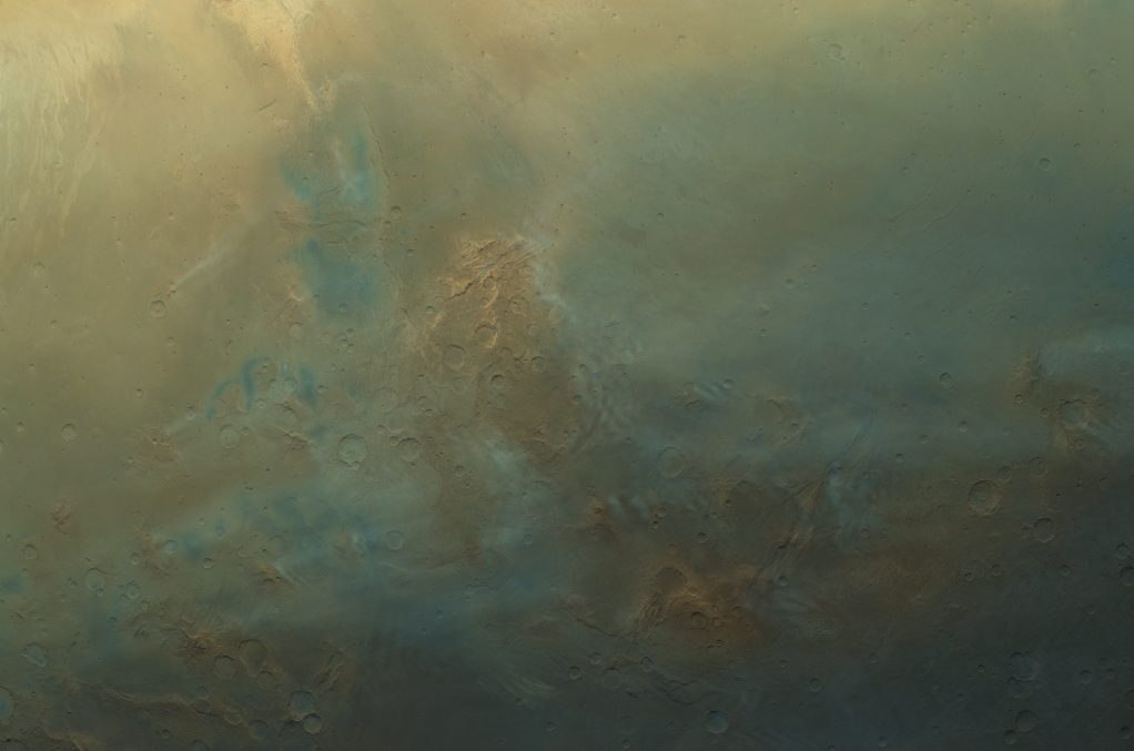
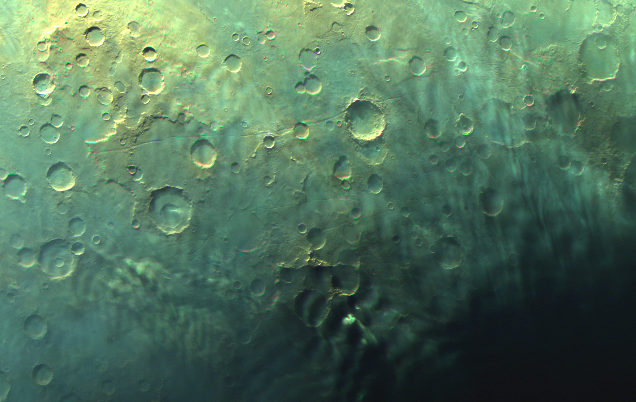
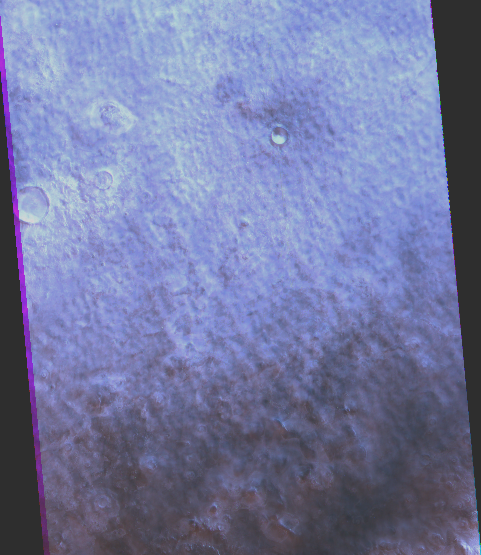
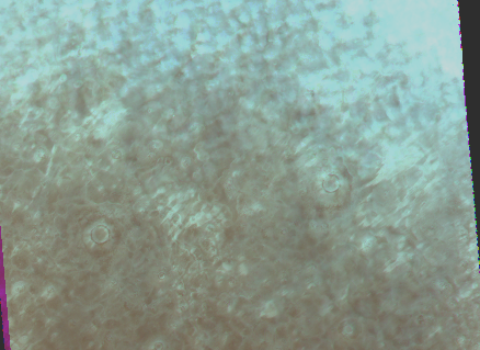
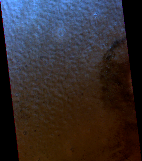
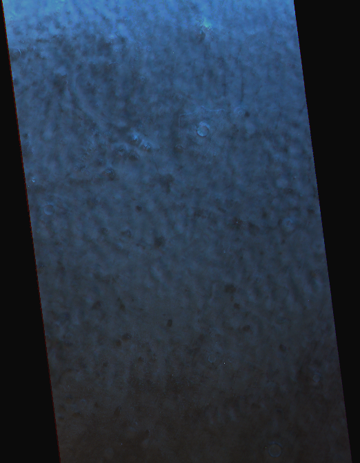
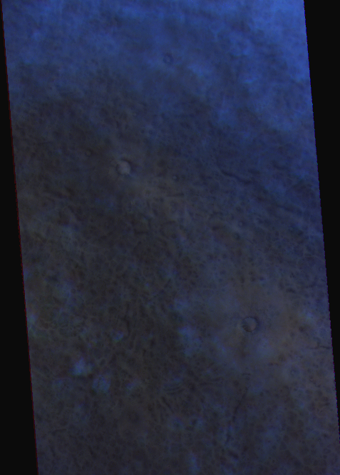
Cloud Atlas of Mars
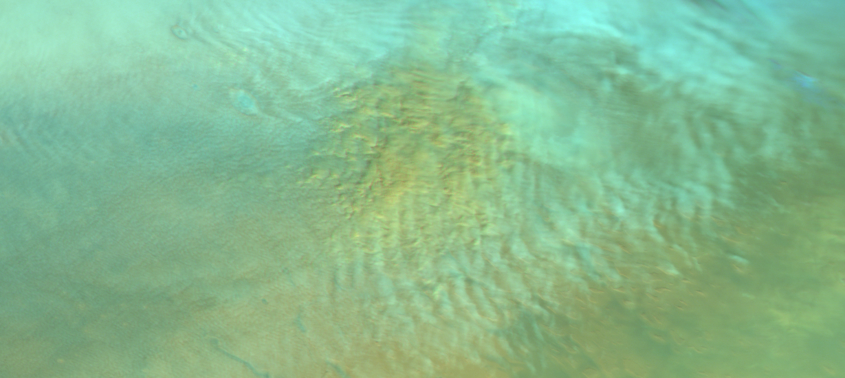
Alternative visualization of the Cloud Atlas of Mars database, presented at the Europlanet Science Congress (EPSC) 2024 in Berlin by Daniela Tirsch of DLR.
The images in the Cloud Atlas have been captured by the High Resolution Stereo Camera (HRSC) instrument, which is on board the European Space Agency (ESA) Mars Express spacecraft.
Source data from https://hrscteam.dlr.de/public/data.php
Index: #
Locations #
Click on a marker to see the corresponding picture.
Cloud Types #
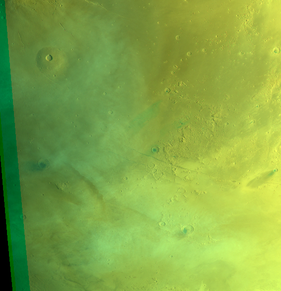
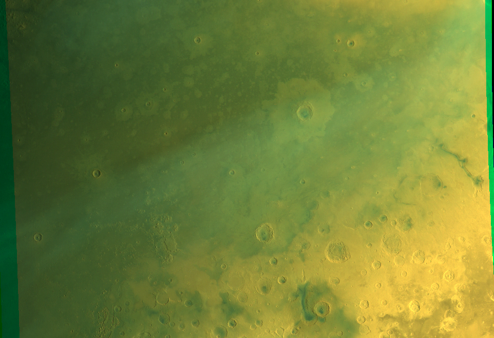
CT-1 #
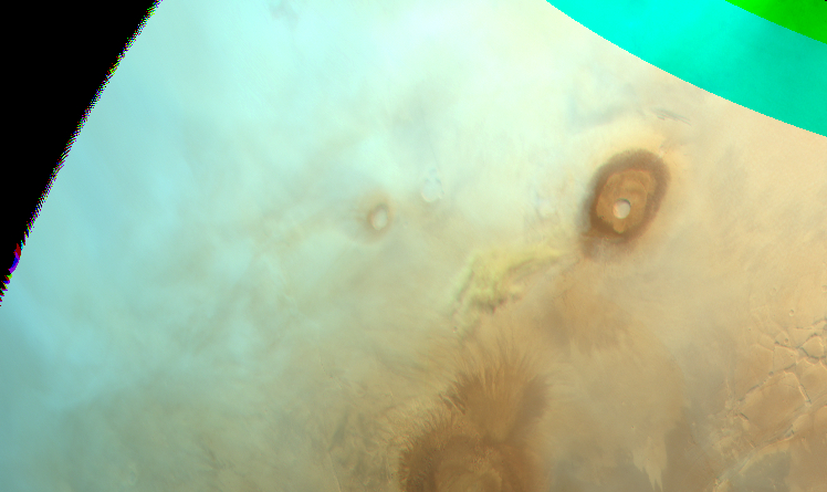
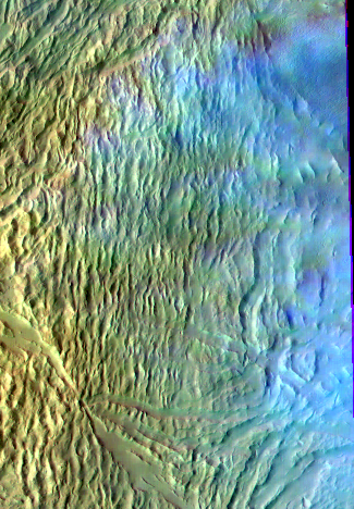
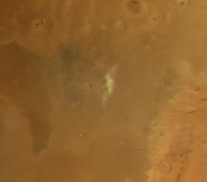
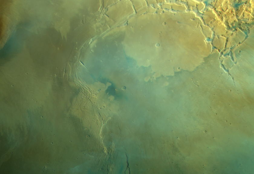
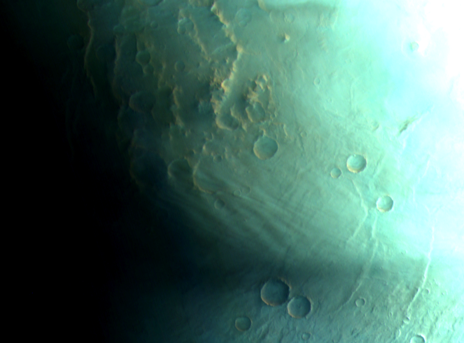
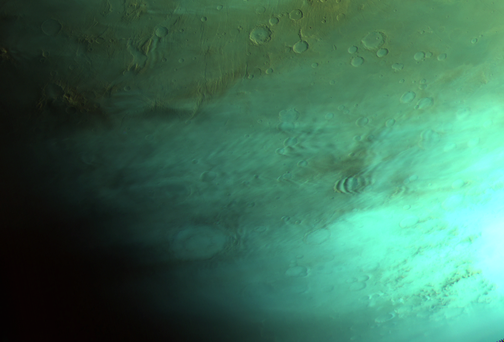
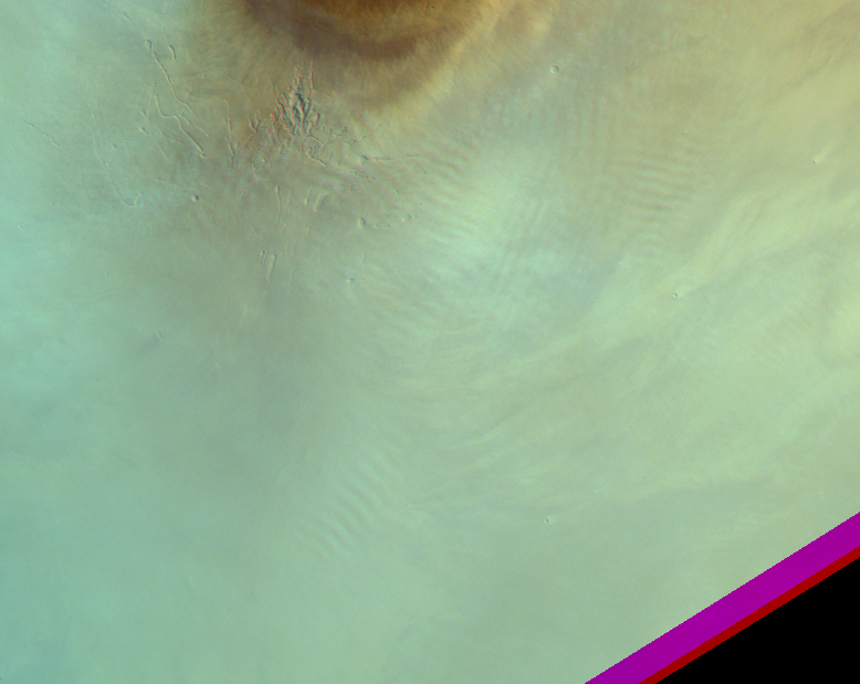
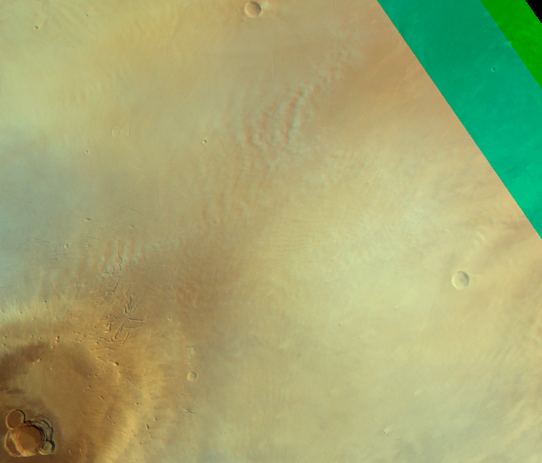
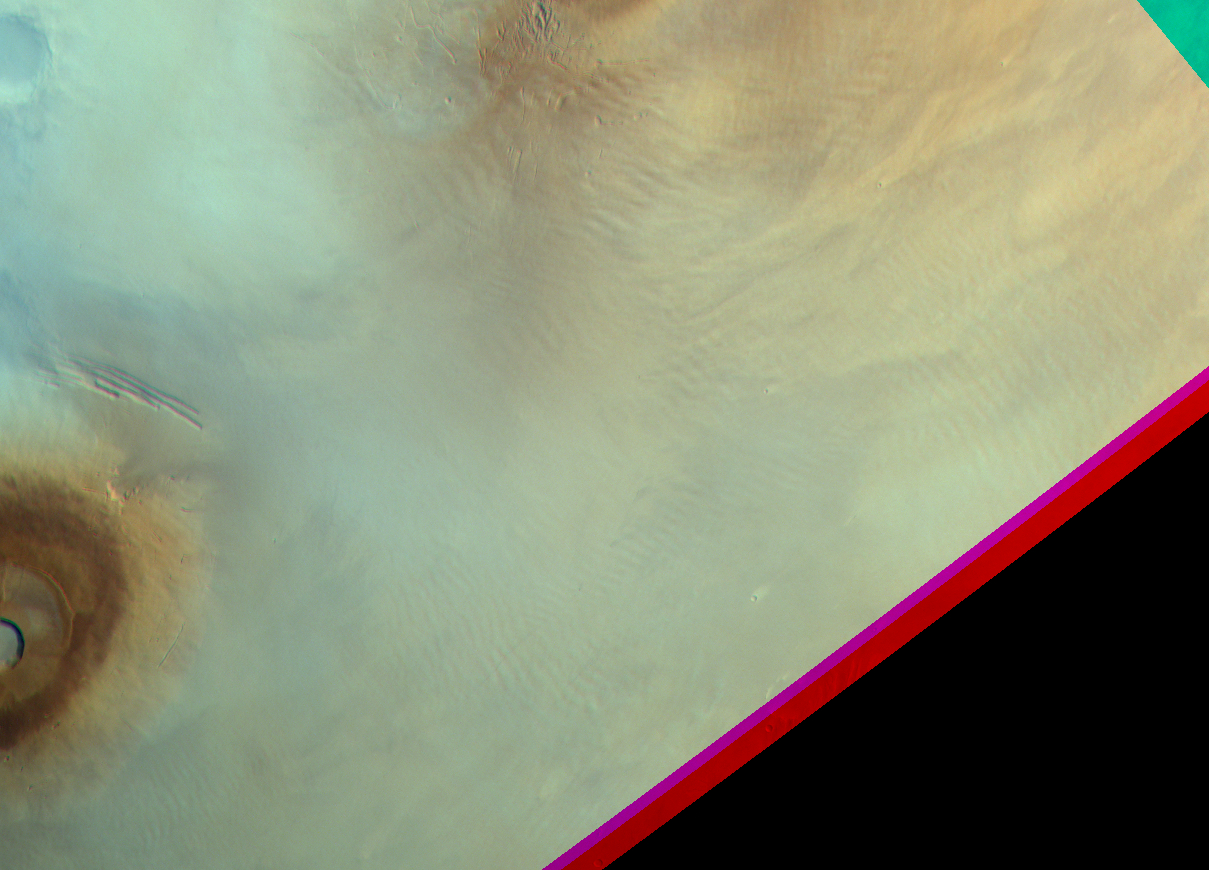
Cirrus clouds at Tharis volcanoes. Map.
| Orbit Number | 25000 |
|---|---|
| Latitude | 4.23 |
| Longitude [E/W] | -118.23 |
| Longitude [E] | 241.77 |
| Ls | 135.7 |
| Date | 2023-10-20 00:00:00 |
| Local time | 07:54:00 |
| Cirrus Clouds | cirrus clouds |
| Lee Waves | |
| Gravity Clouds | |
| ACB | ACB |
| Cloud Streets | |
| Elongated Dust Clouds | |
| Cumulus Cloud Sheet | |
| Plume | |
| Undefined | |
| Observation Type | Broom |
| Potentially Moving | |
| Spalte1 |
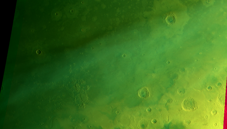
CT-2 #
Cirrus near Aram Chaos. Map.
| Orbit Number | 24978 |
|---|---|
| Latitude | 2.32 |
| Longitude [E/W] | -14.04 |
| Longitude [E] | 345.96 |
| Ls | 132.5 |
| Date | 2023-10-13 00:00:00 |
| Local time | 08:17:00 |
| Cirrus Clouds | cirrus clouds |
| Lee Waves | |
| Gravity Clouds | |
| ACB | ACB |
| Cloud Streets | |
| Elongated Dust Clouds | |
| Cumulus Cloud Sheet | |
| Plume | |
| Undefined | |
| Observation Type | Broom |
| Potentially Moving | |
| Spalte1 |
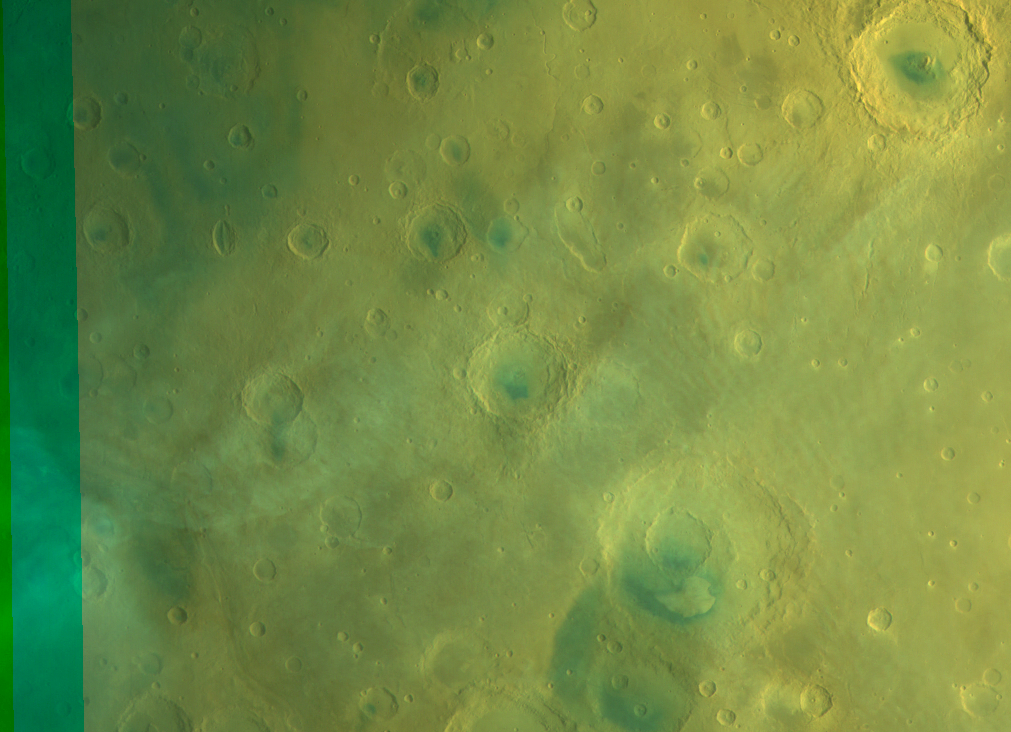
CT-3 #
Cirrus near Marwth Vallis. Map.
| Orbit Number | 24978 |
|---|---|
| Latitude | 19.12 |
| Longitude [E/W] | -19.88 |
| Longitude [E] | 340.12 |
| Ls | 132.5 |
| Date | 2023-10-13 00:00:00 |
| Local time | 07:57:00 |
| Cirrus Clouds | cirrus clouds |
| Lee Waves | |
| Gravity Clouds | |
| ACB | ACB |
| Cloud Streets | |
| Elongated Dust Clouds | |
| Cumulus Cloud Sheet | |
| Plume | |
| Undefined | |
| Observation Type | Broom |
| Potentially Moving | |
| Spalte1 |
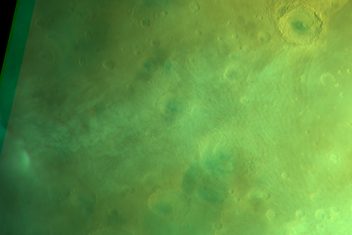
CT-4 #
Cirrus clouds at Kasei Valles (partly overexposed orbit). Map.
| Orbit Number | 24975 |
|---|---|
| Latitude | 25.51 |
| Longitude [E/W] | -61.92 |
| Longitude [E] | 298.08 |
| Ls | 132.1 |
| Date | 2023-10-12 00:00:00 |
| Local time | 07:23:00 |
| Cirrus Clouds | cirrus clouds |
| Lee Waves | |
| Gravity Clouds | |
| ACB | ACB |
| Cloud Streets | |
| Elongated Dust Clouds | |
| Cumulus Cloud Sheet | |
| Plume | |
| Undefined | |
| Observation Type | Broom |
| Potentially Moving | |
| Spalte1 |
CT-5 #
Cirrus clouds at SE Syrtis/NE Tyrrhena. Map.
| Orbit Number | 24970_0001 |
|---|---|
| Latitude | -1.16 |
| Longitude [E/W] | 76.89 |
| Longitude [E] | 76.89 |
| Ls | 131.4 |
| Date | 2023-10-11 00:00:00 |
| Local time | 07:16:00 |
| Cirrus Clouds | cirrus clouds |
| Lee Waves | |
| Gravity Clouds | |
| ACB | ACB |
| Cloud Streets | |
| Elongated Dust Clouds | |
| Cumulus Cloud Sheet | |
| Plume | |
| Undefined | |
| Observation Type | Broom |
| Potentially Moving | |
| Spalte1 |
CT-6 #
Cirrus clouds at Syrtis Major Planum. Map.
| Orbit Number | 24970_0000 |
|---|---|
| Latitude | 7.4 |
| Longitude [E/W] | 69.38 |
| Longitude [E] | 69.38 |
| Ls | 131.4 |
| Date | 2023-10-11 00:00:00 |
| Local time | 06:41:00 |
| Cirrus Clouds | cirrus clouds |
| Lee Waves | |
| Gravity Clouds | |
| ACB | ACB |
| Cloud Streets | |
| Elongated Dust Clouds | |
| Cumulus Cloud Sheet | |
| Plume | |
| Undefined | |
| Observation Type | Broom |
| Potentially Moving | |
| Spalte1 |
CT-7 #
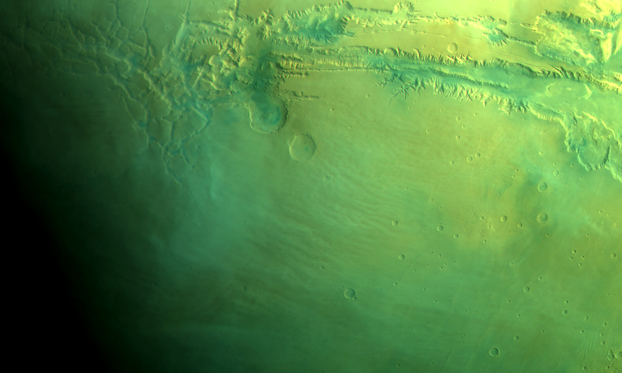
Extensive cirrus from Kasei to Margaritifer and Valles Marineris (ACB?). Map.
| Orbit Number | 24968 |
|---|---|
| Latitude | 18.69 |
| Longitude [E/W] | -46.53 |
| Longitude [E] | 313.47 |
| Ls | 131.1 |
| Date | 2023-10-10 00:00:00 |
| Local time | 09:40:00 |
| Cirrus Clouds | cirrus clouds |
| Lee Waves | |
| Gravity Clouds | |
| ACB | ACB |
| Cloud Streets | |
| Elongated Dust Clouds | |
| Cumulus Cloud Sheet | |
| Plume | |
| Undefined | |
| Observation Type | Broom |
| Potentially Moving | |
| Spalte1 |
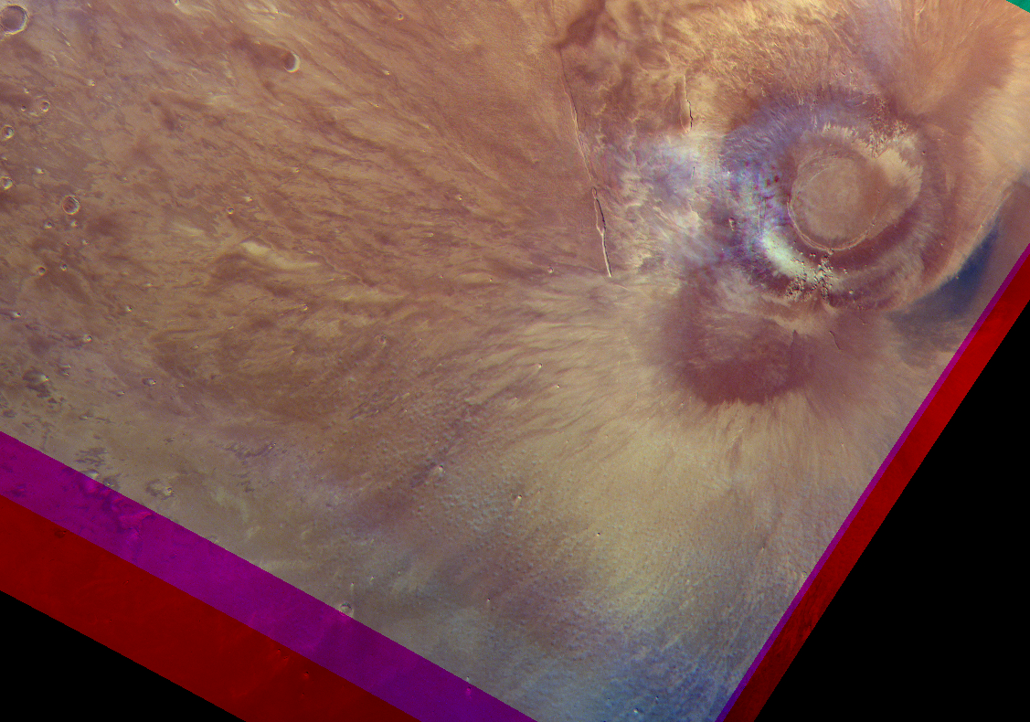
CT-8 #
Cirrus clouds at Olympus Mons. Map.
| Orbit Number | 24965 |
|---|---|
| Latitude | 23.18 |
| Longitude [E/W] | -132.15 |
| Longitude [E] | 227.85 |
| Ls | 130.7 |
| Date | 2023-10-09 00:00:00 |
| Local time | 06:38:00 |
| Cirrus Clouds | cirrus clouds |
| Lee Waves | |
| Gravity Clouds | |
| ACB | ACB |
| Cloud Streets | |
| Elongated Dust Clouds | |
| Cumulus Cloud Sheet | |
| Plume | |
| Undefined | |
| Observation Type | Broom |
| Potentially Moving | |
| Spalte1 |
CT-9 #
Cirrus clouds at SE Amazonis Planitia (Aureole to MFF) (best visible in blue; other channels overexosed). Map.
| Orbit Number | 24930 |
|---|---|
| Latitude | 1.93 |
| Longitude [E/W] | -149.86 |
| Longitude [E] | 210.14 |
| Ls | 125.8 |
| Date | 2023-09-29 00:00:00 |
| Local time | 07:59:00 |
| Cirrus Clouds | cirrus clouds |
| Lee Waves | |
| Gravity Clouds | |
| ACB | ACB |
| Cloud Streets | |
| Elongated Dust Clouds | |
| Cumulus Cloud Sheet | |
| Plume | |
| Undefined | |
| Observation Type | Broom |
| Potentially Moving | |
| Spalte1 |
CT-10 #
(“stripy”) cirrus clouds at Olympus Aureole. Map.
| Orbit Number | 24888 |
|---|---|
| Latitude | 22.1 |
| Longitude [E/W] | -139.79 |
| Longitude [E] | 220.21 |
| Ls | 120.0 |
| Date | 2023-09-17 00:00:00 |
| Local time | 11:43:00 |
| Cirrus Clouds | cirrus clouds |
| Lee Waves | |
| Gravity Clouds | |
| ACB | ACB |
| Cloud Streets | |
| Elongated Dust Clouds | |
| Cumulus Cloud Sheet | |
| Plume | |
| Undefined | |
| Observation Type | Broom |
| Potentially Moving | |
| Spalte1 |
CT-11 #
Very faint cloud streets and cirrus at Elysium Mons. Map.
| Orbit Number | 24846 |
|---|---|
| Latitude | 20.6 |
| Longitude [E/W] | 143.76 |
| Longitude [E] | 143.76 |
| Ls | 114.4 |
| Date | 2023-09-05 00:00:00 |
| Local time | 08:32:00 |
| Cirrus Clouds | cirrus clouds |
| Lee Waves | |
| Gravity Clouds | |
| ACB | ACB |
| Cloud Streets | cloud streets |
| Elongated Dust Clouds | |
| Cumulus Cloud Sheet | |
| Plume | |
| Undefined | |
| Observation Type | Broom |
| Potentially Moving | |
| Spalte1 |
CT-12 #
ACB? at Isidis (Amenthes). Map.
| Orbit Number | 24712 |
|---|---|
| Latitude | 14.95 |
| Longitude [E/W] | 101.68 |
| Longitude [E] | 101.68 |
| Ls | 96.7 |
| Date | 2023-07-28 00:00:00 |
| Local time | 07:22:00 |
| Cirrus Clouds | cirrus clouds |
| Lee Waves | |
| Gravity Clouds | |
| ACB | ACB |
| Cloud Streets | |
| Elongated Dust Clouds | |
| Cumulus Cloud Sheet | |
| Plume | |
| Undefined | |
| Observation Type | Broom |
| Potentially Moving | |
| Spalte1 |
CT-13 #
Cloud streets and cirrus clouds at Daedalia Planum and Arsia Mons. Map.
| Orbit Number | 24680 |
|---|---|
| Latitude | -19.5 |
| Longitude [E/W] | -121.9 |
| Longitude [E] | 238.1 |
| Ls | 92.6 |
| Date | 2023-07-18 00:00:00 |
| Local time | 14:54:00 |
| Cirrus Clouds | cirrus clouds |
| Lee Waves | |
| Gravity Clouds | |
| ACB | ACB |
| Cloud Streets | cloud streets |
| Elongated Dust Clouds | |
| Cumulus Cloud Sheet | |
| Plume | |
| Undefined | |
| Observation Type | Broom |
| Potentially Moving | |
| Spalte1 |
CT-14 #
ACB at Ophir / Lunae. Map.
| Orbit Number | 24644 |
|---|---|
| Latitude | 6.74 |
| Longitude [E/W] | -66.89 |
| Longitude [E] | 293.11 |
| Ls | 88.0 |
| Date | 2023-07-08 00:00:00 |
| Local time | 13:52:00 |
| Cirrus Clouds | cirrus clouds |
| Lee Waves | |
| Gravity Clouds | |
| ACB | ACB |
| Cloud Streets | |
| Elongated Dust Clouds | |
| Cumulus Cloud Sheet | |
| Plume | |
| Undefined | |
| Observation Type | Broom |
| Potentially Moving | |
| Spalte1 |
CT-15 #
ACB at Tharsis. Map.
| Orbit Number | 24644 |
|---|---|
| Latitude | 11.95 |
| Longitude [E/W] | -126.06 |
| Longitude [E] | 233.94 |
| Ls | 88.0 |
| Date | 2023-07-08 00:00:00 |
| Local time | 09:53:00 |
| Cirrus Clouds | cirrus clouds |
| Lee Waves | |
| Gravity Clouds | |
| ACB | ACB |
| Cloud Streets | |
| Elongated Dust Clouds | |
| Cumulus Cloud Sheet | |
| Plume | |
| Undefined | |
| Observation Type | Broom |
| Potentially Moving | |
| Spalte1 |
CT-16 #
ACB at Ophir / Lunae. Map.
| Orbit Number | 24630 |
|---|---|
| Latitude | 4.62 |
| Longitude [E/W] | -69.19 |
| Longitude [E] | 290.81 |
| Ls | 86.2 |
| Date | 2023-07-04 00:00:00 |
| Local time | 14:29:00 |
| Cirrus Clouds | cirrus clouds |
| Lee Waves | |
| Gravity Clouds | |
| ACB | ACB |
| Cloud Streets | |
| Elongated Dust Clouds | |
| Cumulus Cloud Sheet | |
| Plume | |
| Undefined | |
| Observation Type | Broom |
| Potentially Moving | |
| Spalte1 |
CT-17 #
ACB at Tharsis. Map.
| Orbit Number | 24630 |
|---|---|
| Latitude | 9.5 |
| Longitude [E/W] | -119.09 |
| Longitude [E] | 240.91 |
| Ls | 86.2 |
| Date | 2023-07-04 00:00:00 |
| Local time | 11:09:00 |
| Cirrus Clouds | cirrus clouds |
| Lee Waves | |
| Gravity Clouds | |
| ACB | ACB |
| Cloud Streets | |
| Elongated Dust Clouds | |
| Cumulus Cloud Sheet | |
| Plume | |
| Undefined | |
| Observation Type | Broom |
| Potentially Moving | |
| Spalte1 |
CT-18 #
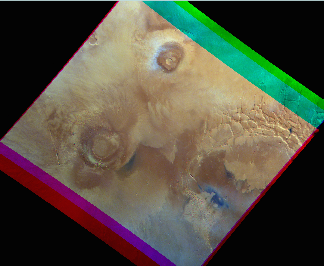
ACB at Tharsis volcanoes. Map.
| Orbit Number | 24623 |
|---|---|
| Latitude | 10.17 |
| Longitude [E/W] | -118.15 |
| Longitude [E] | 241.85 |
| Ls | 85.3 |
| Date | 2023-07-02 00:00:00 |
| Local time | 11:38:00 |
| Cirrus Clouds | cirrus clouds |
| Lee Waves | |
| Gravity Clouds | |
| ACB | ACB |
| Cloud Streets | |
| Elongated Dust Clouds | |
| Cumulus Cloud Sheet | |
| Plume | |
| Undefined | |
| Observation Type | Broom |
| Potentially Moving | |
| Spalte1 |
CT-19 #
ACB at Lunae Planum. Map.
| Orbit Number | 24605 |
|---|---|
| Latitude | 0.23 |
| Longitude [E/W] | -39.64 |
| Longitude [E] | 320.36 |
| Ls | 83.0 |
| Date | 2023-06-27 00:00:00 |
| Local time | 14:27:00 |
| Cirrus Clouds | cirrus clouds |
| Lee Waves | |
| Gravity Clouds | |
| ACB | ACB |
| Cloud Streets | |
| Elongated Dust Clouds | |
| Cumulus Cloud Sheet | |
| Plume | |
| Undefined | |
| Observation Type | Broom |
| Potentially Moving | |
| Spalte1 |
CT-20 #
ACB at Tharsis volcanoes; local dust storm. Map.
| Orbit Number | 24605 |
|---|---|
| Latitude | 6.41 |
| Longitude [E/W] | -131.38 |
| Longitude [E] | 228.62 |
| Ls | 83.0 |
| Date | 2023-06-27 00:00:00 |
| Local time | 08:19:00 |
| Cirrus Clouds | cirrus clouds |
| Lee Waves | |
| Gravity Clouds | |
| ACB | ACB |
| Cloud Streets | |
| Elongated Dust Clouds | |
| Cumulus Cloud Sheet | |
| Plume | |
| Undefined | |
| Observation Type | Broom |
| Potentially Moving | |
| Spalte1 |
CT-21 #
ACB at Lunae Planum. Map.
| Orbit Number | 24598 |
|---|---|
| Latitude | 6.94 |
| Longitude [E/W] | -47.63 |
| Longitude [E] | 312.37 |
| Ls | 82.1 |
| Date | 2023-06-25 00:00:00 |
| Local time | 14:23:00 |
| Cirrus Clouds | cirrus clouds |
| Lee Waves | |
| Gravity Clouds | |
| ACB | ACB |
| Cloud Streets | |
| Elongated Dust Clouds | |
| Cumulus Cloud Sheet | |
| Plume | |
| Undefined | |
| Observation Type | Broom |
| Potentially Moving | |
| Spalte1 |
CT-22 #

ACB at Tharsis volcanoes; orographic clouds; local dust storm/lifting event?. Map.
| Orbit Number | 24598 |
|---|---|
| Latitude | 11.28 |
| Longitude [E/W] | -123.76 |
| Longitude [E] | 236.24 |
| Ls | 82.1 |
| Date | 2023-06-25 00:00:00 |
| Local time | 09:17:00 |
| Cirrus Clouds | cirrus clouds |
| Lee Waves | |
| Gravity Clouds | |
| ACB | ACB |
| Cloud Streets | |
| Elongated Dust Clouds | |
| Cumulus Cloud Sheet | |
| Plume | |
| Undefined | |
| Observation Type | Broom |
| Potentially Moving | |
| Spalte1 |
CT-23 #

ACB at Tharsis volcanoes; orographic clouds. Map.
| Orbit Number | 24588 |
|---|---|
| Latitude | 14.56 |
| Longitude [E/W] | -112.65 |
| Longitude [E] | 247.35 |
| Ls | 80.8 |
| Date | 2023-06-22 00:00:00 |
| Local time | 14:16:00 |
| Cirrus Clouds | cirrus clouds |
| Lee Waves | |
| Gravity Clouds | |
| ACB | ACB |
| Cloud Streets | |
| Elongated Dust Clouds | |
| Cumulus Cloud Sheet | |
| Plume | |
| Undefined | |
| Observation Type | Broom |
| Potentially Moving | |
| Spalte1 |
CT-24 #
Clouds above Nochtis L. Map.
| Orbit Number | 24580 |
|---|---|
| Latitude | -5.2 |
| Longitude [E/W] | -107.0 |
| Longitude [E] | 253.0 |
| Ls | 79.8 |
| Date | 2023-06-19 00:00:00 |
| Local time | 08:07:00 |
| Cirrus Clouds | cirrus clouds |
| Lee Waves | |
| Gravity Clouds | |
| ACB | ACB |
| Cloud Streets | |
| Elongated Dust Clouds | |
| Cumulus Cloud Sheet | |
| Plume | |
| Undefined | |
| Observation Type | Broom |
| Potentially Moving | |
| Spalte1 |
CT-25 #
Clouds at Olympus. Map.
| Orbit Number | 24292 |
|---|---|
| Latitude | 18.3 |
| Longitude [E/W] | -133.37 |
| Longitude [E] | 226.63 |
| Ls | 42.9 |
| Date | 2023-03-27 00:00:00 |
| Local time | 14:30:05 |
| Cirrus Clouds | |
| Lee Waves | |
| Gravity Clouds | |
| ACB | ACB |
| Cloud Streets | |
| Elongated Dust Clouds | |
| Cumulus Cloud Sheet | |
| Plume | |
| Undefined | |
| Observation Type | Surface |
| Potentially Moving | |
| Spalte1 |
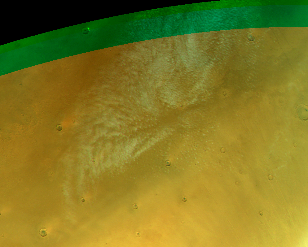
CT-26 #
Cirrus clouds at Olympus. Map.
| Orbit Number | 24278 |
|---|---|
| Latitude | 23.78 |
| Longitude [E/W] | -144.1 |
| Longitude [E] | 215.9 |
| Ls | 41.1 |
| Date | 2023-03-23 00:00:00 |
| Local time | 14:36:11 |
| Cirrus Clouds | cirrus clouds |
| Lee Waves | |
| Gravity Clouds | |
| ACB | ACB |
| Cloud Streets | |
| Elongated Dust Clouds | |
| Cumulus Cloud Sheet | |
| Plume | |
| Undefined | |
| Observation Type | Surface |
| Potentially Moving | |
| Spalte1 |
CT-27 #
Faint cirrus clouds at Olympus. Map.
| Orbit Number | 24271 |
|---|---|
| Latitude | 11.49 |
| Longitude [E/W] | -148.03 |
| Longitude [E] | 211.97 |
| Ls | 40.2 |
| Date | 2023-03-21 00:00:00 |
| Local time | 14:44:05 |
| Cirrus Clouds | cirrus clouds |
| Lee Waves | |
| Gravity Clouds | |
| ACB | ACB |
| Cloud Streets | |
| Elongated Dust Clouds | |
| Cumulus Cloud Sheet | |
| Plume | |
| Undefined | |
| Observation Type | Surface |
| Potentially Moving | |
| Spalte1 |
CT-28 #
Faint cloud fields at Elysium Province. Map.
| Orbit Number | 22720 |
|---|---|
| Latitude | 17.42 |
| Longitude [E/W] | 125.66 |
| Longitude [E] | 125.66 |
| Ls | 147.3 |
| Date | 2021-12-25 00:00:00 |
| Local time | 05:52:02 |
| Cirrus Clouds | cirrus clouds |
| Lee Waves | |
| Gravity Clouds | gravity clouds |
| ACB | ACB |
| Cloud Streets | |
| Elongated Dust Clouds | |
| Cumulus Cloud Sheet | |
| Plume | |
| Undefined | |
| Observation Type | Broom |
| Potentially Moving | |
| Spalte1 |
CT-29 #
Several small clouds fields Nili and NE Syrtis. Map.
| Orbit Number | 22700 |
|---|---|
| Latitude | 6.85 |
| Longitude [E/W] | 77.81 |
| Longitude [E] | 77.81 |
| Ls | 144.4 |
| Date | 2021-12-19 00:00:00 |
| Local time | 10:11:51 |
| Cirrus Clouds | cirrus clouds |
| Lee Waves | |
| Gravity Clouds | |
| ACB | ACB |
| Cloud Streets | |
| Elongated Dust Clouds | |
| Cumulus Cloud Sheet | |
| Plume | |
| Undefined | |
| Observation Type | Broom |
| Potentially Moving | |
| Spalte1 |
CT-30 #
Various (faint) clouds at Ascraeus Mons. Map.
| Orbit Number | 22649 |
|---|---|
| Latitude | 15.0 |
| Longitude [E/W] | -111.61 |
| Longitude [E] | 248.39 |
| Ls | 137.0 |
| Date | 2021-12-04 00:00:00 |
| Local time | 10:28:11 |
| Cirrus Clouds | cirrus clouds |
| Lee Waves | lee waves |
| Gravity Clouds | |
| ACB | ACB |
| Cloud Streets | cloud streets |
| Elongated Dust Clouds | |
| Cumulus Cloud Sheet | |
| Plume | |
| Undefined | |
| Observation Type | Broom |
| Potentially Moving | |
| Spalte1 |
CT-31 #
Various clouds at Valles Marineris. Map.
| Orbit Number | 22620 |
|---|---|
| Latitude | -2.2 |
| Longitude [E/W] | -51.77 |
| Longitude [E] | 308.23 |
| Ls | 132.9 |
| Date | 2021-11-26 00:00:00 |
| Local time | 09:50:14 |
| Cirrus Clouds | cirrus clouds |
| Lee Waves | |
| Gravity Clouds | gravity clouds |
| ACB | ACB |
| Cloud Streets | |
| Elongated Dust Clouds | |
| Cumulus Cloud Sheet | |
| Plume | |
| Undefined | |
| Observation Type | Broom |
| Potentially Moving | |
| Spalte1 |
CT-32 #
Various clouds at Valles Marineris. Map.
| Orbit Number | 22613 |
|---|---|
| Latitude | -2.2 |
| Longitude [E/W] | -51.77 |
| Longitude [E] | 308.23 |
| Ls | 131.9 |
| Date | 2021-11-24 00:00:00 |
| Local time | 10:14:41 |
| Cirrus Clouds | cirrus clouds |
| Lee Waves | |
| Gravity Clouds | gravity clouds |
| ACB | ACB |
| Cloud Streets | |
| Elongated Dust Clouds | |
| Cumulus Cloud Sheet | |
| Plume | |
| Undefined | |
| Observation Type | Broom |
| Potentially Moving | |
| Spalte1 |
CT-33 #
Clouds at Syrtis Major. Map.
| Orbit Number | 22612 |
|---|---|
| Latitude | 7.39 |
| Longitude [E/W] | 74.5 |
| Longitude [E] | 74.5 |
| Ls | 131.8 |
| Date | 2021-11-24 00:00:00 |
| Local time | 11:21:16 |
| Cirrus Clouds | cirrus clouds |
| Lee Waves | |
| Gravity Clouds | |
| ACB | ACB |
| Cloud Streets | |
| Elongated Dust Clouds | |
| Cumulus Cloud Sheet | |
| Plume | |
| Undefined | |
| Observation Type | Broom |
| Potentially Moving | |
| Spalte1 |
CT-34 #
Various clouds at Pavonis Mons as well as noth of it and south of Noctis Labyrhintus. Map.
| Orbit Number | 22596 |
|---|---|
| Latitude | 0.9 |
| Longitude [E/W] | -114.38 |
| Longitude [E] | 245.62 |
| Ls | 129.5 |
| Date | 2021-11-19 00:00:00 |
| Local time | 10:22:18 |
| Cirrus Clouds | |
| Lee Waves | |
| Gravity Clouds | gravity clouds |
| ACB | ACB |
| Cloud Streets | cloud streets |
| Elongated Dust Clouds | |
| Cumulus Cloud Sheet | |
| Plume | |
| Undefined | |
| Observation Type | Broom |
| Potentially Moving | |
| Spalte1 |
CT-35 #
Various clouds at Noctis Labyrintus. Map.
| Orbit Number | 22571 |
|---|---|
| Latitude | 13.7 |
| Longitude [E/W] | -92.2 |
| Longitude [E] | 267.8 |
| Ls | 126.0 |
| Date | 2021-11-12 00:00:00 |
| Local time | 10:00:34 |
| Cirrus Clouds | cirrus clouds |
| Lee Waves | |
| Gravity Clouds | gravity clouds |
| ACB | ACB |
| Cloud Streets | cloud streets |
| Elongated Dust Clouds | |
| Cumulus Cloud Sheet | |
| Plume | |
| Undefined | |
| Observation Type | Broom |
| Potentially Moving | |
| Spalte1 |
CT-36 #
Fleecy ACB clouds and veils of cloud streets near Arsia Mons. Map.
| Orbit Number | 22568 |
|---|---|
| Latitude | 17.0 |
| Longitude [E/W] | -127.0 |
| Longitude [E] | 233.0 |
| Ls | 125.6 |
| Date | 2021-11-11 00:00:00 |
| Local time | 11:04:12 |
| Cirrus Clouds | |
| Lee Waves | |
| Gravity Clouds | |
| ACB | ACB |
| Cloud Streets | cloud streets |
| Elongated Dust Clouds | |
| Cumulus Cloud Sheet | |
| Plume | |
| Undefined | |
| Observation Type | Broom |
| Potentially Moving | |
| Spalte1 |
CT-37 #

Various clouds at Noctis Labyrintus. Map.
| Orbit Number | 22550 |
|---|---|
| Latitude | -0.3 |
| Longitude [E/W] | -100.0 |
| Longitude [E] | 260.0 |
| Ls | 123.1 |
| Date | 2021-11-06 00:00:00 |
| Local time | 10:28:21 |
| Cirrus Clouds | cirrus clouds |
| Lee Waves | |
| Gravity Clouds | gravity clouds |
| ACB | ACB |
| Cloud Streets | cloud streets |
| Elongated Dust Clouds | |
| Cumulus Cloud Sheet | |
| Plume | |
| Undefined | |
| Observation Type | Broom |
| Potentially Moving | |
| Spalte1 |
CT-38 #

NaT Map.
| Orbit Number | NaT |
|---|---|
| Latitude | NaT |
| Longitude [E/W] | NaT |
| Longitude [E] | NaT |
| Ls | NaT |
| Date | NaT |
| Local time | NaT |
| Cirrus Clouds | NaT |
| Lee Waves | NaT |
| Gravity Clouds | NaT |
| ACB | NaT |
| Cloud Streets | NaT |
| Elongated Dust Clouds | NaT |
| Cumulus Cloud Sheet | NaT |
| Plume | NaT |
| Undefined | NaT |
| Observation Type | NaT |
| Potentially Moving | NaT |
| Spalte1 | NaT |
CT-39 #
Large field of cloud streets (part of cyclone?) Vastitas Planitia. Map.
| Orbit Number | 25054 |
|---|---|
| Latitude | 63.97 |
| Longitude [E/W] | -91.02 |
| Longitude [E] | 268.98 |
| Ls | 143.4 |
| Date | 2023-11-04 00:00:00 |
| Local time | 14:16:00 |
| Cirrus Clouds | |
| Lee Waves | |
| Gravity Clouds | |
| ACB | |
| Cloud Streets | cloud streets |
| Elongated Dust Clouds | |
| Cumulus Cloud Sheet | |
| Plume | |
| Undefined | |
| Observation Type | Broom |
| Potentially Moving | |
| Spalte1 |
CT-40 #

Cirrus at crater next to Kunovstky crater. Map.
| Orbit Number | 25046 |
|---|---|
| Latitude | 54.14 |
| Longitude [E/W] | -11.84 |
| Longitude [E] | 348.16 |
| Ls | 142.2 |
| Date | 2023-11-02 00:00:00 |
| Local time | 13:11:00 |
| Cirrus Clouds | cirrus clouds |
| Lee Waves | |
| Gravity Clouds | |
| ACB | |
| Cloud Streets | |
| Elongated Dust Clouds | |
| Cumulus Cloud Sheet | |
| Plume | |
| Undefined | |
| Observation Type | Broom |
| Potentially Moving | |
| Spalte1 |
CT-41 #
Cirrus at E Tempe Terra. Map.
| Orbit Number | 25046 |
|---|---|
| Latitude | 44.96 |
| Longitude [E/W] | -50.05 |
| Longitude [E] | 309.95 |
| Ls | 142.2 |
| Date | 2023-11-02 00:00:00 |
| Local time | 10:35:00 |
| Cirrus Clouds | cirrus clouds |
| Lee Waves | |
| Gravity Clouds | |
| ACB | |
| Cloud Streets | |
| Elongated Dust Clouds | |
| Cumulus Cloud Sheet | |
| Plume | |
| Undefined | |
| Observation Type | Broom |
| Potentially Moving | |
| Spalte1 |
CT-42 #
Cumulus cloud fields at Vastitas. Map.
| Orbit Number | 25045 |
|---|---|
| Latitude | 59.53 |
| Longitude [E/W] | 167.73 |
| Longitude [E] | 167.73 |
| Ls | 142.1 |
| Date | 2023-11-02 00:00:00 |
| Local time | 18:32:00 |
| Cirrus Clouds | |
| Lee Waves | |
| Gravity Clouds | |
| ACB | |
| Cloud Streets | |
| Elongated Dust Clouds | |
| Cumulus Cloud Sheet | cumulus cloud sheet |
| Plume | |
| Undefined | |
| Observation Type | Broom |
| Potentially Moving | |
| Spalte1 |
CT-43 #
Thin cirrus above Olympus Mons. Map.
| Orbit Number | 25043 |
|---|---|
| Latitude | 17.37 |
| Longitude [E/W] | -130.56 |
| Longitude [E] | 229.44 |
| Ls | 141.8 |
| Date | 2023-11-01 00:00:00 |
| Local time | 10:58:00 |
| Cirrus Clouds | cirrus clouds |
| Lee Waves | |
| Gravity Clouds | |
| ACB | |
| Cloud Streets | |
| Elongated Dust Clouds | |
| Cumulus Cloud Sheet | |
| Plume | |
| Undefined | |
| Observation Type | Broom |
| Potentially Moving | |
| Spalte1 |
CT-44 #
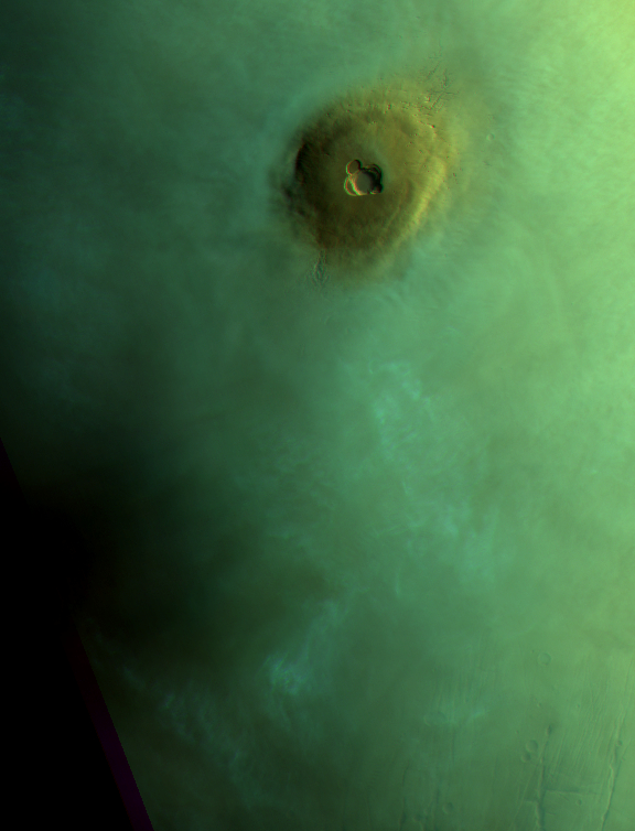
Isolated cumulus cloud patch (plume) W of Olympus Mons Aureole in Amazonis. Map.
| Orbit Number | 25043 |
|---|---|
| Latitude | 26.16 |
| Longitude [E/W] | -153.28 |
| Longitude [E] | 206.72 |
| Ls | 141.8 |
| Date | 2023-11-01 00:00:00 |
| Local time | 09:26:00 |
| Cirrus Clouds | |
| Lee Waves | |
| Gravity Clouds | |
| ACB | |
| Cloud Streets | |
| Elongated Dust Clouds | |
| Cumulus Cloud Sheet | |
| Plume | plume |
| Undefined | |
| Observation Type | Broom |
| Potentially Moving | Yes |
| Spalte1 |
CT-45 #
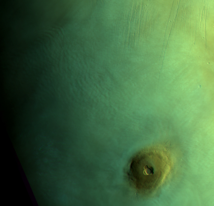
Isolated cloud patch (plume or LDLE?) NW of Olympus Mons Aureole in Amazonis. Map.
| Orbit Number | 25043 |
|---|---|
| Latitude | 40.43 |
| Longitude [E/W] | -143.62 |
| Longitude [E] | 216.38 |
| Ls | 141.8 |
| Date | 2023-11-01 00:00:00 |
| Local time | 10:06:00 |
| Cirrus Clouds | |
| Lee Waves | |
| Gravity Clouds | |
| ACB | |
| Cloud Streets | |
| Elongated Dust Clouds | |
| Cumulus Cloud Sheet | |
| Plume | plume |
| Undefined | |
| Observation Type | Broom |
| Potentially Moving | |
| Spalte1 |
CT-46 #
Thin cirrus clouds above Arabia Terra near Terminator. Map.
| Orbit Number | 25006 |
|---|---|
| Latitude | -7.4 |
| Longitude [E/W] | -17.59 |
| Longitude [E] | 342.41 |
| Ls | 136.5 |
| Date | 2023-10-21 00:00:00 |
| Local time | 07:12:00 |
| Cirrus Clouds | cirrus clouds |
| Lee Waves | |
| Gravity Clouds | |
| ACB | |
| Cloud Streets | |
| Elongated Dust Clouds | |
| Cumulus Cloud Sheet | |
| Plume | |
| Undefined | |
| Observation Type | Broom |
| Potentially Moving | |
| Spalte1 |
CT-47 #
Faint cloud streets (small cyclone?) at Vastitas (near North Pole) (double broom - same as in 25001_0000). Map.
| Orbit Number | 25001_0001 |
|---|---|
| Latitude | 71.41 |
| Longitude [E/W] | -175.91 |
| Longitude [E] | 184.09 |
| Ls | 135.8 |
| Date | 2023-10-20 00:00:00 |
| Local time | 09:13:00 |
| Cirrus Clouds | |
| Lee Waves | |
| Gravity Clouds | |
| ACB | |
| Cloud Streets | cloud streets |
| Elongated Dust Clouds | |
| Cumulus Cloud Sheet | |
| Plume | |
| Undefined | |
| Observation Type | Broom |
| Potentially Moving | |
| Spalte1 |
CT-48 #
Faint cloud streets at Vastitas (near North Pole) (double broom - same as in 25001_0001). Map.
| Orbit Number | 25001_0000 |
|---|---|
| Latitude | 71.15 |
| Longitude [E/W] | -177.81 |
| Longitude [E] | 182.19 |
| Ls | 135.8 |
| Date | 2023-10-20 00:00:00 |
| Local time | 08:27:00 |
| Cirrus Clouds | |
| Lee Waves | |
| Gravity Clouds | |
| ACB | |
| Cloud Streets | cloud streets |
| Elongated Dust Clouds | |
| Cumulus Cloud Sheet | |
| Plume | |
| Undefined | |
| Observation Type | Broom |
| Potentially Moving | |
| Spalte1 |
CT-49 #
Cirrus clouds with sharp fron SE of Albor Tholus across Elysium Planutia (double broom - same as in 25001_0000). Map.
| Orbit Number | 25001_0001 |
|---|---|
| Latitude | 9.94 |
| Longitude [E/W] | 153.7 |
| Longitude [E] | 153.7 |
| Ls | 135.8 |
| Date | 2023-10-20 00:00:00 |
| Local time | 07:09:00 |
| Cirrus Clouds | cirrus clouds |
| Lee Waves | |
| Gravity Clouds | |
| ACB | |
| Cloud Streets | |
| Elongated Dust Clouds | |
| Cumulus Cloud Sheet | |
| Plume | |
| Undefined | |
| Observation Type | Broom |
| Potentially Moving | |
| Spalte1 |
CT-50 #
Cirrus clouds SE of Albor Tholus (orbit partly overexposed) (double broom - same as in 25001_0001). Map.
| Orbit Number | 25001_0000 |
|---|---|
| Latitude | 15.52 |
| Longitude [E/W] | 154.42 |
| Longitude [E] | 154.42 |
| Ls | 135.8 |
| Date | 2023-10-20 00:00:00 |
| Local time | 06:35:00 |
| Cirrus Clouds | cirrus clouds |
| Lee Waves | |
| Gravity Clouds | |
| ACB | |
| Cloud Streets | |
| Elongated Dust Clouds | |
| Cumulus Cloud Sheet | |
| Plume | |
| Undefined | |
| Observation Type | Broom |
| Potentially Moving | |
| Spalte1 |
CT-51 #
Cumulus cloud field accosiated with cloud streets at Ulympia Undae and further east (double broom - same as in 25001_0000). Map.
| Orbit Number | 25001_0001 |
|---|---|
| Latitude | 77.7 |
| Longitude [E/W] | -148.89 |
| Longitude [E] | 211.11 |
| Ls | 135.8 |
| Date | 2023-10-20 00:00:00 |
| Local time | 11:01:00 |
| Cirrus Clouds | |
| Lee Waves | |
| Gravity Clouds | |
| ACB | |
| Cloud Streets | cloud streets |
| Elongated Dust Clouds | |
| Cumulus Cloud Sheet | cumulus cloud sheet |
| Plume | |
| Undefined | |
| Observation Type | Broom |
| Potentially Moving | |
| Spalte1 |
CT-52 #
Cumulus cloud field and cloud streets at Ulympia Undae (double broom - same as in 25001_0001). Map.
| Orbit Number | 25001_0000 |
|---|---|
| Latitude | 80.6 |
| Longitude [E/W] | -166.11 |
| Longitude [E] | 193.89 |
| Ls | 135.8 |
| Date | 2023-10-20 00:00:00 |
| Local time | 09:11:00 |
| Cirrus Clouds | |
| Lee Waves | |
| Gravity Clouds | |
| ACB | |
| Cloud Streets | cloud streets |
| Elongated Dust Clouds | |
| Cumulus Cloud Sheet | cumulus cloud sheet |
| Plume | |
| Undefined | |
| Observation Type | Broom |
| Potentially Moving | |
| Spalte1 |
CT-53 #
Cirrus sheet at Syria Planum. Map.
| Orbit Number | 25000 |
|---|---|
| Latitude | -16.21 |
| Longitude [E/W] | -104.3 |
| Longitude [E] | 255.7 |
| Ls | 135.7 |
| Date | 2023-10-20 00:00:00 |
| Local time | 08:50:00 |
| Cirrus Clouds | cirrus clouds |
| Lee Waves | |
| Gravity Clouds | |
| ACB | |
| Cloud Streets | |
| Elongated Dust Clouds | |
| Cumulus Cloud Sheet | |
| Plume | |
| Undefined | |
| Observation Type | Broom |
| Potentially Moving | |
| Spalte1 |
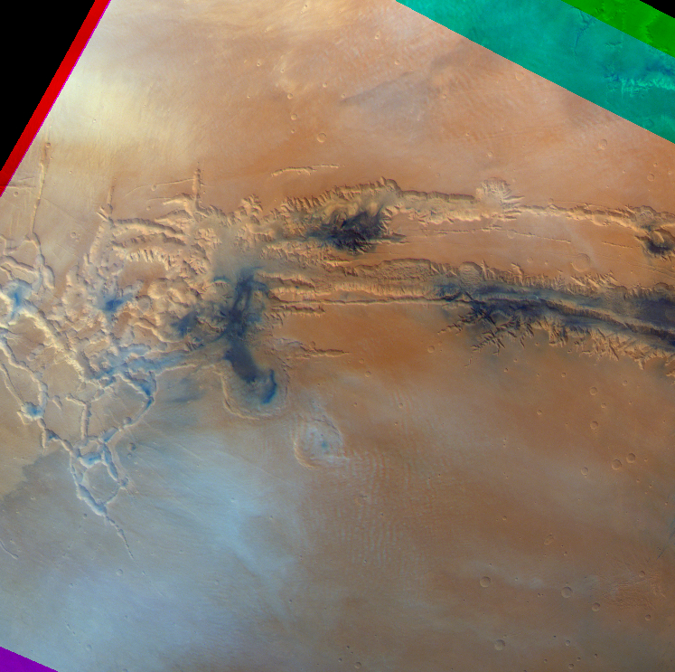
CT-54 #
Unusual cloud front associated with faint gravity waves at Solis Planum. Map.
| Orbit Number | 25000 |
|---|---|
| Latitude | -19.48 |
| Longitude [E/W] | -87.15 |
| Longitude [E] | 272.85 |
| Ls | 135.7 |
| Date | 2023-10-20 00:00:00 |
| Local time | 09:58:00 |
| Cirrus Clouds | |
| Lee Waves | |
| Gravity Clouds | gravity clouds |
| ACB | |
| Cloud Streets | |
| Elongated Dust Clouds | |
| Cumulus Cloud Sheet | |
| Plume | |
| Undefined | undefined |
| Observation Type | Broom |
| Potentially Moving | |
| Spalte1 |
CT-55 #
Orographic ?? cirrus clouds (mountain lee waves?) at Daedalia mountains. Map.
| Orbit Number | 25000 |
|---|---|
| Latitude | -24.69 |
| Longitude [E/W] | -110.53 |
| Longitude [E] | 249.47 |
| Ls | 135.7 |
| Date | 2023-10-20 00:00:00 |
| Local time | 08:26:00 |
| Cirrus Clouds | cirrus clouds |
| Lee Waves | |
| Gravity Clouds | |
| ACB | |
| Cloud Streets | |
| Elongated Dust Clouds | |
| Cumulus Cloud Sheet | |
| Plume | |
| Undefined | |
| Observation Type | Broom |
| Potentially Moving | |
| Spalte1 |
CT-56 #
Lee waves at Thaumasia (see also level 2!). Map.
| Orbit Number | 25000 |
|---|---|
| Latitude | -43.9 |
| Longitude [E/W] | -90.09 |
| Longitude [E] | 269.91 |
| Ls | 135.7 |
| Date | 2023-10-20 00:00:00 |
| Local time | 09:46:00 |
| Cirrus Clouds | |
| Lee Waves | |
| Gravity Clouds | lee waves |
| ACB | |
| Cloud Streets | |
| Elongated Dust Clouds | |
| Cumulus Cloud Sheet | |
| Plume | |
| Undefined | |
| Observation Type | Broom |
| Potentially Moving | |
| Spalte1 |
CT-57 #
Cloud streets at North Pole (double broom - same as in 24995_0000, bad quality). Map.
| Orbit Number | 24995_0001 |
|---|---|
| Latitude | 81.53 |
| Longitude [E/W] | 143.46 |
| Longitude [E] | 143.46 |
| Ls | 134.9 |
| Date | 2023-10-18 00:00:00 |
| Local time | 13:46:00 |
| Cirrus Clouds | |
| Lee Waves | |
| Gravity Clouds | |
| ACB | |
| Cloud Streets | cloud streets |
| Elongated Dust Clouds | |
| Cumulus Cloud Sheet | |
| Plume | |
| Undefined | |
| Observation Type | Broom |
| Potentially Moving | |
| Spalte1 |
CT-58 #
Cloud streets at North Pole (double broom - same as in 24995_0001). Map.
| Orbit Number | 24995_0000 |
|---|---|
| Latitude | 81.21 |
| Longitude [E/W] | 142.61 |
| Longitude [E] | 142.61 |
| Ls | 134.9 |
| Date | 2023-10-18 00:00:00 |
| Local time | 13:04:00 |
| Cirrus Clouds | |
| Lee Waves | |
| Gravity Clouds | |
| ACB | |
| Cloud Streets | cloud streets |
| Elongated Dust Clouds | |
| Cumulus Cloud Sheet | |
| Plume | |
| Undefined | |
| Observation Type | Broom |
| Potentially Moving | |
| Spalte1 |
CT-59 #

Cumulus cloud front at North Pole (double broom - same as in 24995_0000, bad quality). Map.
| Orbit Number | 24995_0001 |
|---|---|
| Latitude | 80.1 |
| Longitude [E/W] | -157.63 |
| Longitude [E] | 202.37 |
| Ls | 134.9 |
| Date | 2023-10-18 00:00:00 |
| Local time | 17:42:00 |
| Cirrus Clouds | |
| Lee Waves | |
| Gravity Clouds | |
| ACB | |
| Cloud Streets | |
| Elongated Dust Clouds | |
| Cumulus Cloud Sheet | cumulus cloud sheet |
| Plume | |
| Undefined | |
| Observation Type | Broom |
| Potentially Moving | |
| Spalte1 |
CT-60 #
Cumulus cloud front at North Pole (double broom - same as in 24995_0001). Map.
| Orbit Number | 24995_0000 |
|---|---|
| Latitude | 80.53 |
| Longitude [E/W] | -154.85 |
| Longitude [E] | 205.15 |
| Ls | 134.9 |
| Date | 2023-10-18 00:00:00 |
| Local time | 17:16:00 |
| Cirrus Clouds | |
| Lee Waves | |
| Gravity Clouds | |
| ACB | |
| Cloud Streets | |
| Elongated Dust Clouds | |
| Cumulus Cloud Sheet | cumulus cloud sheet |
| Plume | |
| Undefined | |
| Observation Type | Broom |
| Potentially Moving | |
| Spalte1 |
CT-61 #
Small plume at SW Syrtis Major (double broom). Map.
| Orbit Number | 24995_0001 |
|---|---|
| Latitude | 4.66 |
| Longitude [E/W] | 57.98 |
| Longitude [E] | 57.98 |
| Ls | 134.9 |
| Date | 2023-10-18 00:00:00 |
| Local time | 13:10:00 |
| Cirrus Clouds | |
| Lee Waves | |
| Gravity Clouds | |
| ACB | |
| Cloud Streets | |
| Elongated Dust Clouds | |
| Cumulus Cloud Sheet | |
| Plume | plume |
| Undefined | |
| Observation Type | Broom |
| Potentially Moving | |
| Spalte1 |
CT-62 #
Faiding isolated cloud patch (plume?) at Arabia, next to Schiaparelli crater. Map.
| Orbit Number | 24992_0001 |
|---|---|
| Latitude | 4.8 |
| Longitude [E/W] | -5.86000000000001 |
| Longitude [E] | 354.14 |
| Ls | 134.5 |
| Date | 2023-10-17 00:00:00 |
| Local time | 07:15:00 |
| Cirrus Clouds | |
| Lee Waves | |
| Gravity Clouds | |
| ACB | |
| Cloud Streets | |
| Elongated Dust Clouds | |
| Cumulus Cloud Sheet | |
| Plume | plume |
| Undefined | |
| Observation Type | Broom |
| Potentially Moving | |
| Spalte1 |
CT-63 #
CO2 ? cirrus at Arabaia Terra (double broom). Map.
| Orbit Number | 24992_0001 |
|---|---|
| Latitude | 4.8 |
| Longitude [E/W] | -5.86000000000001 |
| Longitude [E] | 354.14 |
| Ls | 134.5 |
| Date | 2023-10-17 00:00:00 |
| Local time | 07:15:00 |
| Cirrus Clouds | cirrus clouds |
| Lee Waves | |
| Gravity Clouds | |
| ACB | |
| Cloud Streets | |
| Elongated Dust Clouds | |
| Cumulus Cloud Sheet | |
| Plume | |
| Undefined | |
| Observation Type | Broom |
| Potentially Moving | |
| Spalte1 |
CT-64 #
Double cirrus cloud fronts and cloud streets at Acidalia Planitia (double broom - same as in 24992_0000). Map.
| Orbit Number | 24992_0001 |
|---|---|
| Latitude | 56.81 |
| Longitude [E/W] | -9.88 |
| Longitude [E] | 350.12 |
| Ls | 134.5 |
| Date | 2023-10-17 00:00:00 |
| Local time | 06:59:00 |
| Cirrus Clouds | cirrus clouds |
| Lee Waves | |
| Gravity Clouds | |
| ACB | |
| Cloud Streets | cloud streets |
| Elongated Dust Clouds | |
| Cumulus Cloud Sheet | |
| Plume | |
| Undefined | |
| Observation Type | Broom |
| Potentially Moving | |
| Spalte1 |
CT-65 #
Double cirrus cloud fronts and cloud streets at Acidalia Planitia (double broom - same as in 24992_0001). Map.
| Orbit Number | 24992_0000 |
|---|---|
| Latitude | 56.0 |
| Longitude [E/W] | -8.10000000000002 |
| Longitude [E] | 351.9 |
| Ls | 134.5 |
| Date | 2023-10-17 00:00:00 |
| Local time | 06:29:00 |
| Cirrus Clouds | cirrus clouds |
| Lee Waves | |
| Gravity Clouds | |
| ACB | |
| Cloud Streets | cloud streets |
| Elongated Dust Clouds | |
| Cumulus Cloud Sheet | |
| Plume | |
| Undefined | |
| Observation Type | Broom |
| Potentially Moving | |
| Spalte1 |
CT-66 #
Cirrus clouds at dichotomy boundary / N of Arabia Terra (double broom - same as in 24992_0000). Map.
| Orbit Number | 24992_0001 |
|---|---|
| Latitude | 43.82 |
| Longitude [E/W] | -4.93000000000001 |
| Longitude [E] | 355.07 |
| Ls | 134.5 |
| Date | 2023-10-17 00:00:00 |
| Local time | 07:19:00 |
| Cirrus Clouds | cirrus clouds |
| Lee Waves | |
| Gravity Clouds | |
| ACB | |
| Cloud Streets | |
| Elongated Dust Clouds | |
| Cumulus Cloud Sheet | |
| Plume | |
| Undefined | |
| Observation Type | Broom |
| Potentially Moving | |
| Spalte1 |
CT-67 #
Cirrus clouds at dichotomy boundary / N of Arabia Terra (double broom - same as in 24992_0001). Map.
| Orbit Number | 24992_0000 |
|---|---|
| Latitude | 42.28 |
| Longitude [E/W] | -7.19999999999999 |
| Longitude [E] | 352.8 |
| Ls | 134.5 |
| Date | 2023-10-17 00:00:00 |
| Local time | 06:33:00 |
| Cirrus Clouds | cirrus clouds |
| Lee Waves | |
| Gravity Clouds | |
| ACB | |
| Cloud Streets | |
| Elongated Dust Clouds | |
| Cumulus Cloud Sheet | |
| Plume | |
| Undefined | |
| Observation Type | Broom |
| Potentially Moving | |
| Spalte1 |
CT-68 #
Field of gravity waves at Arabia Terra (double broom - same as in 24992_0000). Map.
| Orbit Number | 24992_0001 |
|---|---|
| Latitude | 23.54 |
| Longitude [E/W] | -8.25999999999999 |
| Longitude [E] | 351.74 |
| Ls | 134.5 |
| Date | 2023-10-17 00:00:00 |
| Local time | 07:03:00 |
| Cirrus Clouds | cirrus clouds |
| Lee Waves | |
| Gravity Clouds | gravity clouds |
| ACB | |
| Cloud Streets | |
| Elongated Dust Clouds | |
| Cumulus Cloud Sheet | |
| Plume | |
| Undefined | |
| Observation Type | Broom |
| Potentially Moving | |
| Spalte1 |
CT-69 #
Field of gravity waves at Arabia Terra (double broom - same as in 24992_0001). Map.
| Orbit Number | 24992_0000 |
|---|---|
| Latitude | 23.58 |
| Longitude [E/W] | -9.19999999999999 |
| Longitude [E] | 350.8 |
| Ls | 134.5 |
| Date | 2023-10-17 00:00:00 |
| Local time | 06:25:00 |
| Cirrus Clouds | cirrus clouds |
| Lee Waves | |
| Gravity Clouds | gravity clouds |
| ACB | |
| Cloud Streets | |
| Elongated Dust Clouds | |
| Cumulus Cloud Sheet | |
| Plume | |
| Undefined | |
| Observation Type | Broom |
| Potentially Moving | |
| Spalte1 |
CT-70 #
Lee waves emerging form Kepler crater at Terra Cimmeria. Map.
| Orbit Number | 24987 |
|---|---|
| Latitude | -44.36 |
| Longitude [E/W] | 144.42 |
| Longitude [E] | 144.42 |
| Ls | 133.8 |
| Date | 2023-10-16 00:00:00 |
| Local time | 07:21:00 |
| Cirrus Clouds | |
| Lee Waves | lee waves |
| Gravity Clouds | |
| ACB | |
| Cloud Streets | |
| Elongated Dust Clouds | |
| Cumulus Cloud Sheet | |
| Plume | |
| Undefined | |
| Observation Type | Broom |
| Potentially Moving | |
| Spalte1 |
CT-71 #
Cirrus clouds at Elysium Province. Map.
| Orbit Number | 24987 |
|---|---|
| Latitude | 15.94 |
| Longitude [E/W] | 150.85 |
| Longitude [E] | 150.85 |
| Ls | 133.8 |
| Date | 2023-10-16 00:00:00 |
| Local time | 08:29:00 |
| Cirrus Clouds | cirrus clouds |
| Lee Waves | |
| Gravity Clouds | |
| ACB | |
| Cloud Streets | |
| Elongated Dust Clouds | |
| Cumulus Cloud Sheet | |
| Plume | |
| Undefined | |
| Observation Type | Broom |
| Potentially Moving | |
| Spalte1 |
CT-72 #
Extensive cloud streets field west and north-west of Arsia Mons. Map.
| Orbit Number | 24986 |
|---|---|
| Latitude | -10.83 |
| Longitude [E/W] | -128.79 |
| Longitude [E] | 231.21 |
| Ls | 133.7 |
| Date | 2023-10-15 00:00:00 |
| Local time | 07:14:00 |
| Cirrus Clouds | |
| Lee Waves | |
| Gravity Clouds | |
| ACB | |
| Cloud Streets | cloud streets |
| Elongated Dust Clouds | |
| Cumulus Cloud Sheet | |
| Plume | |
| Undefined | |
| Observation Type | Broom |
| Potentially Moving | |
| Spalte1 |
CT-73 #
Cirrus clouds at Olypus Mons. Map.
| Orbit Number | 24986 |
|---|---|
| Latitude | 21.42 |
| Longitude [E/W] | -141.08 |
| Longitude [E] | 218.92 |
| Ls | 133.7 |
| Date | 2023-10-15 00:00:00 |
| Local time | 06:22:00 |
| Cirrus Clouds | cirrus clouds |
| Lee Waves | |
| Gravity Clouds | |
| ACB | |
| Cloud Streets | |
| Elongated Dust Clouds | |
| Cumulus Cloud Sheet | |
| Plume | |
| Undefined | |
| Observation Type | Broom |
| Potentially Moving | |
| Spalte1 |
CT-74 #

Orographic ?? cirrus clouds (mountain lee waves?) at Daedalia mountains. Map.
| Orbit Number | 24986 |
|---|---|
| Latitude | -24.49 |
| Longitude [E/W] | -110.42 |
| Longitude [E] | 249.58 |
| Ls | 133.7 |
| Date | 2023-10-15 00:00:00 |
| Local time | 08:26:00 |
| Cirrus Clouds | cirrus clouds |
| Lee Waves | |
| Gravity Clouds | |
| ACB | |
| Cloud Streets | |
| Elongated Dust Clouds | |
| Cumulus Cloud Sheet | |
| Plume | |
| Undefined | |
| Observation Type | Broom |
| Potentially Moving | |
| Spalte1 |
CT-75 #
Wavy clouds at terminator, just on day side; SW of Hellas. Map.
| Orbit Number | 24985 |
|---|---|
| Latitude | -50.09 |
| Longitude [E/W] | 48.74 |
| Longitude [E] | 48.74 |
| Ls | 133.4 |
| Date | 2023-10-15 00:00:00 |
| Local time | 07:41:00 |
| Cirrus Clouds | |
| Lee Waves | |
| Gravity Clouds | gravity clouds |
| ACB | |
| Cloud Streets | |
| Elongated Dust Clouds | |
| Cumulus Cloud Sheet | |
| Plume | |
| Undefined | |
| Observation Type | |
| Potentially Moving | |
| Spalte1 |
CT-76 #
Cirrus clouds S of Ascraeus Mons. Map.
| Orbit Number | 24982 |
|---|---|
| Latitude | 3.9 |
| Longitude [E/W] | -103.29 |
| Longitude [E] | 256.71 |
| Ls | 133.1 |
| Date | 2023-10-14 00:00:00 |
| Local time | 06:32:00 |
| Cirrus Clouds | cirrus clouds |
| Lee Waves | |
| Gravity Clouds | |
| ACB | |
| Cloud Streets | |
| Elongated Dust Clouds | |
| Cumulus Cloud Sheet | |
| Plume | |
| Undefined | |
| Observation Type | Broom |
| Potentially Moving | |
| Spalte1 |
CT-77 #
Cloud streets NW of Ascraeus Mons. Map.
| Orbit Number | 24982 |
|---|---|
| Latitude | 19.58 |
| Longitude [E/W] | -111.46 |
| Longitude [E] | 248.54 |
| Ls | 133.1 |
| Date | 2023-10-14 00:00:00 |
| Local time | 06:00:00 |
| Cirrus Clouds | |
| Lee Waves | |
| Gravity Clouds | |
| ACB | |
| Cloud Streets | cloud streets |
| Elongated Dust Clouds | |
| Cumulus Cloud Sheet | |
| Plume | |
| Undefined | |
| Observation Type | Broom |
| Potentially Moving | |
| Spalte1 |
CT-78 #
Cloud streets and cirrus at Sinai Planum. Map.
| Orbit Number | 24982 |
|---|---|
| Latitude | -15.22 |
| Longitude [E/W] | -87.96 |
| Longitude [E] | 272.04 |
| Ls | 133.1 |
| Date | 2023-10-14 00:00:00 |
| Local time | 07:36:00 |
| Cirrus Clouds | cirrus clouds |
| Lee Waves | |
| Gravity Clouds | |
| ACB | |
| Cloud Streets | cloud streets |
| Elongated Dust Clouds | |
| Cumulus Cloud Sheet | |
| Plume | |
| Undefined | |
| Observation Type | Broom |
| Potentially Moving | |
| Spalte1 |
CT-79 #
Sharp lee waves at Aonia Terra. Map.
| Orbit Number | 24982 |
|---|---|
| Latitude | -46.24 |
| Longitude [E/W] | -70.12 |
| Longitude [E] | 289.88 |
| Ls | 133.1 |
| Date | 2023-10-14 00:00:00 |
| Local time | 08:44:00 |
| Cirrus Clouds | |
| Lee Waves | lee waves |
| Gravity Clouds | |
| ACB | |
| Cloud Streets | |
| Elongated Dust Clouds | |
| Cumulus Cloud Sheet | |
| Plume | |
| Undefined | |
| Observation Type | Broom |
| Potentially Moving | |
| Spalte1 |
CT-80 #
Small isolated cloud patch (plume?) at Arabia, next to Schiaparelli crater. Map.
| Orbit Number | 24978 |
|---|---|
| Latitude | -6.12 |
| Longitude [E/W] | 11.65 |
| Longitude [E] | 11.65 |
| Ls | 132.5 |
| Date | 2023-10-13 00:00:00 |
| Local time | 10:01:00 |
| Cirrus Clouds | |
| Lee Waves | |
| Gravity Clouds | |
| ACB | |
| Cloud Streets | |
| Elongated Dust Clouds | |
| Cumulus Cloud Sheet | |
| Plume | plume |
| Undefined | |
| Observation Type | Broom |
| Potentially Moving | |
| Spalte1 |
CT-81 #
Gravity waves and cirrus at Ascraeus Mons. Map.
| Orbit Number | 24972 |
|---|---|
| Latitude | 9.98 |
| Longitude [E/W] | -109.75 |
| Longitude [E] | 250.25 |
| Ls | 131.7 |
| Date | 2023-10-11 00:00:00 |
| Local time | 09:14:00 |
| Cirrus Clouds | cirrus clouds |
| Lee Waves | |
| Gravity Clouds | gravity clouds |
| ACB | |
| Cloud Streets | |
| Elongated Dust Clouds | |
| Cumulus Cloud Sheet | |
| Plume | |
| Undefined | |
| Observation Type | Broom |
| Potentially Moving | |
| Spalte1 |
CT-82 #
Gravity waves and cirrus at Olympus Mons. Map.
| Orbit Number | 24972 |
|---|---|
| Latitude | 22.57 |
| Longitude [E/W] | -140.53 |
| Longitude [E] | 219.47 |
| Ls | 131.7 |
| Date | 2023-10-11 00:00:00 |
| Local time | 07:10:00 |
| Cirrus Clouds | cirrus clouds |
| Lee Waves | |
| Gravity Clouds | gravity clouds |
| ACB | |
| Cloud Streets | |
| Elongated Dust Clouds | |
| Cumulus Cloud Sheet | |
| Plume | |
| Undefined | |
| Observation Type | Broom |
| Potentially Moving | |
| Spalte1 |
CT-83 #
Cumulus clouds at Tempe (part of cyclone?). Map.
| Orbit Number | 24968 |
|---|---|
| Latitude | 56.06 |
| Longitude [E/W] | -69.24 |
| Longitude [E] | 290.76 |
| Ls | 131.1 |
| Date | 2023-10-10 00:00:00 |
| Local time | 08:08:00 |
| Cirrus Clouds | |
| Lee Waves | |
| Gravity Clouds | |
| ACB | |
| Cloud Streets | |
| Elongated Dust Clouds | |
| Cumulus Cloud Sheet | cumulus cloud sheet |
| Plume | |
| Undefined | |
| Observation Type | Broom |
| Potentially Moving | |
| Spalte1 |
CT-84 #
Faint cirrus clouds near Mawrth Vallis. Map.
| Orbit Number | 24664_0009 |
|---|---|
| Latitude | 20.61 |
| Longitude [E/W] | -20.69 |
| Longitude [E] | 339.31 |
| Ls | 130.5 |
| Date | 2023-10-09 00:00:00 |
| Local time | 07:54:00 |
| Cirrus Clouds | cirrus clouds |
| Lee Waves | |
| Gravity Clouds | |
| ACB | |
| Cloud Streets | |
| Elongated Dust Clouds | |
| Cumulus Cloud Sheet | |
| Plume | |
| Undefined | |
| Observation Type | Broom |
| Potentially Moving | |
| Spalte1 |
CT-85 #
Small cloud-like features at Arabia. Map.
| Orbit Number | 24964 |
|---|---|
| Latitude | -14.26 |
| Longitude [E/W] | -6.67000000000002 |
| Longitude [E] | 353.33 |
| Ls | 130.5 |
| Date | 2023-10-09 00:00:00 |
| Local time | 08:50:00 |
| Cirrus Clouds | |
| Lee Waves | |
| Gravity Clouds | |
| ACB | |
| Cloud Streets | |
| Elongated Dust Clouds | |
| Cumulus Cloud Sheet | |
| Plume | |
| Undefined | undefined |
| Observation Type | Broom |
| Potentially Moving | Yes |
| Spalte1 |
CT-86 #
Small cloud patch, undefined. Map.
| Orbit Number | 24917 |
|---|---|
| Latitude | -6.76 |
| Longitude [E/W] | 116.53 |
| Longitude [E] | 116.53 |
| Ls | 124.0 |
| Date | 2023-09-25 00:00:00 |
| Local time | 09:07:00 |
| Cirrus Clouds | |
| Lee Waves | |
| Gravity Clouds | |
| ACB | |
| Cloud Streets | |
| Elongated Dust Clouds | |
| Cumulus Cloud Sheet | |
| Plume | |
| Undefined | undefined |
| Observation Type | Broom |
| Potentially Moving | Yes |
| Spalte1 |
CT-87 #
Lee waves at Thaumasia (bad colour channel fit, link errorrin orbit). Map.
| Orbit Number | 24866 |
|---|---|
| Latitude | -41.54 |
| Longitude [E/W] | -87.42 |
| Longitude [E] | 272.58 |
| Ls | 117.1 |
| Date | 2023-09-11 00:00:00 |
| Local time | 10:02:00 |
| Cirrus Clouds | |
| Lee Waves | lee waves |
| Gravity Clouds | |
| ACB | |
| Cloud Streets | |
| Elongated Dust Clouds | |
| Cumulus Cloud Sheet | |
| Plume | |
| Undefined | |
| Observation Type | Broom |
| Potentially Moving | |
| Spalte1 |
CT-88 #
Lee waves at Thaumasia and Aonia Terra. Map.
| Orbit Number | 24863 |
|---|---|
| Latitude | -40.1 |
| Longitude [E/W] | -86.82 |
| Longitude [E] | 273.18 |
| Ls | 116.6 |
| Date | 2023-09-09 00:00:00 |
| Local time | 08:33:00 |
| Cirrus Clouds | |
| Lee Waves | lee waves |
| Gravity Clouds | |
| ACB | |
| Cloud Streets | |
| Elongated Dust Clouds | |
| Cumulus Cloud Sheet | |
| Plume | |
| Undefined | |
| Observation Type | Broom |
| Potentially Moving | |
| Spalte1 |
CT-89 #
Cirrus clouds at Olympus Mons. Map.
| Orbit Number | 24824 |
|---|---|
| Latitude | 11.83 |
| Longitude [E/W] | -139.67 |
| Longitude [E] | 220.33 |
| Ls | 111.4 |
| Date | 2023-08-29 00:00:00 |
| Local time | 08:11:00 |
| Cirrus Clouds | cirrus clouds |
| Lee Waves | |
| Gravity Clouds | |
| ACB | |
| Cloud Streets | |
| Elongated Dust Clouds | |
| Cumulus Cloud Sheet | |
| Plume | |
| Undefined | |
| Observation Type | Broom |
| Potentially Moving | |
| Spalte1 |
CT-90 #
Cloud streets at Olympus Mons. Map.
| Orbit Number | 24824 |
|---|---|
| Latitude | 22.11 |
| Longitude [E/W] | -136.71 |
| Longitude [E] | 223.29 |
| Ls | 111.4 |
| Date | 2023-08-29 00:00:00 |
| Local time | 08:23:00 |
| Cirrus Clouds | |
| Lee Waves | |
| Gravity Clouds | |
| ACB | |
| Cloud Streets | cloud streets |
| Elongated Dust Clouds | |
| Cumulus Cloud Sheet | |
| Plume | |
| Undefined | |
| Observation Type | Broom |
| Potentially Moving | |
| Spalte1 |
CT-91 #
Gravity waves at Ascraeus Mons. Map.
| Orbit Number | 24799 |
|---|---|
| Latitude | 7.2 |
| Longitude [E/W] | -103.45 |
| Longitude [E] | 256.55 |
| Ls | 108.1 |
| Date | 2023-08-22 00:00:00 |
| Local time | 08:40:00 |
| Cirrus Clouds | |
| Lee Waves | |
| Gravity Clouds | gravity clouds |
| ACB | |
| Cloud Streets | |
| Elongated Dust Clouds | |
| Cumulus Cloud Sheet | |
| Plume | |
| Undefined | |
| Observation Type | Broom |
| Potentially Moving | |
| Spalte1 |
CT-92 #
Thin cloud streets and lee waves at Ascraeus Mons. Map.
| Orbit Number | 24799 |
|---|---|
| Latitude | 15.13 |
| Longitude [E/W] | -99.11 |
| Longitude [E] | 260.89 |
| Ls | 108.1 |
| Date | 2023-08-22 00:00:00 |
| Local time | 08:54:00 |
| Cirrus Clouds | |
| Lee Waves | lee waves |
| Gravity Clouds | |
| ACB | |
| Cloud Streets | cloud streets |
| Elongated Dust Clouds | |
| Cumulus Cloud Sheet | |
| Plume | |
| Undefined | |
| Observation Type | Broom |
| Potentially Moving | |
| Spalte1 |
CT-93 #
This cirrus clouds at S-Chryse. Map.
| Orbit Number | 24795 |
|---|---|
| Latitude | 20.11 |
| Longitude [E/W] | 31.95 |
| Longitude [E] | 31.95 |
| Ls | 107.6 |
| Date | 2023-08-21 00:00:00 |
| Local time | 14:05:00 |
| Cirrus Clouds | cirrus clouds |
| Lee Waves | |
| Gravity Clouds | |
| ACB | |
| Cloud Streets | |
| Elongated Dust Clouds | |
| Cumulus Cloud Sheet | |
| Plume | |
| Undefined | |
| Observation Type | Broom |
| Potentially Moving | |
| Spalte1 |
CT-94 #
Faint gravity waves at Tharsis. Map.
| Orbit Number | 24792 |
|---|---|
| Latitude | 5.29 |
| Longitude [E/W] | -102.93 |
| Longitude [E] | 257.07 |
| Ls | 107.2 |
| Date | 2023-08-20 00:00:00 |
| Local time | 09:17:00 |
| Cirrus Clouds | |
| Lee Waves | |
| Gravity Clouds | gravity clouds |
| ACB | |
| Cloud Streets | |
| Elongated Dust Clouds | |
| Cumulus Cloud Sheet | |
| Plume | |
| Undefined | |
| Observation Type | Broom |
| Potentially Moving | |
| Spalte1 |
CT-95 #
Thin cloud streets at Sinai and Lunae Planum. Map.
| Orbit Number | 24725 |
|---|---|
| Latitude | -13.86 |
| Longitude [E/W] | -93.78 |
| Longitude [E] | 266.22 |
| Ls | 98.4 |
| Date | 2023-08-01 00:00:00 |
| Local time | 10:42:00 |
| Cirrus Clouds | |
| Lee Waves | |
| Gravity Clouds | |
| ACB | |
| Cloud Streets | cloud streets |
| Elongated Dust Clouds | |
| Cumulus Cloud Sheet | |
| Plume | |
| Undefined | |
| Observation Type | Broom |
| Potentially Moving | |
| Spalte1 |
CT-96 #
Cloud streets at NE Daedalia Planum. Map.
| Orbit Number | 24722 |
|---|---|
| Latitude | -18.68 |
| Longitude [E/W] | -109.2 |
| Longitude [E] | 250.8 |
| Ls | 98.0 |
| Date | 2023-07-31 00:00:00 |
| Local time | 13:14:00 |
| Cirrus Clouds | |
| Lee Waves | |
| Gravity Clouds | |
| ACB | |
| Cloud Streets | cloud streets |
| Elongated Dust Clouds | |
| Cumulus Cloud Sheet | |
| Plume | |
| Undefined | |
| Observation Type | Broom |
| Potentially Moving | |
| Spalte1 |
CT-97 #
Lee waves at Thaumasia. Map.
| Orbit Number | 24722 |
|---|---|
| Latitude | -40.93 |
| Longitude [E/W] | -96.28 |
| Longitude [E] | 263.72 |
| Ls | 98.0 |
| Date | 2023-07-31 00:00:00 |
| Local time | 14:06:00 |
| Cirrus Clouds | |
| Lee Waves | lee waves |
| Gravity Clouds | |
| ACB | |
| Cloud Streets | |
| Elongated Dust Clouds | |
| Cumulus Cloud Sheet | |
| Plume | |
| Undefined | |
| Observation Type | Broom |
| Potentially Moving | |
| Spalte1 |
CT-98 #
Plume at Thaumasia. Map.
| Orbit Number | 24722 |
|---|---|
| Latitude | -30.23 |
| Longitude [E/W] | -89.36 |
| Longitude [E] | 270.64 |
| Ls | 98.0 |
| Date | 2023-07-31 00:00:00 |
| Local time | 14:34:00 |
| Cirrus Clouds | |
| Lee Waves | |
| Gravity Clouds | |
| ACB | |
| Cloud Streets | |
| Elongated Dust Clouds | |
| Cumulus Cloud Sheet | |
| Plume | plume |
| Undefined | |
| Observation Type | Broom |
| Potentially Moving | |
| Spalte1 |
CT-99 #
Thin cloud streets at Sinai and Lunae Planum. Map.
| Orbit Number | 24718 |
|---|---|
| Latitude | -13.63 |
| Longitude [E/W] | -92.62 |
| Longitude [E] | 267.38 |
| Ls | 97.5 |
| Date | 2023-07-29 00:00:00 |
| Local time | 11:12:00 |
| Cirrus Clouds | |
| Lee Waves | |
| Gravity Clouds | |
| ACB | |
| Cloud Streets | cloud streets |
| Elongated Dust Clouds | |
| Cumulus Cloud Sheet | |
| Plume | |
| Undefined | |
| Observation Type | Broom |
| Potentially Moving | |
| Spalte1 |
CT-100 #
Lee waves at W Noachis/Hellas surrounding. Map.
| Orbit Number | 24671 |
|---|---|
| Latitude | -39.34 |
| Longitude [E/W] | 35.82 |
| Longitude [E] | 35.82 |
| Ls | 91.4 |
| Date | 2023-07-16 00:00:00 |
| Local time | 12:52:00 |
| Cirrus Clouds | |
| Lee Waves | lee waves |
| Gravity Clouds | |
| ACB | |
| Cloud Streets | |
| Elongated Dust Clouds | |
| Cumulus Cloud Sheet | |
| Plume | |
| Undefined | |
| Observation Type | Broom |
| Potentially Moving | |
| Spalte1 |
CT-101 #
Thick plume at Thaumasia. Map.
| Orbit Number | 24658 |
|---|---|
| Latitude | -26.94 |
| Longitude [E/W] | -97.39 |
| Longitude [E] | 262.61 |
| Ls | 89.8 |
| Date | 2023-07-12 00:00:00 |
| Local time | 11:25:00 |
| Cirrus Clouds | |
| Lee Waves | |
| Gravity Clouds | |
| ACB | |
| Cloud Streets | |
| Elongated Dust Clouds | |
| Cumulus Cloud Sheet | |
| Plume | plume |
| Undefined | |
| Observation Type | Broom |
| Potentially Moving | |
| Spalte1 |
CT-102 #
Several lee waves emerging from obstacles across SE Thaumasia region and Aonia Terra. Map.
| Orbit Number | 24658 |
|---|---|
| Latitude | -41.89 |
| Longitude [E/W] | -88.45 |
| Longitude [E] | 271.55 |
| Ls | 89.8 |
| Date | 2023-07-12 00:00:00 |
| Local time | 12:01:00 |
| Cirrus Clouds | |
| Lee Waves | lee waves |
| Gravity Clouds | |
| ACB | |
| Cloud Streets | |
| Elongated Dust Clouds | |
| Cumulus Cloud Sheet | |
| Plume | |
| Undefined | |
| Observation Type | Broom |
| Potentially Moving | |
| Spalte1 |
CT-103 #
Lee waves at Thaumasia; cirrus and cloud streets at Solis Planum. Map.
| Orbit Number | 24655 |
|---|---|
| Latitude | -29.51 |
| Longitude [E/W] | -96.61 |
| Longitude [E] | 263.39 |
| Ls | 89.4 |
| Date | 2023-07-11 00:00:00 |
| Local time | 14:37:00 |
| Cirrus Clouds | cirrus clouds |
| Lee Waves | lee waves |
| Gravity Clouds | |
| ACB | |
| Cloud Streets | cloud streets |
| Elongated Dust Clouds | |
| Cumulus Cloud Sheet | |
| Plume | |
| Undefined | |
| Observation Type | Broom |
| Potentially Moving | |
| Spalte1 |
CT-104 #
Cloud streets and cirrus clouds at Sinai Planum. Map.
| Orbit Number | 24644 |
|---|---|
| Latitude | -18.94 |
| Longitude [E/W] | -91.81 |
| Longitude [E] | 268.19 |
| Ls | 88.0 |
| Date | 2023-07-08 00:00:00 |
| Local time | 12:10:00 |
| Cirrus Clouds | cirrus clouds |
| Lee Waves | |
| Gravity Clouds | |
| ACB | |
| Cloud Streets | cloud streets |
| Elongated Dust Clouds | |
| Cumulus Cloud Sheet | |
| Plume | |
| Undefined | |
| Observation Type | Broom |
| Potentially Moving | |
| Spalte1 |
CT-105 #
Cloud streets and cirrus clouds at Sinai Planum. Map.
| Orbit Number | 24630 |
|---|---|
| Latitude | -17.35 |
| Longitude [E/W] | -91.92 |
| Longitude [E] | 268.08 |
| Ls | 86.2 |
| Date | 2023-07-04 00:00:00 |
| Local time | 13:00:00 |
| Cirrus Clouds | cirrus clouds |
| Lee Waves | |
| Gravity Clouds | |
| ACB | |
| Cloud Streets | cloud streets |
| Elongated Dust Clouds | |
| Cumulus Cloud Sheet | |
| Plume | |
| Undefined | |
| Observation Type | Broom |
| Potentially Moving | |
| Spalte1 |
CT-106 #

Gravity and cirrus clouds at Thaumasia; twilight clouds. Map.
| Orbit Number | 24627 |
|---|---|
| Latitude | -34.6 |
| Longitude [E/W] | -102.19 |
| Longitude [E] | 257.81 |
| Ls | 85.8 |
| Date | 2023-07-03 00:00:00 |
| Local time | 15:53:00 |
| Cirrus Clouds | cirrus clouds |
| Lee Waves | |
| Gravity Clouds | gravity clouds |
| ACB | |
| Cloud Streets | |
| Elongated Dust Clouds | |
| Cumulus Cloud Sheet | |
| Plume | |
| Undefined | |
| Observation Type | Broom |
| Potentially Moving | |
| Spalte1 |
CT-107 #

Clouds at Thaumasia. Map.
| Orbit Number | 24567 |
|---|---|
| Latitude | -32.27 |
| Longitude [E/W] | -104.4 |
| Longitude [E] | 255.6 |
| Ls | 78.1 |
| Date | 2023-06-16 00:00:00 |
| Local time | 15:52:00 |
| Cirrus Clouds | cirrus clouds |
| Lee Waves | |
| Gravity Clouds | |
| ACB | |
| Cloud Streets | cloud streets |
| Elongated Dust Clouds | |
| Cumulus Cloud Sheet | |
| Plume | |
| Undefined | |
| Observation Type | Broom |
| Potentially Moving | |
| Spalte1 |
CT-108 #

“linear” clouds near Aram Chaos. Map.
| Orbit Number | 24548 |
|---|---|
| Latitude | 4.1 |
| Longitude [E/W] | -25.0 |
| Longitude [E] | 335.0 |
| Ls | 75.7 |
| Date | 2023-06-10 00:00:00 |
| Local time | 10:42:00 |
| Cirrus Clouds | |
| Lee Waves | |
| Gravity Clouds | |
| ACB | |
| Cloud Streets | |
| Elongated Dust Clouds | |
| Cumulus Cloud Sheet | |
| Plume | |
| Undefined | undefined |
| Observation Type | Broom |
| Potentially Moving | |
| Spalte1 |
CT-109 #
Thick cloud patch (plume?). Map.
| Orbit Number | 24548 |
|---|---|
| Latitude | 4.1 |
| Longitude [E/W] | -42.82 |
| Longitude [E] | 317.18 |
| Ls | 75.7 |
| Date | 2023-06-10 00:00:00 |
| Local time | 10:48:00 |
| Cirrus Clouds | |
| Lee Waves | |
| Gravity Clouds | |
| ACB | |
| Cloud Streets | |
| Elongated Dust Clouds | |
| Cumulus Cloud Sheet | |
| Plume | plume |
| Undefined | |
| Observation Type | Broom |
| Potentially Moving | Yes |
| Spalte1 |
CT-110 #
Single, very bright cloud formation near Margaritifer Chaos. Map.
| Orbit Number | 24544 |
|---|---|
| Latitude | -5.1 |
| Longitude [E/W] | -15.4 |
| Longitude [E] | 344.6 |
| Ls | 75.2 |
| Date | 2023-06-09 00:00:00 |
| Local time | 09:31:00 |
| Cirrus Clouds | |
| Lee Waves | |
| Gravity Clouds | |
| ACB | |
| Cloud Streets | |
| Elongated Dust Clouds | |
| Cumulus Cloud Sheet | |
| Plume | |
| Undefined | undefined |
| Observation Type | Broom |
| Potentially Moving | |
| Spalte1 |
CT-111 #
Single cloud patch near Schiaparelli crater. Map.
| Orbit Number | 24534 |
|---|---|
| Latitude | -9.7 |
| Longitude [E/W] | 16.94 |
| Longitude [E] | 16.94 |
| Ls | 73.9 |
| Date | 2023-06-06 00:00:00 |
| Local time | 15:41:00 |
| Cirrus Clouds | |
| Lee Waves | |
| Gravity Clouds | |
| ACB | |
| Cloud Streets | |
| Elongated Dust Clouds | |
| Cumulus Cloud Sheet | |
| Plume | plume |
| Undefined | |
| Observation Type | Broom |
| Potentially Moving | |
| Spalte1 |
CT-112 #
Thin cloud streets, residual lee waves at Thaumasia. Map.
| Orbit Number | 24524 |
|---|---|
| Latitude | -32.6 |
| Longitude [E/W] | -104.9 |
| Longitude [E] | 255.1 |
| Ls | 72.7 |
| Date | 2023-06-03 00:00:00 |
| Local time | 11:40:00 |
| Cirrus Clouds | |
| Lee Waves | lee waves |
| Gravity Clouds | |
| ACB | |
| Cloud Streets | |
| Elongated Dust Clouds | |
| Cumulus Cloud Sheet | |
| Plume | |
| Undefined | |
| Observation Type | Broom |
| Potentially Moving | |
| Spalte1 |
CT-113 #
Faint cloud streets,l lee waves and cirrus clouds at Thaumasia fog at Valles. Map.
| Orbit Number | 24510 |
|---|---|
| Latitude | -32.6 |
| Longitude [E/W] | -104.6 |
| Longitude [E] | 255.4 |
| Ls | 70.9 |
| Date | 2023-05-30 00:00:00 |
| Local time | 12:26:00 |
| Cirrus Clouds | cirrus clouds |
| Lee Waves | lee waves |
| Gravity Clouds | |
| ACB | |
| Cloud Streets | cloud streets |
| Elongated Dust Clouds | |
| Cumulus Cloud Sheet | |
| Plume | |
| Undefined | |
| Observation Type | Broom |
| Potentially Moving | |
| Spalte1 |
CT-114 #
Faint cloud streets,l lee waves and cirrus clouds at Thaumasia fog at Valles. Map.
| Orbit Number | 24503 |
|---|---|
| Latitude | -32.6 |
| Longitude [E/W] | -104.4 |
| Longitude [E] | 255.6 |
| Ls | 70.0 |
| Date | 2023-05-28 00:00:00 |
| Local time | 12:46:00 |
| Cirrus Clouds | |
| Lee Waves | lee waves |
| Gravity Clouds | |
| ACB | |
| Cloud Streets | cloud streets |
| Elongated Dust Clouds | |
| Cumulus Cloud Sheet | |
| Plume | |
| Undefined | |
| Observation Type | Broom |
| Potentially Moving | |
| Spalte1 |
CT-115 #
Lee waves at Thaumasia; fog at Valles Marineris. Map.
| Orbit Number | 24464 |
|---|---|
| Latitude | -37.06 |
| Longitude [E/W] | -107.95 |
| Longitude [E] | 252.05 |
| Ls | 65.0 |
| Date | 2023-05-17 00:00:00 |
| Local time | 11:21:00 |
| Cirrus Clouds | |
| Lee Waves | lee waves |
| Gravity Clouds | |
| ACB | |
| Cloud Streets | |
| Elongated Dust Clouds | |
| Cumulus Cloud Sheet | |
| Plume | |
| Undefined | |
| Observation Type | Broom |
| Potentially Moving | |
| Spalte1 |
CT-116 #
Terminator observation; twilight lee waves with morning dot?. Map.
| Orbit Number | 24412 |
|---|---|
| Latitude | -50.01 |
| Longitude [E/W] | -131.2 |
| Longitude [E] | 228.8 |
| Ls | 58.4 |
| Date | 2023-05-01 00:00:00 |
| Local time | 15:59:00 |
| Cirrus Clouds | |
| Lee Waves | lee waves |
| Gravity Clouds | |
| ACB | |
| Cloud Streets | |
| Elongated Dust Clouds | |
| Cumulus Cloud Sheet | |
| Plume | |
| Undefined | |
| Observation Type | Broom |
| Potentially Moving | |
| Spalte1 |
CT-117 #
Cloud streets and ice at Vastitas. Map.
| Orbit Number | 24373 |
|---|---|
| Latitude | 70.78 |
| Longitude [E/W] | -130.26 |
| Longitude [E] | 229.74 |
| Ls | 53.4 |
| Date | 2023-04-20 00:00:00 |
| Local time | 13:20:14 |
| Cirrus Clouds | |
| Lee Waves | |
| Gravity Clouds | |
| ACB | |
| Cloud Streets | cloud streets |
| Elongated Dust Clouds | |
| Cumulus Cloud Sheet | |
| Plume | |
| Undefined | |
| Observation Type | Surface |
| Potentially Moving | |
| Spalte1 |
CT-118 #
Cloud streets and ice at Vastitas. Map.
| Orbit Number | 24370 |
|---|---|
| Latitude | 69.91 |
| Longitude [E/W] | 176.5 |
| Longitude [E] | 176.5 |
| Ls | 53.0 |
| Date | 2023-04-19 00:00:00 |
| Local time | 13:23:48 |
| Cirrus Clouds | |
| Lee Waves | |
| Gravity Clouds | |
| ACB | |
| Cloud Streets | cloud streets |
| Elongated Dust Clouds | |
| Cumulus Cloud Sheet | |
| Plume | |
| Undefined | |
| Observation Type | Surface |
| Potentially Moving | |
| Spalte1 |
CT-119 #

Cloud streets at Vastitas. Map.
| Orbit Number | 24363 |
|---|---|
| Latitude | 67.84 |
| Longitude [E/W] | 171.94 |
| Longitude [E] | 171.94 |
| Ls | 52.1 |
| Date | 2023-04-17 00:00:00 |
| Local time | 13:30:12 |
| Cirrus Clouds | |
| Lee Waves | |
| Gravity Clouds | |
| ACB | |
| Cloud Streets | cloud streets |
| Elongated Dust Clouds | |
| Cumulus Cloud Sheet | |
| Plume | |
| Undefined | |
| Observation Type | Surface |
| Potentially Moving | |
| Spalte1 |
CT-120 #
Cloud streets at Vastitas. Map.
| Orbit Number | 24349 |
|---|---|
| Latitude | 66.92 |
| Longitude [E/W] | 160.97 |
| Longitude [E] | 160.97 |
| Ls | 50.3 |
| Date | 2023-04-13 00:00:00 |
| Local time | 13:32:01 |
| Cirrus Clouds | |
| Lee Waves | |
| Gravity Clouds | |
| ACB | |
| Cloud Streets | cloud streets |
| Elongated Dust Clouds | |
| Cumulus Cloud Sheet | |
| Plume | |
| Undefined | |
| Observation Type | Surface |
| Potentially Moving | |
| Spalte1 |
CT-121 #

Cloud streets and ice at Vastitas. Map.
| Orbit Number | 24346 |
|---|---|
| Latitude | 69.61 |
| Longitude [E/W] | 106.87 |
| Longitude [E] | 106.87 |
| Ls | 49.9 |
| Date | 2023-04-12 00:00:00 |
| Local time | 13:31:47 |
| Cirrus Clouds | |
| Lee Waves | |
| Gravity Clouds | |
| ACB | |
| Cloud Streets | cloud streets |
| Elongated Dust Clouds | |
| Cumulus Cloud Sheet | |
| Plume | |
| Undefined | |
| Observation Type | Surface |
| Potentially Moving | |
| Spalte1 |
CT-122 #
Cloud streets at Vastitas. Map.
| Orbit Number | 24341 |
|---|---|
| Latitude | 68.4 |
| Longitude [E/W] | -102.52 |
| Longitude [E] | 257.48 |
| Ls | 49.3 |
| Date | 2023-04-11 00:00:00 |
| Local time | 13:36:04 |
| Cirrus Clouds | |
| Lee Waves | |
| Gravity Clouds | |
| ACB | |
| Cloud Streets | cloud streets |
| Elongated Dust Clouds | |
| Cumulus Cloud Sheet | |
| Plume | |
| Undefined | |
| Observation Type | Surface |
| Potentially Moving | |
| Spalte1 |
CT-123 #
Cloud streets at Vastitas. Map.
| Orbit Number | 24337 |
|---|---|
| Latitude | 65.59 |
| Longitude [E/W] | -52.24 |
| Longitude [E] | 307.76 |
| Ls | 48.8 |
| Date | 2023-04-10 00:00:00 |
| Local time | 13:45:42 |
| Cirrus Clouds | |
| Lee Waves | |
| Gravity Clouds | |
| ACB | |
| Cloud Streets | cloud streets |
| Elongated Dust Clouds | |
| Cumulus Cloud Sheet | |
| Plume | |
| Undefined | |
| Observation Type | Surface |
| Potentially Moving | |
| Spalte1 |
CT-124 #
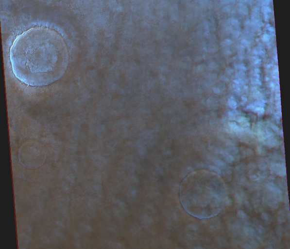
Cloud streets at Vastitas. Map.
| Orbit Number | 24332 |
|---|---|
| Latitude | 67.57 |
| Longitude [E/W] | 99.07 |
| Longitude [E] | 99.07 |
| Ls | 48.1 |
| Date | 2023-04-08 00:00:00 |
| Local time | 13:48:33 |
| Cirrus Clouds | |
| Lee Waves | |
| Gravity Clouds | |
| ACB | |
| Cloud Streets | cloud streets |
| Elongated Dust Clouds | |
| Cumulus Cloud Sheet | |
| Plume | |
| Undefined | |
| Observation Type | Surface |
| Potentially Moving | |
| Spalte1 |
CT-125 #
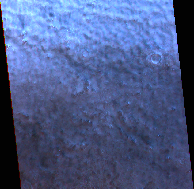
Cloud streets at Vastitas. Map.
| Orbit Number | 24334 |
|---|---|
| Latitude | 70.06 |
| Longitude [E/W] | -107.94 |
| Longitude [E] | 252.06 |
| Ls | 48.4 |
| Date | 2023-04-09 00:00:00 |
| Local time | 13:37:22 |
| Cirrus Clouds | |
| Lee Waves | |
| Gravity Clouds | |
| ACB | |
| Cloud Streets | cloud streets |
| Elongated Dust Clouds | |
| Cumulus Cloud Sheet | |
| Plume | |
| Undefined | |
| Observation Type | Surface |
| Potentially Moving | |
| Spalte1 |
CT-126 #
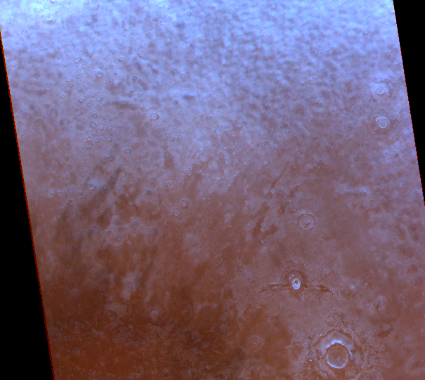
Cloud streets at Vastitas. Map.
| Orbit Number | 24328 |
|---|---|
| Latitude | 68.26 |
| Longitude [E/W] | 145.11 |
| Longitude [E] | 145.11 |
| Ls | 47.6 |
| Date | 2023-04-07 00:00:00 |
| Local time | 13:40:16 |
| Cirrus Clouds | |
| Lee Waves | |
| Gravity Clouds | |
| ACB | |
| Cloud Streets | cloud streets |
| Elongated Dust Clouds | |
| Cumulus Cloud Sheet | |
| Plume | |
| Undefined | |
| Observation Type | Surface |
| Potentially Moving | |
| Spalte1 |
CT-127 #
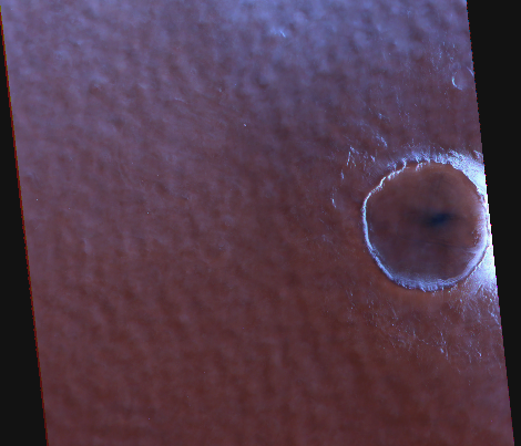
Cloud streets at Vastitas. Map.
| Orbit Number | 24327 |
|---|---|
| Latitude | 67.69 |
| Longitude [E/W] | -111.86 |
| Longitude [E] | 248.14 |
| Ls | 47.5 |
| Date | 2023-04-07 00:00:00 |
| Local time | 13:46:07 |
| Cirrus Clouds | |
| Lee Waves | |
| Gravity Clouds | |
| ACB | |
| Cloud Streets | cloud streets |
| Elongated Dust Clouds | |
| Cumulus Cloud Sheet | |
| Plume | |
| Undefined | |
| Observation Type | Surface |
| Potentially Moving | |
| Spalte1 |
CT-128 #
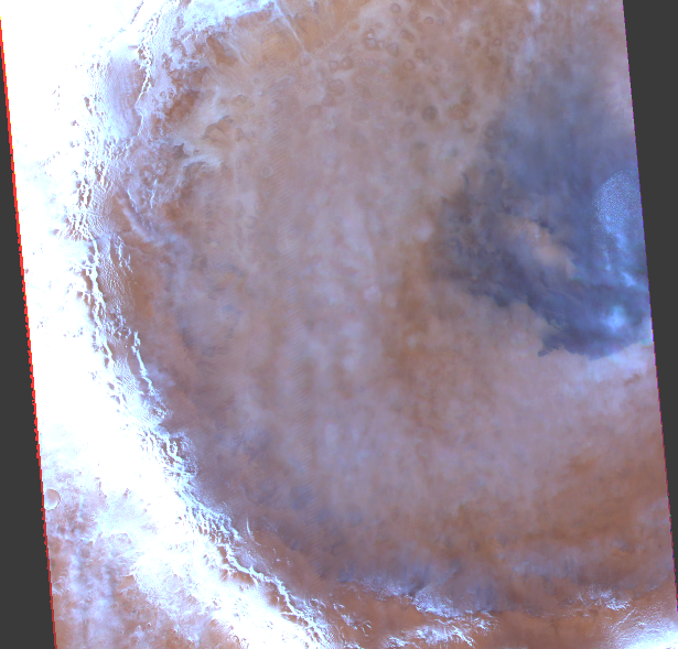
Cloud streets and ice at Vastitas. Map.
| Orbit Number | 24326 |
|---|---|
| Latitude | 67.16 |
| Longitude [E/W] | -10.98 |
| Longitude [E] | 349.02 |
| Ls | 47.3 |
| Date | 2023-04-06 00:00:00 |
| Local time | 13:46:01 |
| Cirrus Clouds | |
| Lee Waves | |
| Gravity Clouds | |
| ACB | |
| Cloud Streets | cloud streets |
| Elongated Dust Clouds | |
| Cumulus Cloud Sheet | |
| Plume | |
| Undefined | |
| Observation Type | Surface |
| Potentially Moving | |
| Spalte1 |
CT-129 #
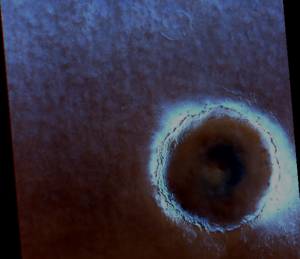
Cloud streets at Vastitas. Map.
| Orbit Number | 24322 |
|---|---|
| Latitude | 67.64 |
| Longitude [E/W] | 38.62 |
| Longitude [E] | 38.62 |
| Ls | 46.8 |
| Date | 2023-04-05 00:00:00 |
| Local time | 13:47:43 |
| Cirrus Clouds | |
| Lee Waves | |
| Gravity Clouds | |
| ACB | |
| Cloud Streets | cloud streets |
| Elongated Dust Clouds | |
| Cumulus Cloud Sheet | |
| Plume | |
| Undefined | |
| Observation Type | Surface |
| Potentially Moving | |
| Spalte1 |
CT-130 #
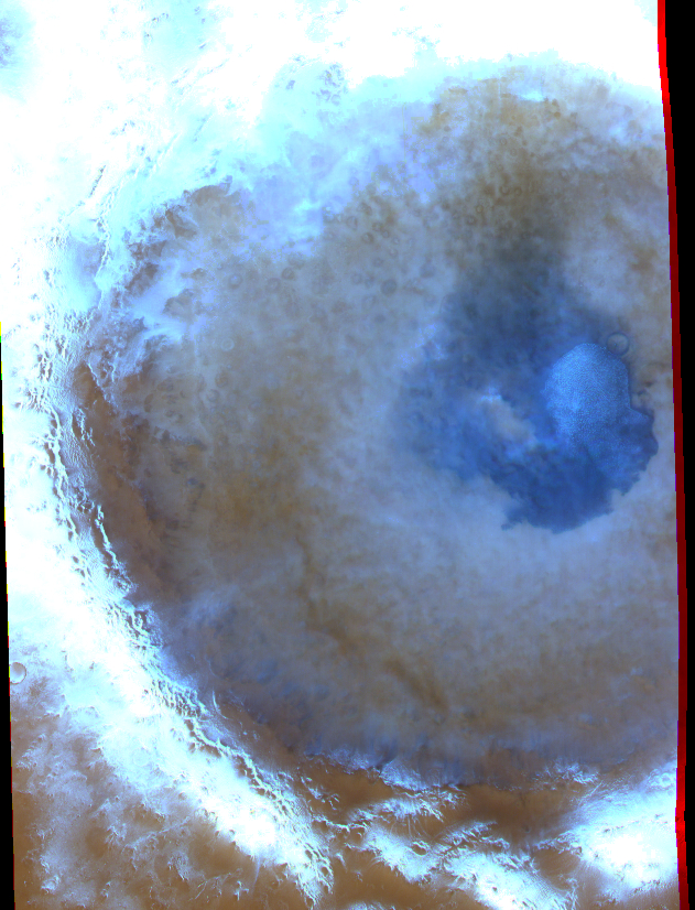
Cloud streets and ice at Vastitas. Map.
| Orbit Number | 24319 |
|---|---|
| Latitude | 64.82 |
| Longitude [E/W] | -9.56 |
| Longitude [E] | 350.44 |
| Ls | 46.4 |
| Date | 2023-04-04 00:00:00 |
| Local time | 14:11:12 |
| Cirrus Clouds | cirrus clouds |
| Lee Waves | |
| Gravity Clouds | |
| ACB | |
| Cloud Streets | cloud streets |
| Elongated Dust Clouds | |
| Cumulus Cloud Sheet | |
| Plume | |
| Undefined | |
| Observation Type | Surface |
| Potentially Moving | |
| Spalte1 |
CT-131 #
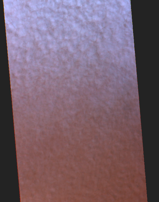
Cloud streets at Vastitas. Map.
| Orbit Number | 24315 |
|---|---|
| Latitude | 68.03 |
| Longitude [E/W] | 33.49 |
| Longitude [E] | 33.49 |
| Ls | 45.9 |
| Date | 2023-04-03 00:00:00 |
| Local time | 13:52:18 |
| Cirrus Clouds | |
| Lee Waves | |
| Gravity Clouds | |
| ACB | |
| Cloud Streets | cloud streets |
| Elongated Dust Clouds | |
| Cumulus Cloud Sheet | |
| Plume | |
| Undefined | |
| Observation Type | Surface |
| Potentially Moving | |
| Spalte1 |
CT-132 #
Cloud streets at Vastitas. Map.
| Orbit Number | 24313 |
|---|---|
| Latitude | 69.38 |
| Longitude [E/W] | -122.23 |
| Longitude [E] | 237.77 |
| Ls | 45.7 |
| Date | 2023-04-03 00:00:00 |
| Local time | 13:53:31 |
| Cirrus Clouds | |
| Lee Waves | |
| Gravity Clouds | |
| ACB | |
| Cloud Streets | cloud streets |
| Elongated Dust Clouds | |
| Cumulus Cloud Sheet | |
| Plume | |
| Undefined | |
| Observation Type | Surface |
| Potentially Moving | |
| Spalte1 |
CT-133 #

Cloud steets at Vastitas. Map.
| Orbit Number | 24312 |
|---|---|
| Latitude | 70.45 |
| Longitude [E/W] | -20.87 |
| Longitude [E] | 339.13 |
| Ls | 45.5 |
| Date | 2023-04-02 00:00:00 |
| Local time | 13:51:05 |
| Cirrus Clouds | |
| Lee Waves | |
| Gravity Clouds | |
| ACB | |
| Cloud Streets | cloud streets |
| Elongated Dust Clouds | |
| Cumulus Cloud Sheet | |
| Plume | |
| Undefined | |
| Observation Type | Surface |
| Potentially Moving | |
| Spalte1 |
CT-134 #
Cloud streets at Vastitas. Map.
| Orbit Number | 24310 |
|---|---|
| Latitude | 67.78 |
| Longitude [E/W] | -175.59 |
| Longitude [E] | 184.41 |
| Ls | 45.3 |
| Date | 2023-04-02 00:00:00 |
| Local time | 13:56:51 |
| Cirrus Clouds | |
| Lee Waves | |
| Gravity Clouds | |
| ACB | |
| Cloud Streets | cloud streets |
| Elongated Dust Clouds | |
| Cumulus Cloud Sheet | |
| Plume | |
| Undefined | |
| Observation Type | Surface |
| Potentially Moving | |
| Spalte1 |
CT-135 #
Cloud streets at Vastitas. Map.
| Orbit Number | 24308 |
|---|---|
| Latitude | 67.19 |
| Longitude [E/W] | 28.72 |
| Longitude [E] | 28.72 |
| Ls | 45.0 |
| Date | 2023-04-01 00:00:00 |
| Local time | 13:57:39 |
| Cirrus Clouds | |
| Lee Waves | |
| Gravity Clouds | |
| ACB | |
| Cloud Streets | cloud streets |
| Elongated Dust Clouds | |
| Cumulus Cloud Sheet | |
| Plume | |
| Undefined | |
| Observation Type | Surface |
| Potentially Moving | |
| Spalte1 |
CT-136 #
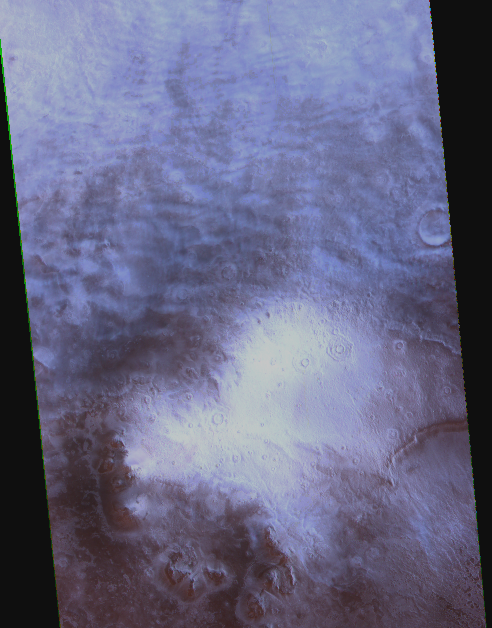
Cloud streets at Vastitas. Map.
| Orbit Number | 24306 |
|---|---|
| Latitude | 70.26 |
| Longitude [E/W] | -128.27 |
| Longitude [E] | 231.73 |
| Ls | 44.8 |
| Date | 2023-03-31 00:00:00 |
| Local time | 13:53:47 |
| Cirrus Clouds | |
| Lee Waves | |
| Gravity Clouds | |
| ACB | |
| Cloud Streets | cloud streets |
| Elongated Dust Clouds | |
| Cumulus Cloud Sheet | |
| Plume | |
| Undefined | |
| Observation Type | Surface |
| Potentially Moving | |
| Spalte1 |
CT-137 #
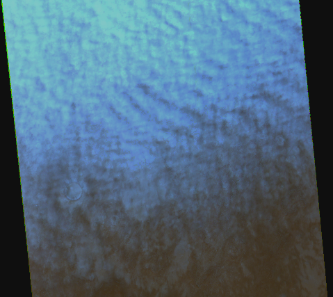
Cloud streets at Vastitas. Map.
| Orbit Number | 24303 |
|---|---|
| Latitude | 67.88 |
| Longitude [E/W] | 179.32 |
| Longitude [E] | 179.32 |
| Ls | 44.4 |
| Date | 2023-03-31 00:00:00 |
| Local time | 14:00:28 |
| Cirrus Clouds | |
| Lee Waves | |
| Gravity Clouds | |
| ACB | |
| Cloud Streets | cloud streets |
| Elongated Dust Clouds | |
| Cumulus Cloud Sheet | |
| Plume | |
| Undefined | |
| Observation Type | Surface |
| Potentially Moving | |
| Spalte1 |
CT-138 #
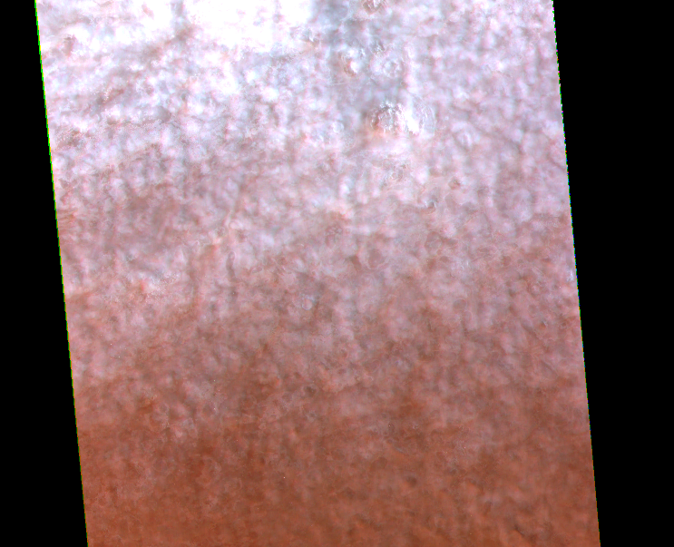
Cloud streets at Vastitas. Map.
| Orbit Number | 24299 |
|---|---|
| Latitude | 68.53 |
| Longitude [E/W] | -132.29 |
| Longitude [E] | 227.71 |
| Ls | 43.8 |
| Date | 2023-03-29 00:00:00 |
| Local time | 14:02:12 |
| Cirrus Clouds | |
| Lee Waves | |
| Gravity Clouds | |
| ACB | |
| Cloud Streets | cloud streets |
| Elongated Dust Clouds | |
| Cumulus Cloud Sheet | |
| Plume | |
| Undefined | |
| Observation Type | Surface |
| Potentially Moving | |
| Spalte1 |
CT-139 #
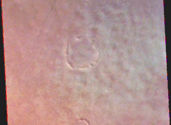
Cloud streets? at Tantalus Fosae. Map.
| Orbit Number | 24288 |
|---|---|
| Latitude | 58.25 |
| Longitude [E/W] | -85.04 |
| Longitude [E] | 274.96 |
| Ls | 42.4 |
| Date | 2023-03-26 00:00:00 |
| Local time | 14:24:01 |
| Cirrus Clouds | |
| Lee Waves | |
| Gravity Clouds | |
| ACB | |
| Cloud Streets | cloud streets |
| Elongated Dust Clouds | |
| Cumulus Cloud Sheet | |
| Plume | |
| Undefined | |
| Observation Type | Surface |
| Potentially Moving | |
| Spalte1 |
CT-140 #

Cirrus clouds and columuls cloud front at Tantalus Fosae. Map.
| Orbit Number | 24288 |
|---|---|
| Latitude | 51.19 |
| Longitude [E/W] | -84.84 |
| Longitude [E] | 275.16 |
| Ls | 42.4 |
| Date | 2023-03-26 00:00:00 |
| Local time | 14:24:49 |
| Cirrus Clouds | cirrus clouds |
| Lee Waves | |
| Gravity Clouds | |
| ACB | |
| Cloud Streets | |
| Elongated Dust Clouds | |
| Cumulus Cloud Sheet | cumulus cloud sheet |
| Plume | |
| Undefined | |
| Observation Type | Surface |
| Potentially Moving | |
| Spalte1 |
CT-141 #
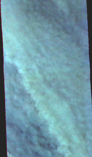
Thick cloud field at vastitas. Map.
| Orbit Number | 24277 |
|---|---|
| Latitude | 52.25 |
| Longitude [E/W] | -42.89 |
| Longitude [E] | 317.11 |
| Ls | 41.0 |
| Date | 2023-03-23 00:00:00 |
| Local time | 14:25:28 |
| Cirrus Clouds | |
| Lee Waves | |
| Gravity Clouds | |
| ACB | |
| Cloud Streets | |
| Elongated Dust Clouds | |
| Cumulus Cloud Sheet | cumulus cloud sheet |
| Plume | |
| Undefined | |
| Observation Type | Surface |
| Potentially Moving | |
| Spalte1 |
CT-142 #
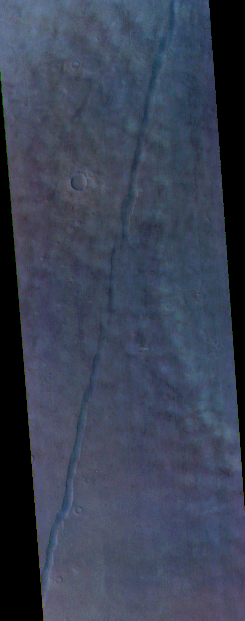
Cumulus clouds at Tantalus Fosae. Map.
| Orbit Number | 24274 |
|---|---|
| Latitude | 64.42 |
| Longitude [E/W] | -98.45 |
| Longitude [E] | 261.55 |
| Ls | 40.6 |
| Date | 2023-03-22 00:00:00 |
| Local time | 14:19:30 |
| Cirrus Clouds | |
| Lee Waves | |
| Gravity Clouds | |
| ACB | |
| Cloud Streets | cloud streets |
| Elongated Dust Clouds | |
| Cumulus Cloud Sheet | |
| Plume | |
| Undefined | |
| Observation Type | Surface |
| Potentially Moving | |
| Spalte1 |
CT-143 #
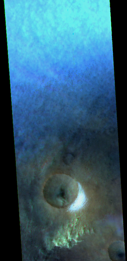
Cloud streets and located patch of cumulus clouds at Vastitas. Map.
| Orbit Number | 24270 |
|---|---|
| Latitude | 60.69 |
| Longitude [E/W] | -48.35 |
| Longitude [E] | 311.65 |
| Ls | 40.1 |
| Date | 2023-03-21 00:00:00 |
| Local time | 14:26:26 |
| Cirrus Clouds | |
| Lee Waves | |
| Gravity Clouds | |
| ACB | |
| Cloud Streets | cloud streets |
| Elongated Dust Clouds | |
| Cumulus Cloud Sheet | cumulus cloud sheet |
| Plume | |
| Undefined | |
| Observation Type | Surface |
| Potentially Moving | |
| Spalte1 |
CT-144 #

Lee waves at Vasisitas. Map.
| Orbit Number | 24258 |
|---|---|
| Latitude | 77.23 |
| Longitude [E/W] | 91.46 |
| Longitude [E] | 91.46 |
| Ls | 38.5 |
| Date | 2023-03-18 00:00:00 |
| Local time | 14:08:11 |
| Cirrus Clouds | |
| Lee Waves | lee waves |
| Gravity Clouds | |
| ACB | |
| Cloud Streets | |
| Elongated Dust Clouds | |
| Cumulus Cloud Sheet | |
| Plume | |
| Undefined | |
| Observation Type | Surface |
| Potentially Moving | |
| Spalte1 |
CT-145 #

Edge of cloud street field at Vasitas. Map.
| Orbit Number | 24219 |
|---|---|
| Latitude | 64.43 |
| Longitude [E/W] | 118.44 |
| Longitude [E] | 118.44 |
| Ls | 33.4 |
| Date | 2023-03-06 00:00:00 |
| Local time | 14:49:08 |
| Cirrus Clouds | |
| Lee Waves | |
| Gravity Clouds | |
| ACB | |
| Cloud Streets | cloud streets |
| Elongated Dust Clouds | |
| Cumulus Cloud Sheet | |
| Plume | |
| Undefined | |
| Observation Type | Surface |
| Potentially Moving | |
| Spalte1 |
CT-146 #
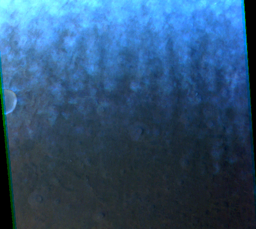
Edge of cloud street field at Vasitas. Map.
| Orbit Number | 24214 |
|---|---|
| Latitude | 65.79 |
| Longitude [E/W] | -90.82 |
| Longitude [E] | 269.18 |
| Ls | 33.4 |
| Date | 2023-03-05 00:00:00 |
| Local time | 14:52:26 |
| Cirrus Clouds | |
| Lee Waves | |
| Gravity Clouds | |
| ACB | |
| Cloud Streets | cloud streets |
| Elongated Dust Clouds | |
| Cumulus Cloud Sheet | |
| Plume | |
| Undefined | |
| Observation Type | Surface |
| Potentially Moving | |
| Spalte1 |
CT-147 #
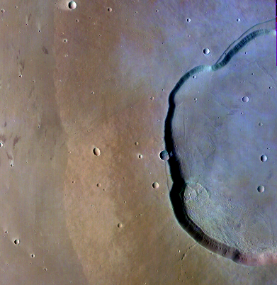
Cirrus clouds at Uranius Tholus. Map.
| Orbit Number | 24207 |
|---|---|
| Latitude | 26.21 |
| Longitude [E/W] | -93.41 |
| Longitude [E] | 266.59 |
| Ls | 31.8 |
| Date | 2023-03-03 00:00:00 |
| Local time | 15:14:22 |
| Cirrus Clouds | cirrus clouds |
| Lee Waves | |
| Gravity Clouds | |
| ACB | |
| Cloud Streets | |
| Elongated Dust Clouds | |
| Cumulus Cloud Sheet | |
| Plume | |
| Undefined | |
| Observation Type | Surface |
| Potentially Moving | |
| Spalte1 |
CT-148 #
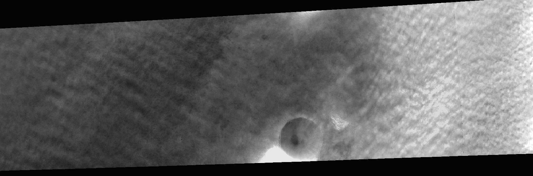
Cloud streets at Vastitas (very bad colour channel data quality; browse image is nadir channel). Map.
| Orbit Number | 24196 |
|---|---|
| Latitude | 60.24 |
| Longitude [E/W] | -49.61 |
| Longitude [E] | 310.39 |
| Ls | 30.3 |
| Date | 2023-02-27 00:00:00 |
| Local time | 15:13:27 |
| Cirrus Clouds | |
| Lee Waves | |
| Gravity Clouds | |
| ACB | |
| Cloud Streets | cloud streets |
| Elongated Dust Clouds | |
| Cumulus Cloud Sheet | |
| Plume | |
| Undefined | |
| Observation Type | Surface |
| Potentially Moving | |
| Spalte1 |
CT-149 #
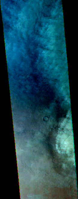
Cloud front in crater? at Tempe/Acidialia. Map.
| Orbit Number | 24189 |
|---|---|
| Latitude | 55.15 |
| Longitude [E/W] | -59.11 |
| Longitude [E] | 300.89 |
| Ls | 29.4 |
| Date | 2023-02-25 00:00:00 |
| Local time | 15:02:31 |
| Cirrus Clouds | |
| Lee Waves | |
| Gravity Clouds | |
| ACB | |
| Cloud Streets | |
| Elongated Dust Clouds | |
| Cumulus Cloud Sheet | cumulus cloud sheet |
| Plume | |
| Undefined | |
| Observation Type | Surface |
| Potentially Moving | |
| Spalte1 |
CT-150 #
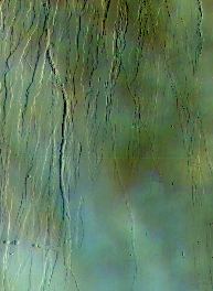
Cirrus clouds north of Ascareus Mons. Map.
| Orbit Number | 24186 |
|---|---|
| Latitude | 21.05 |
| Longitude [E/W] | -107.94 |
| Longitude [E] | 252.06 |
| Ls | 29.0 |
| Date | 2023-02-25 00:00:00 |
| Local time | 15:31:14 |
| Cirrus Clouds | cirrus clouds |
| Lee Waves | |
| Gravity Clouds | |
| ACB | |
| Cloud Streets | |
| Elongated Dust Clouds | |
| Cumulus Cloud Sheet | |
| Plume | |
| Undefined | |
| Observation Type | Surface |
| Potentially Moving | |
| Spalte1 |
CT-151 #
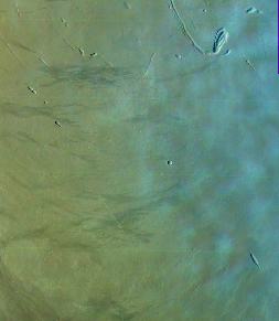
Cloud streets north of Ascareus Mons. Map.
| Orbit Number | 24186 |
|---|---|
| Latitude | 7.87 |
| Longitude [E/W] | -107.39 |
| Longitude [E] | 252.61 |
| Ls | 29.0 |
| Date | 2023-02-25 00:00:00 |
| Local time | 15:33:26 |
| Cirrus Clouds | |
| Lee Waves | |
| Gravity Clouds | |
| ACB | |
| Cloud Streets | cloud streets |
| Elongated Dust Clouds | |
| Cumulus Cloud Sheet | |
| Plume | |
| Undefined | |
| Observation Type | Surface |
| Potentially Moving | |
| Spalte1 |
CT-152 #
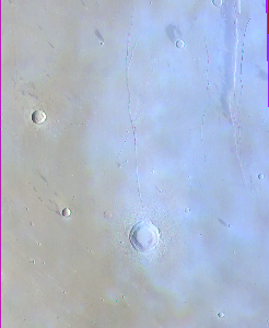
Cirrus clouds at Elysium. Map.
| Orbit Number | 24180 |
|---|---|
| Latitude | 25.09 |
| Longitude [E/W] | 143.49 |
| Longitude [E] | 143.49 |
| Ls | 28.2 |
| Date | 2023-02-23 00:00:00 |
| Local time | 15:28:15 |
| Cirrus Clouds | cirrus clouds |
| Lee Waves | |
| Gravity Clouds | |
| ACB | |
| Cloud Streets | |
| Elongated Dust Clouds | |
| Cumulus Cloud Sheet | |
| Plume | |
| Undefined | |
| Observation Type | Surface |
| Potentially Moving | |
| Spalte1 |
CT-153 #
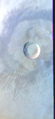
Cirrus clouds at Pavonis Mons. Map.
| Orbit Number | 24179 |
|---|---|
| Latitude | -0.13 |
| Longitude [E/W] | -112.38 |
| Longitude [E] | 247.62 |
| Ls | 28.0 |
| Date | 2023-02-23 00:00:00 |
| Local time | 15:41:50 |
| Cirrus Clouds | cirrus clouds |
| Lee Waves | |
| Gravity Clouds | |
| ACB | |
| Cloud Streets | |
| Elongated Dust Clouds | |
| Cumulus Cloud Sheet | |
| Plume | |
| Undefined | |
| Observation Type | Surface |
| Potentially Moving | |
| Spalte1 |
CT-154 #
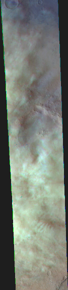
Cumulus clouds at TempeTerra (moving?). Map.
| Orbit Number | 24175 |
|---|---|
| Latitude | 51.21 |
| Longitude [E/W] | -65.02 |
| Longitude [E] | 294.98 |
| Ls | 27.5 |
| Date | 2023-02-21 00:00:00 |
| Local time | 15:27:28 |
| Cirrus Clouds | |
| Lee Waves | |
| Gravity Clouds | |
| ACB | |
| Cloud Streets | |
| Elongated Dust Clouds | |
| Cumulus Cloud Sheet | cumulus cloud sheet |
| Plume | |
| Undefined | |
| Observation Type | Surface |
| Potentially Moving | Yes |
| Spalte1 |
CT-155 #
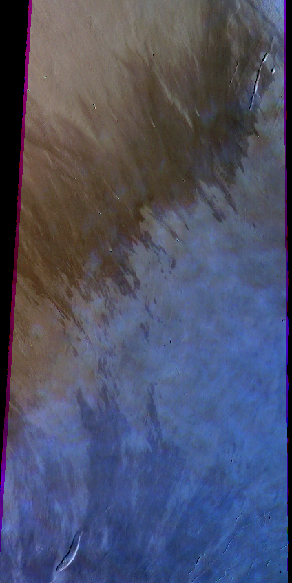
Cloud streets? at Tharsis. Map.
| Orbit Number | 24172 |
|---|---|
| Latitude | -3.78 |
| Longitude [E/W] | -117.85 |
| Longitude [E] | 242.15 |
| Ls | 27.1 |
| Date | 2023-02-21 00:00:00 |
| Local time | 15:41:48 |
| Cirrus Clouds | |
| Lee Waves | |
| Gravity Clouds | |
| ACB | |
| Cloud Streets | cloud streets |
| Elongated Dust Clouds | |
| Cumulus Cloud Sheet | |
| Plume | |
| Undefined | |
| Observation Type | Surface |
| Potentially Moving | |
| Spalte1 |
CT-156 #
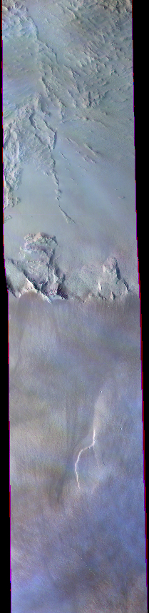
Cirrus clouds at Olympus. Map.
| Orbit Number | 24151 |
|---|---|
| Latitude | 20.85 |
| Longitude [E/W] | -134.94 |
| Longitude [E] | 225.06 |
| Ls | 24.4 |
| Date | 2023-02-14 00:00:00 |
| Local time | 15:41:32 |
| Cirrus Clouds | cirrus clouds |
| Lee Waves | |
| Gravity Clouds | |
| ACB | |
| Cloud Streets | |
| Elongated Dust Clouds | |
| Cumulus Cloud Sheet | |
| Plume | |
| Undefined | |
| Observation Type | Surface |
| Potentially Moving | |
| Spalte1 |
CT-157 #
Cumulus? cloud field at Acidalia. Map.
| Orbit Number | 24150 |
|---|---|
| Latitude | 50.47 |
| Longitude [E/W] | -33.37 |
| Longitude [E] | 326.63 |
| Ls | 24.1 |
| Date | 2023-02-14 00:00:00 |
| Local time | 15:35:15 |
| Cirrus Clouds | |
| Lee Waves | |
| Gravity Clouds | |
| ACB | |
| Cloud Streets | |
| Elongated Dust Clouds | |
| Cumulus Cloud Sheet | cumulus cloud sheet |
| Plume | |
| Undefined | |
| Observation Type | Surface |
| Potentially Moving | |
| Spalte1 |
CT-158 #
Cloud streets at Vastitas. Map.
| Orbit Number | 24147 |
|---|---|
| Latitude | 64.24 |
| Longitude [E/W] | -90.0 |
| Longitude [E] | 270.0 |
| Ls | 23.7 |
| Date | 2023-02-13 00:00:00 |
| Local time | 15:21:03 |
| Cirrus Clouds | |
| Lee Waves | |
| Gravity Clouds | |
| ACB | |
| Cloud Streets | cloud streets |
| Elongated Dust Clouds | |
| Cumulus Cloud Sheet | |
| Plume | |
| Undefined | |
| Observation Type | Surface |
| Potentially Moving | |
| Spalte1 |
CT-159 #
Cirrus clouds at Olympus. Map.
| Orbit Number | 24144 |
|---|---|
| Latitude | 20.87 |
| Longitude [E/W] | -136.48 |
| Longitude [E] | 223.52 |
| Ls | 23.3 |
| Date | 2023-02-12 00:00:00 |
| Local time | 16:00:32 |
| Cirrus Clouds | cirrus clouds |
| Lee Waves | |
| Gravity Clouds | |
| ACB | |
| Cloud Streets | |
| Elongated Dust Clouds | |
| Cumulus Cloud Sheet | |
| Plume | |
| Undefined | |
| Observation Type | Surface |
| Potentially Moving | |
| Spalte1 |
CT-160 #
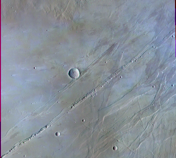
Small clouds at Uranius Palera and Tharsis Tholus. Map.
| Orbit Number | 24140 |
|---|---|
| Latitude | 24.24 |
| Longitude [E/W] | -91.43 |
| Longitude [E] | 268.57 |
| Ls | 22.8 |
| Date | 2023-02-11 00:00:00 |
| Local time | 15:49:27 |
| Cirrus Clouds | cirrus clouds |
| Lee Waves | |
| Gravity Clouds | |
| ACB | |
| Cloud Streets | |
| Elongated Dust Clouds | |
| Cumulus Cloud Sheet | |
| Plume | |
| Undefined | |
| Observation Type | Surface |
| Potentially Moving | |
| Spalte1 |
CT-161 #
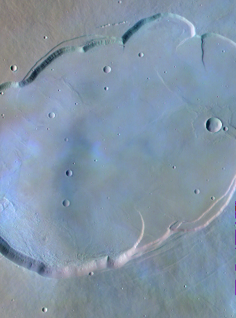
Cirrus clouds at Uranius Palera. Map.
| Orbit Number | 24133 |
|---|---|
| Latitude | 26.17 |
| Longitude [E/W] | -93.24 |
| Longitude [E] | 266.76 |
| Ls | 21.8 |
| Date | 2023-02-09 00:00:00 |
| Local time | 16:06:15 |
| Cirrus Clouds | cirrus clouds |
| Lee Waves | |
| Gravity Clouds | |
| ACB | |
| Cloud Streets | |
| Elongated Dust Clouds | |
| Cumulus Cloud Sheet | |
| Plume | |
| Undefined | |
| Observation Type | Surface |
| Potentially Moving | |
| Spalte1 |
CT-162 #
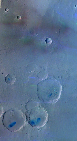
Moving? cirrus clouds at Arabia Terra. Map.
| Orbit Number | 24125 |
|---|---|
| Latitude | 11.92 |
| Longitude [E/W] | 5.47 |
| Longitude [E] | 5.47 |
| Ls | 20.0 |
| Date | 2023-02-05 00:00:00 |
| Local time | 06:10:48 |
| Cirrus Clouds | cirrus clouds |
| Lee Waves | |
| Gravity Clouds | |
| ACB | |
| Cloud Streets | |
| Elongated Dust Clouds | |
| Cumulus Cloud Sheet | |
| Plume | |
| Undefined | |
| Observation Type | Surface |
| Potentially Moving | Yes |
| Spalte1 |
CT-163 #
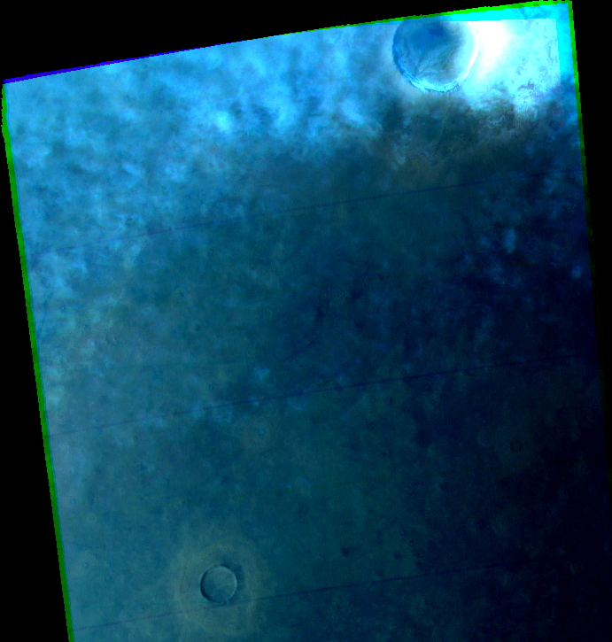
Cloud streets? at Vastitas. Map.
| Orbit Number | 24120 |
|---|---|
| Latitude | 60.19 |
| Longitude [E/W] | 146.21 |
| Longitude [E] | 146.21 |
| Ls | 20.0 |
| Date | 2023-02-05 00:00:00 |
| Local time | 15:33:45 |
| Cirrus Clouds | |
| Lee Waves | |
| Gravity Clouds | |
| ACB | |
| Cloud Streets | cloud streets |
| Elongated Dust Clouds | |
| Cumulus Cloud Sheet | |
| Plume | |
| Undefined | |
| Observation Type | Surface |
| Potentially Moving | |
| Spalte1 |
CT-164 #

Cirrus cloud at Ascareus. Map.
| Orbit Number | 24119 |
|---|---|
| Latitude | 15.3 |
| Longitude [E/W] | -105.06 |
| Longitude [E] | 254.94 |
| Ls | 19.9 |
| Date | 2023-02-05 00:00:00 |
| Local time | 16:08:01 |
| Cirrus Clouds | cirrus clouds |
| Lee Waves | |
| Gravity Clouds | |
| ACB | |
| Cloud Streets | |
| Elongated Dust Clouds | |
| Cumulus Cloud Sheet | |
| Plume | |
| Undefined | |
| Observation Type | Surface |
| Potentially Moving | |
| Spalte1 |
CT-165 #
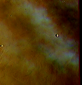
Clouds at Elysium. Map.
| Orbit Number | 24113 |
|---|---|
| Latitude | 21.8 |
| Longitude [E/W] | 146.8 |
| Longitude [E] | 146.8 |
| Ls | 19.1 |
| Date | 2023-02-03 00:00:00 |
| Local time | 16:07:30 |
| Cirrus Clouds | cirrus clouds |
| Lee Waves | |
| Gravity Clouds | |
| ACB | |
| Cloud Streets | |
| Elongated Dust Clouds | |
| Cumulus Cloud Sheet | |
| Plume | |
| Undefined | |
| Observation Type | Surface |
| Potentially Moving | Yes |
| Spalte1 |
CT-166 #
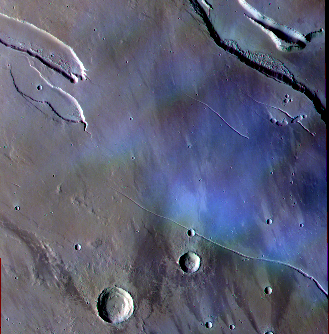
Cirrus clouds at Elysium. Map.
| Orbit Number | 24106 |
|---|---|
| Latitude | 26.9 |
| Longitude [E/W] | 141.8 |
| Longitude [E] | 141.8 |
| Ls | 16.9 |
| Date | 2023-01-30 00:00:00 |
| Local time | 02:54:36 |
| Cirrus Clouds | |
| Lee Waves | lee waves |
| Gravity Clouds | |
| ACB | |
| Cloud Streets | |
| Elongated Dust Clouds | |
| Cumulus Cloud Sheet | |
| Plume | |
| Undefined | |
| Observation Type | Surface |
| Potentially Moving | Yes |
| Spalte1 |
CT-167 #
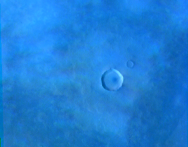
Cirrus clouds at Acidalia. Map.
| Orbit Number | 24097 |
|---|---|
| Latitude | 52.21 |
| Longitude [E/W] | -16.09 |
| Longitude [E] | 343.91 |
| Ls | 16.9 |
| Date | 2023-01-30 00:00:00 |
| Local time | 16:23:02 |
| Cirrus Clouds | cirrus clouds |
| Lee Waves | |
| Gravity Clouds | |
| ACB | |
| Cloud Streets | |
| Elongated Dust Clouds | |
| Cumulus Cloud Sheet | |
| Plume | |
| Undefined | |
| Observation Type | Surface |
| Potentially Moving | |
| Spalte1 |
CT-168 #
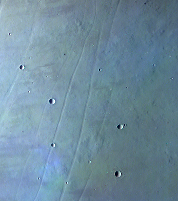
Cirrus clouds at utopia. Map.
| Orbit Number | 24066 |
|---|---|
| Latitude | 4.29 |
| Longitude [E/W] | -91.79 |
| Longitude [E] | 268.21 |
| Ls | 12.6 |
| Date | 2023-01-21 00:00:00 |
| Local time | 16:43:38 |
| Cirrus Clouds | cirrus clouds |
| Lee Waves | |
| Gravity Clouds | |
| ACB | |
| Cloud Streets | |
| Elongated Dust Clouds | |
| Cumulus Cloud Sheet | |
| Plume | |
| Undefined | |
| Observation Type | Surface |
| Potentially Moving | |
| Spalte1 |
CT-169 #
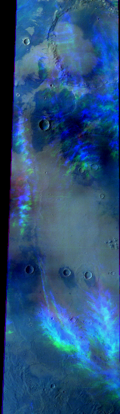
(moving?) cirrus clouds at S Arabia Terra. Map.
| Orbit Number | 24065 |
|---|---|
| Latitude | -6.72 |
| Longitude [E/W] | 10.39 |
| Longitude [E] | 10.39 |
| Ls | 12.4 |
| Date | 2023-01-20 00:00:00 |
| Local time | 16:45:40 |
| Cirrus Clouds | cirrus clouds |
| Lee Waves | |
| Gravity Clouds | |
| ACB | |
| Cloud Streets | |
| Elongated Dust Clouds | |
| Cumulus Cloud Sheet | |
| Plume | |
| Undefined | |
| Observation Type | Surface |
| Potentially Moving | Yes |
| Spalte1 |
CT-170 #
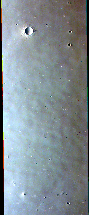
Cloud-street-like clouds southwest of Utopia Planitia. Map.
| Orbit Number | 24064 |
|---|---|
| Latitude | 24.75 |
| Longitude [E/W] | 110.83 |
| Longitude [E] | 110.83 |
| Ls | 12.3 |
| Date | 2023-01-20 00:00:00 |
| Local time | 16:34:19 |
| Cirrus Clouds | |
| Lee Waves | |
| Gravity Clouds | |
| ACB | |
| Cloud Streets | cloud streets |
| Elongated Dust Clouds | |
| Cumulus Cloud Sheet | |
| Plume | |
| Undefined | |
| Observation Type | Surface |
| Potentially Moving | |
| Spalte1 |
CT-171 #
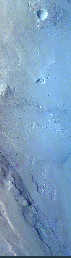
Clouds near Olympus. Map.
| Orbit Number | 24063 |
|---|---|
| Latitude | 2.32 |
| Longitude [E/W] | -142.92 |
| Longitude [E] | 217.08 |
| Ls | 12.1 |
| Date | 2023-01-20 00:00:00 |
| Local time | 16:52:48 |
| Cirrus Clouds | cirrus clouds |
| Lee Waves | |
| Gravity Clouds | |
| ACB | |
| Cloud Streets | |
| Elongated Dust Clouds | |
| Cumulus Cloud Sheet | |
| Plume | |
| Undefined | |
| Observation Type | Surface |
| Potentially Moving | |
| Spalte1 |
CT-172 #
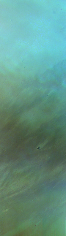
Cirrus clouds at Tharsis. Map.
| Orbit Number | 24052 |
|---|---|
| Latitude | 11.94 |
| Longitude [E/W] | -99.2 |
| Longitude [E] | 260.8 |
| Ls | 10.6 |
| Date | 2023-01-17 00:00:00 |
| Local time | 17:01:41 |
| Cirrus Clouds | cirrus clouds |
| Lee Waves | |
| Gravity Clouds | |
| ACB | |
| Cloud Streets | |
| Elongated Dust Clouds | |
| Cumulus Cloud Sheet | |
| Plume | |
| Undefined | |
| Observation Type | Surface |
| Potentially Moving | |
| Spalte1 |
CT-173 #

Cirrus clouds at Xanthe. Map.
| Orbit Number | 24048 |
|---|---|
| Latitude | 7.06 |
| Longitude [E/W] | -51.6 |
| Longitude [E] | 308.4 |
| Ls | 10.0 |
| Date | 2023-01-15 00:00:00 |
| Local time | 16:57:48 |
| Cirrus Clouds | cirrus clouds |
| Lee Waves | |
| Gravity Clouds | |
| ACB | |
| Cloud Streets | |
| Elongated Dust Clouds | |
| Cumulus Cloud Sheet | |
| Plume | |
| Undefined | |
| Observation Type | Surface |
| Potentially Moving | |
| Spalte1 |
CT-174 #
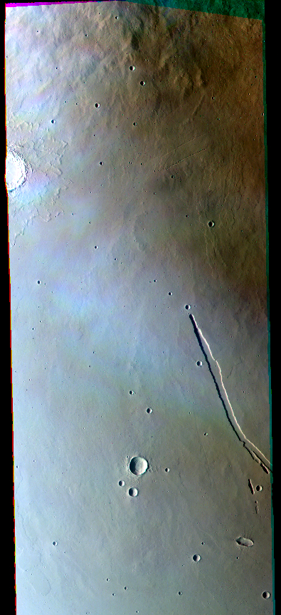
Cirrus cloud at Elysium. Map.
| Orbit Number | 24046 |
|---|---|
| Latitude | 21.14 |
| Longitude [E/W] | 146.76 |
| Longitude [E] | 146.76 |
| Ls | 9.7 |
| Date | 2023-01-15 00:00:00 |
| Local time | 16:36:09 |
| Cirrus Clouds | cirrus clouds |
| Lee Waves | |
| Gravity Clouds | |
| ACB | |
| Cloud Streets | |
| Elongated Dust Clouds | |
| Cumulus Cloud Sheet | |
| Plume | |
| Undefined | |
| Observation Type | Surface |
| Potentially Moving | |
| Spalte1 |
CT-175 #
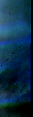
Horizontal lines of clouds at Tharsis. Map.
| Orbit Number | 24045 |
|---|---|
| Latitude | 0.24 |
| Longitude [E/W] | -105.9 |
| Longitude [E] | 254.1 |
| Ls | 9.6 |
| Date | 2023-01-15 00:00:00 |
| Local time | 16:58:13 |
| Cirrus Clouds | cirrus clouds |
| Lee Waves | |
| Gravity Clouds | |
| ACB | |
| Cloud Streets | |
| Elongated Dust Clouds | |
| Cumulus Cloud Sheet | |
| Plume | |
| Undefined | |
| Observation Type | Surface |
| Potentially Moving | |
| Spalte1 |
CT-176 #

Clouds at Tharsis. Map.
| Orbit Number | 24031 |
|---|---|
| Latitude | 2.76 |
| Longitude [E/W] | -116.51 |
| Longitude [E] | 243.49 |
| Ls | 7.6 |
| Date | 2023-01-10 00:00:00 |
| Local time | 17:04:16 |
| Cirrus Clouds | cirrus clouds |
| Lee Waves | |
| Gravity Clouds | |
| ACB | |
| Cloud Streets | |
| Elongated Dust Clouds | |
| Cumulus Cloud Sheet | |
| Plume | |
| Undefined | |
| Observation Type | Surface |
| Potentially Moving | |
| Spalte1 |
CT-177 #

Faint early monring cirrus clouds at Olypmus Mons (terminator observation). Map.
| Orbit Number | 23924 |
|---|---|
| Latitude | 18.0 |
| Longitude [E/W] | -131.0 |
| Longitude [E] | 229.0 |
| Ls | 352.0 |
| Date | 2022-12-10 00:00:00 |
| Local time | 06:11:44 |
| Cirrus Clouds | cirrus clouds |
| Lee Waves | |
| Gravity Clouds | |
| ACB | |
| Cloud Streets | |
| Elongated Dust Clouds | |
| Cumulus Cloud Sheet | |
| Plume | |
| Undefined | |
| Observation Type | Broom |
| Potentially Moving | |
| Spalte1 |
CT-178 #
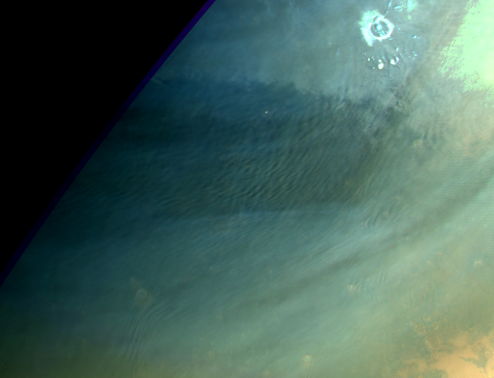
Extensive gravity cloud field and lee waves at Acidalia Colles. Map.
| Orbit Number | 23835 |
|---|---|
| Latitude | 50.0 |
| Longitude [E/W] | -20.0 |
| Longitude [E] | 340.0 |
| Ls | 338.5 |
| Date | 2022-11-14 00:00:00 |
| Local time | 08:59:41 |
| Cirrus Clouds | cirrus clouds |
| Lee Waves | lee waves |
| Gravity Clouds | gravity clouds |
| ACB | |
| Cloud Streets | |
| Elongated Dust Clouds | |
| Cumulus Cloud Sheet | |
| Plume | |
| Undefined | |
| Observation Type | Broom |
| Potentially Moving | |
| Spalte1 |
CT-179 #
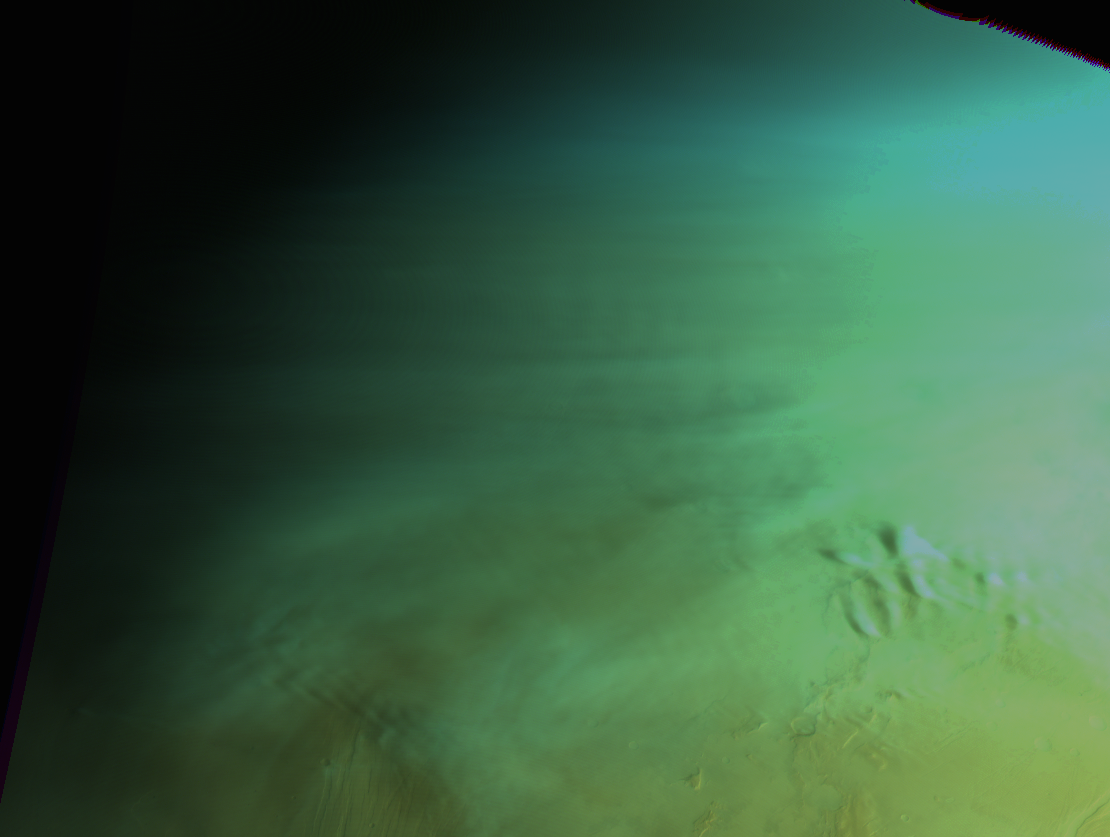
Lee waves NE of Alba Patera and at Mareotis Fossae. Map.
| Orbit Number | 23775 |
|---|---|
| Latitude | 55.0 |
| Longitude [E/W] | -91.0 |
| Longitude [E] | 269.0 |
| Ls | 329.1 |
| Date | 2022-10-28 00:00:00 |
| Local time | 08:40:04 |
| Cirrus Clouds | |
| Lee Waves | lee waves |
| Gravity Clouds | |
| ACB | |
| Cloud Streets | |
| Elongated Dust Clouds | |
| Cumulus Cloud Sheet | |
| Plume | |
| Undefined | |
| Observation Type | Broom |
| Potentially Moving | |
| Spalte1 |
CT-180 #

Gravitiy clouds and lee wavesnorth of NE of Alba Patera and at Mareotis Fossae. Map.
| Orbit Number | 23754 |
|---|---|
| Latitude | 47.0 |
| Longitude [E/W] | -99.0 |
| Longitude [E] | 261.0 |
| Ls | 325.7 |
| Date | 2022-10-22 00:00:00 |
| Local time | 08:52:23 |
| Cirrus Clouds | |
| Lee Waves | lee waves |
| Gravity Clouds | gravity clouds |
| ACB | |
| Cloud Streets | |
| Elongated Dust Clouds | |
| Cumulus Cloud Sheet | |
| Plume | |
| Undefined | |
| Observation Type | Broom |
| Potentially Moving | |
| Spalte1 |
CT-181 #
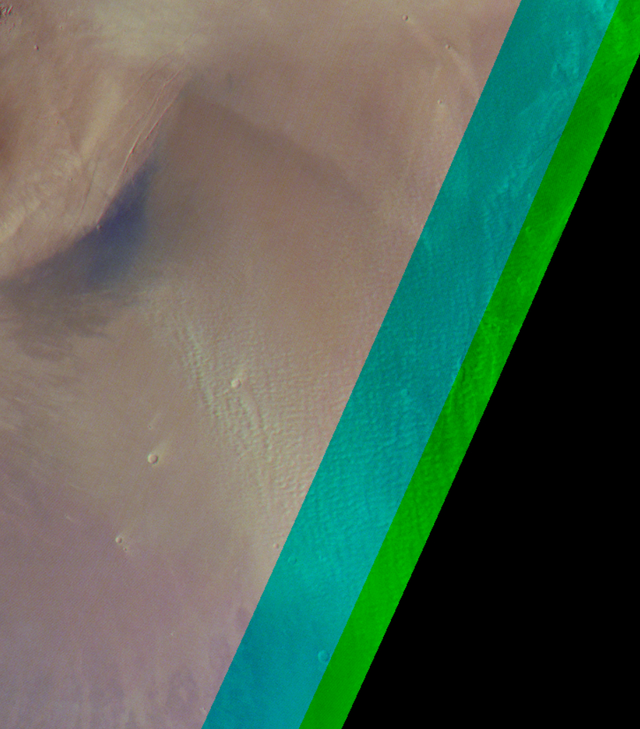
Cloud streets near Arsia Mons. Map.
| Orbit Number | 23673 |
|---|---|
| Latitude | -14.0 |
| Longitude [E/W] | -119.39 |
| Longitude [E] | 240.61 |
| Ls | 312.2 |
| Date | 2022-09-28 00:00:00 |
| Local time | 07:45:35 |
| Cirrus Clouds | |
| Lee Waves | |
| Gravity Clouds | |
| ACB | |
| Cloud Streets | cloud streets |
| Elongated Dust Clouds | |
| Cumulus Cloud Sheet | |
| Plume | |
| Undefined | |
| Observation Type | Broom |
| Potentially Moving | |
| Spalte1 |
CT-182 #
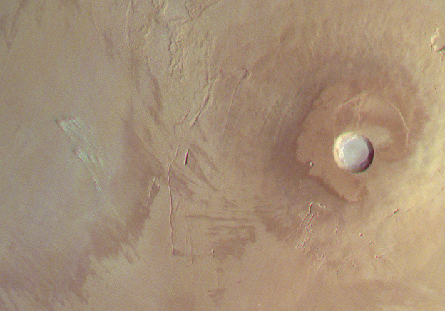
Very small, streak-like, elongated clouds at Tharsis Montes (dust lifting event?). Map.
| Orbit Number | 23673 |
|---|---|
| Latitude | 0.85 |
| Longitude [E/W] | -118.11 |
| Longitude [E] | 241.89 |
| Ls | 312.2 |
| Date | 2022-09-28 00:00:00 |
| Local time | 07:45:35 |
| Cirrus Clouds | |
| Lee Waves | |
| Gravity Clouds | |
| ACB | |
| Cloud Streets | |
| Elongated Dust Clouds | elongated dust cloud |
| Cumulus Cloud Sheet | |
| Plume | |
| Undefined | |
| Observation Type | Broom |
| Potentially Moving | Yes |
| Spalte1 |
CT-183 #
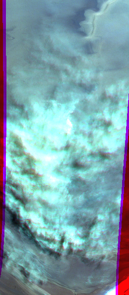
Thick cumulus cloud field and elongated (dust?) clouds at south polar region (EDCs at lower image part). Map.
| Orbit Number | 23663 |
|---|---|
| Latitude | -84.0 |
| Longitude [E/W] | -158.0 |
| Longitude [E] | 202.0 |
| Ls | 310.5 |
| Date | 2022-09-25 00:00:00 |
| Local time | 08:52:19 |
| Cirrus Clouds | |
| Lee Waves | |
| Gravity Clouds | |
| ACB | |
| Cloud Streets | |
| Elongated Dust Clouds | elongated dust cloud |
| Cumulus Cloud Sheet | cumulus cloud sheet |
| Plume | |
| Undefined | |
| Observation Type | Surface |
| Potentially Moving | Yes |
| Spalte1 |
CT-184 #
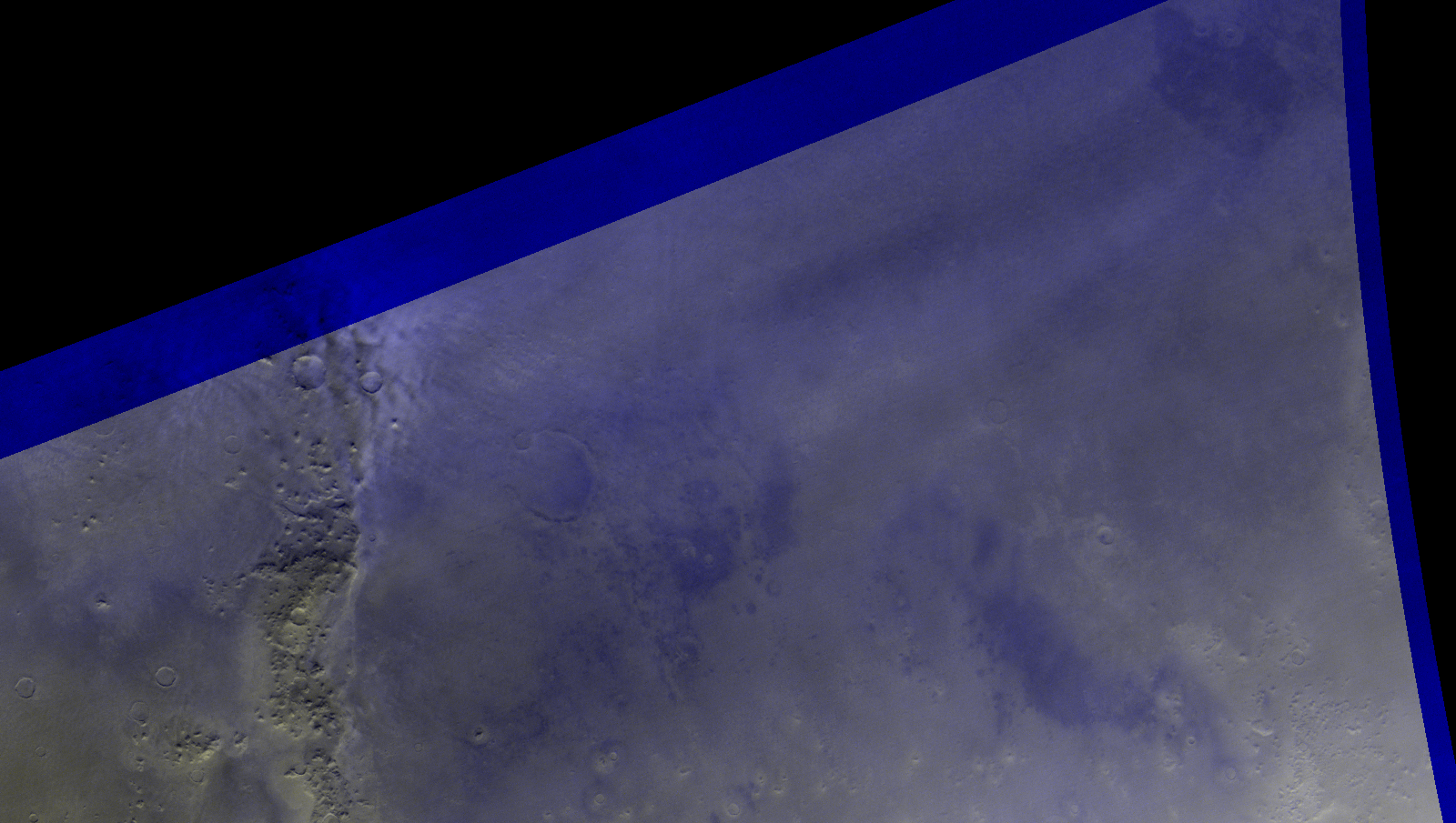
Lee wave clouds at Phlegra Montes. Map.
| Orbit Number | 23526 |
|---|---|
| Latitude | 40.0 |
| Longitude [E/W] | 179.0 |
| Longitude [E] | 179.0 |
| Ls | 286.6 |
| Date | 2022-08-17 00:00:00 |
| Local time | 20:38:56 |
| Cirrus Clouds | |
| Lee Waves | lee waves |
| Gravity Clouds | |
| ACB | |
| Cloud Streets | |
| Elongated Dust Clouds | |
| Cumulus Cloud Sheet | |
| Plume | |
| Undefined | |
| Observation Type | Broom |
| Potentially Moving | |
| Spalte1 |
CT-185 #
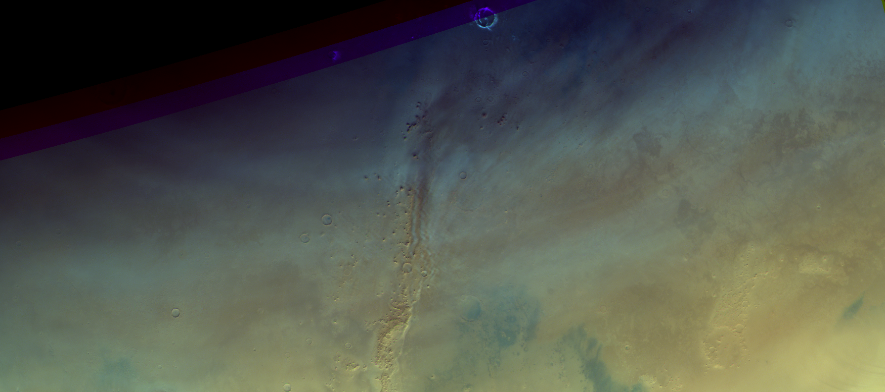
Lee wave clouds + early mornig frost at Phlegra Montes. Map.
| Orbit Number | 23515 |
|---|---|
| Latitude | 48.0 |
| Longitude [E/W] | 175.0 |
| Longitude [E] | 175.0 |
| Ls | 284.7 |
| Date | 2022-08-13 00:00:00 |
| Local time | 18:19:58 |
| Cirrus Clouds | cirrus clouds |
| Lee Waves | lee waves |
| Gravity Clouds | |
| ACB | |
| Cloud Streets | |
| Elongated Dust Clouds | |
| Cumulus Cloud Sheet | |
| Plume | |
| Undefined | |
| Observation Type | Broom |
| Potentially Moving | |
| Spalte1 |
CT-186 #
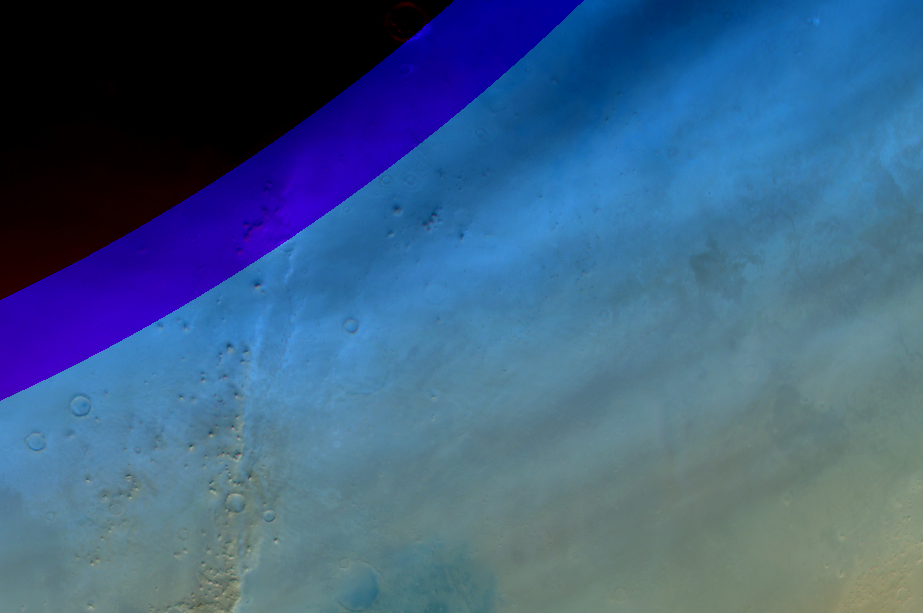
Lee wave and cirrus clouds at Phlegra and Arcadia Planitia. Map.
| Orbit Number | 23501 |
|---|---|
| Latitude | 45.0 |
| Longitude [E/W] | -172.0 |
| Longitude [E] | 188.0 |
| Ls | 282.2 |
| Date | 2022-08-09 00:00:00 |
| Local time | 11:55:03 |
| Cirrus Clouds | cirrus clouds |
| Lee Waves | lee waves |
| Gravity Clouds | |
| ACB | |
| Cloud Streets | |
| Elongated Dust Clouds | |
| Cumulus Cloud Sheet | |
| Plume | |
| Undefined | |
| Observation Type | Broom |
| Potentially Moving | |
| Spalte1 |
CT-187 #
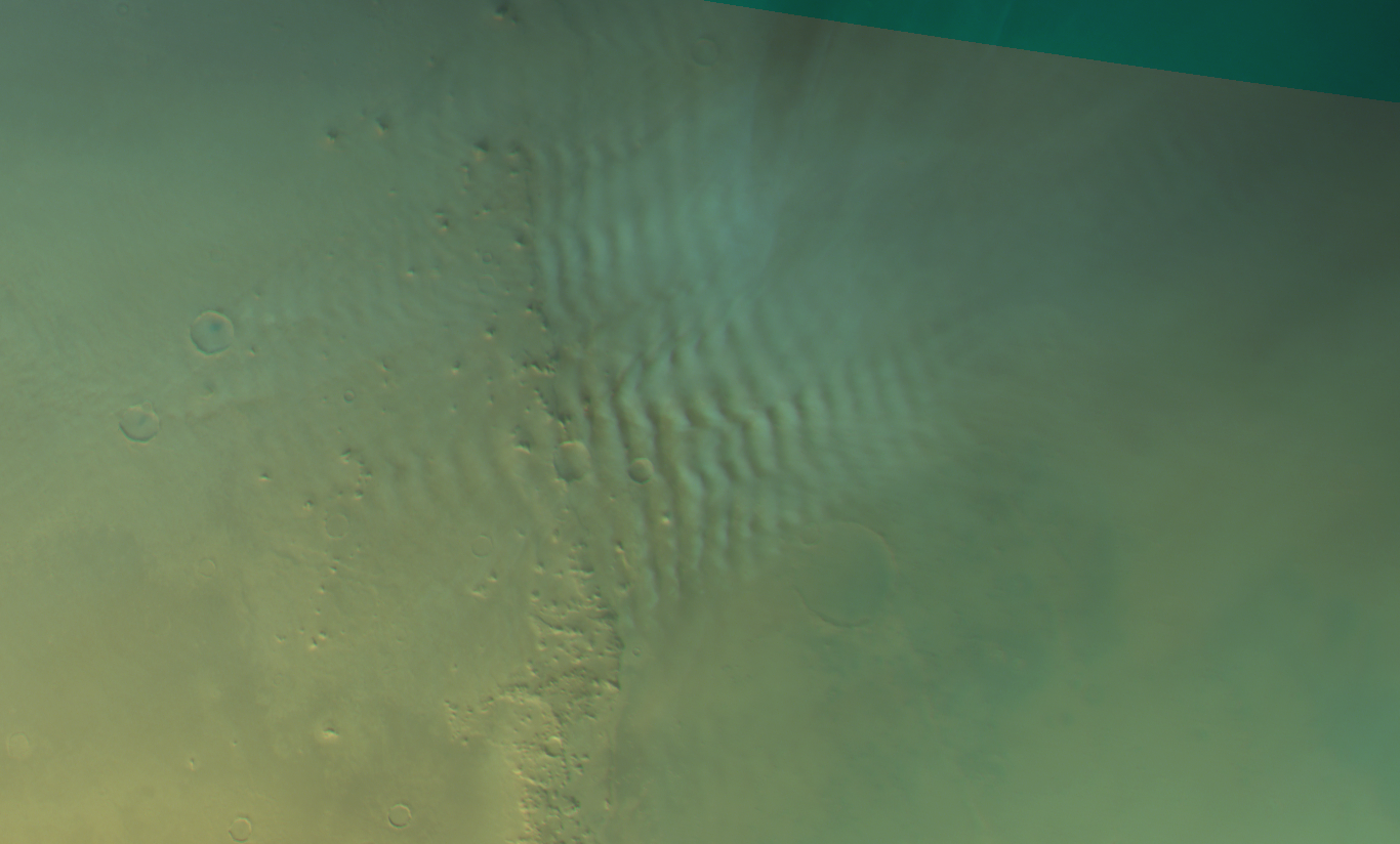
Lee wave clouds at Phlegra Montes. Map.
| Orbit Number | 23498_0001 |
|---|---|
| Latitude | 43.0 |
| Longitude [E/W] | 167.0 |
| Longitude [E] | 167.0 |
| Ls | 281.6 |
| Date | 2022-08-08 00:00:00 |
| Local time | 14:17:36 |
| Cirrus Clouds | |
| Lee Waves | lee waves |
| Gravity Clouds | |
| ACB | |
| Cloud Streets | |
| Elongated Dust Clouds | |
| Cumulus Cloud Sheet | |
| Plume | |
| Undefined | |
| Observation Type | Broom |
| Potentially Moving | |
| Spalte1 |
CT-188 #
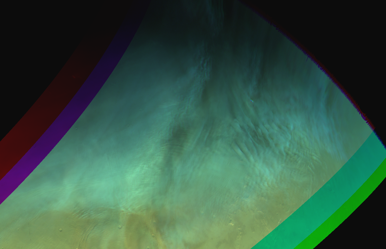
Complex gravity clouds supersosing each other at Mareotis. Map.
| Orbit Number | 23497 |
|---|---|
| Latitude | 46.0 |
| Longitude [E/W] | -83.0 |
| Longitude [E] | 277.0 |
| Ls | 281.4 |
| Date | 2022-08-08 00:00:00 |
| Local time | 14:40:06 |
| Cirrus Clouds | |
| Lee Waves | |
| Gravity Clouds | gravity clouds |
| ACB | |
| Cloud Streets | |
| Elongated Dust Clouds | |
| Cumulus Cloud Sheet | |
| Plume | |
| Undefined | |
| Observation Type | Broom |
| Potentially Moving | |
| Spalte1 |
CT-189 #
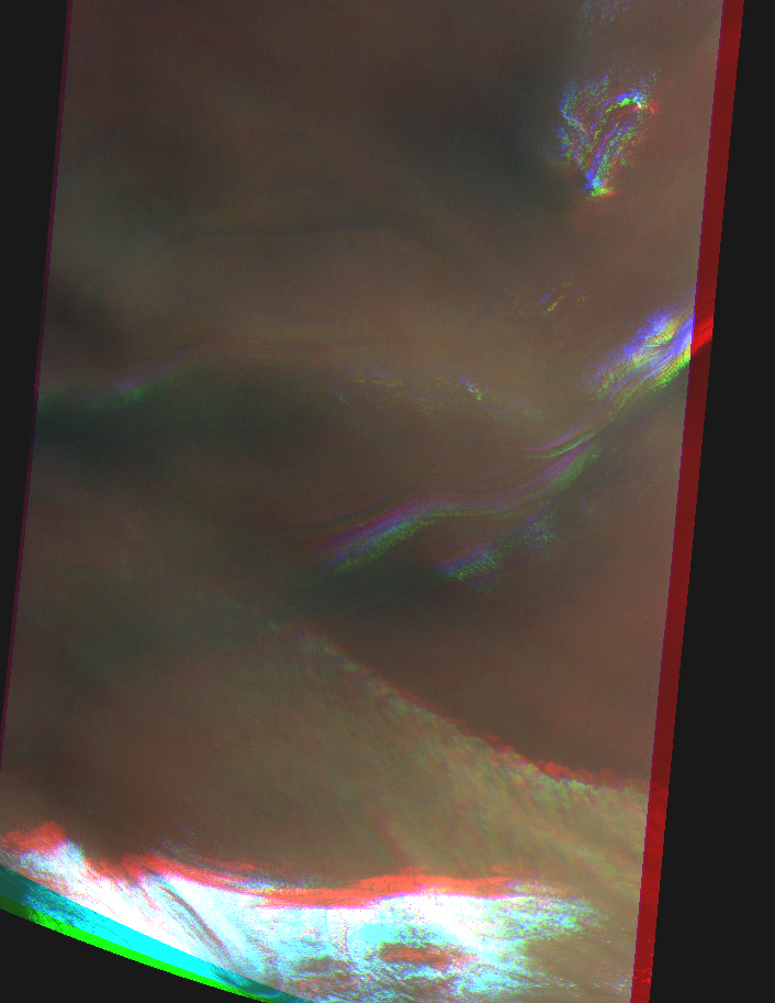
Elongated dust cloud at south polar cap scarp (bad image channel fit). Map.
| Orbit Number | 23455 |
|---|---|
| Latitude | -86.0 |
| Longitude [E/W] | -163.0 |
| Longitude [E] | 197.0 |
| Ls | 273.8 |
| Date | 2022-07-27 00:00:00 |
| Local time | 11:02:14 |
| Cirrus Clouds | |
| Lee Waves | |
| Gravity Clouds | |
| ACB | |
| Cloud Streets | |
| Elongated Dust Clouds | elongated dust cloud |
| Cumulus Cloud Sheet | |
| Plume | |
| Undefined | |
| Observation Type | Surface |
| Potentially Moving | Yes |
| Spalte1 |
CT-190 #
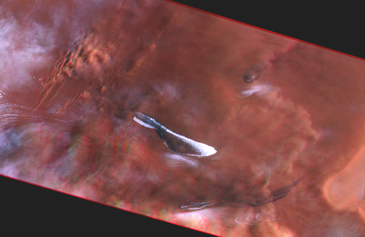
Elongated elongated dust clouds (partly moving?) at south polar region (north is to the right in browse image). Map.
| Orbit Number | 23343 |
|---|---|
| Latitude | -81.31 |
| Longitude [E/W] | 104.54 |
| Longitude [E] | 104.54 |
| Ls | 253.2 |
| Date | 2022-06-24 00:00:00 |
| Local time | 11:55:37 |
| Cirrus Clouds | |
| Lee Waves | |
| Gravity Clouds | |
| ACB | |
| Cloud Streets | |
| Elongated Dust Clouds | elongated dust cloud |
| Cumulus Cloud Sheet | |
| Plume | |
| Undefined | |
| Observation Type | Surface |
| Potentially Moving | Yes |
| Spalte1 |
CT-191 #
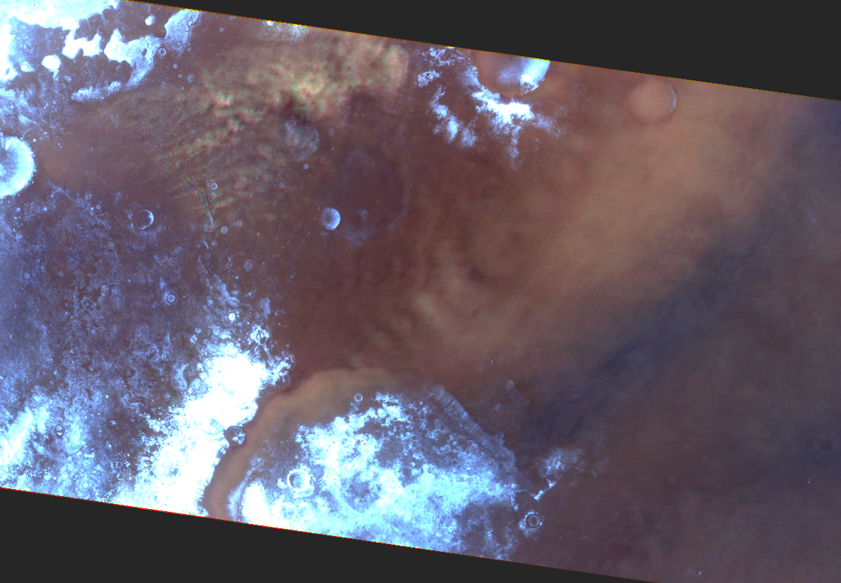
Elongated elongated dust clouds at south polar region (north is to the right in browse image). Map.
| Orbit Number | 23313 |
|---|---|
| Latitude | -70.38 |
| Longitude [E/W] | -55.62 |
| Longitude [E] | 304.38 |
| Ls | 247.7 |
| Date | 2022-06-16 00:00:00 |
| Local time | 13:27:30 |
| Cirrus Clouds | |
| Lee Waves | |
| Gravity Clouds | |
| ACB | |
| Cloud Streets | |
| Elongated Dust Clouds | elongated dust cloud |
| Cumulus Cloud Sheet | |
| Plume | |
| Undefined | |
| Observation Type | Surface |
| Potentially Moving | Yes |
| Spalte1 |
CT-192 #
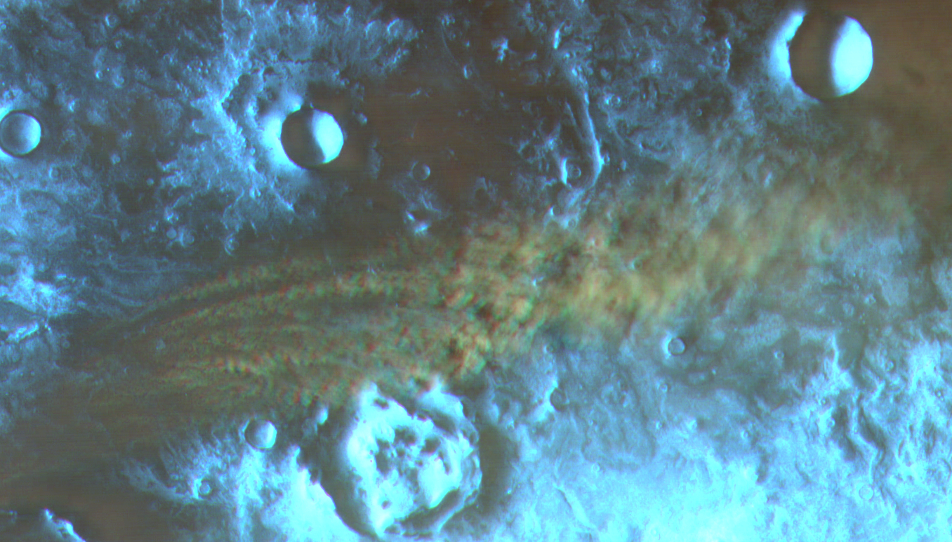
Elongated clouds at south polar region (north is to the right in browse image). Map.
| Orbit Number | 23305 |
|---|---|
| Latitude | -72.0 |
| Longitude [E/W] | 51.67 |
| Longitude [E] | 51.67 |
| Ls | 246.2 |
| Date | 2022-06-13 00:00:00 |
| Local time | 14:15:53 |
| Cirrus Clouds | |
| Lee Waves | |
| Gravity Clouds | |
| ACB | |
| Cloud Streets | |
| Elongated Dust Clouds | elongated dust cloud |
| Cumulus Cloud Sheet | |
| Plume | |
| Undefined | |
| Observation Type | Surface |
| Potentially Moving | Yes |
| Spalte1 |
CT-193 #
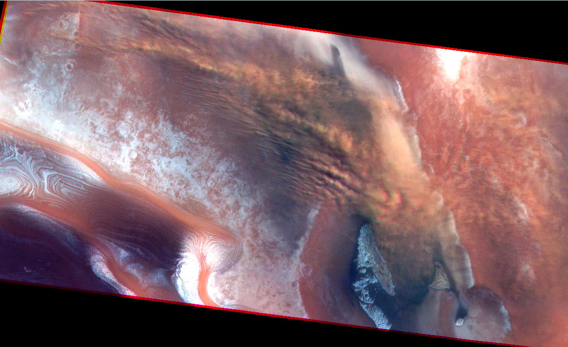
Elongated clouds @south polar region (north is to the right in browse image). Map.
| Orbit Number | 23290 |
|---|---|
| Latitude | -72.57 |
| Longitude [E/W] | 132.23 |
| Longitude [E] | 132.23 |
| Ls | 243.4 |
| Date | 2022-06-09 00:00:00 |
| Local time | 13:43:54 |
| Cirrus Clouds | |
| Lee Waves | |
| Gravity Clouds | |
| ACB | |
| Cloud Streets | |
| Elongated Dust Clouds | elongated dust cloud |
| Cumulus Cloud Sheet | |
| Plume | |
| Undefined | |
| Observation Type | Surface |
| Potentially Moving | Yes |
| Spalte1 |
CT-194 #
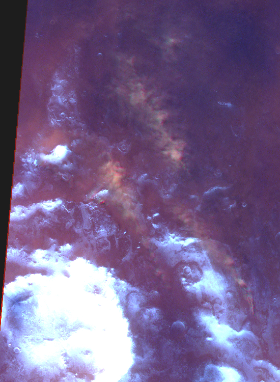
Elongated clouds @south polar region (noisy image) (north is to the right in browse image). Map.
| Orbit Number | 23277 |
|---|---|
| Latitude | -68.96 |
| Longitude [E/W] | 23.57 |
| Longitude [E] | 23.57 |
| Ls | 241.0 |
| Date | 2022-06-05 00:00:00 |
| Local time | 14:09:57 |
| Cirrus Clouds | |
| Lee Waves | |
| Gravity Clouds | |
| ACB | |
| Cloud Streets | |
| Elongated Dust Clouds | elongated dust cloud |
| Cumulus Cloud Sheet | |
| Plume | |
| Undefined | |
| Observation Type | Surface |
| Potentially Moving | Yes |
| Spalte1 |
CT-195 #
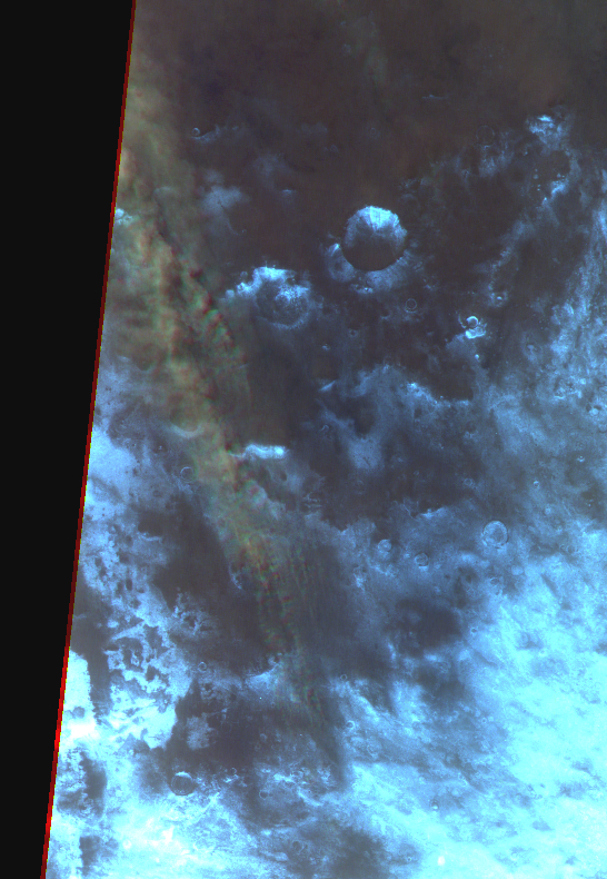
Elongated dust cloud at south polar region (north is to the right in browse image). Map.
| Orbit Number | 23274 |
|---|---|
| Latitude | -67.6 |
| Longitude [E/W] | -32.72 |
| Longitude [E] | 327.28 |
| Ls | 240.5 |
| Date | 2022-06-04 00:00:00 |
| Local time | 14:01:28 |
| Cirrus Clouds | |
| Lee Waves | |
| Gravity Clouds | |
| ACB | |
| Cloud Streets | |
| Elongated Dust Clouds | elongated dust cloud |
| Cumulus Cloud Sheet | |
| Plume | |
| Undefined | |
| Observation Type | Surface |
| Potentially Moving | Yes |
| Spalte1 |
CT-196 #

Elongated dust clouds at Thyles Rupes (south polar region). Map.
| Orbit Number | 23258 |
|---|---|
| Latitude | -69.33 |
| Longitude [E/W] | 131.82 |
| Longitude [E] | 131.82 |
| Ls | 237.5 |
| Date | 2022-05-31 00:00:00 |
| Local time | 12:17:31 |
| Cirrus Clouds | |
| Lee Waves | |
| Gravity Clouds | |
| ACB | |
| Cloud Streets | |
| Elongated Dust Clouds | elongated dust cloud |
| Cumulus Cloud Sheet | |
| Plume | |
| Undefined | |
| Observation Type | Surface |
| Potentially Moving | Yes |
| Spalte1 |
CT-197 #
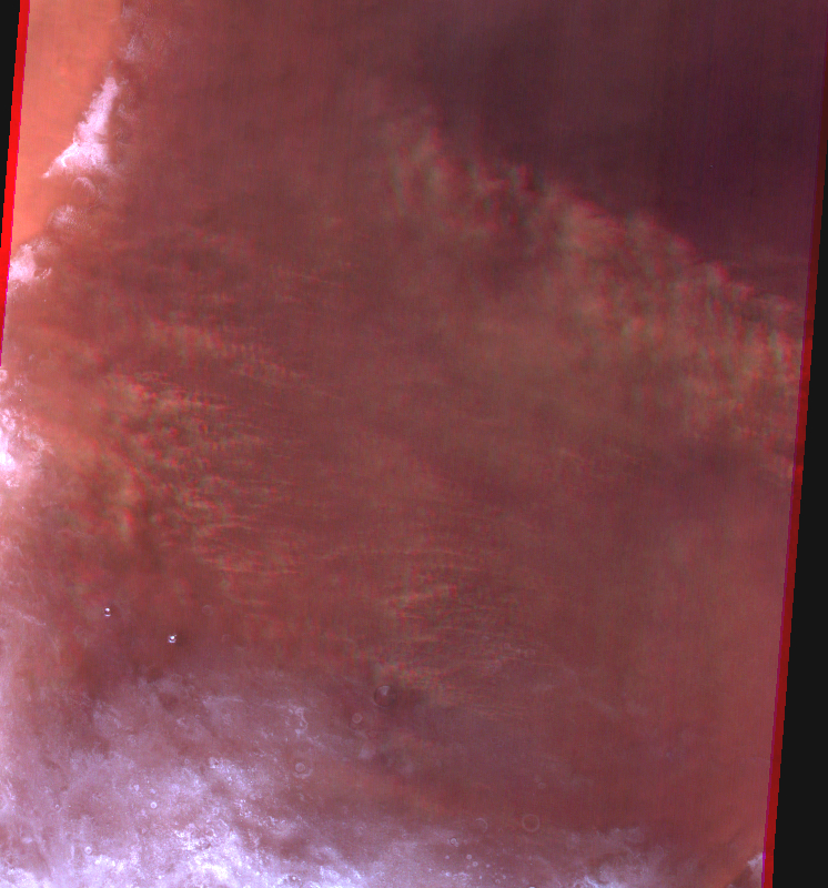
Elongated dust clouds at S - Terra Sirenum (south polar region) (north is to the right in browse image). Map.
| Orbit Number | 23236 |
|---|---|
| Latitude | -67.6 |
| Longitude [E/W] | -110.91 |
| Longitude [E] | 249.09 |
| Ls | 233.5 |
| Date | 2022-05-24 00:00:00 |
| Local time | 14:38:48 |
| Cirrus Clouds | |
| Lee Waves | |
| Gravity Clouds | |
| ACB | |
| Cloud Streets | |
| Elongated Dust Clouds | elongated dust cloud |
| Cumulus Cloud Sheet | |
| Plume | |
| Undefined | |
| Observation Type | Surface |
| Potentially Moving | Yes |
| Spalte1 |
CT-198 #
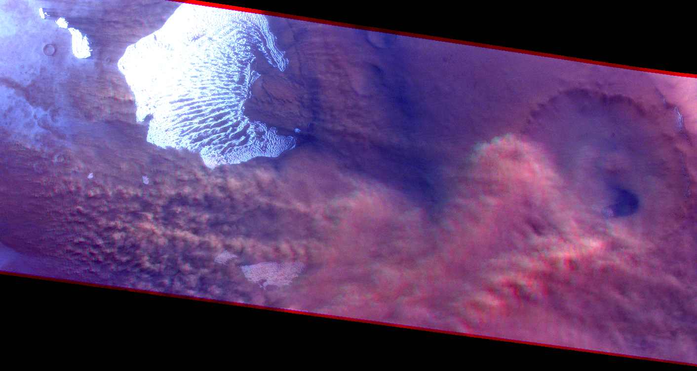
Elongated dust cloud at Thyles Rupes (south polar region); partly moving? (north is to the right in browse image). Map.
| Orbit Number | 23230 |
|---|---|
| Latitude | -66.5 |
| Longitude [E/W] | 141.36 |
| Longitude [E] | 141.36 |
| Ls | 232.4 |
| Date | 2022-05-22 00:00:00 |
| Local time | 14:40:26 |
| Cirrus Clouds | |
| Lee Waves | |
| Gravity Clouds | |
| ACB | |
| Cloud Streets | |
| Elongated Dust Clouds | elongated dust cloud |
| Cumulus Cloud Sheet | |
| Plume | |
| Undefined | |
| Observation Type | Surface |
| Potentially Moving | Yes |
| Spalte1 |
CT-199 #

Lee wave-like clouds at south polar region (blue channel overexposed). Map.
| Orbit Number | 23202 |
|---|---|
| Latitude | -67.48 |
| Longitude [E/W] | 124.1 |
| Longitude [E] | 124.1 |
| Ls | 227.3 |
| Date | 2022-05-14 00:00:00 |
| Local time | 15:16:19 |
| Cirrus Clouds | |
| Lee Waves | lee waves |
| Gravity Clouds | |
| ACB | |
| Cloud Streets | |
| Elongated Dust Clouds | |
| Cumulus Cloud Sheet | |
| Plume | |
| Undefined | |
| Observation Type | Broom |
| Potentially Moving | |
| Spalte1 |
CT-200 #
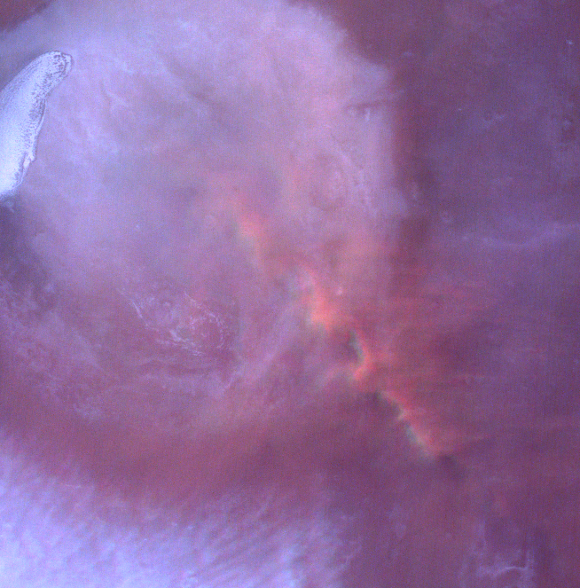
Small elongated dust cloud at south polar region. Map.
| Orbit Number | 23202 |
|---|---|
| Latitude | -68.08 |
| Longitude [E/W] | 124.94 |
| Longitude [E] | 124.94 |
| Ls | 227.3 |
| Date | 2022-05-14 00:00:00 |
| Local time | 15:15:00 |
| Cirrus Clouds | |
| Lee Waves | |
| Gravity Clouds | |
| ACB | |
| Cloud Streets | |
| Elongated Dust Clouds | elongated dust cloud |
| Cumulus Cloud Sheet | |
| Plume | |
| Undefined | |
| Observation Type | Surface |
| Potentially Moving | |
| Spalte1 |
CT-201 #
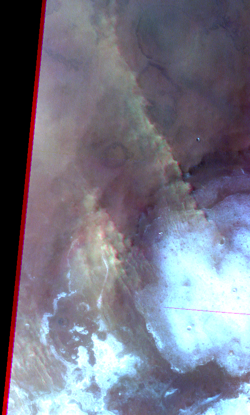
Elongated dust clouds at south polar region (noisy image) (north is to the right in browse image). Map.
| Orbit Number | 23190 |
|---|---|
| Latitude | -64.2 |
| Longitude [E/W] | -92.47 |
| Longitude [E] | 267.53 |
| Ls | 225.1 |
| Date | 2022-05-11 00:00:00 |
| Local time | 15:18:50 |
| Cirrus Clouds | |
| Lee Waves | |
| Gravity Clouds | |
| ACB | |
| Cloud Streets | |
| Elongated Dust Clouds | elongated dust cloud |
| Cumulus Cloud Sheet | |
| Plume | |
| Undefined | |
| Observation Type | Surface |
| Potentially Moving | |
| Spalte1 |
CT-202 #
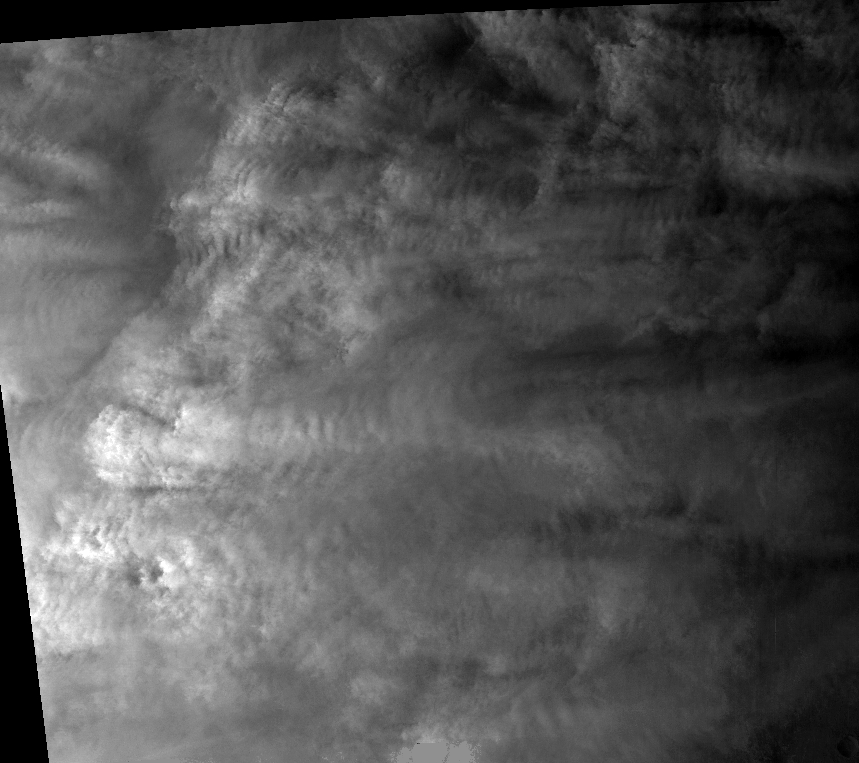
Lee waves and gravity clouds at Oxia Planum (very bad image quality; browse image is green channel). Map.
| Orbit Number | 23147_0001 |
|---|---|
| Latitude | 26.07 |
| Longitude [E/W] | -21.37 |
| Longitude [E] | 338.63 |
| Ls | 217.3 |
| Date | 2022-04-28 00:00:00 |
| Local time | 16:00:06 |
| Cirrus Clouds | |
| Lee Waves | lee waves |
| Gravity Clouds | gravity clouds |
| ACB | |
| Cloud Streets | |
| Elongated Dust Clouds | |
| Cumulus Cloud Sheet | |
| Plume | |
| Undefined | |
| Observation Type | Surface |
| Potentially Moving | |
| Spalte1 |
CT-203 #
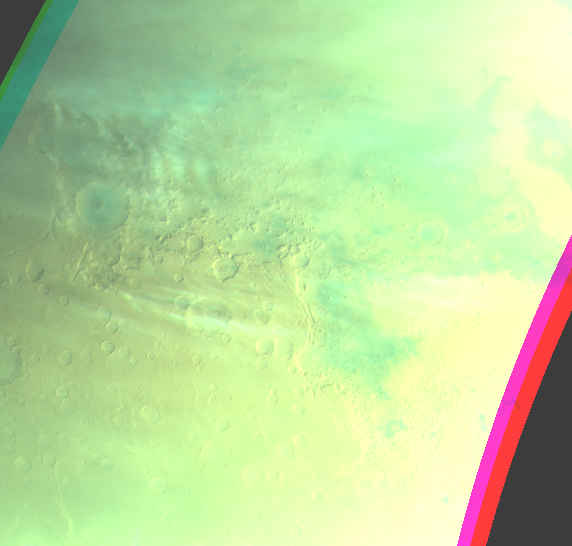
Lee waves and cloud stripes at Protonilus Mensae. Map.
| Orbit Number | 22933 |
|---|---|
| Latitude | 37.8 |
| Longitude [E/W] | 43.3 |
| Longitude [E] | 43.3 |
| Ls | 180.5 |
| Date | 2022-02-25 00:00:00 |
| Local time | 07:01:00 |
| Cirrus Clouds | |
| Lee Waves | lee waves |
| Gravity Clouds | |
| ACB | |
| Cloud Streets | |
| Elongated Dust Clouds | |
| Cumulus Cloud Sheet | |
| Plume | |
| Undefined | |
| Observation Type | Broom |
| Potentially Moving | |
| Spalte1 |
CT-204 #

Lee waves at Vastitas Borealis (bad image quality). Map.
| Orbit Number | 22828 |
|---|---|
| Latitude | 60.65 |
| Longitude [E/W] | -45.41 |
| Longitude [E] | 314.59 |
| Ls | 163.7 |
| Date | 2022-01-25 00:00:00 |
| Local time | 07:06:26 |
| Cirrus Clouds | |
| Lee Waves | lee waves |
| Gravity Clouds | |
| ACB | |
| Cloud Streets | |
| Elongated Dust Clouds | |
| Cumulus Cloud Sheet | |
| Plume | |
| Undefined | |
| Observation Type | Broom |
| Potentially Moving | |
| Spalte1 |
CT-205 #
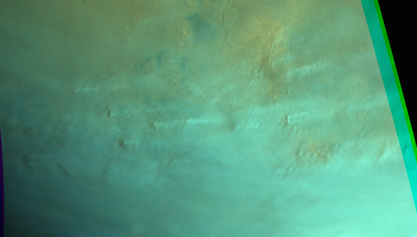
Elongated orographic clouds and lee waves at Solis Planum (second of 2 concecutive observatiosn in one orbit; for cloud movement). Map.
| Orbit Number | 22758_0000 |
|---|---|
| Latitude | -40.58 |
| Longitude [E/W] | -93.56 |
| Longitude [E] | 266.44 |
| Ls | 151.8 |
| Date | 2022-01-05 00:00:00 |
| Local time | 09:47:42 |
| Cirrus Clouds | |
| Lee Waves | lee waves |
| Gravity Clouds | |
| ACB | |
| Cloud Streets | |
| Elongated Dust Clouds | |
| Cumulus Cloud Sheet | |
| Plume | |
| Undefined | |
| Observation Type | Broom |
| Potentially Moving | Yes |
| Spalte1 |
CT-206 #

Elongated orographic clouds and lee waves at Solis Planum (first of 2 concecutive observation in one orbit; for cloud movement). Map.
| Orbit Number | 22758_0001 |
|---|---|
| Latitude | -40.58 |
| Longitude [E/W] | -93.56 |
| Longitude [E] | 266.44 |
| Ls | 151.8 |
| Date | 2022-01-05 00:00:00 |
| Local time | 09:47:42 |
| Cirrus Clouds | |
| Lee Waves | lee waves |
| Gravity Clouds | |
| ACB | |
| Cloud Streets | |
| Elongated Dust Clouds | |
| Cumulus Cloud Sheet | |
| Plume | |
| Undefined | |
| Observation Type | Broom |
| Potentially Moving | Yes |
| Spalte1 |
CT-207 #
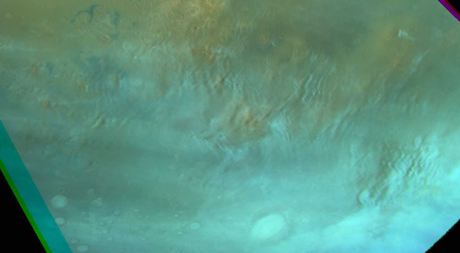
Gravity clouds at S-Daedalia (second of 2 concecutive observatiosn in one orbit; for cloud movement). Map.
| Orbit Number | 22744 |
|---|---|
| _0001 | |
| Latitude | -36.85 |
| Longitude [E/W] | -101.36 |
| Longitude [E] | 258.64 |
| Ls | 150.9 |
| Date | 2022-01-01 00:00:00 |
| Local time | 10:28:53 |
| Cirrus Clouds | |
| Lee Waves | lee waves |
| Gravity Clouds | gravity clouds |
| ACB | |
| Cloud Streets | |
| Elongated Dust Clouds | |
| Cumulus Cloud Sheet | |
| Plume | |
| Undefined | |
| Observation Type | Broom |
| Potentially Moving | Yes |
| Spalte1 |
CT-208 #
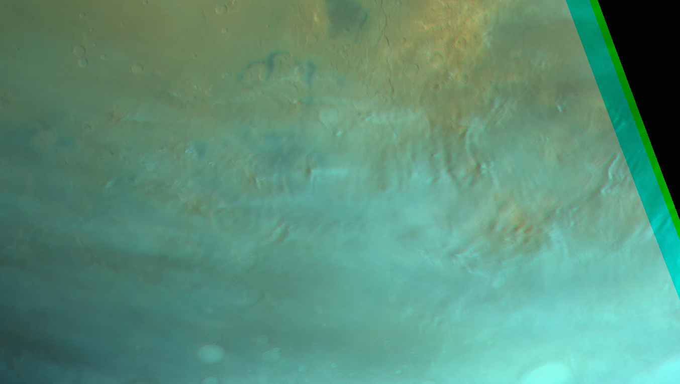
Gravity clouds and lee waves S-Daedalia (first of 2 concecutive observatiosn in one orbit; for cloud movement). Map.
| Orbit Number | 22744 |
|---|---|
| _0000 | |
| Latitude | -36.85 |
| Longitude [E/W] | -101.36 |
| Longitude [E] | 258.64 |
| Ls | 150.9 |
| Date | 2022-01-01 00:00:00 |
| Local time | 10:00:15 |
| Cirrus Clouds | |
| Lee Waves | lee waves |
| Gravity Clouds | gravity clouds |
| ACB | |
| Cloud Streets | |
| Elongated Dust Clouds | |
| Cumulus Cloud Sheet | |
| Plume | |
| Undefined | |
| Observation Type | Broom |
| Potentially Moving | Yes |
| Spalte1 |
CT-209 #
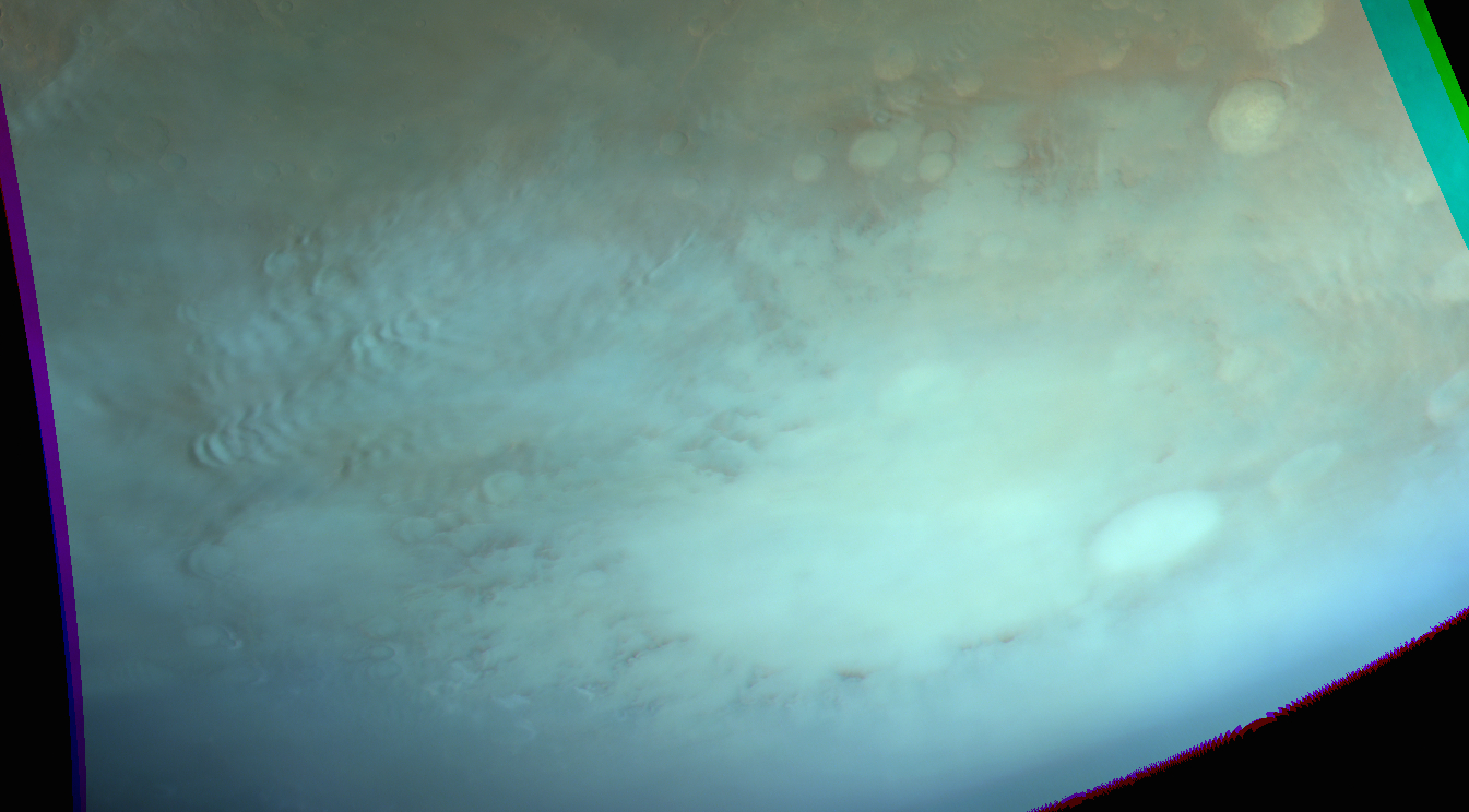
Lee waves Aonia Terra. Map.
| Orbit Number | 22740 |
|---|---|
| Latitude | -44.87 |
| Longitude [E/W] | -67.21 |
| Longitude [E] | 292.79 |
| Ls | 150.3 |
| Date | 2021-12-31 00:00:00 |
| Local time | 08:50:24 |
| Cirrus Clouds | |
| Lee Waves | lee waves |
| Gravity Clouds | |
| ACB | |
| Cloud Streets | |
| Elongated Dust Clouds | |
| Cumulus Cloud Sheet | |
| Plume | |
| Undefined | |
| Observation Type | Broom |
| Potentially Moving | |
| Spalte1 |
CT-210 #
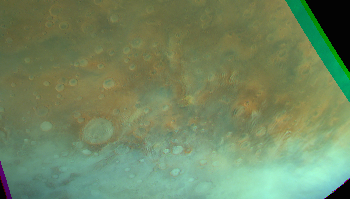
Gravity cloud fields and lee waves at Terra Sirenum + small local dust storm? or lifting event. Map.
| Orbit Number | 22731 |
|---|---|
| Latitude | -43.5 |
| Longitude [E/W] | -105.59 |
| Longitude [E] | 254.41 |
| Ls | 149.0 |
| Date | 2021-12-28 00:00:00 |
| Local time | 17:27:16 |
| Cirrus Clouds | |
| Lee Waves | lee waves |
| Gravity Clouds | gravity clouds |
| ACB | |
| Cloud Streets | |
| Elongated Dust Clouds | |
| Cumulus Cloud Sheet | |
| Plume | |
| Undefined | |
| Observation Type | Broom |
| Potentially Moving | |
| Spalte1 |
CT-211 #
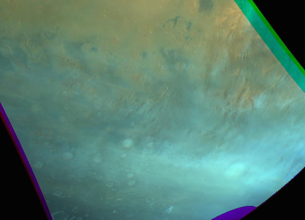
Gravity cloud and lee waves at Icaria Planum. Map.
| Orbit Number | 22723 |
|---|---|
| Latitude | -43.5 |
| Longitude [E/W] | -105.59 |
| Longitude [E] | 254.41 |
| Ls | 147.8 |
| Date | 2021-12-26 00:00:00 |
| Local time | 11:16:20 |
| Cirrus Clouds | |
| Lee Waves | lee waves |
| Gravity Clouds | gravity clouds |
| ACB | |
| Cloud Streets | |
| Elongated Dust Clouds | |
| Cumulus Cloud Sheet | |
| Plume | |
| Undefined | |
| Observation Type | Broom |
| Potentially Moving | |
| Spalte1 |
CT-212 #
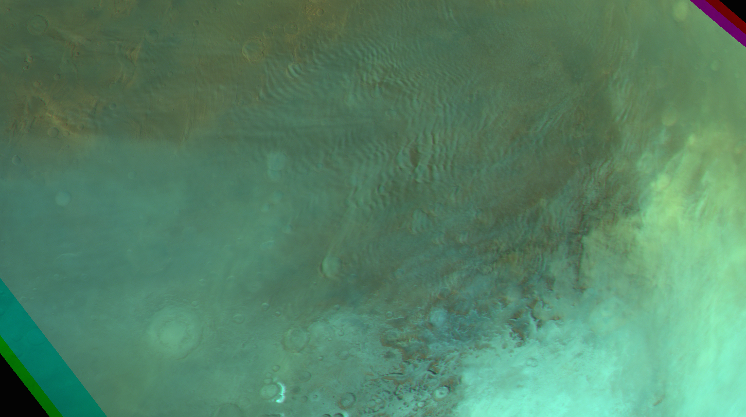
Gravity clouds at Aonia Terra (second of 2 concecutive observatiosn in one orbit; for cloud movement). Map.
| Orbit Number | 22719 |
|---|---|
| _0001 | |
| Latitude | -39.58 |
| Longitude [E/W] | -67.53 |
| Longitude [E] | 292.47 |
| Ls | 147.2 |
| Date | 2021-12-25 00:00:00 |
| Local time | 11:17:33 |
| Cirrus Clouds | |
| Lee Waves | |
| Gravity Clouds | gravity clouds |
| ACB | |
| Cloud Streets | |
| Elongated Dust Clouds | |
| Cumulus Cloud Sheet | |
| Plume | |
| Undefined | |
| Observation Type | Broom |
| Potentially Moving | Yes |
| Spalte1 |
CT-213 #
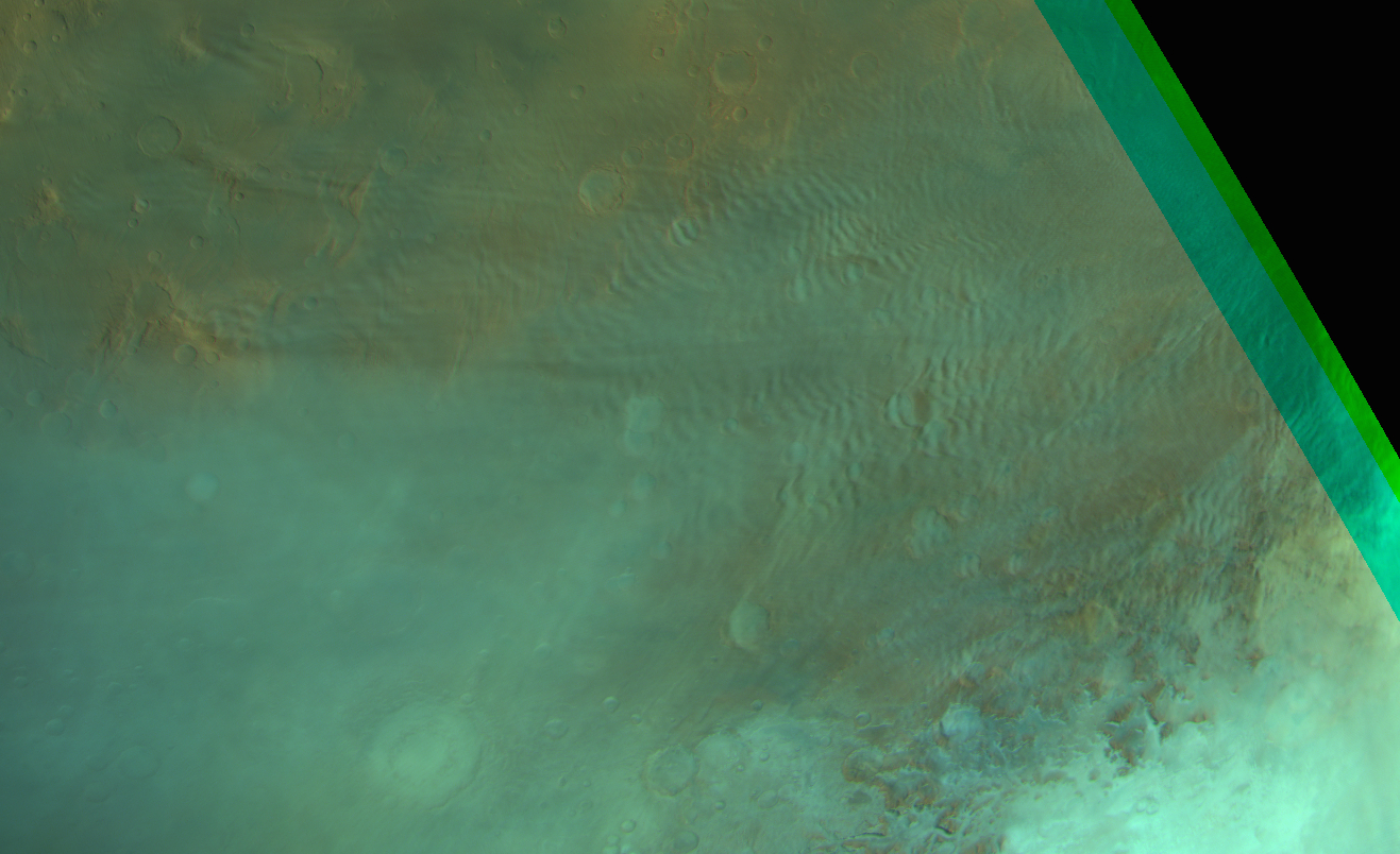
Gravity clouds at Aonia Terra (first of 2 concecutive observatiosn in one orbit; for cloud movement). Map.
| Orbit Number | 22719 |
|---|---|
| _0000 | |
| Latitude | -39.58 |
| Longitude [E/W] | -67.53 |
| Longitude [E] | 292.47 |
| Ls | 147.2 |
| Date | 2021-12-25 00:00:00 |
| Local time | 10:48:19 |
| Cirrus Clouds | |
| Lee Waves | |
| Gravity Clouds | gravity clouds |
| ACB | |
| Cloud Streets | |
| Elongated Dust Clouds | |
| Cumulus Cloud Sheet | |
| Plume | |
| Undefined | |
| Observation Type | Broom |
| Potentially Moving | Yes |
| Spalte1 |
CT-214 #
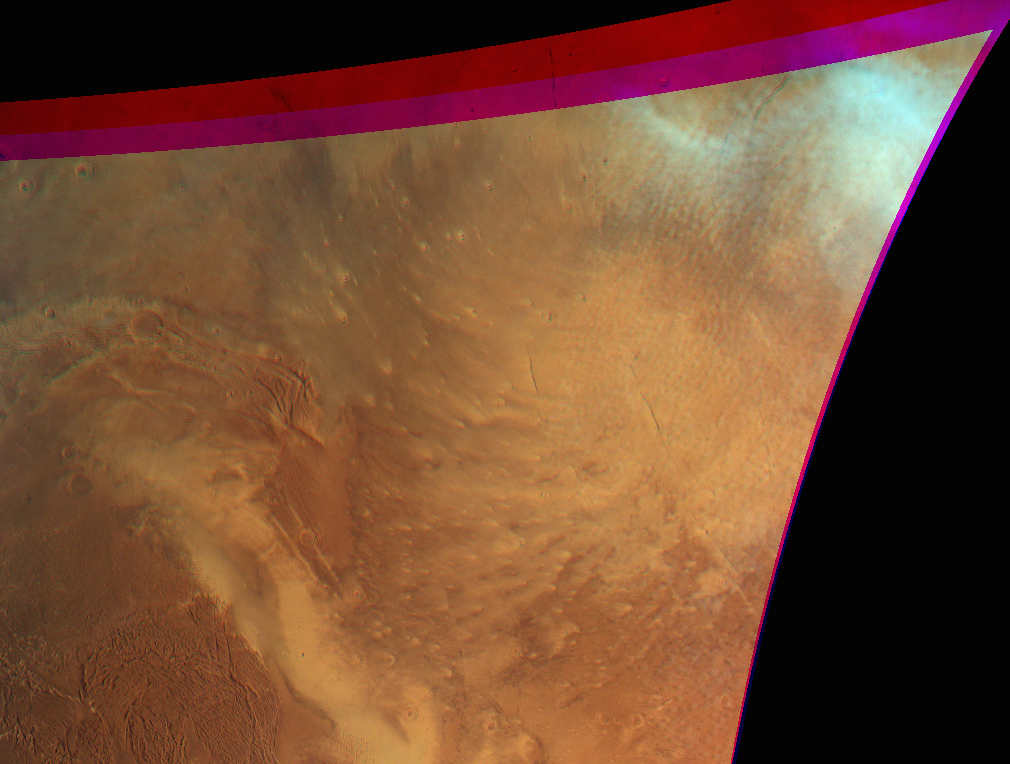
Cloud streets NE of Olympus Mons. Map.
| Orbit Number | 22681 |
|---|---|
| Latitude | 42.68 |
| Longitude [E/W] | -108.31 |
| Longitude [E] | 251.69 |
| Ls | 141.6 |
| Date | 2021-12-14 00:00:00 |
| Local time | 12:10:09 |
| Cirrus Clouds | |
| Lee Waves | |
| Gravity Clouds | |
| ACB | |
| Cloud Streets | cloud streets |
| Elongated Dust Clouds | |
| Cumulus Cloud Sheet | cumulus cloud sheet |
| Plume | |
| Undefined | |
| Observation Type | Broom |
| Potentially Moving | |
| Spalte1 |
CT-215 #
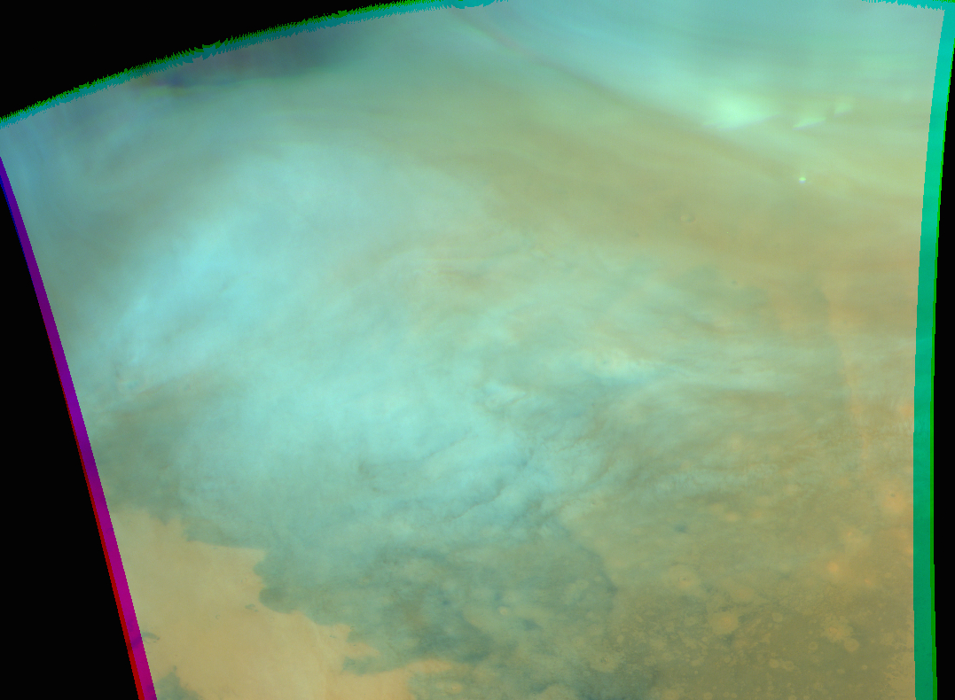
Clouds at Utopia Planitia. Map.
| Orbit Number | 22661 |
|---|---|
| Latitude | 58.27 |
| Longitude [E/W] | 74.04 |
| Longitude [E] | 74.04 |
| Ls | 138.7 |
| Date | 2021-12-08 00:00:00 |
| Local time | 08:22:40 |
| Cirrus Clouds | cirrus clouds |
| Lee Waves | |
| Gravity Clouds | |
| ACB | |
| Cloud Streets | |
| Elongated Dust Clouds | |
| Cumulus Cloud Sheet | cumulus cloud sheet |
| Plume | |
| Undefined | |
| Observation Type | Broom |
| Potentially Moving | |
| Spalte1 |
CT-216 #

Lee waves and some dust-loaded cirrus clous at Solis to Thaumasia Planum. Map.
| Orbit Number | 22638 |
|---|---|
| Latitude | -345.19 |
| Longitude [E/W] | -68.14 |
| Longitude [E] | 291.86 |
| Ls | 135.4 |
| Date | 2021-12-01 00:00:00 |
| Local time | 10:26:00 |
| Cirrus Clouds | cirrus clouds |
| Lee Waves | lee waves |
| Gravity Clouds | |
| ACB | |
| Cloud Streets | |
| Elongated Dust Clouds | |
| Cumulus Cloud Sheet | |
| Plume | |
| Undefined | |
| Observation Type | Broom |
| Potentially Moving | |
| Spalte1 |
CT-217 #
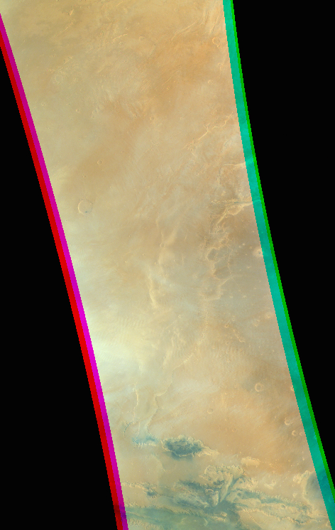
Faint gravity cloud fields at Lunae Planukm (extending down to Thaumasia Planum). Map.
| Orbit Number | 22638 |
|---|---|
| Latitude | 8.32 |
| Longitude [E/W] | -76.24 |
| Longitude [E] | 283.76 |
| Ls | 135.4 |
| Date | 2021-12-01 00:00:00 |
| Local time | 09:55:21 |
| Cirrus Clouds | cirrus clouds |
| Lee Waves | |
| Gravity Clouds | gravity clouds |
| ACB | |
| Cloud Streets | |
| Elongated Dust Clouds | |
| Cumulus Cloud Sheet | |
| Plume | |
| Undefined | |
| Observation Type | Broom |
| Potentially Moving | |
| Spalte1 |
CT-218 #
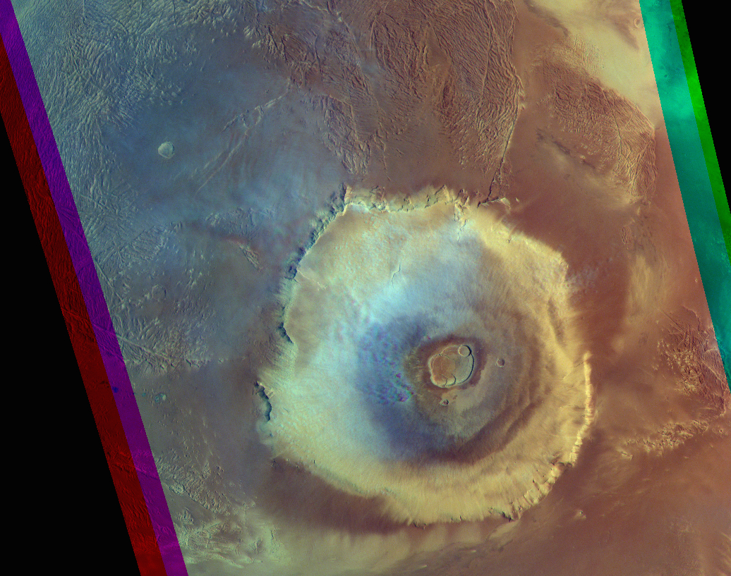
Clouds Olympus Mons. Map.
| Orbit Number | 22628 |
|---|---|
| Latitude | 19.56 |
| Longitude [E/W] | -135.82 |
| Longitude [E] | 224.18 |
| Ls | 134.0 |
| Date | 2021-11-28 00:00:00 |
| Local time | 10:00:29 |
| Cirrus Clouds | cirrus clouds |
| Lee Waves | |
| Gravity Clouds | gravity clouds |
| ACB | |
| Cloud Streets | cloud streets |
| Elongated Dust Clouds | |
| Cumulus Cloud Sheet | |
| Plume | |
| Undefined | |
| Observation Type | Broom |
| Potentially Moving | |
| Spalte1 |
CT-219 #
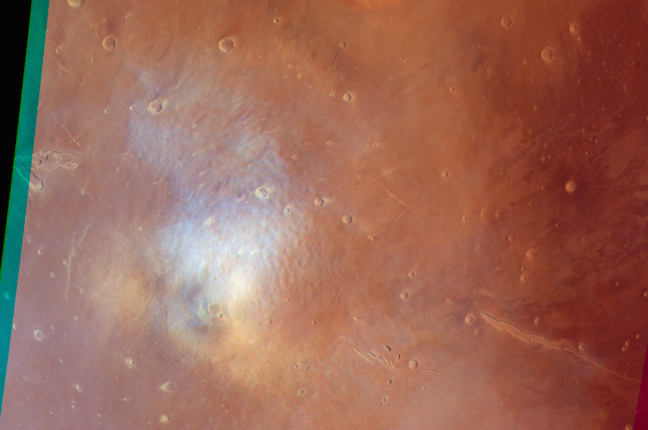
Cloud-street-like cloud field Elysium Mons. Map.
| Orbit Number | 22590 |
|---|---|
| Latitude | 25.53 |
| Longitude [E/W] | 146.9 |
| Longitude [E] | 146.9 |
| Ls | 128.7 |
| Date | 2021-11-17 00:00:00 |
| Local time | 10:13:56 |
| Cirrus Clouds | |
| Lee Waves | |
| Gravity Clouds | |
| ACB | |
| Cloud Streets | cloud streets |
| Elongated Dust Clouds | |
| Cumulus Cloud Sheet | |
| Plume | |
| Undefined | |
| Observation Type | Broom |
| Potentially Moving | |
| Spalte1 |
CT-220 #
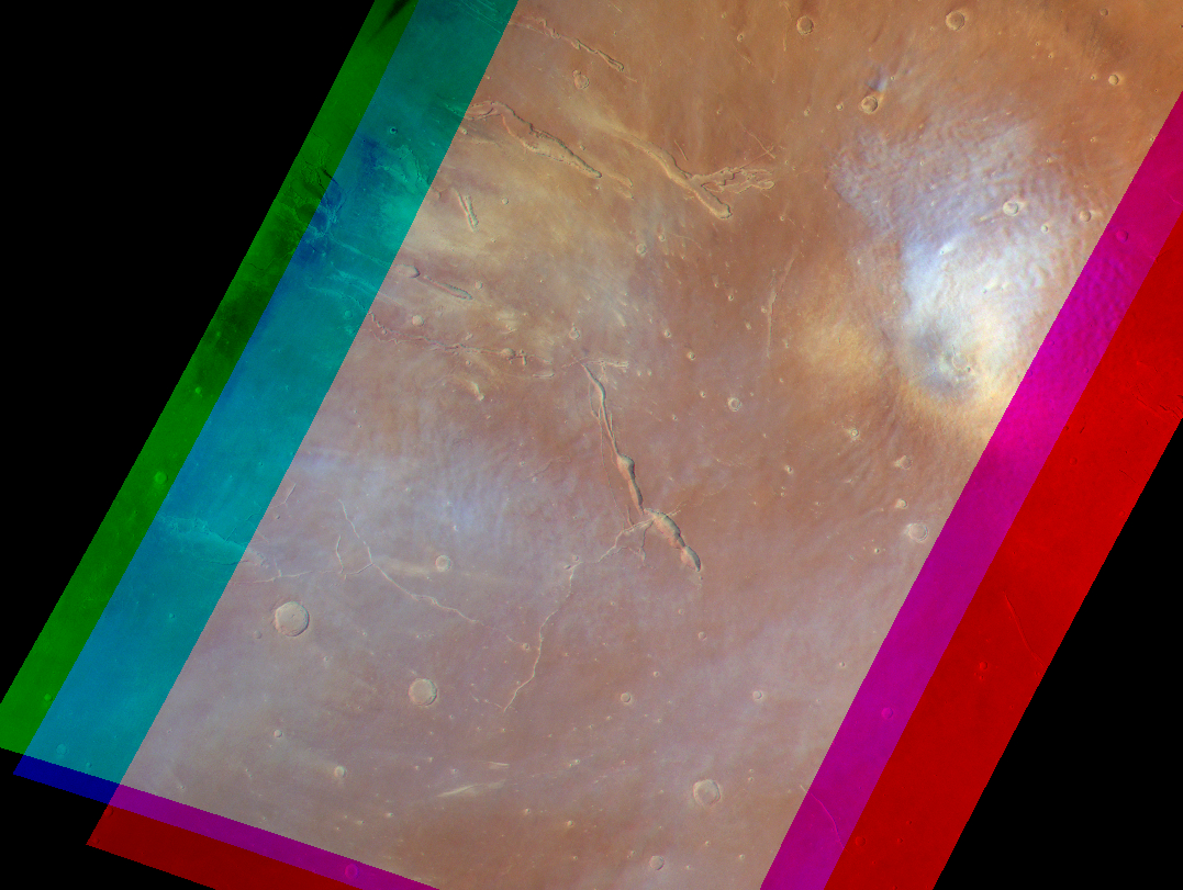
Clouds at Elysium Mons. Map.
| Orbit Number | 22583 |
|---|---|
| Latitude | 26.8 |
| Longitude [E/W] | 146.6 |
| Longitude [E] | 146.6 |
| Ls | 127.7 |
| Date | 2021-11-15 00:00:00 |
| Local time | 10:36:40 |
| Cirrus Clouds | |
| Lee Waves | |
| Gravity Clouds | |
| ACB | |
| Cloud Streets | cloud streets |
| Elongated Dust Clouds | |
| Cumulus Cloud Sheet | |
| Plume | |
| Undefined | |
| Observation Type | Broom |
| Potentially Moving | |
| Spalte1 |
CT-221 #
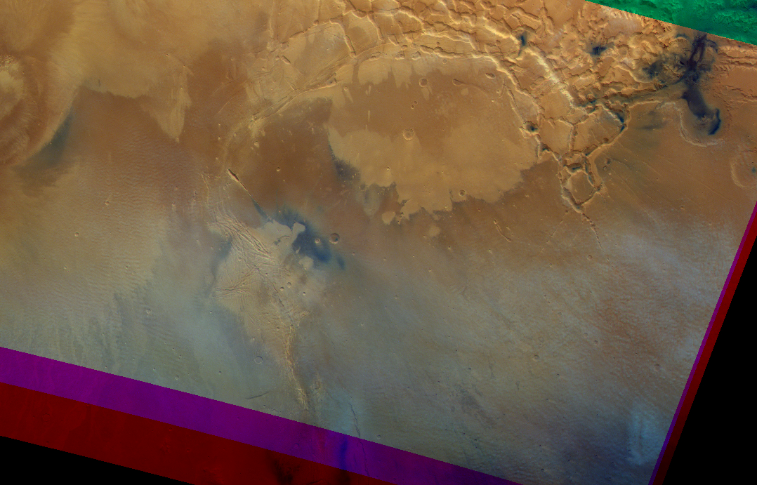
Various clouds at Noctis Labyrintus. Map.
| Orbit Number | 22536 |
|---|---|
| Latitude | -16.5 |
| Longitude [E/W] | -110.0 |
| Longitude [E] | 250.0 |
| Ls | 121.2 |
| Date | 2021-11-02 00:00:00 |
| Local time | 10:39:21 |
| Cirrus Clouds | |
| Lee Waves | |
| Gravity Clouds | gravity clouds |
| ACB | |
| Cloud Streets | cloud streets |
| Elongated Dust Clouds | |
| Cumulus Cloud Sheet | |
| Plume | |
| Undefined | |
| Observation Type | Broom |
| Potentially Moving | |
| Spalte1 |
CT-222 #
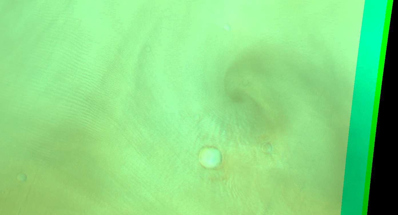
Faint gravity clouds (with faint spiral dust storm?) at Vastitas Borealis. Map.
| Orbit Number | 21893 |
|---|---|
| Latitude | 62.17 |
| Longitude [E/W] | -85.64 |
| Longitude [E] | 274.36 |
| Ls | 37.9 |
| Date | 2021-04-28 00:00:00 |
| Local time | 07:28:00 |
| Cirrus Clouds | |
| Lee Waves | |
| Gravity Clouds | gravity clouds |
| ACB | |
| Cloud Streets | |
| Elongated Dust Clouds | |
| Cumulus Cloud Sheet | |
| Plume | |
| Undefined | |
| Observation Type | Broom |
| Potentially Moving | |
| Spalte1 |
CT-223 #
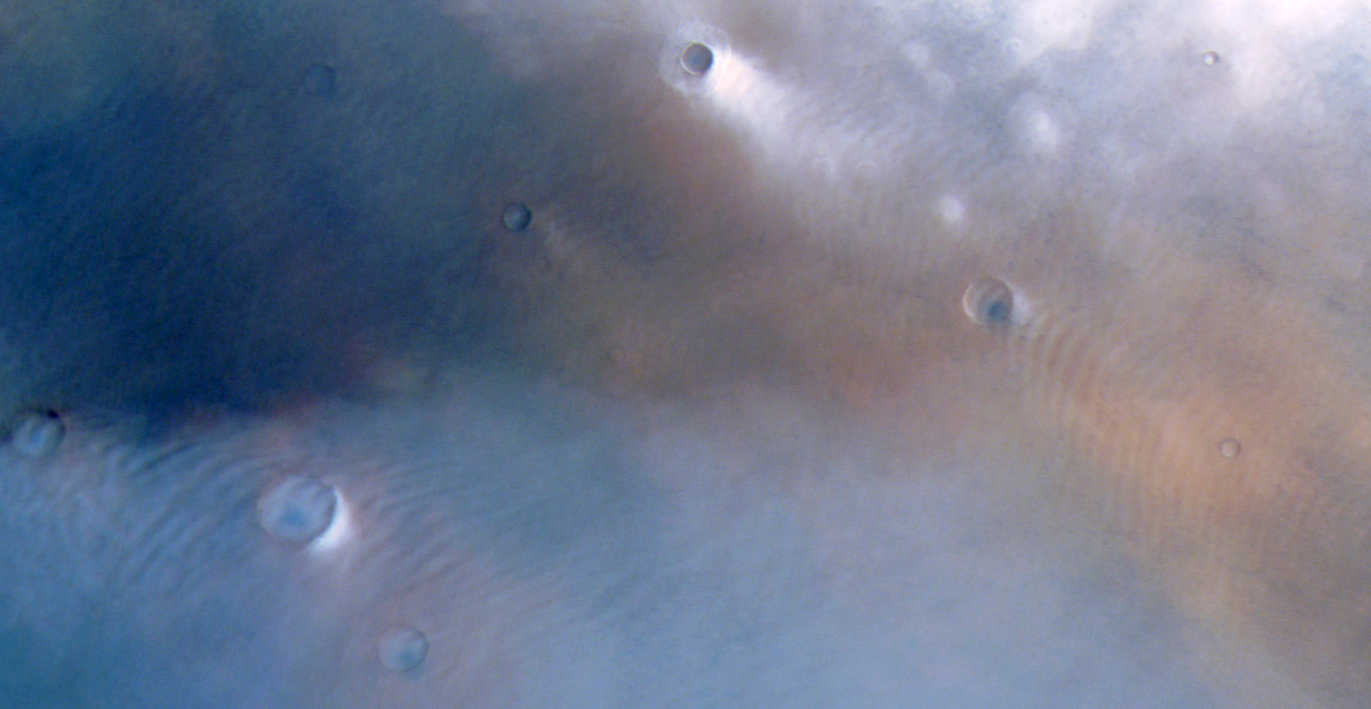
Lee waves at Vastitas. Map.
| Orbit Number | 21882 |
|---|---|
| Latitude | 63.8 |
| Longitude [E/W] | -41.03 |
| Longitude [E] | 318.97 |
| Ls | 36.5 |
| Date | 2021-04-25 00:00:00 |
| Local time | 07:25:23 |
| Cirrus Clouds | |
| Lee Waves | lee waves |
| Gravity Clouds | |
| ACB | |
| Cloud Streets | |
| Elongated Dust Clouds | |
| Cumulus Cloud Sheet | |
| Plume | |
| Undefined | |
| Observation Type | Broom |
| Potentially Moving | |
| Spalte1 |
CT-224 #

Isolated early morning cirrus clouds near Aram Chaos; terminator observation. Map.
| Orbit Number | 21850 |
|---|---|
| Latitude | 2.45 |
| Longitude [E/W] | -16.03 |
| Longitude [E] | 343.97 |
| Ls | 32.2 |
| Date | 2021-04-16 00:00:00 |
| Local time | 06:59:00 |
| Cirrus Clouds | cirrus clouds |
| Lee Waves | |
| Gravity Clouds | |
| ACB | |
| Cloud Streets | |
| Elongated Dust Clouds | |
| Cumulus Cloud Sheet | |
| Plume | |
| Undefined | |
| Observation Type | |
| Potentially Moving | |
| Spalte1 |
CT-225 #

Early morning lee waves at Vastitas; partly saturated terminator obervation. Map.
| Orbit Number | 21850 |
|---|---|
| Latitude | 60.41 |
| Longitude [E/W] | -42.58 |
| Longitude [E] | 317.42 |
| Ls | 32.2 |
| Date | 2021-04-16 00:00:00 |
| Local time | 05:18:35 |
| Cirrus Clouds | |
| Lee Waves | lee waves |
| Gravity Clouds | |
| ACB | |
| Cloud Streets | |
| Elongated Dust Clouds | |
| Cumulus Cloud Sheet | |
| Plume | |
| Undefined | |
| Observation Type | Broom |
| Potentially Moving | |
| Spalte1 |
CT-226 #
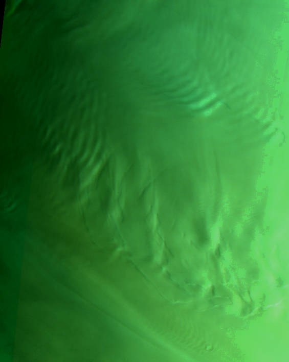
Gravity clouds and lee waves at North Pole; partly saturated terminator obervation. Map.
| Orbit Number | 21846 |
|---|---|
| Latitude | 81.4 |
| Longitude [E/W] | -12.3 |
| Longitude [E] | 347.7 |
| Ls | 31.7 |
| Date | 2021-04-15 00:00:00 |
| Local time | 04:29:57 |
| Cirrus Clouds | |
| Lee Waves | lee waves |
| Gravity Clouds | gravity clouds |
| ACB | |
| Cloud Streets | |
| Elongated Dust Clouds | |
| Cumulus Cloud Sheet | |
| Plume | |
| Undefined | |
| Observation Type | Broom |
| Potentially Moving | |
| Spalte1 |
CT-227 #

Lee waves and gravity clouds at Vastitas; partly saturated terminator obervation. Map.
| Orbit Number | 21840 |
|---|---|
| Latitude | 64.99 |
| Longitude [E/W] | -89.76 |
| Longitude [E] | 270.24 |
| Ls | 30.9 |
| Date | 2021-04-13 00:00:00 |
| Local time | 06:28:54 |
| Cirrus Clouds | |
| Lee Waves | lee waves |
| Gravity Clouds | gravity clouds |
| ACB | |
| Cloud Streets | |
| Elongated Dust Clouds | |
| Cumulus Cloud Sheet | |
| Plume | |
| Undefined | |
| Observation Type | Broom |
| Potentially Moving | |
| Spalte1 |
CT-228 #
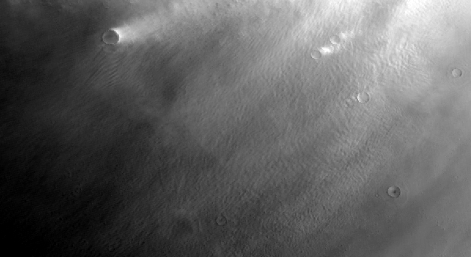
Lee waves and cloud streets? at Vastitas; partly saturated terminator obervation; browse image is nadir channel. Map.
| Orbit Number | 21823 |
|---|---|
| Latitude | 60.05 |
| Longitude [E/W] | -154.57 |
| Longitude [E] | 205.43 |
| Ls | 28.6 |
| Date | 2021-04-08 00:00:00 |
| Local time | 06:17:08 |
| Cirrus Clouds | |
| Lee Waves | lee waves |
| Gravity Clouds | |
| ACB | |
| Cloud Streets | cloud streets |
| Elongated Dust Clouds | |
| Cumulus Cloud Sheet | |
| Plume | |
| Undefined | |
| Observation Type | Broom |
| Potentially Moving | |
| Spalte1 | 40.0 |
CT-229 #
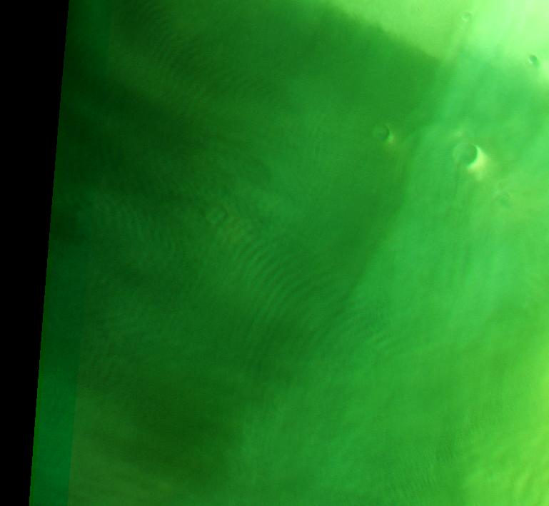
Faint early morning lee waves at Acidalia. Map.
| Orbit Number | 21822 |
|---|---|
| Latitude | 58.74 |
| Longitude [E/W] | -56.07 |
| Longitude [E] | 303.93 |
| Ls | 28.5 |
| Date | 2021-04-08 00:00:00 |
| Local time | 06:08:00 |
| Cirrus Clouds | |
| Lee Waves | lee waves |
| Gravity Clouds | gravity clouds |
| ACB | |
| Cloud Streets | |
| Elongated Dust Clouds | |
| Cumulus Cloud Sheet | |
| Plume | |
| Undefined | |
| Observation Type | Broom |
| Potentially Moving | |
| Spalte1 |
CT-230 #
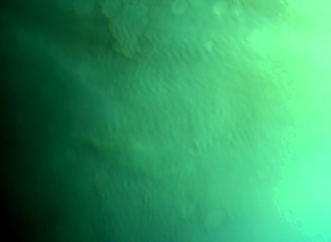
Early morning gravity cloud field at Noachis Terra. Map.
| Orbit Number | 21789 |
|---|---|
| Latitude | -55.63 |
| Longitude [E/W] | 33.51 |
| Longitude [E] | 33.51 |
| Ls | 24.2 |
| Date | 2021-03-29 00:00:00 |
| Local time | 08:22:46 |
| Cirrus Clouds | |
| Lee Waves | |
| Gravity Clouds | gravity clouds |
| ACB | |
| Cloud Streets | |
| Elongated Dust Clouds | |
| Cumulus Cloud Sheet | |
| Plume | |
| Undefined | |
| Observation Type | Broom |
| Potentially Moving | |
| Spalte1 |
CT-231 #

Faint early morning lee waves (with bright cloud spot - morning dot?)at Noachis Terra. Map.
| Orbit Number | 21779 |
|---|---|
| Latitude | -50.52 |
| Longitude [E/W] | -21.75 |
| Longitude [E] | 338.25 |
| Ls | 22.8 |
| Date | 2021-03-26 00:00:00 |
| Local time | 07:55:00 |
| Cirrus Clouds | |
| Lee Waves | lee waves |
| Gravity Clouds | |
| ACB | |
| Cloud Streets | |
| Elongated Dust Clouds | |
| Cumulus Cloud Sheet | |
| Plume | |
| Undefined | |
| Observation Type | Broom |
| Potentially Moving | |
| Spalte1 |
CT-232 #

Early morning gravity cloud field (or lee waves?) at Noachis Terra. Map.
| Orbit Number | 21779 |
|---|---|
| Latitude | -63.0 |
| Longitude [E/W] | -2.56999999999999 |
| Longitude [E] | 357.43 |
| Ls | 22.8 |
| Date | 2021-03-26 00:00:00 |
| Local time | 09:13:38 |
| Cirrus Clouds | |
| Lee Waves | |
| Gravity Clouds | gravity clouds |
| ACB | |
| Cloud Streets | |
| Elongated Dust Clouds | |
| Cumulus Cloud Sheet | |
| Plume | |
| Undefined | |
| Observation Type | Broom |
| Potentially Moving | |
| Spalte1 |
CT-233 #

Early morning lee waves at Promethei Terra. Map.
| Orbit Number | 21760 |
|---|---|
| Latitude | -52.22 |
| Longitude [E/W] | 114.25 |
| Longitude [E] | 114.25 |
| Ls | 20.2 |
| Date | 2021-03-21 00:00:00 |
| Local time | 07:47:51 |
| Cirrus Clouds | |
| Lee Waves | lee waves |
| Gravity Clouds | |
| ACB | |
| Cloud Streets | |
| Elongated Dust Clouds | |
| Cumulus Cloud Sheet | |
| Plume | |
| Undefined | |
| Observation Type | Broom |
| Potentially Moving | |
| Spalte1 |
CT-234 #
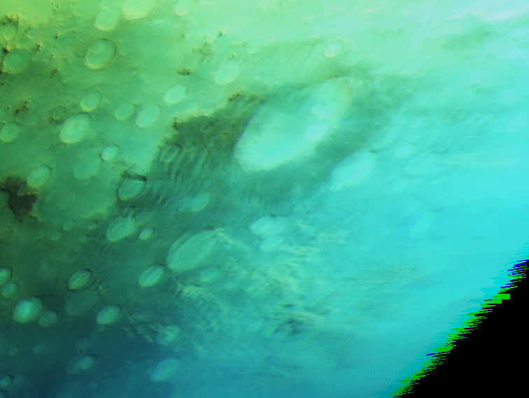
Lee waves at craters SE of Hellas / S Promethei Terra. Map.
| Orbit Number | 21736 |
|---|---|
| Latitude | -61.64 |
| Longitude [E/W] | 100.0 |
| Longitude [E] | 100.0 |
| Ls | 16.6 |
| Date | 2021-03-14 00:00:00 |
| Local time | 11:11:16 |
| Cirrus Clouds | |
| Lee Waves | lee waves |
| Gravity Clouds | |
| ACB | |
| Cloud Streets | |
| Elongated Dust Clouds | |
| Cumulus Cloud Sheet | |
| Plume | |
| Undefined | |
| Observation Type | Broom |
| Potentially Moving | |
| Spalte1 |
CT-235 #

Lee waves (?) at Thaumasia Highlands. Map.
| Orbit Number | 21727 |
|---|---|
| Latitude | -41.61 |
| Longitude [E/W] | -88.24 |
| Longitude [E] | 271.76 |
| Ls | 15.7 |
| Date | 2021-03-11 00:00:00 |
| Local time | 10:19:03 |
| Cirrus Clouds | |
| Lee Waves | lee waves |
| Gravity Clouds | |
| ACB | |
| Cloud Streets | |
| Elongated Dust Clouds | |
| Cumulus Cloud Sheet | |
| Plume | |
| Undefined | |
| Observation Type | Broom |
| Potentially Moving | |
| Spalte1 |
CT-236 #
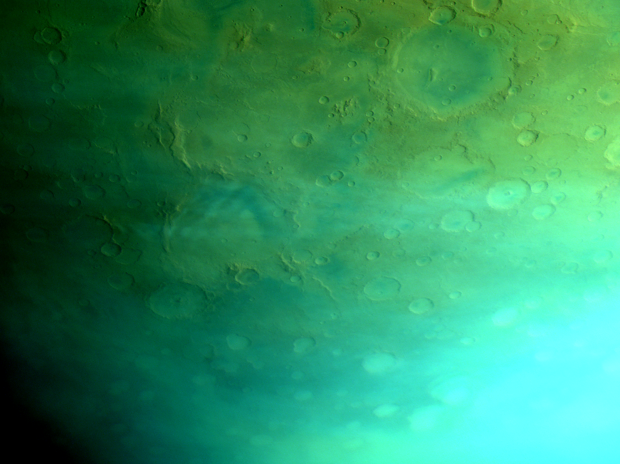
Faint lee waves at Copernicus crater. Map.
| Orbit Number | 21724 |
|---|---|
| Latitude | -47.96 |
| Longitude [E/W] | -169.17 |
| Longitude [E] | 190.83 |
| Ls | 15.2 |
| Date | 2021-03-10 00:00:00 |
| Local time | 08:16:04 |
| Cirrus Clouds | |
| Lee Waves | lee waves |
| Gravity Clouds | |
| ACB | |
| Cloud Streets | |
| Elongated Dust Clouds | |
| Cumulus Cloud Sheet | |
| Plume | |
| Undefined | |
| Observation Type | Broom |
| Potentially Moving | |
| Spalte1 |
CT-237 #
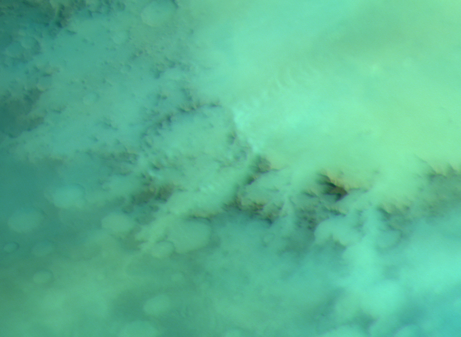
Lee waves at western rim of Argyre Planitia. Map.
| Orbit Number | 21688 |
|---|---|
| Latitude | -56.11 |
| Longitude [E/W] | -49.92 |
| Longitude [E] | 310.08 |
| Ls | 10.2 |
| Date | 2021-02-28 00:00:00 |
| Local time | 10:36:00 |
| Cirrus Clouds | |
| Lee Waves | lee waves |
| Gravity Clouds | |
| ACB | |
| Cloud Streets | |
| Elongated Dust Clouds | |
| Cumulus Cloud Sheet | |
| Plume | |
| Undefined | |
| Observation Type | Broom |
| Potentially Moving | |
| Spalte1 |
CT-238 #

Gravity waves NE of Alba Patera. Map.
| Orbit Number | 21688 |
|---|---|
| Latitude | 43.65 |
| Longitude [E/W] | -101.28 |
| Longitude [E] | 258.72 |
| Ls | 10.2 |
| Date | 2021-02-28 00:00:00 |
| Local time | 07:12:59 |
| Cirrus Clouds | |
| Lee Waves | |
| Gravity Clouds | gravity clouds |
| ACB | |
| Cloud Streets | |
| Elongated Dust Clouds | |
| Cumulus Cloud Sheet | |
| Plume | |
| Undefined | |
| Observation Type | Broom |
| Potentially Moving | |
| Spalte1 |
CT-239 #
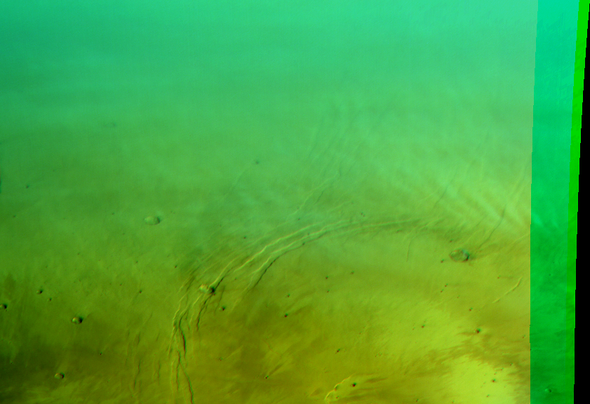
Faint gravity waves at Alba Patera. Map.
| Orbit Number | 21660 |
|---|---|
| Latitude | 48.97 |
| Longitude [E/W] | -107.84 |
| Longitude [E] | 252.16 |
| Ls | 6.2 |
| Date | 2021-02-20 00:00:00 |
| Local time | 08:31:37 |
| Cirrus Clouds | |
| Lee Waves | |
| Gravity Clouds | gravity clouds |
| ACB | |
| Cloud Streets | |
| Elongated Dust Clouds | |
| Cumulus Cloud Sheet | |
| Plume | |
| Undefined | |
| Observation Type | Broom |
| Potentially Moving | |
| Spalte1 |
CT-240 #

Lee waves at Phlegra Montes. Map.
| Orbit Number | 21650 |
|---|---|
| Latitude | 47.26 |
| Longitude [E/W] | 166.52 |
| Longitude [E] | 166.52 |
| Ls | 4.8 |
| Date | 2021-02-17 00:00:00 |
| Local time | 07:16:33 |
| Cirrus Clouds | |
| Lee Waves | lee waves |
| Gravity Clouds | |
| ACB | |
| Cloud Streets | |
| Elongated Dust Clouds | |
| Cumulus Cloud Sheet | |
| Plume | |
| Undefined | |
| Observation Type | Broom |
| Potentially Moving | |
| Spalte1 |
CT-241 #
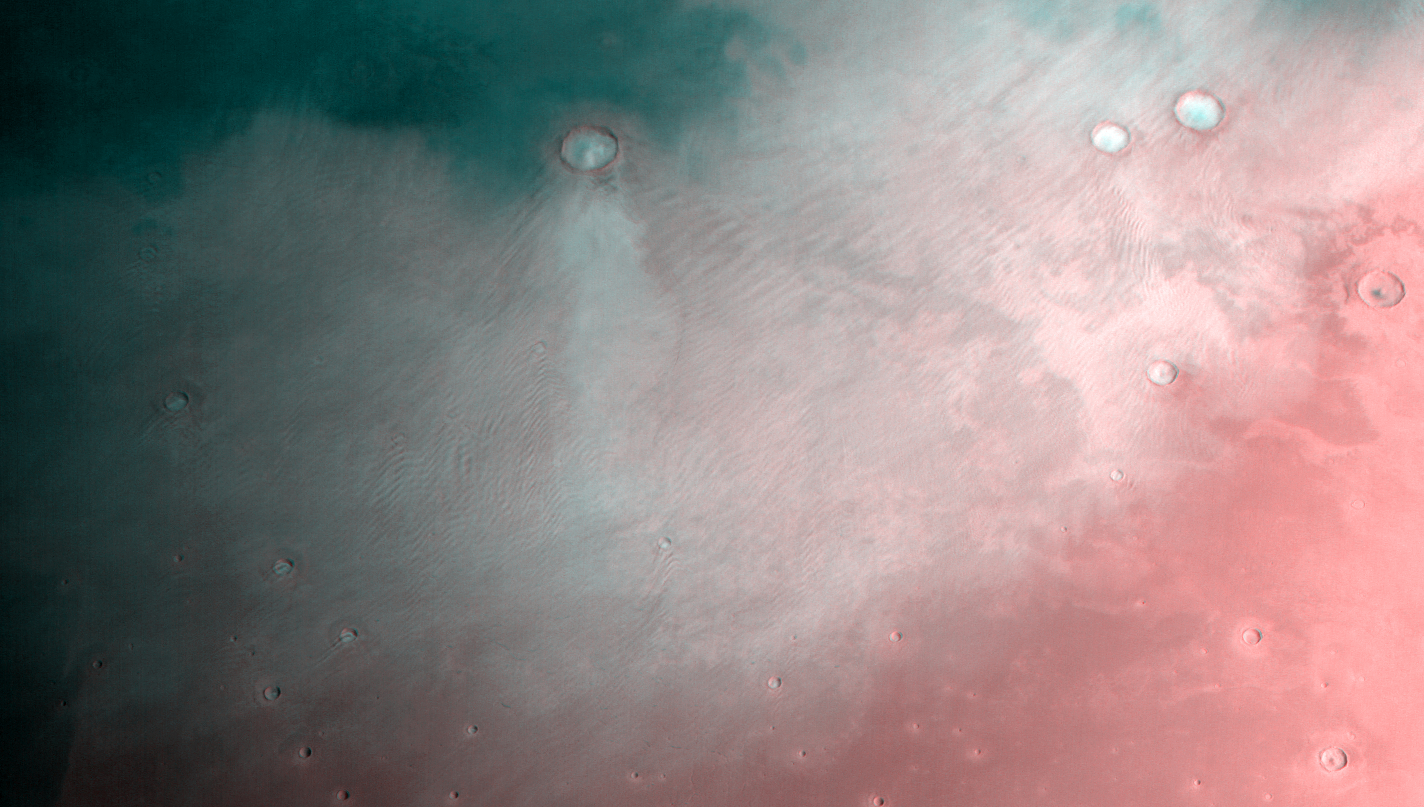
Extensive lee wave “field” emerging from many craters at Utopia Planitia, combined with gravity clouds (browse image is RGG(!) composit for better contrast). Map.
| Orbit Number | 21626 |
|---|---|
| Latitude | 39.56 |
| Longitude [E/W] | 106.97 |
| Longitude [E] | 106.97 |
| Ls | 1.1 |
| Date | 2021-02-10 00:00:00 |
| Local time | 08:05:52 |
| Cirrus Clouds | |
| Lee Waves | lee waves |
| Gravity Clouds | gravity clouds |
| ACB | |
| Cloud Streets | |
| Elongated Dust Clouds | |
| Cumulus Cloud Sheet | |
| Plume | |
| Undefined | |
| Observation Type | Broom |
| Potentially Moving | |
| Spalte1 |
CT-242 #
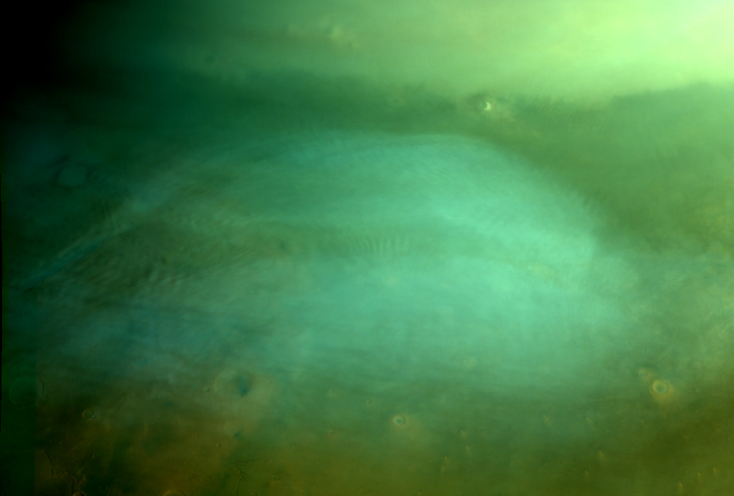
Gravity clouds (?) and cirrus clouds at Acidalia Planitia. Map.
| Orbit Number | 21624 |
|---|---|
| Latitude | 49.42 |
| Longitude [E/W] | -49.6 |
| Longitude [E] | 310.4 |
| Ls | 1.1 |
| Date | 2021-02-09 00:00:00 |
| Local time | 08:13:08 |
| Cirrus Clouds | cirrus clouds |
| Lee Waves | |
| Gravity Clouds | gravity clouds |
| ACB | |
| Cloud Streets | |
| Elongated Dust Clouds | |
| Cumulus Cloud Sheet | |
| Plume | |
| Undefined | |
| Observation Type | Broom |
| Potentially Moving | |
| Spalte1 |
CT-243 #
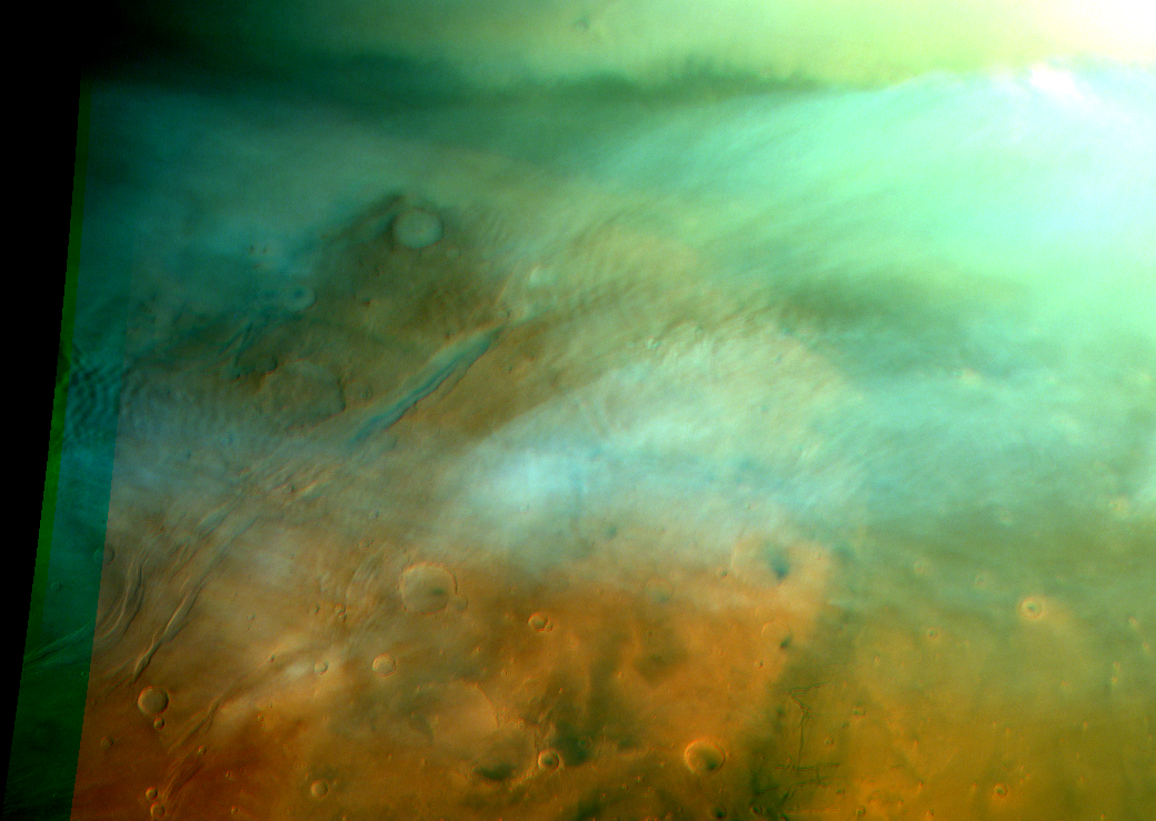
Lee and gravity waves and cirrus cloud sheets at Tempe Terra. Map.
| Orbit Number | 21603 |
|---|---|
| Latitude | 50.33 |
| Longitude [E/W] | -58.18 |
| Longitude [E] | 301.82 |
| Ls | 358.0 |
| Date | 2021-02-03 00:00:00 |
| Local time | 08:52:53 |
| Cirrus Clouds | cirrus clouds |
| Lee Waves | lee waves |
| Gravity Clouds | gravity clouds |
| ACB | |
| Cloud Streets | |
| Elongated Dust Clouds | |
| Cumulus Cloud Sheet | |
| Plume | |
| Undefined | |
| Observation Type | Broom |
| Potentially Moving | |
| Spalte1 |
CT-244 #
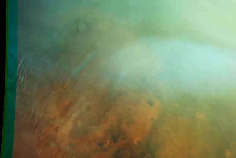
Lee waves at Tempe Terra. Map.
| Orbit Number | 21596 |
|---|---|
| Latitude | 46.8 |
| Longitude [E/W] | -76.3 |
| Longitude [E] | 283.7 |
| Ls | 357.0 |
| Date | 2021-02-01 00:00:00 |
| Local time | 07:54:58 |
| Cirrus Clouds | |
| Lee Waves | lee waves |
| Gravity Clouds | |
| ACB | |
| Cloud Streets | |
| Elongated Dust Clouds | |
| Cumulus Cloud Sheet | |
| Plume | |
| Undefined | |
| Observation Type | Broom |
| Potentially Moving | |
| Spalte1 |
CT-245 #
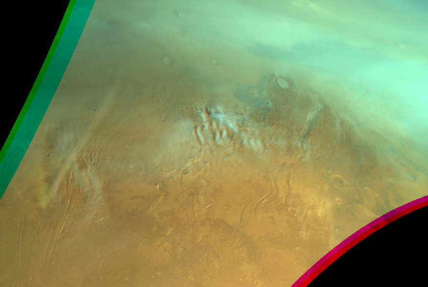
Gravity clouds; lee waves and cloud streets at NE Alba, Tempe Terra and Acidalia. Map.
| Orbit Number | 21547 |
|---|---|
| Latitude | 47.63 |
| Longitude [E/W] | -79.57 |
| Longitude [E] | 280.43 |
| Ls | 349.7 |
| Date | 2021-01-18 00:00:00 |
| Local time | 10:54:33 |
| Cirrus Clouds | |
| Lee Waves | lee waves |
| Gravity Clouds | gravity clouds |
| ACB | |
| Cloud Streets | cloud streets |
| Elongated Dust Clouds | |
| Cumulus Cloud Sheet | |
| Plume | |
| Undefined | |
| Observation Type | Broom |
| Potentially Moving | |
| Spalte1 |
CT-246 #
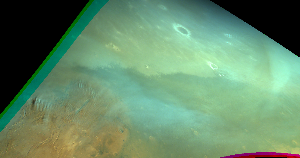
Gravity clouds and residual dust storm? at Acidaila/Vastitas. Map.
| Orbit Number | 21536 |
|---|---|
| Latitude | 48.17 |
| Longitude [E/W] | -67.11 |
| Longitude [E] | 292.89 |
| Ls | 348.1 |
| Date | 2021-01-14 00:00:00 |
| Local time | 09:30:19 |
| Cirrus Clouds | |
| Lee Waves | |
| Gravity Clouds | gravity clouds |
| ACB | |
| Cloud Streets | |
| Elongated Dust Clouds | |
| Cumulus Cloud Sheet | |
| Plume | |
| Undefined | |
| Observation Type | Broom |
| Potentially Moving | |
| Spalte1 |
CT-247 #
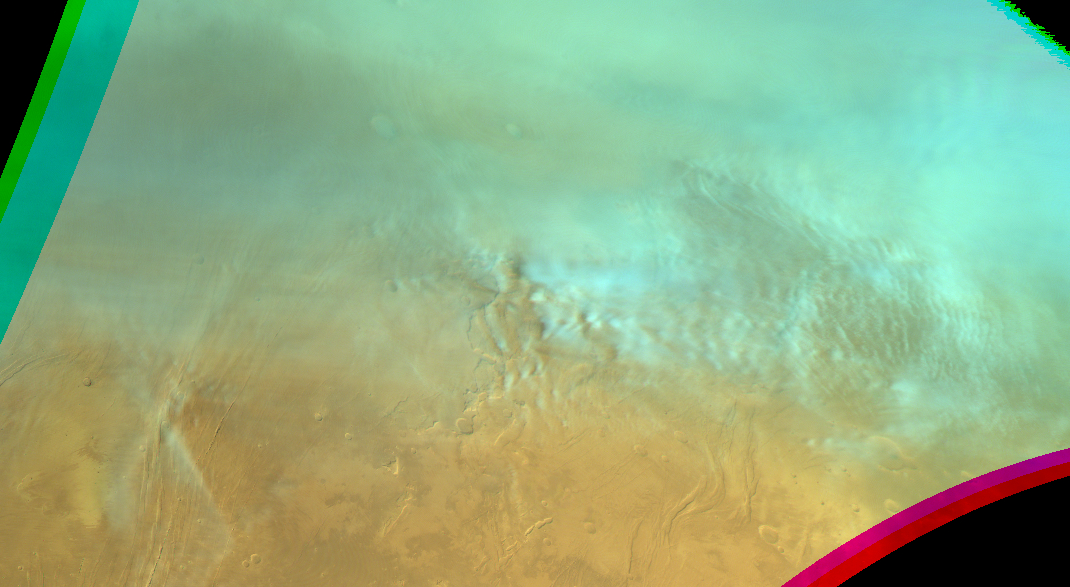
Faint gravity clouds north of Alba Patera and pronounced gravity clouds at Acidalia. Map.
| Orbit Number | 21526 |
|---|---|
| Latitude | 47.94 |
| Longitude [E/W] | -75.22 |
| Longitude [E] | 284.78 |
| Ls | 346.5 |
| Date | 2021-01-12 00:00:00 |
| Local time | 12:02:22 |
| Cirrus Clouds | |
| Lee Waves | |
| Gravity Clouds | gravity clouds |
| ACB | |
| Cloud Streets | |
| Elongated Dust Clouds | |
| Cumulus Cloud Sheet | |
| Plume | |
| Undefined | |
| Observation Type | Broom |
| Potentially Moving | |
| Spalte1 |
CT-248 #
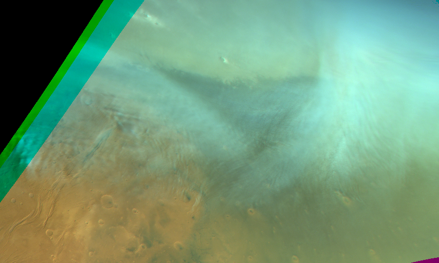
Gravity clouds in Acidalia Planita, part of cyclone?. Map.
| Orbit Number | 21508 |
|---|---|
| Latitude | 52.65 |
| Longitude [E/W] | -37.49 |
| Longitude [E] | 322.51 |
| Ls | 343.8 |
| Date | 2021-01-06 00:00:00 |
| Local time | 12:15:52 |
| Cirrus Clouds | |
| Lee Waves | |
| Gravity Clouds | gravity clouds |
| ACB | |
| Cloud Streets | |
| Elongated Dust Clouds | |
| Cumulus Cloud Sheet | |
| Plume | |
| Undefined | |
| Observation Type | Broom |
| Potentially Moving | |
| Spalte1 |
CT-249 #
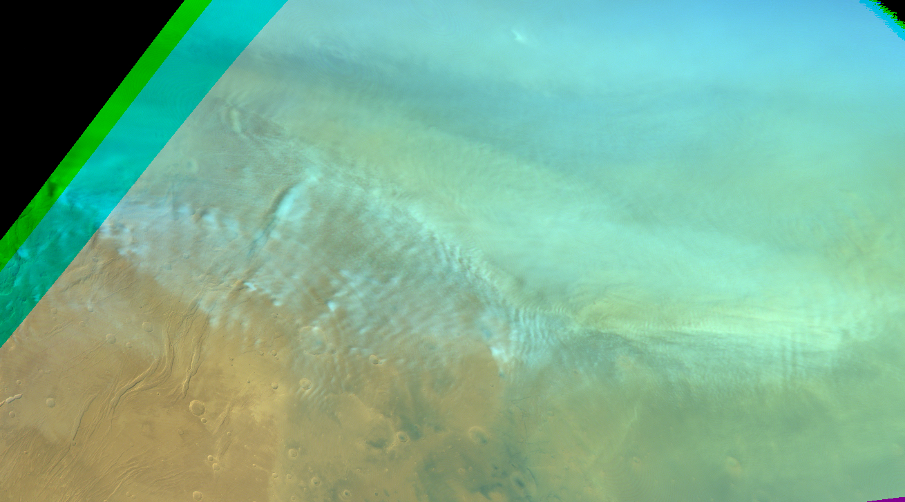
Gravity clouds and lee waves at Acidalia Planita; partial dust-loaded + faiding dust storm ?. Map.
| Orbit Number | 21487 |
|---|---|
| Latitude | 49.5 |
| Longitude [E/W] | 161.83 |
| Longitude [E] | 161.83 |
| Ls | 340.6 |
| Date | 2020-12-31 00:00:00 |
| Local time | 02:33:53 |
| Cirrus Clouds | |
| Lee Waves | lee waves |
| Gravity Clouds | gravity clouds |
| ACB | |
| Cloud Streets | |
| Elongated Dust Clouds | |
| Cumulus Cloud Sheet | |
| Plume | |
| Undefined | |
| Observation Type | Broom |
| Potentially Moving | |
| Spalte1 |
CT-250 #

Gravity clouds and lee waves at Acidalia Planita; partial dust-loaded. Map.
| Orbit Number | 21480 |
|---|---|
| Latitude | 48.05 |
| Longitude [E/W] | -51.21 |
| Longitude [E] | 308.79 |
| Ls | 339.5 |
| Date | 2020-12-29 00:00:00 |
| Local time | 12:34:55 |
| Cirrus Clouds | |
| Lee Waves | lee waves |
| Gravity Clouds | gravity clouds |
| ACB | |
| Cloud Streets | |
| Elongated Dust Clouds | |
| Cumulus Cloud Sheet | |
| Plume | |
| Undefined | |
| Observation Type | Broom |
| Potentially Moving | |
| Spalte1 |
CT-251 #
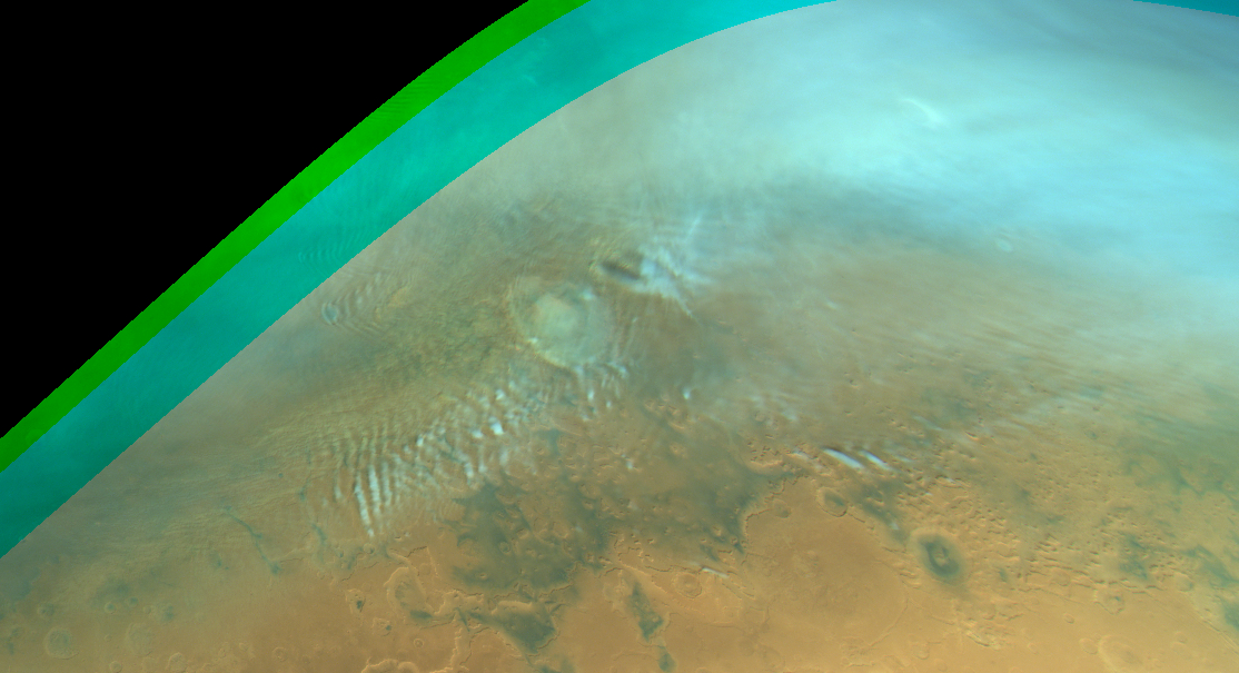
Gravity clouds and lee waves near/at Lyot Crater; partially loaded with dust. Map.
| Orbit Number | 21479 |
|---|---|
| Latitude | 49.5 |
| Longitude [E/W] | 24.6 |
| Longitude [E] | 24.6 |
| Ls | 339.3 |
| Date | 2020-12-29 00:00:00 |
| Local time | 11:19:34 |
| Cirrus Clouds | |
| Lee Waves | lee waves |
| Gravity Clouds | gravity clouds |
| ACB | |
| Cloud Streets | |
| Elongated Dust Clouds | |
| Cumulus Cloud Sheet | |
| Plume | |
| Undefined | |
| Observation Type | Broom |
| Potentially Moving | |
| Spalte1 |
CT-252 #

Gravity clouds in Utopia Planitia; partially loaded with dust; dust storm?. Map.
| Orbit Number | 21478 |
|---|---|
| Latitude | 50.06 |
| Longitude [E/W] | 168.05 |
| Longitude [E] | 168.05 |
| Ls | 339.2 |
| Date | 2020-12-29 00:00:00 |
| Local time | 13:46:22 |
| Cirrus Clouds | |
| Lee Waves | lee waves |
| Gravity Clouds | gravity clouds |
| ACB | |
| Cloud Streets | |
| Elongated Dust Clouds | |
| Cumulus Cloud Sheet | |
| Plume | |
| Undefined | |
| Observation Type | Broom |
| Potentially Moving | |
| Spalte1 |
CT-253 #
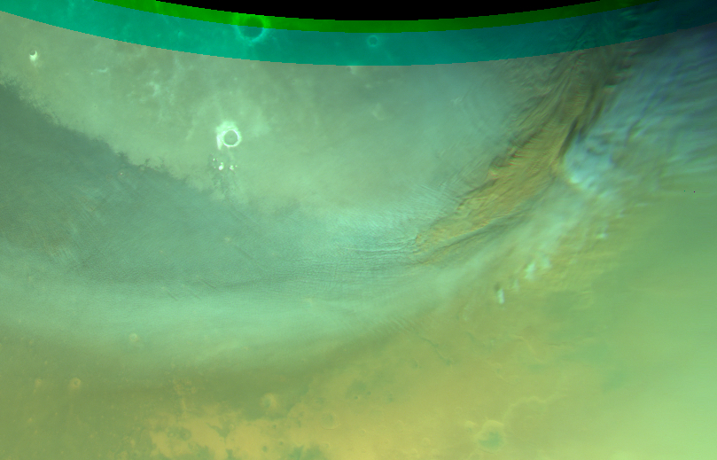
Dust storm in Vastitas Borealis; and gravity clouds. Map.
| Orbit Number | 21469 |
|---|---|
| Latitude | 53.56 |
| Longitude [E/W] | 30.02 |
| Longitude [E] | 30.02 |
| Ls | 337.8 |
| Date | 2020-12-26 00:00:00 |
| Local time | 15:57:45 |
| Cirrus Clouds | |
| Lee Waves | lee waves |
| Gravity Clouds | gravity clouds |
| ACB | |
| Cloud Streets | |
| Elongated Dust Clouds | |
| Cumulus Cloud Sheet | |
| Plume | |
| Undefined | |
| Observation Type | Broom |
| Potentially Moving | |
| Spalte1 |
CT-254 #

Gravity clouds near Lyot crater; dust loaded?. Map.
| Orbit Number | 21465 |
|---|---|
| Latitude | 50.04 |
| Longitude [E/W] | 39.84 |
| Longitude [E] | 39.84 |
| Ls | 337.1 |
| Date | 2020-12-25 00:00:00 |
| Local time | 12:44:58 |
| Cirrus Clouds | |
| Lee Waves | lee waves |
| Gravity Clouds | gravity clouds |
| ACB | |
| Cloud Streets | |
| Elongated Dust Clouds | |
| Cumulus Cloud Sheet | |
| Plume | |
| Undefined | |
| Observation Type | Broom |
| Potentially Moving | |
| Spalte1 |
CT-255 #
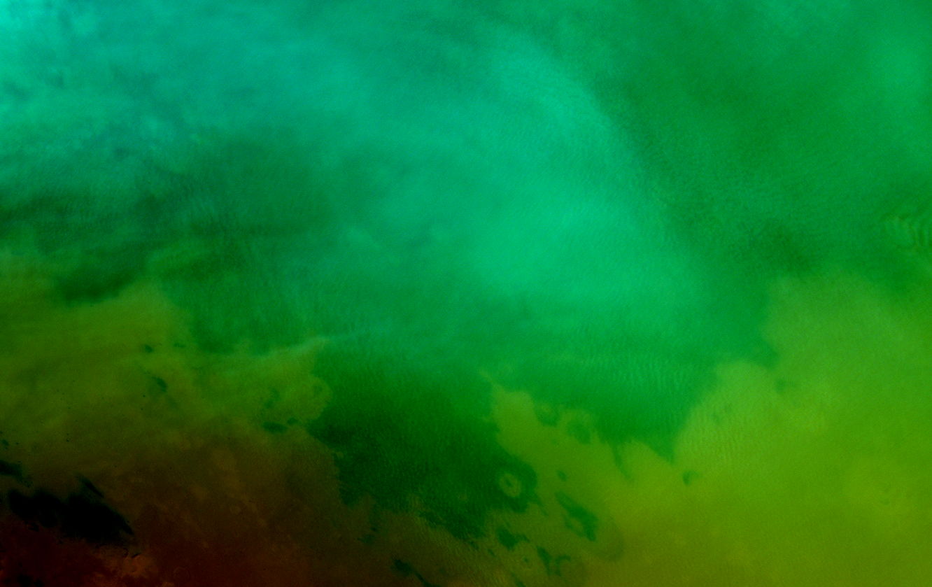
Extended cloud street field at Utopia. Map.
| Orbit Number | 21454 |
|---|---|
| Latitude | 46.41 |
| Longitude [E/W] | 86.81 |
| Longitude [E] | 86.81 |
| Ls | 335.4 |
| Date | 2020-12-22 00:00:00 |
| Local time | 13:00:00 |
| Cirrus Clouds | |
| Lee Waves | |
| Gravity Clouds | |
| ACB | |
| Cloud Streets | cloud streets |
| Elongated Dust Clouds | |
| Cumulus Cloud Sheet | |
| Plume | |
| Undefined | |
| Observation Type | Broom |
| Potentially Moving | |
| Spalte1 |
CT-256 #
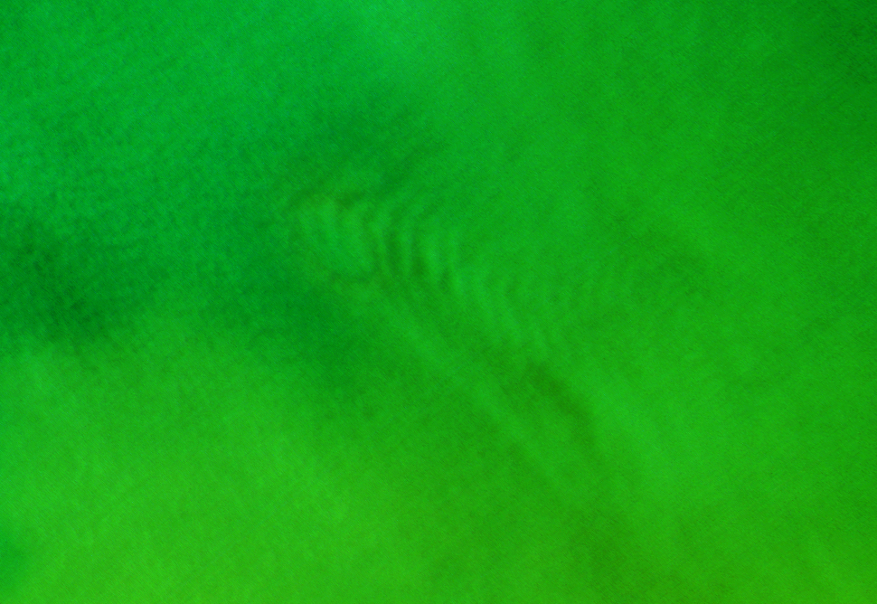
Lee waves at Nier crater. Map.
| Orbit Number | 21454 |
|---|---|
| Latitude | 42.22 |
| Longitude [E/W] | 107.01 |
| Longitude [E] | 107.01 |
| Ls | 335.4 |
| Date | 2020-12-22 00:00:00 |
| Local time | 14:25:12 |
| Cirrus Clouds | |
| Lee Waves | lee waves |
| Gravity Clouds | |
| ACB | |
| Cloud Streets | |
| Elongated Dust Clouds | |
| Cumulus Cloud Sheet | |
| Plume | |
| Undefined | |
| Observation Type | Broom |
| Potentially Moving | |
| Spalte1 |
CT-257 #
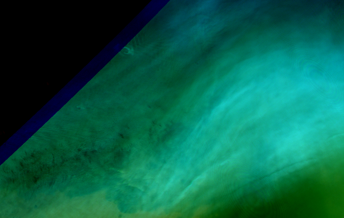
Extensive cumulus cloud sheet (part of dust storm?) and lee waves at Vastitas. Map.
| Orbit Number | 21447 |
|---|---|
| Latitude | 54.3 |
| Longitude [E/W] | 83.08 |
| Longitude [E] | 83.08 |
| Ls | 334.3 |
| Date | 2020-12-20 00:00:00 |
| Local time | 13:24:00 |
| Cirrus Clouds | |
| Lee Waves | lee waves |
| Gravity Clouds | |
| ACB | |
| Cloud Streets | |
| Elongated Dust Clouds | |
| Cumulus Cloud Sheet | cumulus cloud sheet |
| Plume | |
| Undefined | |
| Observation Type | Broom |
| Potentially Moving | |
| Spalte1 |
CT-258 #
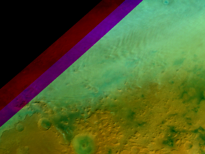
Lee waves at Deuteronilus Region. Map.
| Orbit Number | 21447 |
|---|---|
| Latitude | 49.54 |
| Longitude [E/W] | 51.47 |
| Longitude [E] | 51.47 |
| Ls | 334.3 |
| Date | 2020-12-20 00:00:00 |
| Local time | 11:19:13 |
| Cirrus Clouds | |
| Lee Waves | lee waves |
| Gravity Clouds | |
| ACB | |
| Cloud Streets | |
| Elongated Dust Clouds | |
| Cumulus Cloud Sheet | |
| Plume | |
| Undefined | |
| Observation Type | Broom |
| Potentially Moving | |
| Spalte1 |
CT-259 #
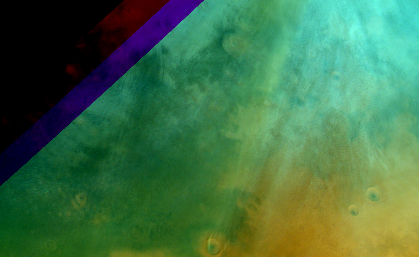
Extended cloud street field at Utopia and small lee wave at Nier crater. Map.
| Orbit Number | 21436 |
|---|---|
| Latitude | 47.95 |
| Longitude [E/W] | 109.63 |
| Longitude [E] | 109.63 |
| Ls | 332.6 |
| Date | 2020-12-16 00:00:00 |
| Local time | 12:13:00 |
| Cirrus Clouds | |
| Lee Waves | lee waves |
| Gravity Clouds | |
| ACB | |
| Cloud Streets | cloud streets |
| Elongated Dust Clouds | |
| Cumulus Cloud Sheet | |
| Plume | |
| Undefined | |
| Observation Type | Broom |
| Potentially Moving | |
| Spalte1 |
CT-260 #
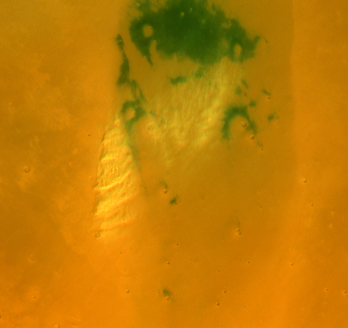
Unusual cumulus cloud formation (local (dust) storm event?) with gravity cloud-like components at SW Utopia. Map.
| Orbit Number | 21436 |
|---|---|
| Latitude | 29.99 |
| Longitude [E/W] | 92.86 |
| Longitude [E] | 92.86 |
| Ls | 332.6 |
| Date | 2020-12-16 00:00:00 |
| Local time | 11:05:00 |
| Cirrus Clouds | |
| Lee Waves | |
| Gravity Clouds | gravity clouds |
| ACB | |
| Cloud Streets | |
| Elongated Dust Clouds | |
| Cumulus Cloud Sheet | cumulus cloud sheet |
| Plume | |
| Undefined | |
| Observation Type | Broom |
| Potentially Moving | Yes? |
| Spalte1 |
CT-261 #
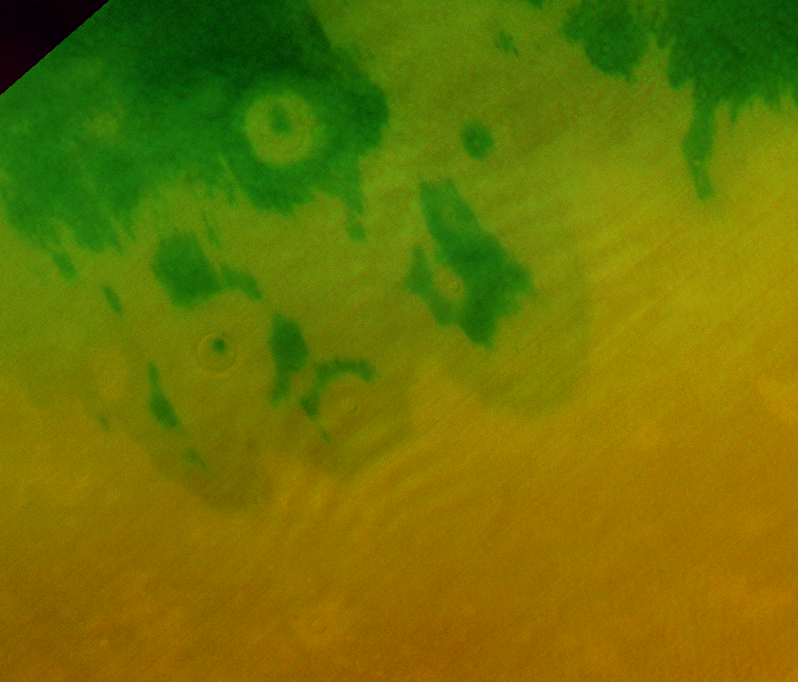
Very faint gravity waves at Utopia Planitia. Map.
| Orbit Number | 21436 |
|---|---|
| Latitude | 40.25 |
| Longitude [E/W] | 89.25 |
| Longitude [E] | 89.25 |
| Ls | 332.6 |
| Date | 2020-12-16 00:00:00 |
| Local time | 10:54:39 |
| Cirrus Clouds | |
| Lee Waves | |
| Gravity Clouds | gravity clouds |
| ACB | |
| Cloud Streets | |
| Elongated Dust Clouds | |
| Cumulus Cloud Sheet | |
| Plume | |
| Undefined | |
| Observation Type | Broom |
| Potentially Moving | |
| Spalte1 |
CT-262 #

Cloud streest (with dust storm) in Acidalia Planitia. Map.
| Orbit Number | 21430 |
|---|---|
| Latitude | 47.209 |
| Longitude [E/W] | 9.2 |
| Longitude [E] | 9.2 |
| Ls | 331.0 |
| Date | 2020-12-15 00:00:00 |
| Local time | 12:46:00 |
| Cirrus Clouds | |
| Lee Waves | |
| Gravity Clouds | |
| ACB | |
| Cloud Streets | cloud streets |
| Elongated Dust Clouds | |
| Cumulus Cloud Sheet | |
| Plume | |
| Undefined | |
| Observation Type | Broom |
| Potentially Moving | |
| Spalte1 |
CT-263 #
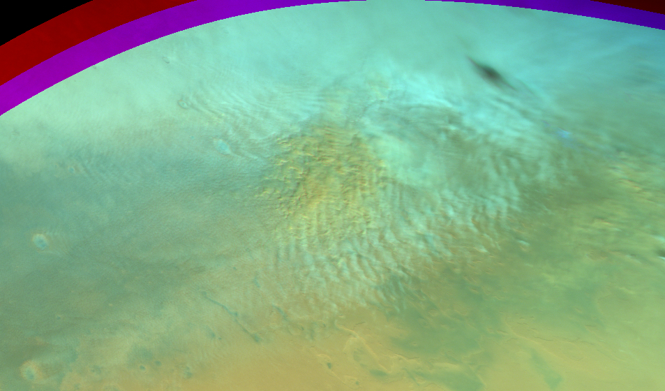
Gravity clouds and lee waves (with dust storm) at Acidalia Planitia. Map.
| Orbit Number | 21430 |
|---|---|
| Latitude | 48.47 |
| Longitude [E/W] | 22.58 |
| Longitude [E] | 22.58 |
| Ls | 331.0 |
| Date | 2020-12-15 00:00:00 |
| Local time | 13:39:08 |
| Cirrus Clouds | |
| Lee Waves | lee waves |
| Gravity Clouds | gravity clouds |
| ACB | |
| Cloud Streets | |
| Elongated Dust Clouds | |
| Cumulus Cloud Sheet | |
| Plume | |
| Undefined | |
| Observation Type | Broom |
| Potentially Moving | |
| Spalte1 |
CT-264 #
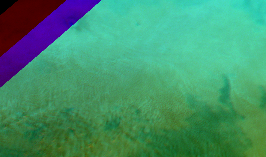
Cloud streets at Deuteronilus Mensae. Map.
| Orbit Number | 21426 |
|---|---|
| Latitude | 49.95 |
| Longitude [E/W] | 57.44 |
| Longitude [E] | 57.44 |
| Ls | 328.6 |
| Date | 2020-12-13 00:00:00 |
| Local time | 12:41:03 |
| Cirrus Clouds | |
| Lee Waves | |
| Gravity Clouds | |
| ACB | |
| Cloud Streets | cloud streets |
| Elongated Dust Clouds | |
| Cumulus Cloud Sheet | |
| Plume | |
| Undefined | |
| Observation Type | Broom |
| Potentially Moving | |
| Spalte1 |
CT-265 #
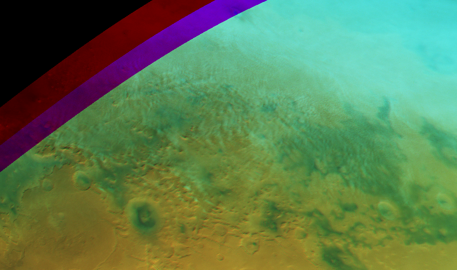
Lee waves and gravity clouds at Deuteronilus Mensae. Map.
| Orbit Number | 21426 |
|---|---|
| Latitude | 46.95 |
| Longitude [E/W] | 50.7 |
| Longitude [E] | 50.7 |
| Ls | 328.6 |
| Date | 2020-12-13 00:00:00 |
| Local time | 12:41:03 |
| Cirrus Clouds | |
| Lee Waves | lee waves |
| Gravity Clouds | gravity clouds |
| ACB | |
| Cloud Streets | |
| Elongated Dust Clouds | |
| Cumulus Cloud Sheet | |
| Plume | |
| Undefined | |
| Observation Type | Broom |
| Potentially Moving | |
| Spalte1 |
CT-266 #
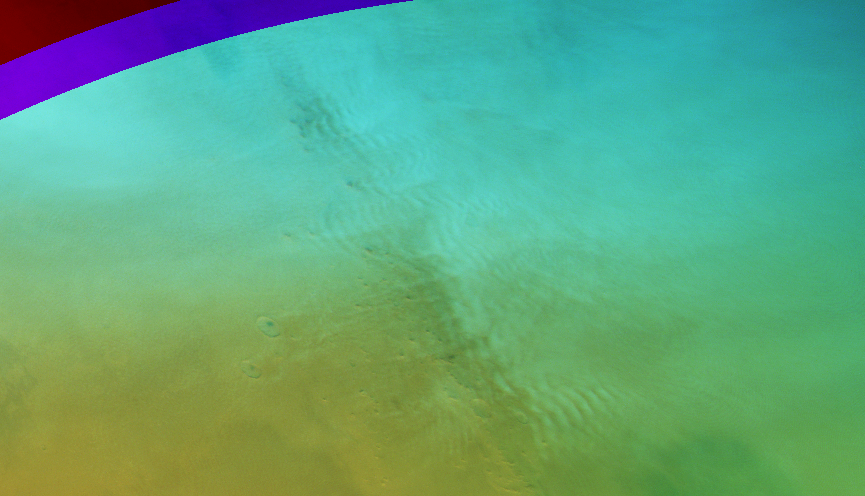
Lee waves at Phlegra Montes. Map.
| Orbit Number | 21411 |
|---|---|
| Latitude | 47.058 |
| Longitude [E/W] | 169.056 |
| Longitude [E] | 169.056 |
| Ls | 328.9 |
| Date | 2020-12-09 00:00:00 |
| Local time | 14:07:07 |
| Cirrus Clouds | |
| Lee Waves | lee waves |
| Gravity Clouds | |
| ACB | |
| Cloud Streets | |
| Elongated Dust Clouds | |
| Cumulus Cloud Sheet | |
| Plume | |
| Undefined | |
| Observation Type | Broom |
| Potentially Moving | |
| Spalte1 |
CT-267 #
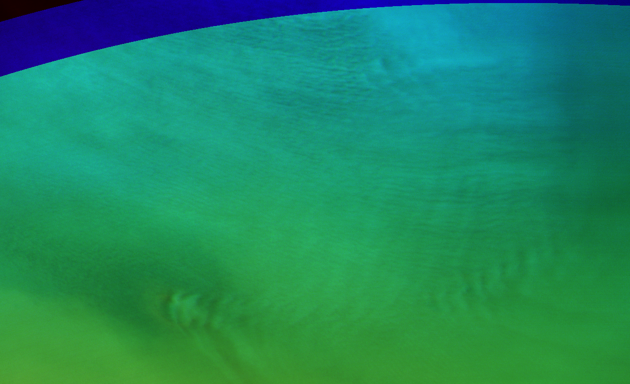
Lee waves and cloud streets at Nier crater / Utopia. Map.
| Orbit Number | 21401 |
|---|---|
| Latitude | 46.01 |
| Longitude [E/W] | 115.463 |
| Longitude [E] | 115.463 |
| Ls | 326.9 |
| Date | 2020-12-06 00:00:00 |
| Local time | 14:26:54 |
| Cirrus Clouds | |
| Lee Waves | lee waves |
| Gravity Clouds | |
| ACB | |
| Cloud Streets | cloud streets |
| Elongated Dust Clouds | |
| Cumulus Cloud Sheet | |
| Plume | |
| Undefined | |
| Observation Type | Broom |
| Potentially Moving | |
| Spalte1 |
CT-268 #
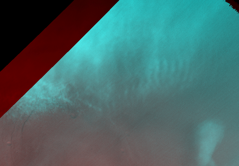
Small gravity cloud field and cumulus clouds north of Alba Patera (not good coverd by all channels; browse image is RBB-composite). Map.
| Orbit Number | 21396 |
|---|---|
| Latitude | 45.97 |
| Longitude [E/W] | -98.55 |
| Longitude [E] | 261.45 |
| Ls | 326.1 |
| Date | 2020-12-05 00:00:00 |
| Local time | 14:02:03 |
| Cirrus Clouds | |
| Lee Waves | |
| Gravity Clouds | gravity clouds |
| ACB | |
| Cloud Streets | |
| Elongated Dust Clouds | |
| Cumulus Cloud Sheet | cumulus cloud sheet |
| Plume | |
| Undefined | |
| Observation Type | Broom |
| Potentially Moving | |
| Spalte1 |
CT-269 #
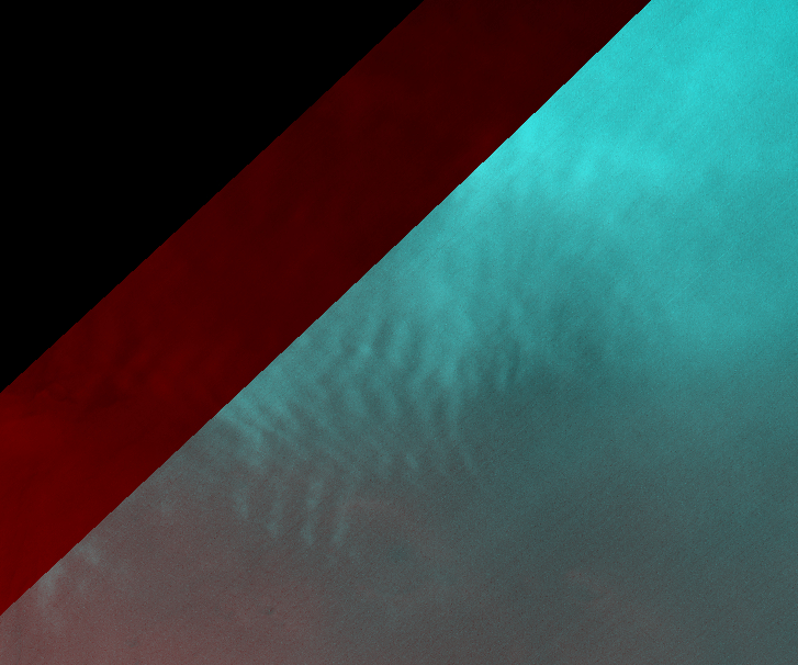
Gravity clouds (or lee waves?) at Tempa Terra (best coverd by red channel only; browse image is RBB-composite). Map.
| Orbit Number | 21385 |
|---|---|
| Latitude | 43.27 |
| Longitude [E/W] | -61.67 |
| Longitude [E] | 298.33 |
| Ls | 324.3 |
| Date | 2020-12-02 00:00:00 |
| Local time | 13:39:03 |
| Cirrus Clouds | |
| Lee Waves | |
| Gravity Clouds | gravity clouds |
| ACB | |
| Cloud Streets | |
| Elongated Dust Clouds | |
| Cumulus Cloud Sheet | |
| Plume | |
| Undefined | |
| Observation Type | Broom |
| Potentially Moving | |
| Spalte1 |
CT-270 #
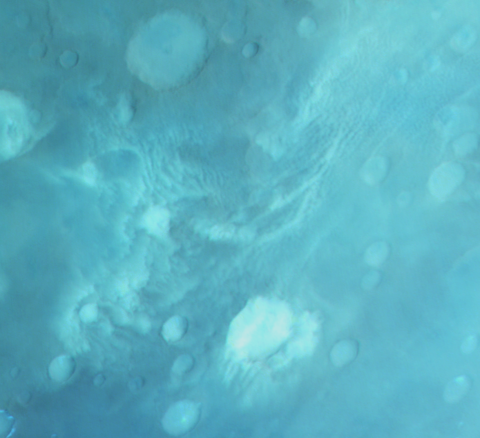
Unusual cumulus cloud formation with cloud street-like components. Map.
| Orbit Number | 20792_0001 |
|---|---|
| Latitude | -57.862 |
| Longitude [E/W] | -131.889 |
| Longitude [E] | 228.111 |
| Ls | 218.3 |
| Date | 2020-06-12 00:00:00 |
| Local time | 08:49:04 |
| Cirrus Clouds | |
| Lee Waves | |
| Gravity Clouds | |
| ACB | |
| Cloud Streets | cloud streets |
| Elongated Dust Clouds | |
| Cumulus Cloud Sheet | |
| Plume | |
| Undefined | |
| Observation Type | Broom |
| Potentially Moving | |
| Spalte1 |
CT-271 #
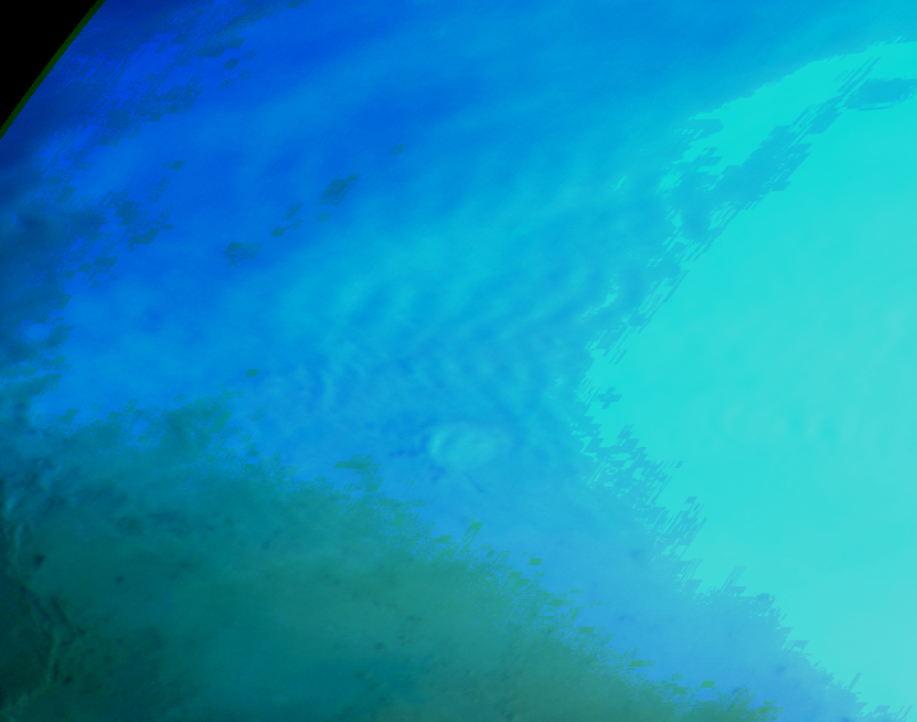
Lee waves?)near Lyot crater (partly overexposed orbit). Map.
| Orbit Number | 20776 |
|---|---|
| Latitude | 45.58 |
| Longitude [E/W] | 62.969 |
| Longitude [E] | 62.969 |
| Ls | 215.5 |
| Date | 2020-06-07 00:00:00 |
| Local time | 08:40:58 |
| Cirrus Clouds | |
| Lee Waves | lee waves |
| Gravity Clouds | |
| ACB | |
| Cloud Streets | |
| Elongated Dust Clouds | |
| Cumulus Cloud Sheet | |
| Plume | |
| Undefined | |
| Observation Type | Broom |
| Potentially Moving | |
| Spalte1 |
CT-272 #
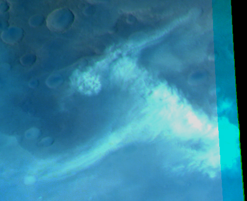
Unusual cumulus cloud formation with elongated (lee wave-like?) components. Map.
| Orbit Number | 20733 |
|---|---|
| _0001 | |
| Latitude | -55.73 |
| Longitude [E/W] | 140.57 |
| Longitude [E] | 140.57 |
| Ls | 207.8 |
| Date | 2020-05-26 00:00:00 |
| Local time | 09:43:00 |
| Cirrus Clouds | |
| Lee Waves | |
| Gravity Clouds | |
| ACB | |
| Cloud Streets | |
| Elongated Dust Clouds | |
| Cumulus Cloud Sheet | cumulus cloud sheet |
| Plume | |
| Undefined | |
| Observation Type | Broom |
| Potentially Moving | |
| Spalte1 |
CT-273 #
Lee waves at Phlegra Montes (bad data quality). Map.
| Orbit Number | 20725 |
|---|---|
| Latitude | 46.376 |
| Longitude [E/W] | 167.513 |
| Longitude [E] | 167.513 |
| Ls | 206.6 |
| Date | 2020-05-24 00:00:00 |
| Local time | 10:47:34 |
| Cirrus Clouds | |
| Lee Waves | lee waves |
| Gravity Clouds | |
| ACB | |
| Cloud Streets | |
| Elongated Dust Clouds | |
| Cumulus Cloud Sheet | |
| Plume | |
| Undefined | |
| Observation Type | Broom |
| Potentially Moving | |
| Spalte1 |
CT-274 #

Gravity cloud field at Acidalia. Map.
| Orbit Number | 20695 |
|---|---|
| Latitude | 49.264 |
| Longitude [E/W] | -23.592 |
| Longitude [E] | 336.408 |
| Ls | 201.3 |
| Date | 2020-05-15 00:00:00 |
| Local time | 09:24:06 |
| Cirrus Clouds | |
| Lee Waves | |
| Gravity Clouds | gravity clouds |
| ACB | |
| Cloud Streets | |
| Elongated Dust Clouds | |
| Cumulus Cloud Sheet | |
| Plume | |
| Undefined | |
| Observation Type | Broom |
| Potentially Moving | |
| Spalte1 |
CT-275 #
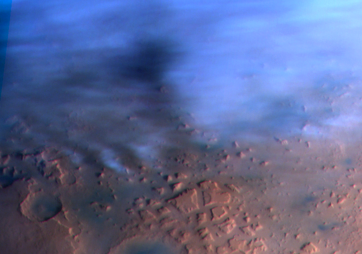
Lee (or gravity?) waves at Deuteronilus Mensae. Map.
| Orbit Number | 20687 |
|---|---|
| Latitude | 47.07 |
| Longitude [E/W] | 41.38 |
| Longitude [E] | 41.38 |
| Ls | 199.9 |
| Date | 2020-05-12 00:00:00 |
| Local time | 07:39:38 |
| Cirrus Clouds | |
| Lee Waves | lee waves |
| Gravity Clouds | |
| ACB | |
| Cloud Streets | |
| Elongated Dust Clouds | |
| Cumulus Cloud Sheet | |
| Plume | |
| Undefined | |
| Observation Type | Broom |
| Potentially Moving | |
| Spalte1 |
CT-276 #

Lee waves? at Noachis Terra. Map.
| Orbit Number | 20684 |
|---|---|
| Latitude | -48.32 |
| Longitude [E/W] | -26.77 |
| Longitude [E] | 333.23 |
| Ls | 199.4 |
| Date | 2020-05-12 00:00:00 |
| Local time | 06:41:46 |
| Cirrus Clouds | |
| Lee Waves | lee waves |
| Gravity Clouds | |
| ACB | |
| Cloud Streets | |
| Elongated Dust Clouds | |
| Cumulus Cloud Sheet | |
| Plume | |
| Undefined | |
| Observation Type | Broom |
| Potentially Moving | |
| Spalte1 |
CT-277 #
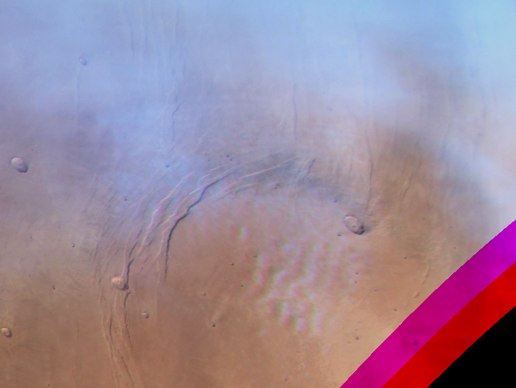
Gravity waves above Alba Patera. Map.
| Orbit Number | 20682 |
|---|---|
| Latitude | 43.596 |
| Longitude [E/W] | -109.136 |
| Longitude [E] | 250.864 |
| Ls | 199.1 |
| Date | 2020-05-11 00:00:00 |
| Local time | 10:58:32 |
| Cirrus Clouds | |
| Lee Waves | |
| Gravity Clouds | gravity clouds |
| ACB | |
| Cloud Streets | |
| Elongated Dust Clouds | |
| Cumulus Cloud Sheet | |
| Plume | |
| Undefined | |
| Observation Type | Broom |
| Potentially Moving | |
| Spalte1 |
CT-278 #

Lee waves at Tempe Terra. Map.
| Orbit Number | 20674 |
|---|---|
| Latitude | 48.91 |
| Longitude [E/W] | -60.35 |
| Longitude [E] | 299.65 |
| Ls | 197.7 |
| Date | 2020-05-09 00:00:00 |
| Local time | 08:19:03 |
| Cirrus Clouds | |
| Lee Waves | lee waves |
| Gravity Clouds | |
| ACB | |
| Cloud Streets | |
| Elongated Dust Clouds | |
| Cumulus Cloud Sheet | |
| Plume | |
| Undefined | |
| Observation Type | Broom |
| Potentially Moving | |
| Spalte1 |
CT-279 #

Gravity and lee waves at Mareotis Fossae + thick cloud layer. Map.
| Orbit Number | 20664 |
|---|---|
| Latitude | 49.237 |
| Longitude [E/W] | -78.103 |
| Longitude [E] | 281.897 |
| Ls | 196.0 |
| Date | 2020-05-06 00:00:00 |
| Local time | 10:36:41 |
| Cirrus Clouds | |
| Lee Waves | lee waves |
| Gravity Clouds | gravity clouds |
| ACB | |
| Cloud Streets | |
| Elongated Dust Clouds | |
| Cumulus Cloud Sheet | |
| Plume | |
| Undefined | |
| Observation Type | Broom |
| Potentially Moving | |
| Spalte1 |
CT-280 #

Lee waves emerging from Kunovsty crater. Map.
| Orbit Number | 20628 |
|---|---|
| Latitude | 57.444 |
| Longitude [E/W] | -5.61900000000003 |
| Longitude [E] | 354.381 |
| Ls | 189.8 |
| Date | 2020-04-25 00:00:00 |
| Local time | 11:12:23 |
| Cirrus Clouds | |
| Lee Waves | lee waves |
| Gravity Clouds | |
| ACB | |
| Cloud Streets | |
| Elongated Dust Clouds | |
| Cumulus Cloud Sheet | |
| Plume | |
| Undefined | |
| Observation Type | Broom |
| Potentially Moving | |
| Spalte1 |
CT-281 #
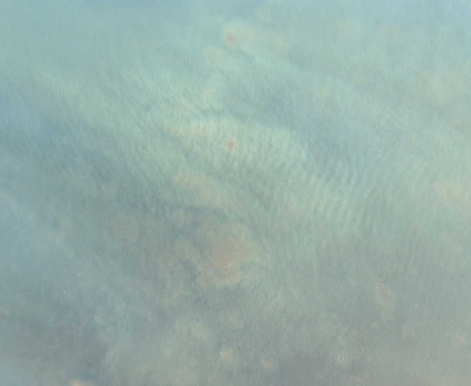
Gravity waves loaded with dust at Acidalia Planitia dust storm?. Map.
| Orbit Number | 20607 |
|---|---|
| Latitude | 49.251 |
| Longitude [E/W] | -23.376 |
| Longitude [E] | 336.624 |
| Ls | 186.3 |
| Date | 2020-04-19 00:00:00 |
| Local time | 10:48:18 |
| Cirrus Clouds | |
| Lee Waves | |
| Gravity Clouds | gravity clouds |
| ACB | |
| Cloud Streets | |
| Elongated Dust Clouds | |
| Cumulus Cloud Sheet | |
| Plume | |
| Undefined | |
| Observation Type | Broom |
| Potentially Moving | |
| Spalte1 |
CT-282 #
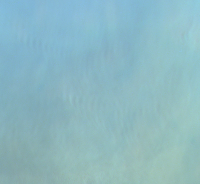
Gravity waves. Map.
| Orbit Number | 20606 |
|---|---|
| Latitude | 58.186 |
| Longitude [E/W] | 76.81 |
| Longitude [E] | 76.81 |
| Ls | 186.1 |
| Date | 2020-04-19 00:00:00 |
| Local time | 10:54:04 |
| Cirrus Clouds | |
| Lee Waves | |
| Gravity Clouds | gravity clouds |
| ACB | |
| Cloud Streets | |
| Elongated Dust Clouds | |
| Cumulus Cloud Sheet | |
| Plume | |
| Undefined | |
| Observation Type | Broom |
| Potentially Moving | |
| Spalte1 |
CT-283 #
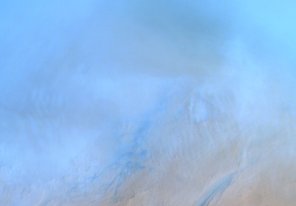
Gravity clouds at Mareotis Fossae. Map.
| Orbit Number | 20586 |
|---|---|
| Latitude | 50.911 |
| Longitude [E/W] | -69.909 |
| Longitude [E] | 290.091 |
| Ls | 182.8 |
| Date | 2020-04-13 00:00:00 |
| Local time | 09:06:57 |
| Cirrus Clouds | |
| Lee Waves | |
| Gravity Clouds | gravity clouds |
| ACB | |
| Cloud Streets | |
| Elongated Dust Clouds | |
| Cumulus Cloud Sheet | |
| Plume | |
| Undefined | |
| Observation Type | Broom |
| Potentially Moving | |
| Spalte1 |
CT-284 #

Gravity waves. Map.
| Orbit Number | 20476 |
|---|---|
| Latitude | -43.866 |
| Longitude [E/W] | -4.54000000000002 |
| Longitude [E] | 355.46 |
| Ls | 165.1 |
| Date | 2020-03-12 00:00:00 |
| Local time | 10:50:18 |
| Cirrus Clouds | |
| Lee Waves | |
| Gravity Clouds | gravity clouds |
| ACB | |
| Cloud Streets | |
| Elongated Dust Clouds | |
| Cumulus Cloud Sheet | |
| Plume | |
| Undefined | |
| Observation Type | Broom |
| Potentially Moving | |
| Spalte1 |
CT-285 #

Fleecy clouds and gravity waves?. Map.
| Orbit Number | 20455 |
|---|---|
| Latitude | -47.712 |
| Longitude [E/W] | 34.776 |
| Longitude [E] | 34.776 |
| Ls | 161.1 |
| Date | 2020-03-06 00:00:00 |
| Local time | 14:09:30 |
| Cirrus Clouds | |
| Lee Waves | |
| Gravity Clouds | gravity clouds |
| ACB | |
| Cloud Streets | |
| Elongated Dust Clouds | |
| Cumulus Cloud Sheet | |
| Plume | |
| Undefined | |
| Observation Type | Broom |
| Potentially Moving | |
| Spalte1 |
CT-286 #
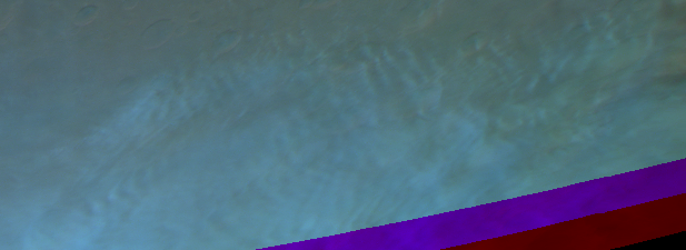
Fleecy clouds and gravity waves?. Map.
| Orbit Number | 20442 |
|---|---|
| Latitude | -44.311 |
| Longitude [E/W] | -62.546 |
| Longitude [E] | 297.454 |
| Ls | 159.8 |
| Date | 2020-03-02 00:00:00 |
| Local time | 15:13:30 |
| Cirrus Clouds | |
| Lee Waves | |
| Gravity Clouds | gravity clouds |
| ACB | |
| Cloud Streets | |
| Elongated Dust Clouds | |
| Cumulus Cloud Sheet | |
| Plume | |
| Undefined | |
| Observation Type | Broom |
| Potentially Moving | |
| Spalte1 |
CT-287 #
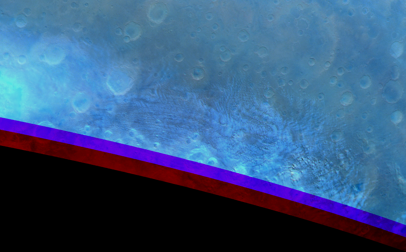
Lee-wave-like arranged cloud streets at Noachis Terra. Map.
| Orbit Number | 20434 |
|---|---|
| Latitude | -45.256 |
| Longitude [E/W] | 1.763 |
| Longitude [E] | 1.763 |
| Ls | 158.6 |
| Date | 2020-02-29 00:00:00 |
| Local time | 13:10:26 |
| Cirrus Clouds | |
| Lee Waves | lee waves |
| Gravity Clouds | |
| ACB | |
| Cloud Streets | cloud streets |
| Elongated Dust Clouds | |
| Cumulus Cloud Sheet | |
| Plume | |
| Undefined | |
| Observation Type | Broom |
| Potentially Moving | |
| Spalte1 |
CT-288 #
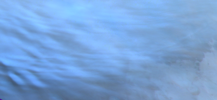
Gravity waves at lower left side, blue channel partly saturated, some parts can be used. Map.
| Orbit Number | 20394 |
|---|---|
| Latitude | -47.03 |
| Longitude [E/W] | 52.49 |
| Longitude [E] | 52.49 |
| Ls | 152.6 |
| Date | 2020-02-17 00:00:00 |
| Local time | 08:47:13 |
| Cirrus Clouds | |
| Lee Waves | |
| Gravity Clouds | gravity clouds |
| ACB | |
| Cloud Streets | |
| Elongated Dust Clouds | |
| Cumulus Cloud Sheet | |
| Plume | |
| Undefined | |
| Observation Type | Broom |
| Potentially Moving | |
| Spalte1 |
CT-289 #
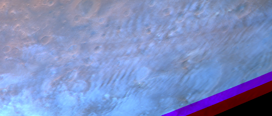
Gravity clouds. Map.
| Orbit Number | 20387 |
|---|---|
| Latitude | -45.026 |
| Longitude [E/W] | 130.315 |
| Longitude [E] | 130.315 |
| Ls | 151.5 |
| Date | 2020-02-15 00:00:00 |
| Local time | 14:21:47 |
| Cirrus Clouds | |
| Lee Waves | |
| Gravity Clouds | gravity clouds |
| ACB | |
| Cloud Streets | |
| Elongated Dust Clouds | |
| Cumulus Cloud Sheet | |
| Plume | |
| Undefined | |
| Observation Type | Broom |
| Potentially Moving | |
| Spalte1 |
CT-290 #
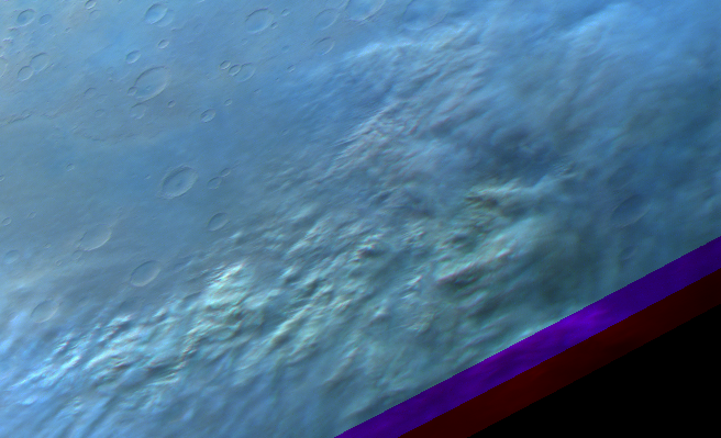
Thick cumulus cloud sheet (local dust stomr?). Map.
| Orbit Number | 20366 |
|---|---|
| Latitude | -39.088 |
| Longitude [E/W] | 136.341 |
| Longitude [E] | 136.341 |
| Ls | 148.4 |
| Date | 2020-02-09 00:00:00 |
| Local time | 16:04:54 |
| Cirrus Clouds | |
| Lee Waves | |
| Gravity Clouds | |
| ACB | |
| Cloud Streets | |
| Elongated Dust Clouds | |
| Cumulus Cloud Sheet | cumulus cloud sheet |
| Plume | |
| Undefined | |
| Observation Type | |
| Potentially Moving | |
| Spalte1 |
CT-291 #
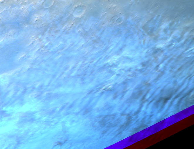
Gravity clouds. Map.
| Orbit Number | 20366 |
|---|---|
| Latitude | -44.351 |
| Longitude [E/W] | 115.563 |
| Longitude [E] | 115.563 |
| Ls | 148.4 |
| Date | 2020-02-09 00:00:00 |
| Local time | 14:39:41 |
| Cirrus Clouds | |
| Lee Waves | |
| Gravity Clouds | gravity clouds |
| ACB | |
| Cloud Streets | |
| Elongated Dust Clouds | |
| Cumulus Cloud Sheet | |
| Plume | |
| Undefined | |
| Observation Type | Broom |
| Potentially Moving | |
| Spalte1 |
CT-292 #
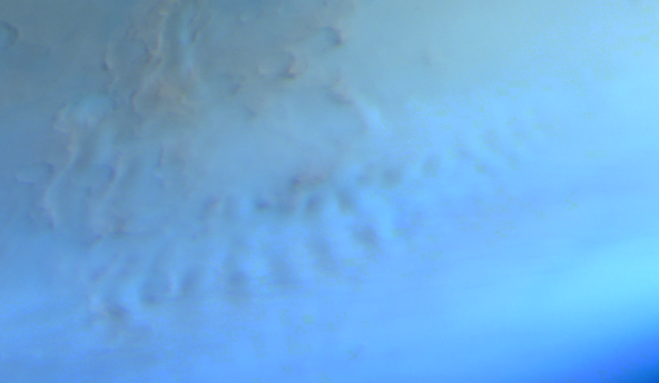
Lee waves at western Hellas rim (maybe gravity waves?). Map.
| Orbit Number | 19582 |
|---|---|
| Latitude | -48.39 |
| Longitude [E/W] | 47.56 |
| Longitude [E] | 47.56 |
| Ls | 44.5 |
| Date | 2019-06-26 00:00:00 |
| Local time | 09:53:57 |
| Cirrus Clouds | |
| Lee Waves | lee waves |
| Gravity Clouds | |
| ACB | |
| Cloud Streets | |
| Elongated Dust Clouds | |
| Cumulus Cloud Sheet | |
| Plume | |
| Undefined | |
| Observation Type | Broom |
| Potentially Moving | |
| Spalte1 |
CT-293 #
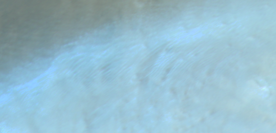
“narrow” gravity wave field. Map.
| Orbit Number | 19362 |
|---|---|
| Latitude | 62.624 |
| Longitude [E/W] | -156.938 |
| Longitude [E] | 203.062 |
| Ls | 15.1 |
| Date | 2019-04-23 00:00:00 |
| Local time | 12:44:48 |
| Cirrus Clouds | |
| Lee Waves | |
| Gravity Clouds | gravity clouds |
| ACB | |
| Cloud Streets | |
| Elongated Dust Clouds | |
| Cumulus Cloud Sheet | |
| Plume | |
| Undefined | |
| Observation Type | Broom |
| Potentially Moving | |
| Spalte1 |
CT-294 #
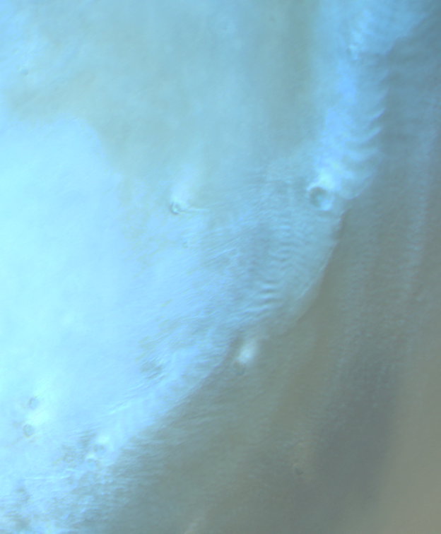
Lee waves and cloud streets at north Utopia. Map.
| Orbit Number | 19362 |
|---|---|
| Latitude | 62.302 |
| Longitude [E/W] | -120.64 |
| Longitude [E] | 239.36 |
| Ls | 15.1 |
| Date | 2019-04-23 00:00:00 |
| Local time | 15:22:48 |
| Cirrus Clouds | |
| Lee Waves | lee waves |
| Gravity Clouds | |
| ACB | |
| Cloud Streets | cloud streets |
| Elongated Dust Clouds | |
| Cumulus Cloud Sheet | |
| Plume | |
| Undefined | |
| Observation Type | Broom |
| Potentially Moving | |
| Spalte1 |
CT-295 #
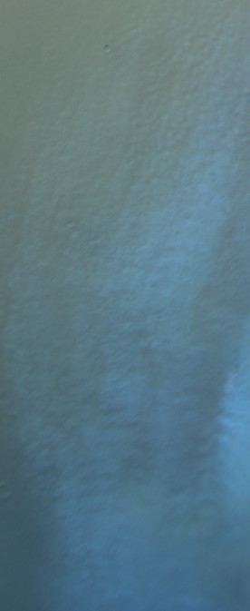
Fleecy clouds and gravity waves?. Map.
| Orbit Number | 19362 |
|---|---|
| Latitude | 57.272 |
| Longitude [E/W] | -104.129 |
| Longitude [E] | 255.871 |
| Ls | 15.1 |
| Date | 2019-04-23 00:00:00 |
| Local time | 16:15:19 |
| Cirrus Clouds | |
| Lee Waves | |
| Gravity Clouds | |
| ACB | |
| Cloud Streets | cloud streets |
| Elongated Dust Clouds | |
| Cumulus Cloud Sheet | |
| Plume | |
| Undefined | |
| Observation Type | Broom |
| Potentially Moving | |
| Spalte1 |
CT-296 #
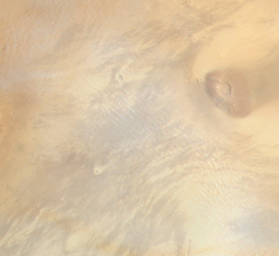
Gravity waves at Tharsis Tholus. Map.
| Orbit Number | 17444 |
|---|---|
| Latitude | 13.483 |
| Longitude [E/W] | -90.933 |
| Longitude [E] | 269.067 |
| Ls | 73.0 |
| Date | 2017-10-12 00:00:00 |
| Local time | 10:38:45 |
| Cirrus Clouds | |
| Lee Waves | |
| Gravity Clouds | gravity clouds |
| ACB | |
| Cloud Streets | |
| Elongated Dust Clouds | |
| Cumulus Cloud Sheet | |
| Plume | |
| Undefined | |
| Observation Type | Broom |
| Potentially Moving | |
| Spalte1 |
CT-297 #
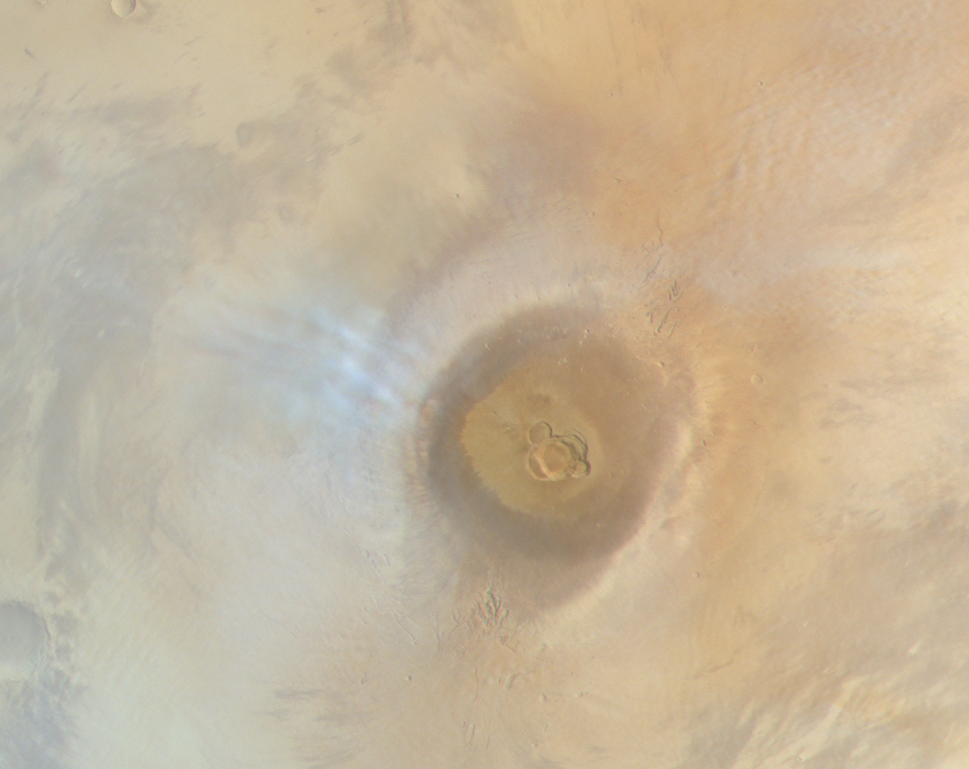
Some small bright gravity waves at Ascraeus Mons; and fainter ones to the southwest. Map.
| Orbit Number | 17444 |
|---|---|
| Latitude | 11.202 |
| Longitude [E/W] | -104.447 |
| Longitude [E] | 255.553 |
| Ls | 73.0 |
| Date | 2017-10-12 00:00:00 |
| Local time | 09:45:25 |
| Cirrus Clouds | |
| Lee Waves | |
| Gravity Clouds | gravity clouds |
| ACB | |
| Cloud Streets | cloud streets |
| Elongated Dust Clouds | |
| Cumulus Cloud Sheet | |
| Plume | |
| Undefined | |
| Observation Type | Broom |
| Potentially Moving | |
| Spalte1 |
CT-298 #

Cloud streets around pole. Map.
| Orbit Number | 17050 |
|---|---|
| Latitude | 64.6 |
| Longitude [E/W] | -89.58 |
| Longitude [E] | 270.42 |
| Ls | 21.7 |
| Date | 2017-06-19 00:00:00 |
| Local time | 14:33:38 |
| Cirrus Clouds | |
| Lee Waves | |
| Gravity Clouds | |
| ACB | |
| Cloud Streets | cloud streets |
| Elongated Dust Clouds | |
| Cumulus Cloud Sheet | |
| Plume | |
| Undefined | |
| Observation Type | Broom |
| Potentially Moving | |
| Spalte1 |
CT-299 #

Faint cloud streets at Vastitas (north of Alba Patera). Map.
| Orbit Number | 16969 |
|---|---|
| Latitude | 58.64 |
| Longitude [E/W] | -85.8 |
| Longitude [E] | 274.2 |
| Ls | 10.5 |
| Date | 2017-05-26 00:00:00 |
| Local time | 15:15:00 |
| Cirrus Clouds | |
| Lee Waves | |
| Gravity Clouds | |
| ACB | |
| Cloud Streets | cloud streets |
| Elongated Dust Clouds | |
| Cumulus Cloud Sheet | |
| Plume | |
| Undefined | |
| Observation Type | Broom |
| Potentially Moving | |
| Spalte1 |
CT-300 #
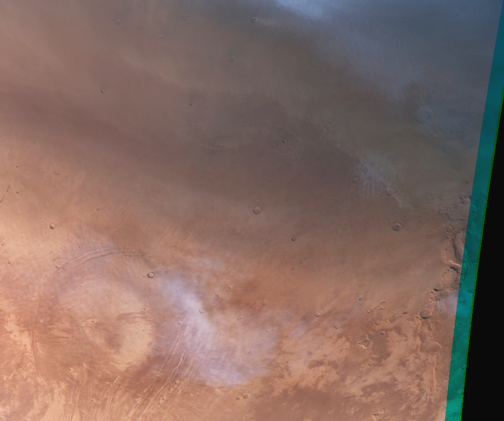
Cirrus clouds and faint cloud streets at Alba patera. Map.
| Orbit Number | 16969 |
|---|---|
| Latitude | 43.0 |
| Longitude [E/W] | -104.55 |
| Longitude [E] | 255.45 |
| Ls | 10.5 |
| Date | 2017-05-26 00:00:00 |
| Local time | 14:00:00 |
| Cirrus Clouds | cirrus clouds |
| Lee Waves | |
| Gravity Clouds | |
| ACB | |
| Cloud Streets | cloud streets |
| Elongated Dust Clouds | |
| Cumulus Cloud Sheet | |
| Plume | |
| Undefined | |
| Observation Type | Broom |
| Potentially Moving | |
| Spalte1 |
CT-301 #

Cloud streets near north pole. Map.
| Orbit Number | 16961 |
|---|---|
| Latitude | 58.23 |
| Longitude [E/W] | 21.01 |
| Longitude [E] | 21.01 |
| Ls | 9.3 |
| Date | 2017-05-24 00:00:00 |
| Local time | 15:44:28 |
| Cirrus Clouds | |
| Lee Waves | |
| Gravity Clouds | |
| ACB | |
| Cloud Streets | cloud streets |
| Elongated Dust Clouds | |
| Cumulus Cloud Sheet | |
| Plume | |
| Undefined | |
| Observation Type | Broom |
| Potentially Moving | |
| Spalte1 |
CT-302 #
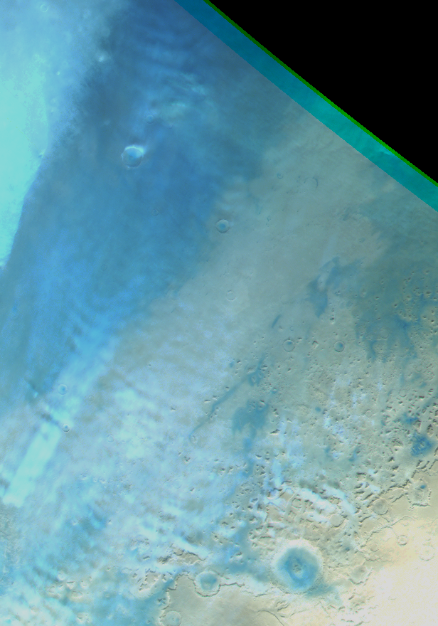
Gravity clouds at Deuteronilus. Map.
| Orbit Number | 16957 |
|---|---|
| Latitude | 50.281 |
| Longitude [E/W] | 41.274 |
| Longitude [E] | 41.274 |
| Ls | 8.8 |
| Date | 2017-05-23 00:00:00 |
| Local time | 13:50:22 |
| Cirrus Clouds | |
| Lee Waves | lee waves |
| Gravity Clouds | gravity clouds |
| ACB | |
| Cloud Streets | |
| Elongated Dust Clouds | |
| Cumulus Cloud Sheet | |
| Plume | |
| Undefined | |
| Observation Type | Broom |
| Potentially Moving | |
| Spalte1 |
CT-303 #
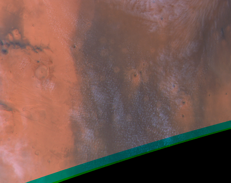
Cloud streets surrounding double-annular cyclone. Map.
| Orbit Number | 13125 |
|---|---|
| Latitude | 57.21 |
| Longitude [E/W] | -52.16 |
| Longitude [E] | 307.84 |
| Ls | 124.8 |
| Date | 2014-05-02 00:00:00 |
| Local time | 12:17:00 |
| Cirrus Clouds | |
| Lee Waves | |
| Gravity Clouds | |
| ACB | |
| Cloud Streets | cloud streets |
| Elongated Dust Clouds | |
| Cumulus Cloud Sheet | |
| Plume | |
| Undefined | |
| Observation Type | Broom |
| Potentially Moving | |
| Spalte1 |
CT-304 #
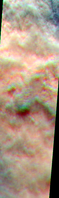
Thick cumulus clouds at Russell Crater. Map.
| Orbit Number | 4467 |
|---|---|
| Latitude | -62.16 |
| Longitude [E/W] | 14.9 |
| Longitude [E] | 14.9 |
| Ls | 265.6 |
| Date | 2007-02-26 00:00:00 |
| Local time | 16:26:00 |
| Cirrus Clouds | |
| Lee Waves | |
| Gravity Clouds | |
| ACB | |
| Cloud Streets | |
| Elongated Dust Clouds | |
| Cumulus Cloud Sheet | cumulus cloud sheet |
| Plume | |
| Undefined | |
| Observation Type | Surface |
| Potentially Moving | Yes |
| Spalte1 |
Orographic Clouds #
OC-1 #
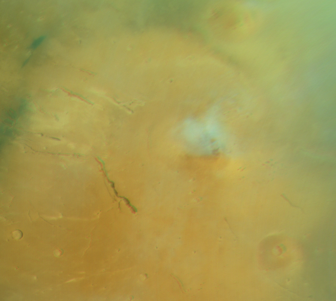
Orographic cirrus cloud at Elysium Mons. Map.
| Orbit Number | 24041 |
|---|---|
| Latitude | 25.95 |
| Longitude [E/W] | 147.87 |
| Longitude [E] | 147.87 |
| Ls | 141.4 |
| Date | 2023-10-31 00:00:00 |
| Local time | 10:21:00 |
OC-2 #
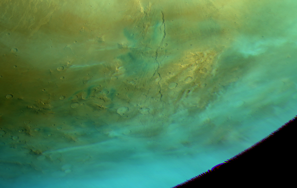
Elongated clouds (cloud trails?) emerging from obstacles at Daedalia & Thaumasia. Map.
| Orbit Number | 24972 |
|---|---|
| Latitude | -39.36 |
| Longitude [E/W] | -113.47 |
| Longitude [E] | 246.53 |
| Ls | 131.7 |
| Date | 2023-10-11 00:00:00 |
| Local time | 08:58:00 |
OC-3 #
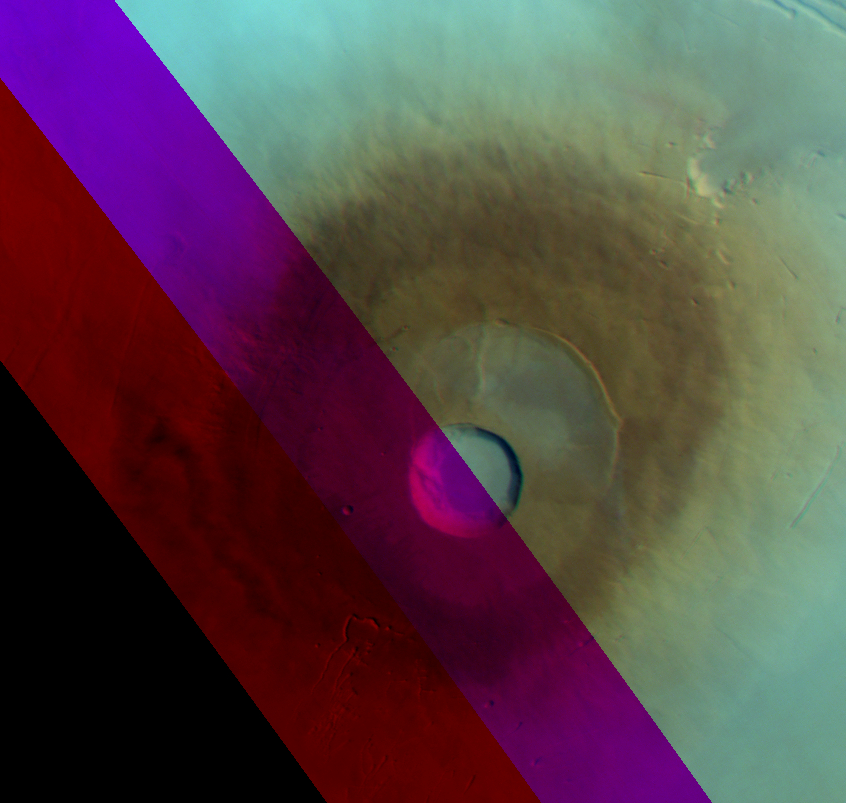
Residual? orographic cloud near Pavonis Mons (only covered by red channel). Map.
| Orbit Number | 24799 |
|---|---|
| Latitude | 0.12 |
| Longitude [E/W] | -114.76 |
| Longitude [E] | 245.24 |
| Ls | 108.1 |
| Date | 2023-08-22 00:00:00 |
| Local time | 07:54:00 |
OC-4 #
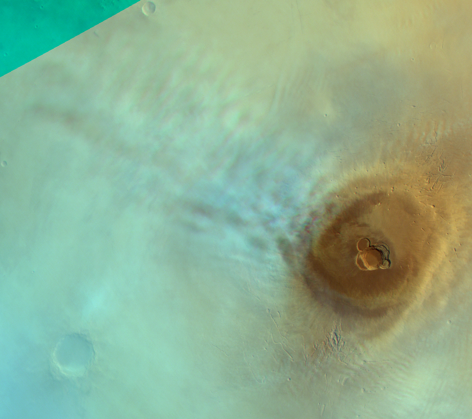
Orographic cloud at Ascraeus. Map.
| Orbit Number | 24799 |
|---|---|
| Latitude | 12.86 |
| Longitude [E/W] | -108.14 |
| Longitude [E] | 251.86 |
| Ls | 108.1 |
| Date | 2023-08-22 00:00:00 |
| Local time | 08:20:00 |
OC-5 #
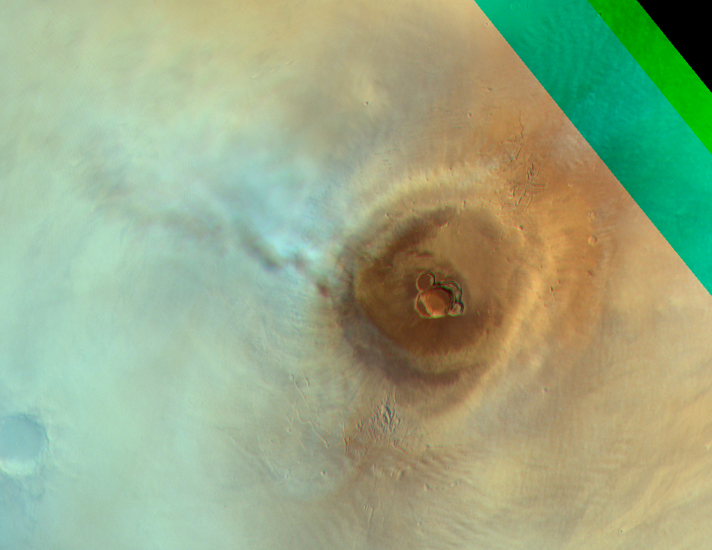
Orographic cloud at Ascraeus. Map.
| Orbit Number | 24792 |
|---|---|
| Latitude | 12.42 |
| Longitude [E/W] | -117.64 |
| Longitude [E] | 242.36 |
| Ls | 107.2 |
| Date | 2023-08-20 00:00:00 |
| Local time | 08:18:00 |
OC-6 #
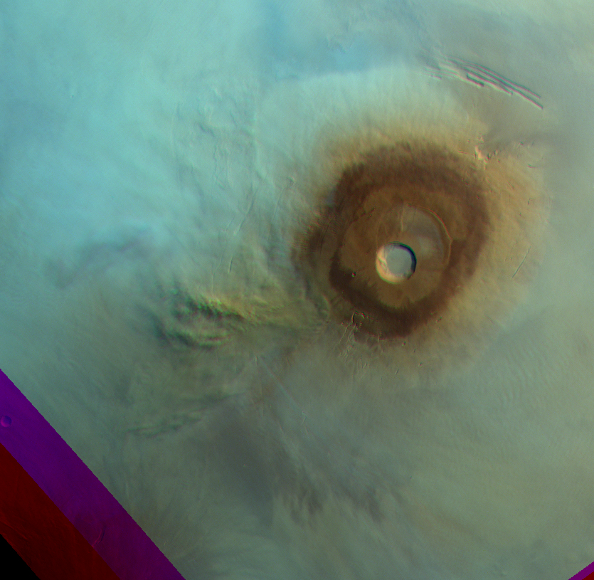
Dust loaded orographic cloud near Pavonis Mons. Map.
| Orbit Number | 24792 |
|---|---|
| Latitude | -0.34 |
| Longitude [E/W] | -116.23 |
| Longitude [E] | 243.77 |
| Ls | 107.2 |
| Date | 2023-08-20 00:00:00 |
| Local time | 08:20:00 |
OC-7 #
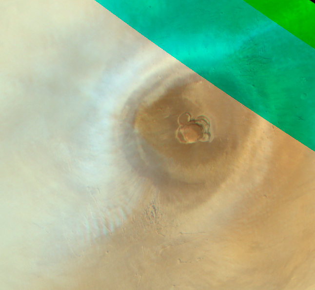
Orographic cirrus cloud at Ascraeus Mons. Map.
| Orbit Number | 24725 |
|---|---|
| Latitude | 10.13 |
| Longitude [E/W] | -107.05 |
| Longitude [E] | 252.95 |
| Ls | 98.4 |
| Date | 2023-08-01 00:00:00 |
| Local time | 09:46:00 |
OC-8 #

Residual dust loaded orographic cloud near Pavonis Mons. Map.
| Orbit Number | 24725 |
|---|---|
| Latitude | -1.12 |
| Longitude [E/W] | -117.18 |
| Longitude [E] | 242.82 |
| Ls | 98.4 |
| Date | 2023-08-01 00:00:00 |
| Local time | 09:06:00 |
OC-9 #
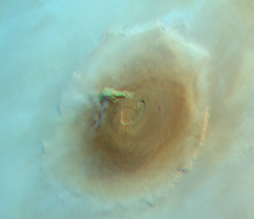
Dust loaded orographic cloud near Olympus Mons. Map.
| Orbit Number | 24725 |
|---|---|
| Latitude | 19.98 |
| Longitude [E/W] | -135.49 |
| Longitude [E] | 224.51 |
| Ls | 98.4 |
| Date | 2023-08-01 00:00:00 |
| Local time | 07:54:00 |
OC-10 #
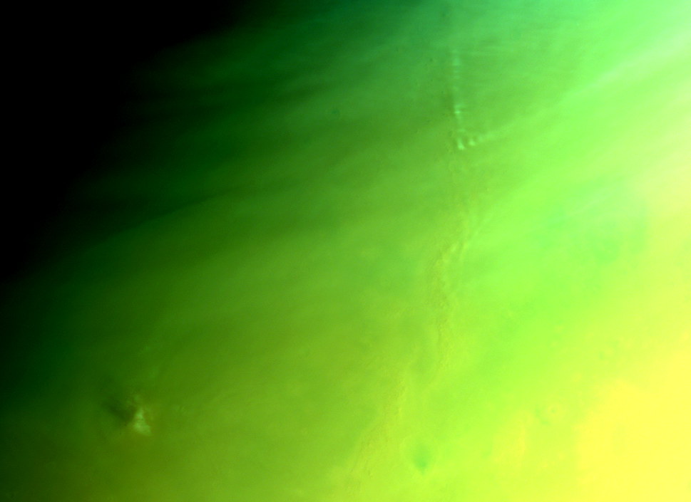
Oro cloud @Phlegra Montes & Hecales Thlolus. Map.
| Orbit Number | 23723 |
|---|---|
| Latitude | 55.0 |
| Longitude [E/W] | -175.0 |
| Longitude [E] | 185.0 |
| Ls | 320.6 |
| Date | 2022-10-13 00:00:00 |
| Local time | 10:10:04 |
OC-11 #
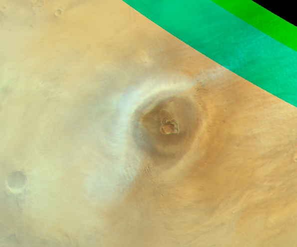
Orographic cirrus cloud at Ascraeus Mons. Map.
| Orbit Number | 24718 |
|---|---|
| Latitude | 11.82 |
| Longitude [E/W] | -106.84 |
| Longitude [E] | 253.16 |
| Ls | 97.5 |
| Date | 2023-07-29 00:00:00 |
| Local time | 10:16:00 |
OC-12 #
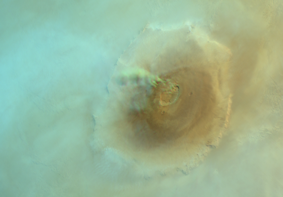
Dust loaded orographic cloud near Olympus Mons. Map.
| Orbit Number | 24718 |
|---|---|
| Latitude | 20.01 |
| Longitude [E/W] | -135.64 |
| Longitude [E] | 224.36 |
| Ls | 97.5 |
| Date | 2023-07-29 00:00:00 |
| Local time | 08:19:00 |
OC-13 #
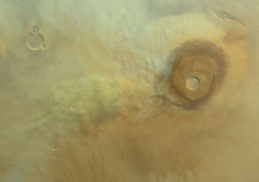
Residual dust loaded orographic cloud near Pavonis Mons. Map.
| Orbit Number | 24718 |
|---|---|
| Latitude | -0.098 |
| Longitude [E/W] | -118.27 |
| Longitude [E] | 241.73 |
| Ls | 97.5 |
| Date | 2023-07-29 00:00:00 |
| Local time | 09:28:00 |
OC-14 #
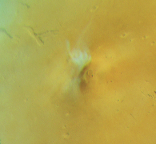
Orographic (lee) cloud at Elysium Mons. Map.
| Orbit Number | 24680 |
|---|---|
| Latitude | 25.93 |
| Longitude [E/W] | 145.4 |
| Longitude [E] | 145.4 |
| Ls | 92.6 |
| Date | 2023-07-18 00:00:00 |
| Local time | 08:42:00 |
OC-15 #
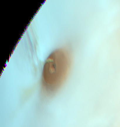
Elongated cloud at Ascraeus Mons. Map.
| Orbit Number | 24647 |
|---|---|
| Latitude | 13.55 |
| Longitude [E/W] | -108.61 |
| Longitude [E] | 251.39 |
| Ls | 88.3 |
| Date | 2023-07-09 00:00:00 |
| Local time | 07:25:00 |
OC-16 #
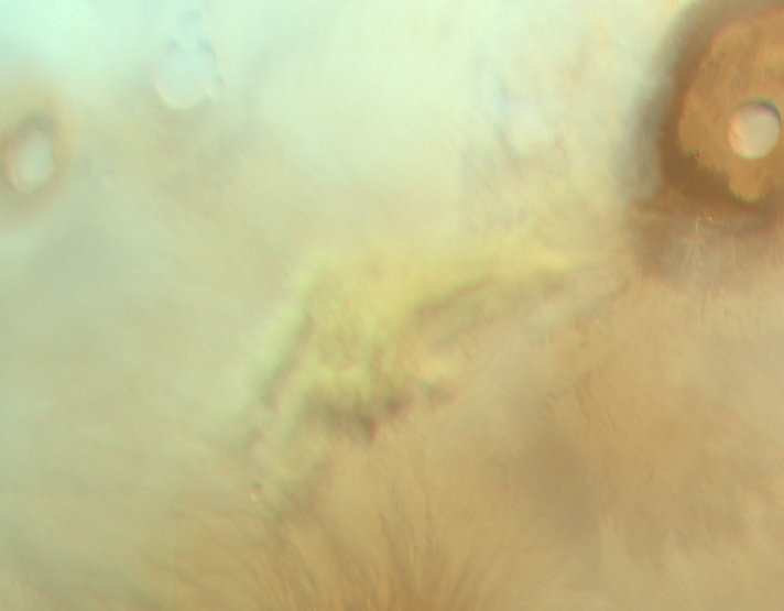
Residual dust loaded? orographic cloud near Pavonis Mons. Map.
| Orbit Number | 24605 |
|---|---|
| Latitude | -0.59 |
| Longitude [E/W] | -118.99 |
| Longitude [E] | 241.01 |
| Ls | 83.0 |
| Date | 2023-06-27 00:00:00 |
| Local time | 09:11:00 |
OC-17 #
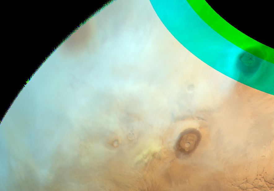
Residual dust loaded orographic cloud near Pavonis Mons. Map.
| Orbit Number | 24598 |
|---|---|
| Latitude | 0.3 |
| Longitude [E/W] | -119.4 |
| Longitude [E] | 240.6 |
| Ls | 82.1 |
| Date | 2023-06-25 00:00:00 |
| Local time | 09:35:00 |
OC-18 #
Cirrus clouds at Olympus Mons. Map.
| Orbit Number | 24588 |
|---|---|
| Latitude | 18.9 |
| Longitude [E/W] | -134.92 |
| Longitude [E] | 225.08 |
| Ls | 80.8 |
| Date | 2023-06-22 00:00:00 |
| Local time | 14:16:00 |
OC-19 #

V-shaped cirrus clouds at Ascraeus Mons. Map.
| Orbit Number | 24588 |
|---|---|
| Latitude | 12.15 |
| Longitude [E/W] | -106.9 |
| Longitude [E] | 253.1 |
| Ls | 80.8 |
| Date | 2023-06-22 00:00:00 |
| Local time | 14:16:00 |
OC-20 #
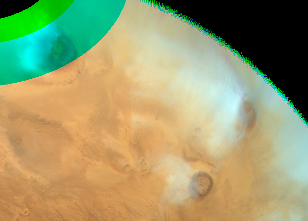
V-shaped cirrus clouds at Pavonis Mons. Map.
| Orbit Number | 24588 |
|---|---|
| Latitude | 0.8 |
| Longitude [E/W] | -115.1 |
| Longitude [E] | 244.9 |
| Ls | 80.8 |
| Date | 2023-06-22 00:00:00 |
| Local time | 14:16:00 |
OC-21 #
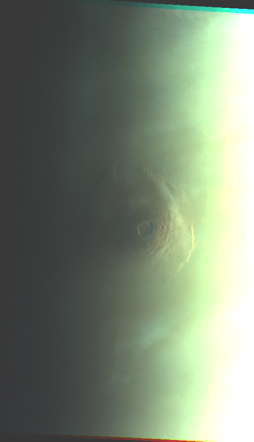
Cirrus clouds @Olypmus Mons. Map.
| Orbit Number | 23924 |
|---|---|
| Latitude | 18.0 |
| Longitude [E/W] | -131.0 |
| Longitude [E] | 229.0 |
| Ls | 352.0 |
| Date | 2022-12-10 00:00:00 |
| Local time | 06:11:44 |
OC-22 #
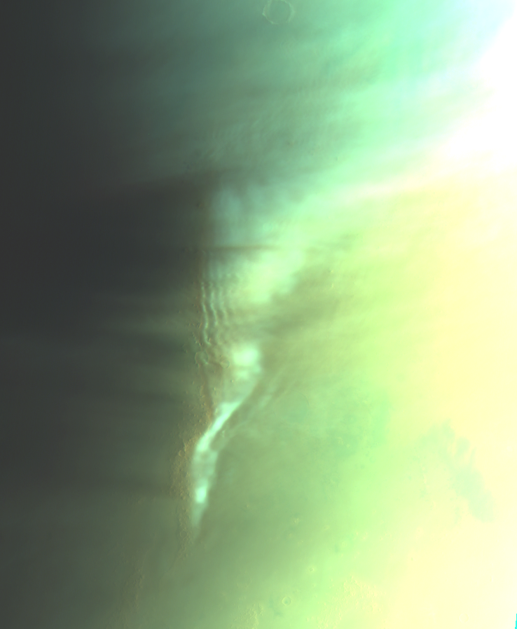
Orographic gravitiy waves @Phlegra Montes. Map.
| Orbit Number | 23914 |
|---|---|
| Latitude | 43.0 |
| Longitude [E/W] | 164.0 |
| Longitude [E] | 164.0 |
| Ls | 350.5 |
| Date | 2022-12-07 00:00:00 |
| Local time | 06:27:23 |
OC-23 #
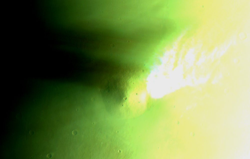
Overexposed cloud?? + shadow @Elysium Mons. Map.
| Orbit Number | 23893 |
|---|---|
| Latitude | 32.0 |
| Longitude [E/W] | 152.0 |
| Longitude [E] | 152.0 |
| Ls | 347.4 |
| Date | 2022-12-01 00:00:00 |
| Local time | 06:49:45 |
OC-24 #
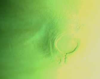
Evolving AMEC. Map.
| Orbit Number | 23782 |
|---|---|
| Latitude | -10.0 |
| Longitude [E/W] | -128.0 |
| Longitude [E] | 232.0 |
| Ls | 330.2 |
| Date | 2022-10-30 00:00:00 |
| Local time | 05:54:34 |
OC-25 #
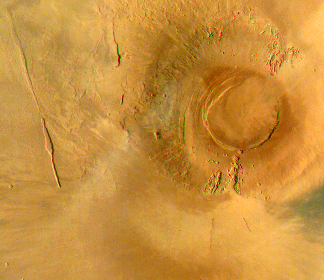
Faint AMEC. Map.
| Orbit Number | 23779 |
|---|---|
| Latitude | -10.0 |
| Longitude [E/W] | -124.0 |
| Longitude [E] | 236.0 |
| Ls | 329.7 |
| Date | 2022-10-29 00:00:00 |
| Local time | 08:36:45 |
OC-26 #
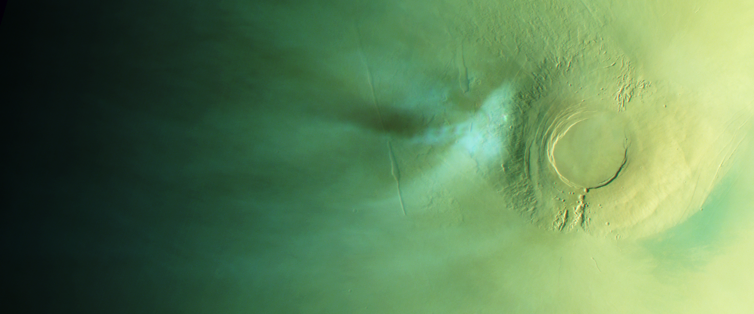
AMEC. Map.
| Orbit Number | 23761 |
|---|---|
| Latitude | -9.0 |
| Longitude [E/W] | -124.0 |
| Longitude [E] | 236.0 |
| Ls | 326.8 |
| Date | 2022-10-24 00:00:00 |
| Local time | 06:32:01 |
OC-27 #
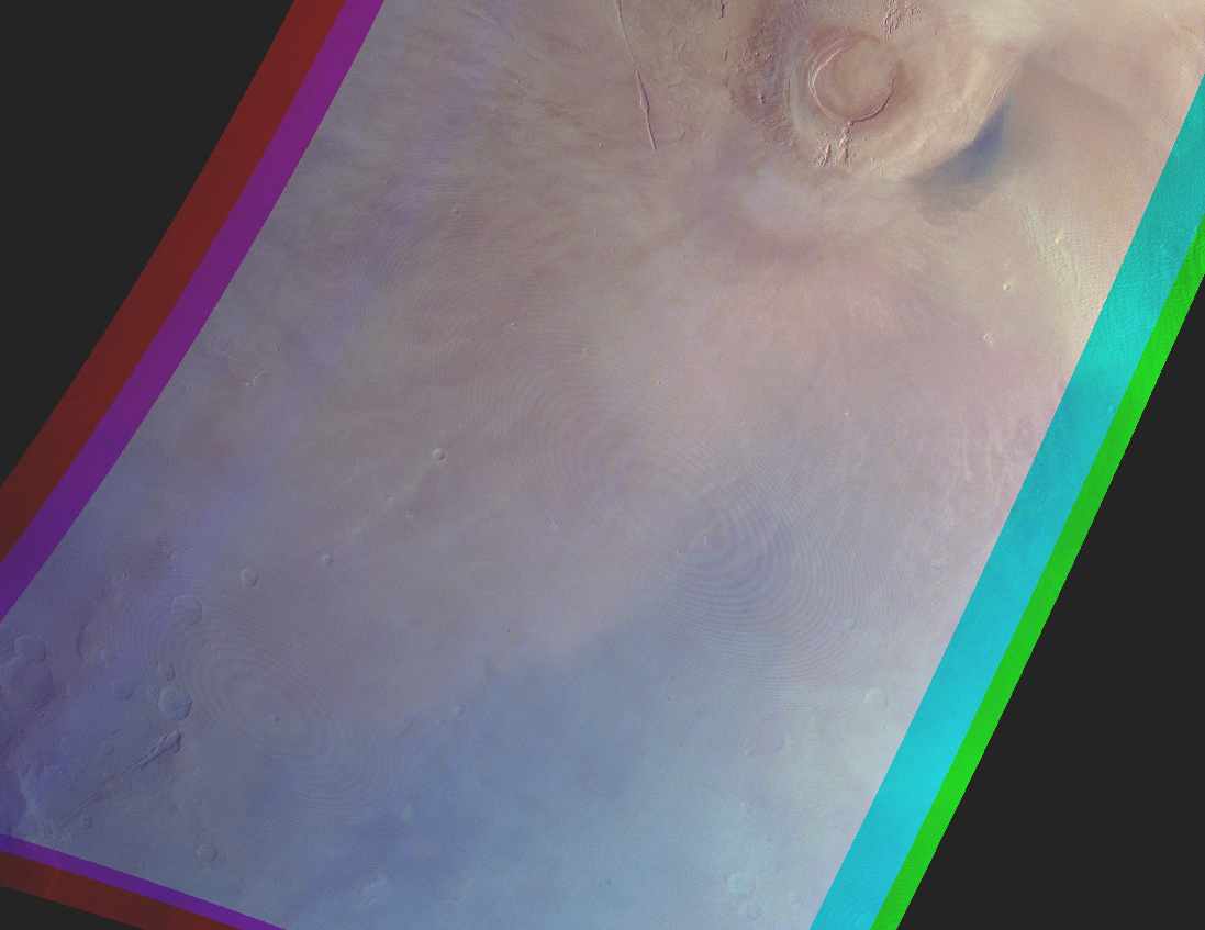
Sheep clouds @Tharsis Montes. Map.
| Orbit Number | 23673 |
|---|---|
| Latitude | -18.0 |
| Longitude [E/W] | -128.0 |
| Longitude [E] | 232.0 |
| Ls | 312.2 |
| Date | 2022-09-28 00:00:00 |
| Local time | 07:45:35 |
OC-28 #
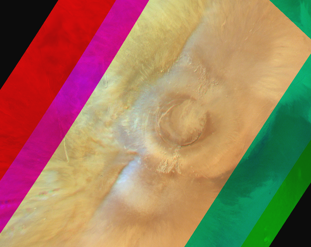
Zigzag-shaped AMEC?. Map.
| Orbit Number | 23511 |
|---|---|
| Latitude | -9.0 |
| Longitude [E/W] | -122.0 |
| Longitude [E] | 238.0 |
| Ls | 283.9 |
| Date | 2022-08-12 00:00:00 |
| Local time | 10:47:09 |
OC-29 #
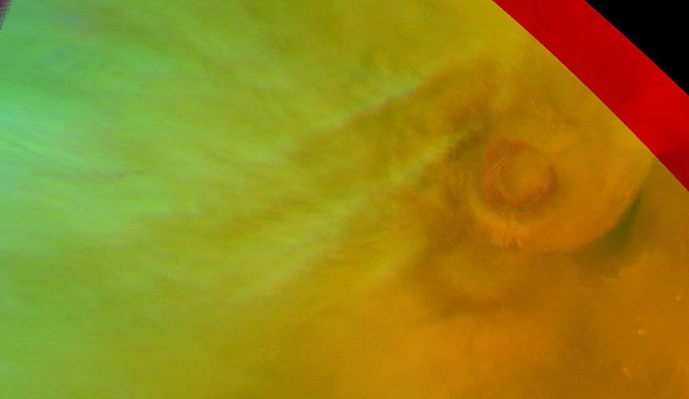
Zigzag-shaped AMEC?. Map.
| Orbit Number | 23479 |
|---|---|
| Latitude | -9.0 |
| Longitude [E/W] | -126.0 |
| Longitude [E] | 234.0 |
| Ls | 278.2 |
| Date | 2022-08-03 00:00:00 |
| Local time | 09:04:18 |
OC-30 #
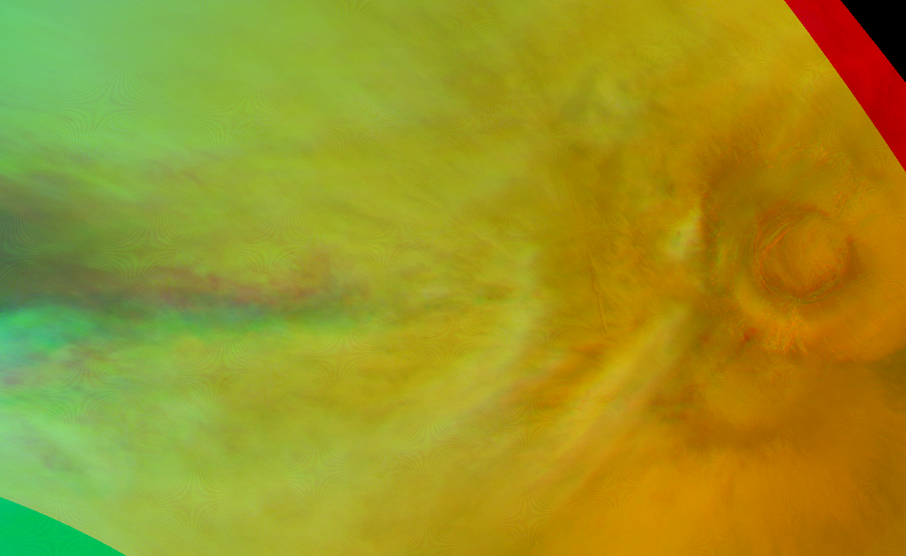
Zigzag-shaped AMEC?. Map.
| Orbit Number | 23472 |
|---|---|
| Latitude | -11.0 |
| Longitude [E/W] | -125.0 |
| Longitude [E] | 235.0 |
| Ls | 276.9 |
| Date | 2022-08-01 00:00:00 |
| Local time | 09:28:59 |
OC-31 #
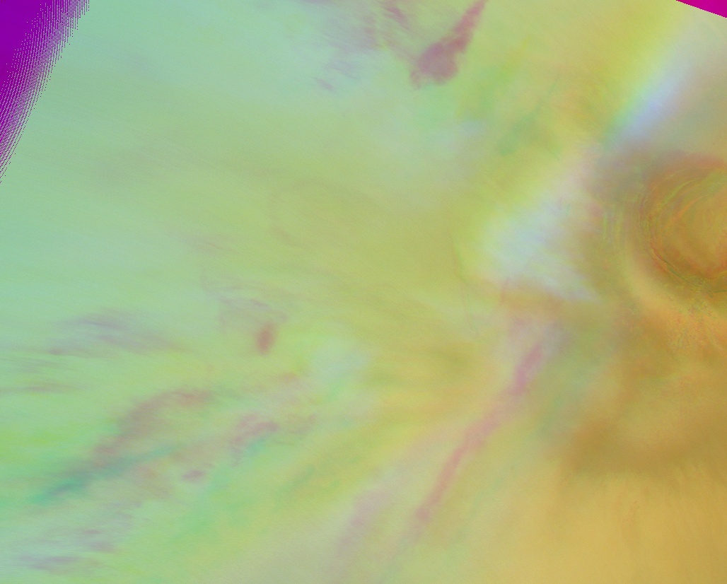
Zigzag-shaped AMEC?. Map.
| Orbit Number | 23465 |
|---|---|
| Latitude | -9.0 |
| Longitude [E/W] | -125.0 |
| Longitude [E] | 235.0 |
| Ls | 275.6 |
| Date | 2022-07-30 00:00:00 |
| Local time | 09:54:41 |
OC-32 #
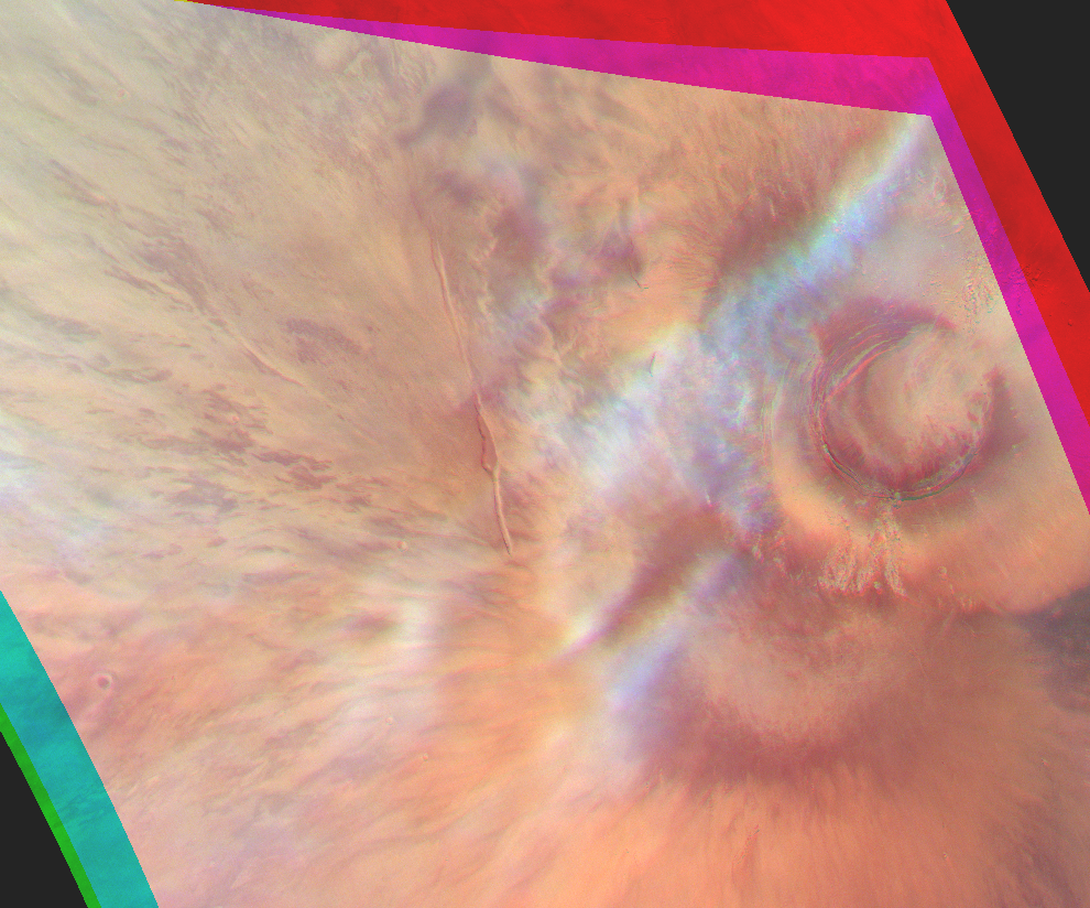
Zigzag-shaped AMEC?. Map.
| Orbit Number | 23458 |
|---|---|
| Latitude | -10.0 |
| Longitude [E/W] | -128.0 |
| Longitude [E] | 232.0 |
| Ls | 274.3 |
| Date | 2022-07-28 00:00:00 |
| Local time | 10:09:36 |
OC-33 #
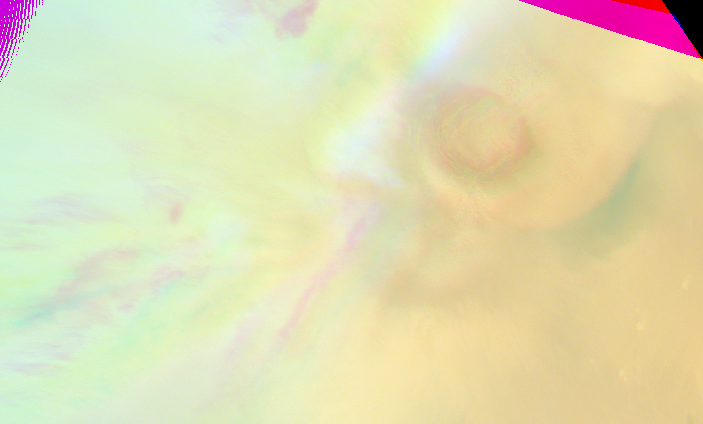
Zigzag-shaped AMEC?. Map.
| Orbit Number | 23405 |
|---|---|
| Latitude | -10.0 |
| Longitude [E/W] | -125.0 |
| Longitude [E] | 235.0 |
| Ls | 264.6 |
| Date | 2022-07-12 00:00:00 |
| Local time | 10:12:41 |
OC-34 #
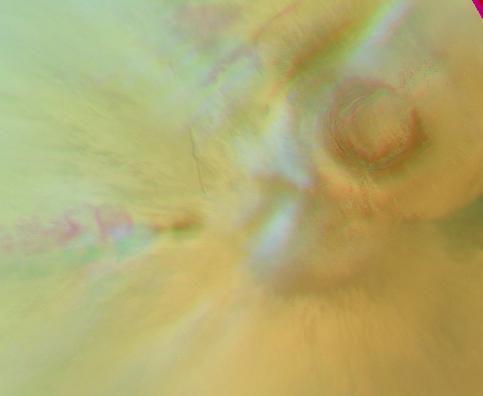
Zigzag-shaped AMEC?. Map.
| Orbit Number | 23398 |
|---|---|
| Latitude | -10.0 |
| Longitude [E/W] | -124.0 |
| Longitude [E] | 236.0 |
| Ls | 263.3 |
| Date | 2022-07-10 00:00:00 |
| Local time | 10:43:28 |
OC-35 #
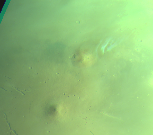
Orographic cloud @ Hecates Tholus. Map.
| Orbit Number | 22989 |
|---|---|
| Latitude | 33.7 |
| Longitude [E/W] | 153.1 |
| Longitude [E] | 153.1 |
| Ls | 189.7 |
| Date | 2022-03-13 00:00:00 |
| Local time | 07:48:46 |
OC-36 #

Elongated orographic clouds and lee waves at Solis Planum (second of 2 concecutive observatiosn in one orbit; for cloud movement). Map.
| Orbit Number | 22758_0000 |
|---|---|
| Latitude | -40.58 |
| Longitude [E/W] | -93.56 |
| Longitude [E] | 266.44 |
| Ls | 151.8 |
| Date | 2022-01-05 00:00:00 |
| Local time | 09:47:42 |
OC-37 #
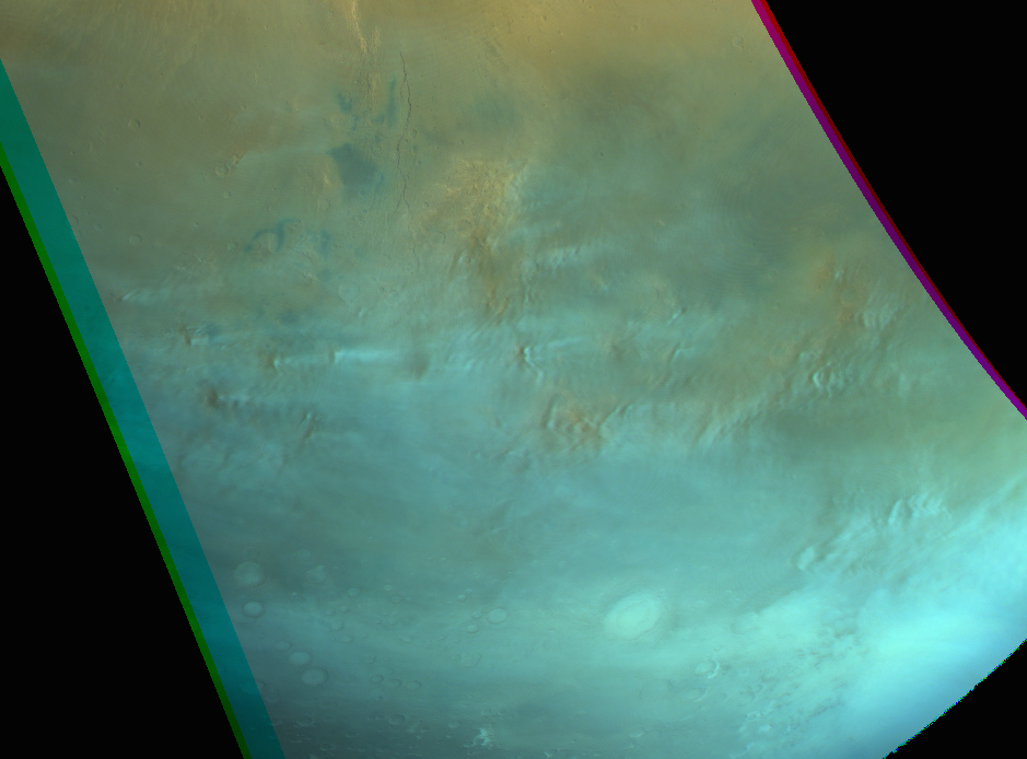
Elongated orographic clouds and lee waves at Solis Planum (first of 2 concecutive observation in one orbit; for cloud movement). Map.
| Orbit Number | 22758_0001 |
|---|---|
| Latitude | -40.58 |
| Longitude [E/W] | -93.56 |
| Longitude [E] | 266.44 |
| Ls | 151.8 |
| Date | 2022-01-05 00:00:00 |
| Local time | 09:47:42 |
OC-38 #

ACB clouds at Ascraeus Mons. Map.
| Orbit Number | 22649 |
|---|---|
| Latitude | 15.0 |
| Longitude [E/W] | -111.61 |
| Longitude [E] | 248.39 |
| Ls | 137.0 |
| Date | 2021-12-04 00:00:00 |
| Local time | 10:28:11 |
OC-39 #

Clouds @ Pavonis Mons as well as noth of it and south of Noctis Labyrhintus. Map.
| Orbit Number | 22596 |
|---|---|
| Latitude | 0.9 |
| Longitude [E/W] | -114.38 |
| Longitude [E] | 245.62 |
| Ls | 129.5 |
| Date | 2021-11-19 00:00:00 |
| Local time | 10:22:18 |
OC-40 #
Elongated orographic cloud emerging from mountain rise at Promethei Terra. Map.
| Orbit Number | 21760 |
|---|---|
| Latitude | -44.0 |
| Longitude [E/W] | 110.85 |
| Longitude [E] | 110.85 |
| Ls | 20.2 |
| Date | 2021-03-21 00:00:00 |
| Local time | 07:38:13 |
OC-41 #
Faint elongated orographic clouds emerging from mountain rises between Daedalia and Icaria. Map.
| Orbit Number | 21727 |
|---|---|
| Latitude | -38.27 |
| Longitude [E/W] | -112.45 |
| Longitude [E] | 247.55 |
| Ls | 15.7 |
| Date | 2021-03-11 00:00:00 |
| Local time | 10:27:00 |
OC-42 #
Small (elongated?) cloud patch at Ceraunius Tholus. Map.
| Orbit Number | 21688 |
|---|---|
| Latitude | 24.59 |
| Longitude [E/W] | -96.21 |
| Longitude [E] | 263.79 |
| Ls | 10.2 |
| Date | 2021-02-28 00:00:00 |
| Local time | 07:28:00 |
OC-43 #
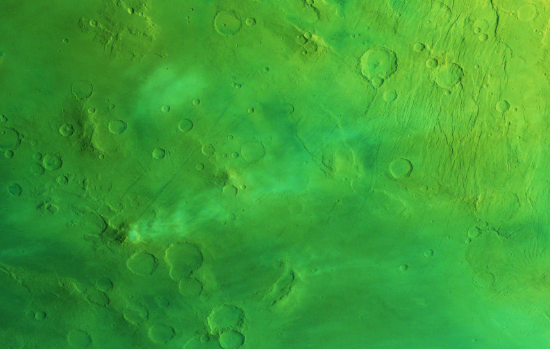
Elongated orographic cloud emerging from mountain rise between Daedalia and Icaria. Map.
| Orbit Number | 21660 |
|---|---|
| Latitude | -39.43 |
| Longitude [E/W] | -116.56 |
| Longitude [E] | 243.44 |
| Ls | 6.2 |
| Date | 2021-02-20 00:00:00 |
| Local time | 08:04:21 |
OC-44 #
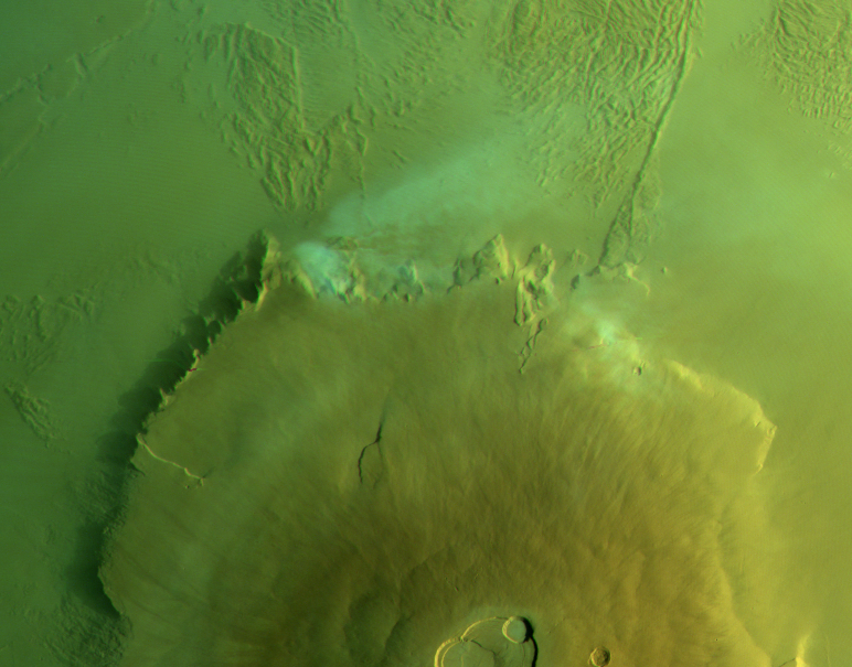
Orographic/lee cloud at northern flank of Olympus Mons. Map.
| Orbit Number | 21653 |
|---|---|
| Latitude | 23.32 |
| Longitude [E/W] | -135.33 |
| Longitude [E] | 224.67 |
| Ls | 5.2 |
| Date | 2021-02-18 00:00:00 |
| Local time | 07:09:40 |
OC-45 #
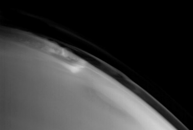
AMEC at Limb. Map.
| Orbit Number | 20929 |
|---|---|
| Latitude | -9.0 |
| Longitude [E/W] | -120.0 |
| Longitude [E] | 240.0 |
| Ls | 243.4 |
| Date | 2020-07-22 00:00:00 |
| Local time | 06:10:00 |
OC-46 #
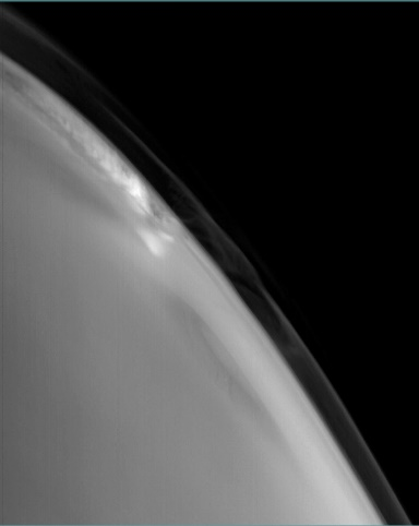
AMEC at Limb. Map.
| Orbit Number | 20922 |
|---|---|
| Latitude | -9.0 |
| Longitude [E/W] | -120.0 |
| Longitude [E] | 240.0 |
| Ls | 242.1 |
| Date | 2020-07-20 00:00:00 |
| Local time | 06:35:17 |
OC-47 #
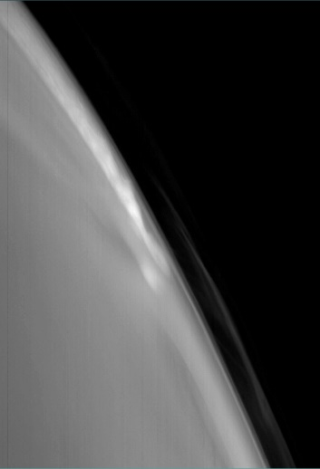
AMEC at Limb. Map.
| Orbit Number | 20915 |
|---|---|
| Latitude | -9.0 |
| Longitude [E/W] | -120.0 |
| Longitude [E] | 240.0 |
| Ls | 240.8 |
| Date | 2020-07-18 00:00:00 |
| Local time | 07:00:33 |
OC-48 #
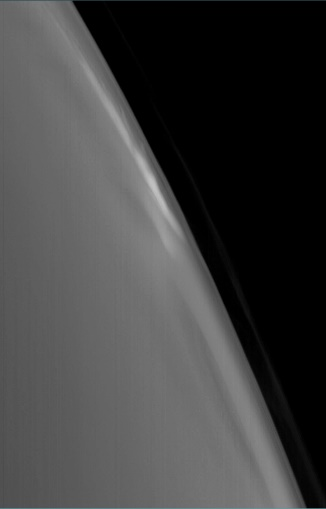
AMEC at Limb. Map.
| Orbit Number | 20908 |
|---|---|
| Latitude | -9.0 |
| Longitude [E/W] | -120.0 |
| Longitude [E] | 240.0 |
| Ls | 239.5 |
| Date | 2020-07-16 00:00:00 |
| Local time | 07:25:48 |
OC-49 #
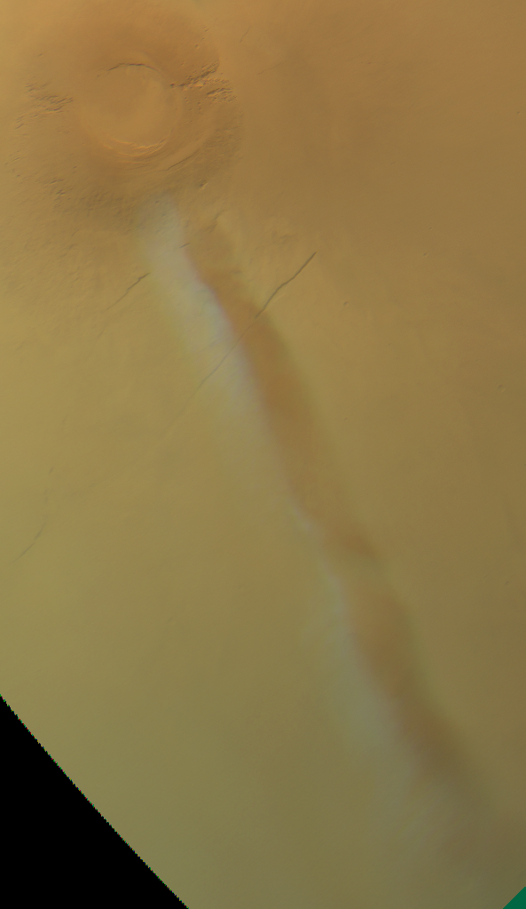
AMEC at Arsia Mons. Map.
| Orbit Number | 18627 |
|---|---|
| Latitude | -8.255 |
| Longitude [E/W] | -125.252 |
| Longitude [E] | 234.748 |
| Ls | 245.3 |
| Date | 2018-09-21 00:00:00 |
| Local time | 08:24:56 |
OC-50 #
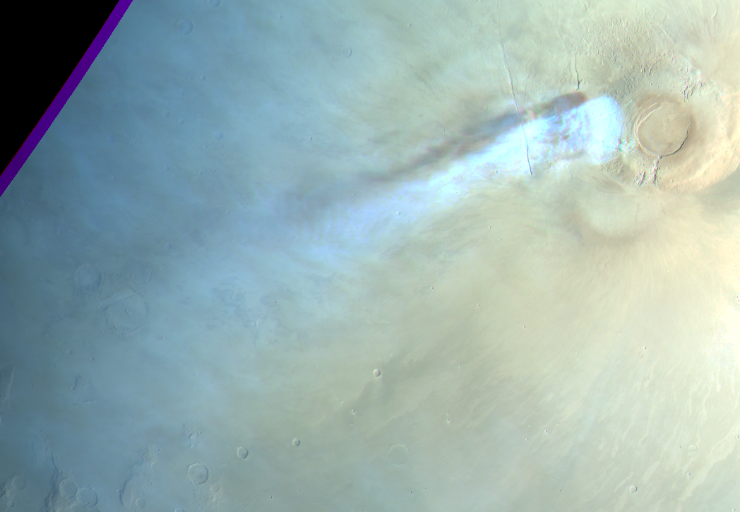
AMEC at Arsia Mons. Map.
| Orbit Number | 16486 |
|---|---|
| Latitude | -8.749 |
| Longitude [E/W] | -120.078 |
| Longitude [E] | 239.922 |
| Ls | 293.8 |
| Date | 2017-01-05 00:00:00 |
| Local time | 07:58:51 |
OC-51 #
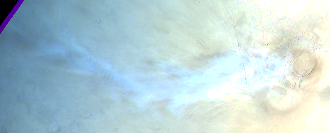
AMEC at Arsia Mons; graining into gravity wave structures. Map.
| Orbit Number | 16472 |
|---|---|
| Latitude | -8.695 |
| Longitude [E/W] | -119.947 |
| Longitude [E] | 240.053 |
| Ls | 291.3 |
| Date | 2017-01-01 00:00:00 |
| Local time | 08:22:27 |
Twilight Clouds #
TC-1 #

Twilight gravity-wave-like clouds at Tyrrhena Terra / Hesperia Planum. Map.
| Orbit Number | 25009.0 |
|---|---|
| Latitude | -20.83 |
| Longitude [E/W] | 98.69 |
| Longitude | 98.69 |
| Ls | 136.8 |
| Date | 2023-10-22 00:00:00 |
| Local time | 05:47:00 |
TC-2 #
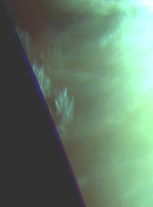
Twilight clouds at Chryse Planitia. Map.
| Orbit Number | 25006.0 |
|---|---|
| Latitude | 25.79 |
| Longitude [E/W] | -55.91 |
| Longitude | 304.09 |
| Ls | 136.5 |
| Date | 2023-10-21 00:00:00 |
| Local time | 04:40:00 |
TC-3 #
NaT Map.
| Orbit Number | NaT |
|---|---|
| Latitude | NaT |
| Longitude [E/W] | NaT |
| Longitude | NaT |
| Ls | NaT |
| Date | NaT |
| Local time | NaT |
TC-4 #

Small twilight cloud patches at S Noachis. Map.
| Orbit Number | 24703.0 |
|---|---|
| Latitude | -64.83 |
| Longitude [E/W] | -20.69 |
| Longitude | 339.31 |
| Ls | 95.6 |
| Date | 2023-07-25 00:00:00 |
| Local time | 11:25:00 |
TC-5 #

Various shapes of twilight clouds at Terra Sirenum. Map.
| Orbit Number | 24688.0 |
|---|---|
| Latitude | -55.23 |
| Longitude [E/W] | -122.79 |
| Longitude | 237.21 |
| Ls | 93.5 |
| Date | 2023-07-21 00:00:00 |
| Local time | 16:18:00 |
TC-6 #

Twilight clouds at Terra Cimmeria near Kepler crater. Map.
| Orbit Number | 24627.0 |
|---|---|
| Latitude | -46.62 |
| Longitude [E/W] | 124.1 |
| Longitude | 124.1 |
| Ls | 85.8 |
| Date | 2023-07-03 00:00:00 |
| Local time | 07:01:00 |
TC-7 #

Twilight cirrus clouds @north of Acheron Fossae. Map.
| Orbit Number | 24012.0 |
|---|---|
| Latitude | 48.0 |
| Longitude [E/W] | -141.0 |
| Longitude | 219.0 |
| Ls | 4.9 |
| Date | 2023-01-05 00:00:00 |
| Local time | 05:38:02 |
TC-8 #

Twilight clouds at Acidalia Planitia. Map.
| Orbit Number | 23983.0 |
|---|---|
| Latitude | 47.0 |
| Longitude [E/W] | -41.0 |
| Longitude | 319.0 |
| Ls | 0.7 |
| Date | 2022-12-27 00:00:00 |
| Local time | 05:33:20 |
TC-9 #
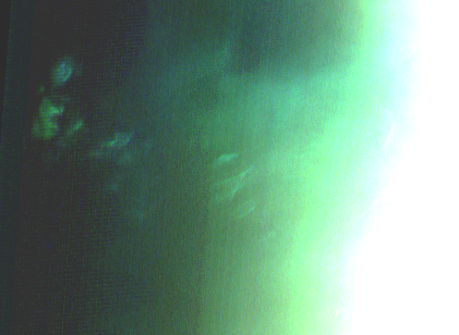
Twilight clouds east of Alba Patera. Map.
| Orbit Number | 23980.0 |
|---|---|
| Latitude | 41.0 |
| Longitude [E/W] | -102.0 |
| Longitude | 258.0 |
| Ls | 0.3 |
| Date | 2022-12-27 00:00:00 |
| Local time | 05:08:57 |
TC-10 #
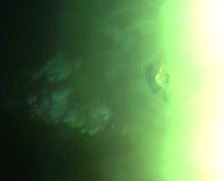
Twilight clouds west of Tharsis Tholus. Map.
| Orbit Number | 23980.0 |
|---|---|
| Latitude | 11.0 |
| Longitude [E/W] | -97.0 |
| Longitude | 263.0 |
| Ls | 0.3 |
| Date | 2022-12-27 00:00:00 |
| Local time | 05:27:00 |
TC-11 #
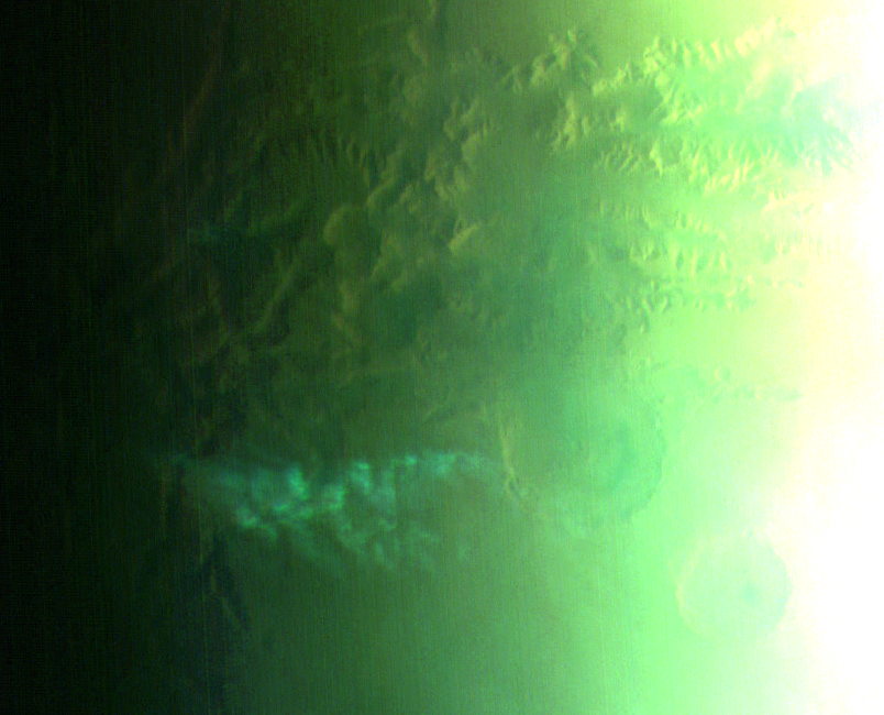
Twilight clouds south of Noctis Labyrinthus. Map.
| Orbit Number | 23980.0 |
|---|---|
| Latitude | -10.0 |
| Longitude [E/W] | -95.5 |
| Longitude | 264.5 |
| Ls | 0.3 |
| Date | 2022-12-27 00:00:00 |
| Local time | 05:08:57 |
TC-12 #

Cirrus-like twilight clouds near terminator north of Elysium Mons. Map.
| Orbit Number | 23900.0 |
|---|---|
| Latitude | 48.0 |
| Longitude [E/W] | 147.0 |
| Longitude | 147.0 |
| Ls | 348.4 |
| Date | 2022-12-03 00:00:00 |
| Local time | 06:23:26 |
TC-13 #
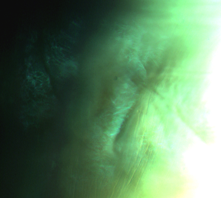
Strange, aster-like twilight cloud at Alba Patera. Map.
| Orbit Number | 23892.0 |
|---|---|
| Latitude | 43.0 |
| Longitude [E/W] | -105.0 |
| Longitude | 255.0 |
| Ls | 347.2 |
| Date | 2022-12-01 00:00:00 |
| Local time | 06:23:07 |
TC-14 #
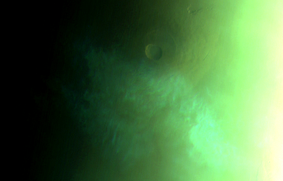
Cirrus-shaped twilight cloud at Pavonis Mons, close to dayside/terminator but still on night side. Map.
| Orbit Number | 23892.0 |
|---|---|
| Latitude | -2.0 |
| Longitude [E/W] | -105.0 |
| Longitude | 255.0 |
| Ls | 347.2 |
| Date | 2022-12-01 00:00:00 |
| Local time | 06:23:07 |
TC-15 #
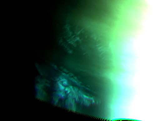
Cirrus-shaped twilight clouds at southern Daedalia Planum. Map.
| Orbit Number | 23892.0 |
|---|---|
| Latitude | -38.0 |
| Longitude [E/W] | -125.0 |
| Longitude | 235.0 |
| Ls | 347.2 |
| Date | 2022-12-01 00:00:00 |
| Local time | 05:47:07 |
TC-16 #
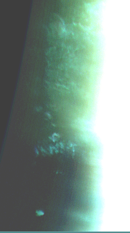
Cirrus-shaped twilight clouds at Noachis Terra with isolated morning dot?. Map.
| Orbit Number | 23883.0 |
|---|---|
| Latitude | -21.0 |
| Longitude [E/W] | -8.0 |
| Longitude | 352.0 |
| Ls | 346.0 |
| Date | 2022-11-29 00:00:00 |
| Local time | 05:16:42 |
TC-17 #
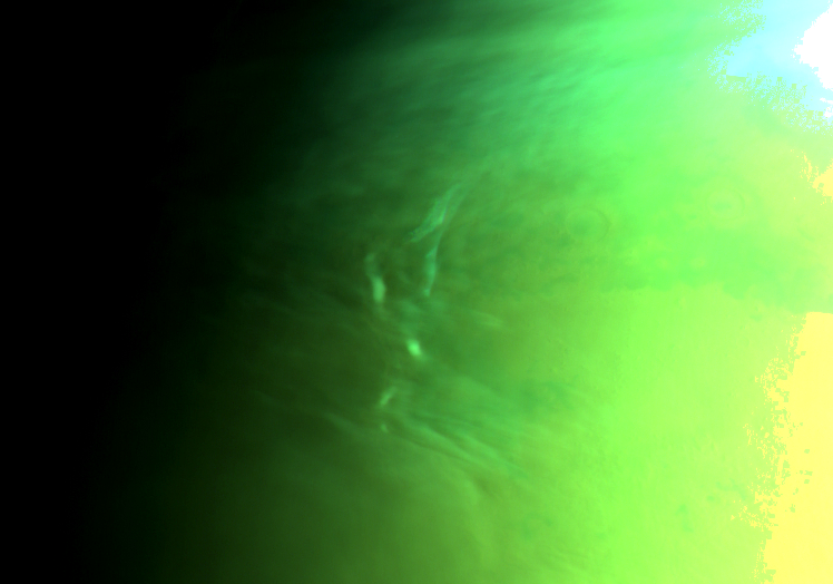
Several small isolated twilight cloud patches at Protonilus Mensae. Map.
| Orbit Number | 23879.0 |
|---|---|
| Latitude | 44.0 |
| Longitude [E/W] | 54.0 |
| Longitude | 54.0 |
| Ls | 345.4 |
| Date | 2022-11-27 00:00:00 |
| Local time | 06:23:25 |
TC-18 #
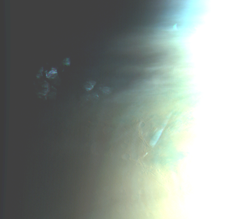
Cirrus-shaped twilight cloud patches at Protonilus Mensae. Map.
| Orbit Number | 23872.0 |
|---|---|
| Latitude | 46.0 |
| Longitude [E/W] | 42.0 |
| Longitude | 42.0 |
| Ls | 344.3 |
| Date | 2022-11-25 00:00:00 |
| Local time | 05:31:18 |
TC-19 #
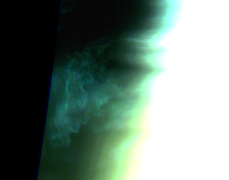
‘cirrus-shaped twilight clouds at Utopia Planitia. Map.
| Orbit Number | 23865.0 |
|---|---|
| Latitude | 43.0 |
| Longitude [E/W] | 132.0 |
| Longitude | 132.0 |
| Ls | 343.1 |
| Date | 2022-11-23 00:00:00 |
| Local time | 05:56:02 |
TC-20 #
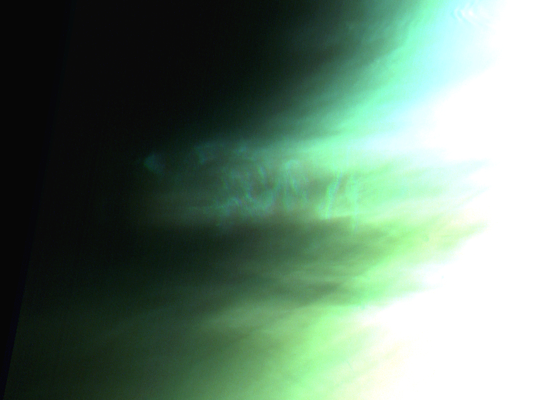
Cirrus-shaped ’twilight clouds northwest of Alba Patera. Map.
| Orbit Number | 23836.0 |
|---|---|
| Latitude | 56.0 |
| Longitude [E/W] | -121.0 |
| Longitude | 239.0 |
| Ls | 338.6 |
| Date | 2022-11-15 00:00:00 |
| Local time | 07:45:22 |
TC-21 #
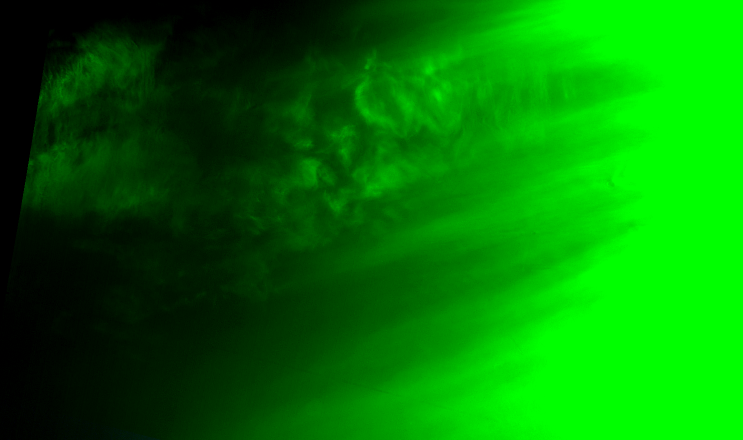
Twilight clouds north of Acheron Fossae (data gap, only green channel). Map.
| Orbit Number | 23828.0 |
|---|---|
| Latitude | 50.0 |
| Longitude [E/W] | -139.0 |
| Longitude | 221.0 |
| Ls | 337.5 |
| Date | 2022-11-13 00:00:00 |
| Local time | 06:44:54 |
TC-22 #
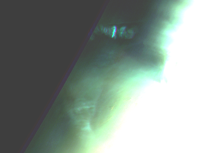
Isolated twilight cloud patch accosiated with cirris-shaped clouds north of Alba Patera. Map.
| Orbit Number | 23800.0 |
|---|---|
| Latitude | 51.0 |
| Longitude [E/W] | -94.0 |
| Longitude | 266.0 |
| Ls | 333.0 |
| Date | 2022-11-04 00:00:00 |
| Local time | 06:16:31 |
TC-23 #

Gravity-wave shaped twilight cloud at Tharsis Montes. Map.
| Orbit Number | 23207.0 |
|---|---|
| Latitude | 11.0 |
| Longitude [E/W] | -140.0 |
| Longitude | 220.0 |
| Ls | 228.1 |
| Date | 2022-05-16 00:00:00 |
| Local time | 06:06:54 |
TC-24 #
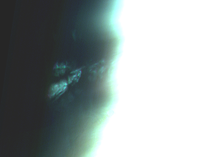
NW of Olympus Mons. Map.
| Orbit Number | 23012.0 |
|---|---|
| Latitude | 43.2 |
| Longitude [E/W] | -144.2 |
| Longitude | 215.8 |
| Ls | 193.8 |
| Date | 2022-03-20 00:00:00 |
| Local time | 05:39:00 |
TC-25 #

Cirrus-shaped twilight clouds north of Nilosyrtis Mensae. Map.
| Orbit Number | 23010.0 |
|---|---|
| Latitude | 42.3 |
| Longitude [E/W] | 61.5 |
| Longitude | 61.5 |
| Ls | 193.4 |
| Date | 2022-03-19 00:00:00 |
| Local time | 05:47:00 |
TC-26 #
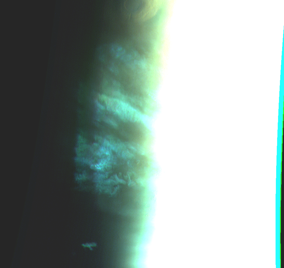
Cirrus-shaped twilight clouds at Daedalia Planum. Map.
| Orbit Number | 23009.0 |
|---|---|
| Latitude | -29.3 |
| Longitude [E/W] | -126.4 |
| Longitude | 233.6 |
| Ls | 193.1 |
| Date | 2022-03-19 00:00:00 |
| Local time | 05:08:00 |
TC-27 #
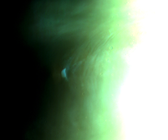
Small and compact twilight cloud patch at Hecates Tholus. Map.
| Orbit Number | 22995.0 |
|---|---|
| Latitude | 31.9 |
| Longitude [E/W] | 151.8 |
| Longitude | 151.8 |
| Ls | 190.9 |
| Date | 2022-03-15 00:00:00 |
| Local time | 05:51:00 |
TC-28 #
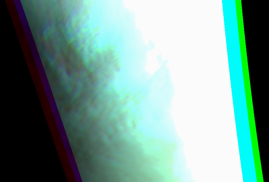
West of Hellas Planitia’. Map.
| Orbit Number | 22972.0 |
|---|---|
| Latitude | -42.8 |
| Longitude [E/W] | 37.0 |
| Longitude | 37.0 |
| Ls | 186.9 |
| Date | 2022-03-08 00:00:00 |
| Local time | 05:55:00 |
TC-29 #
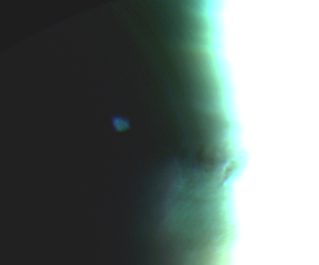
Isolated twilight cloud patch north of Alba Patera. Map.
| Orbit Number | 22916.0 |
|---|---|
| Latitude | 52.2 |
| Longitude [E/W] | -93.2 |
| Longitude | 266.8 |
| Ls | 177.8 |
| Date | 2022-02-22 00:00:00 |
| Local time | 04:33:00 |
Synoptic Phenomena #
SP-1 #
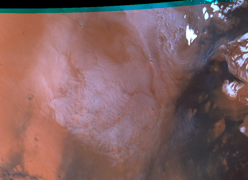
Double-annular cyclone [Sanchéz-Lavega 2023]. Map.
| Orbit Number | 13125 |
|---|---|
| Latitude | 66.86 |
| Longitude [E/W] | -84.03 |
| Longitude [E] | 275.97 |
| Ls | 124.8 |
| Date | 2014-05-02 00:00:00 |
| Local time | 10:09:00 |
| dust storm | |
| cyclone | cyclone |
| frontal cloud |
SP-2 #
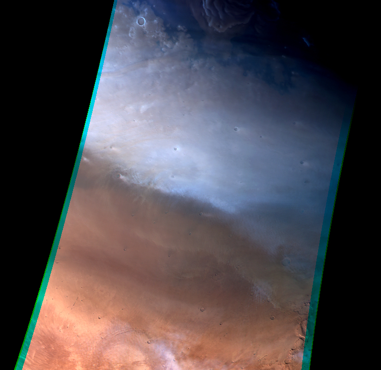
Faint , residual?, spiral? dust storm. Map.
| Orbit Number | 16969 |
|---|---|
| Latitude | 57.12 |
| Longitude [E/W] | -104.53 |
| Longitude [E] | 255.47 |
| Ls | 10.5 |
| Date | 2017-05-26 00:00:00 |
| Local time | 13:59:00 |
| dust storm | dust storm |
| cyclone | |
| frontal cloud |
SP-3 #
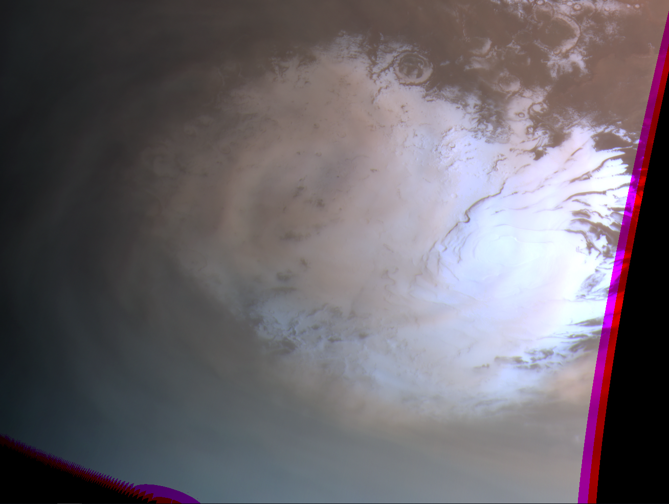
Spiral? dust storm above south pole cap. Map.
| Orbit Number | 18671 |
|---|---|
| Latitude | -78.01 |
| Longitude [E/W] | -14.3 |
| Longitude [E] | 345.7 |
| Ls | 262.4 |
| Date | 2018-10-04 00:00:00 |
| Local time | 02:21:53 |
| dust storm | dust storm |
| cyclone | |
| frontal cloud |
SP-4 #

Dust (storm?) above south pole cap. Map.
| Orbit Number | 18674 |
|---|---|
| Latitude | -81.92 |
| Longitude [E/W] | -14.98 |
| Longitude [E] | 345.02 |
| Ls | 263.0 |
| Date | 2018-10-05 00:00:00 |
| Local time | 22:30:28 |
| dust storm | dust storm |
| cyclone | |
| frontal cloud |
SP-5 #
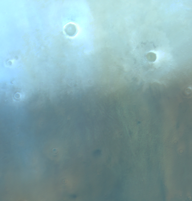
Faint dust lifting event; residual dust storm?; lee waves and faint gravity waves in same orbit. Map.
| Orbit Number | 19362 |
|---|---|
| Latitude | 62.21 |
| Longitude [E/W] | -128.02 |
| Longitude [E] | 231.98 |
| Ls | 15.1 |
| Date | 2019-04-23 00:00:00 |
| Local time | 14:35:00 |
| dust storm | dust storm |
| cyclone | |
| frontal cloud |
SP-6 #
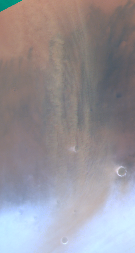
Spiral/frontal? dust storm. Map.
| Orbit Number | 19461 |
|---|---|
| Latitude | 61.779 |
| Longitude [E/W] | -172.732 |
| Longitude [E] | 187.268 |
| Ls | 28.6 |
| Date | 2019-05-22 00:00:00 |
| Local time | 12:45:15 |
| dust storm | dust storm |
| cyclone | |
| frontal cloud |
SP-7 #
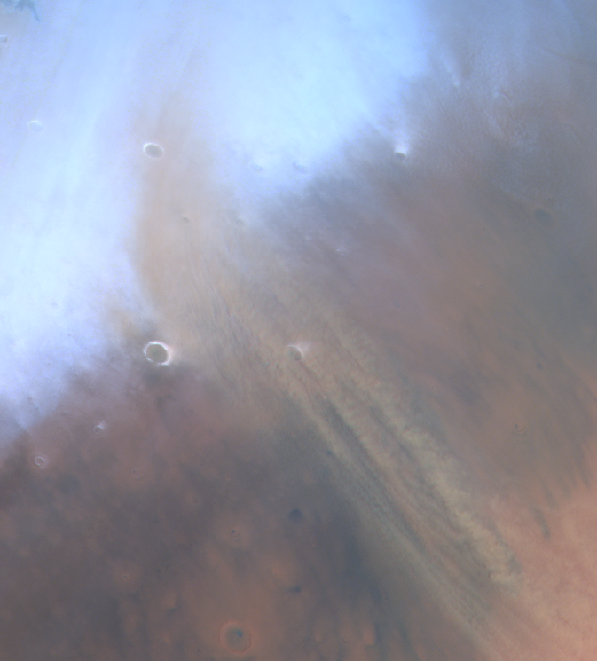
Spiral/frontal? dust storm. Map.
| Orbit Number | 19461 |
|---|---|
| Latitude | 63.02 |
| Longitude [E/W] | -173.96 |
| Longitude [E] | 186.04 |
| Ls | 28.6 |
| Date | 2019-05-22 00:00:00 |
| Local time | 12:42:03 |
| dust storm | dust storm |
| cyclone | |
| frontal cloud |
SP-8 #

Spiral dust storm. Map.
| Orbit Number | 19475 |
|---|---|
| Latitude | 66.273 |
| Longitude [E/W] | -144.298 |
| Longitude [E] | 215.702 |
| Ls | 30.5 |
| Date | 2019-05-26 00:00:00 |
| Local time | 13:45:19 |
| dust storm | dust storm |
| cyclone | |
| frontal cloud |
SP-9 #
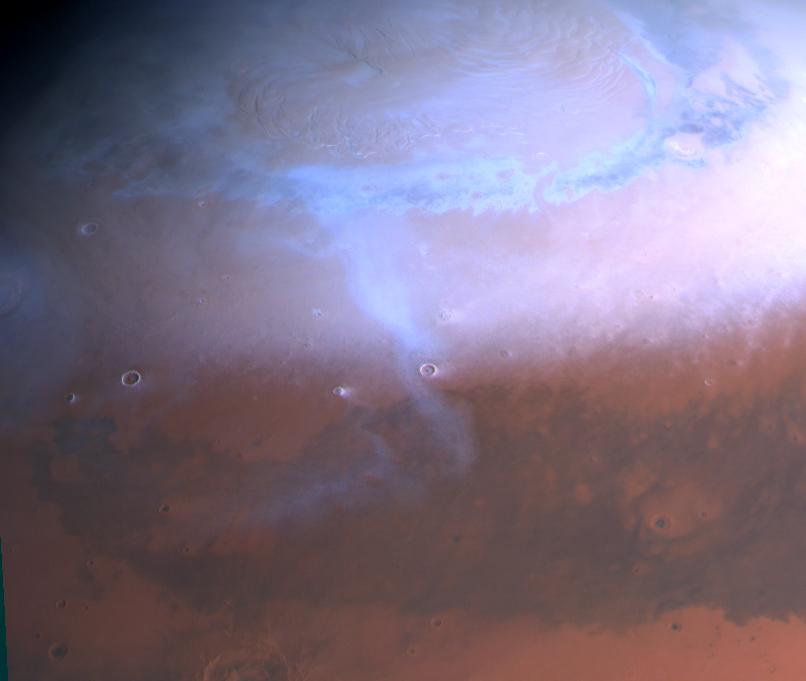
Arcshaped cloud at north pole; frontal cloud. Map.
| Orbit Number | 19550 |
|---|---|
| Latitude | 62.61 |
| Longitude [E/W] | 41.09 |
| Longitude [E] | 41.09 |
| Ls | 40.4 |
| Date | 2019-06-17 00:00:00 |
| Local time | 08:20:00 |
| dust storm | |
| cyclone | |
| frontal cloud | frontal cloud |
SP-10 #

Gravity waves loaded with dust at Acidalia Planitia; textured dust storm?. Map.
| Orbit Number | 20607 |
|---|---|
| Latitude | 49.251 |
| Longitude [E/W] | -23.376 |
| Longitude [E] | 336.624 |
| Ls | 186.3 |
| Date | 2020-04-19 00:00:00 |
| Local time | 10:48:18 |
| dust storm | dust storm |
| cyclone | |
| frontal cloud |
SP-11 #
Textured dust storm with gravity waves at Deuteronilus. Map.
| Orbit Number | 21430 |
|---|---|
| Latitude | 49.48 |
| Longitude [E/W] | 23.37 |
| Longitude [E] | 23.37 |
| Ls | 331.6 |
| Date | 2020-12-15 00:00:00 |
| Local time | 13:44:20 |
| dust storm | dust storm |
| cyclone | |
| frontal cloud |
SP-12 #
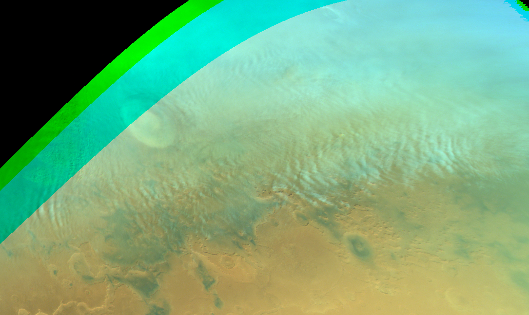
Textured dust storm wiht gravity clouds near Lyot crater; dust loaded?. Map.
| Orbit Number | 21465 |
|---|---|
| Latitude | 50.04 |
| Longitude [E/W] | 39.84 |
| Longitude [E] | 39.84 |
| Ls | 337.1 |
| Date | 2020-12-25 00:00:00 |
| Local time | 12:46:24 |
| dust storm | dust storm |
| cyclone | |
| frontal cloud |
SP-13 #

Textured dust storm in Vastitas Borealis; and gravity clouds. Map.
| Orbit Number | 21469 |
|---|---|
| Latitude | 53.56 |
| Longitude [E/W] | 30.02 |
| Longitude [E] | 30.02 |
| Ls | 337.8 |
| Date | 2020-12-26 00:00:00 |
| Local time | 15:57:45 |
| dust storm | dust storm |
| cyclone | |
| frontal cloud |
SP-14 #
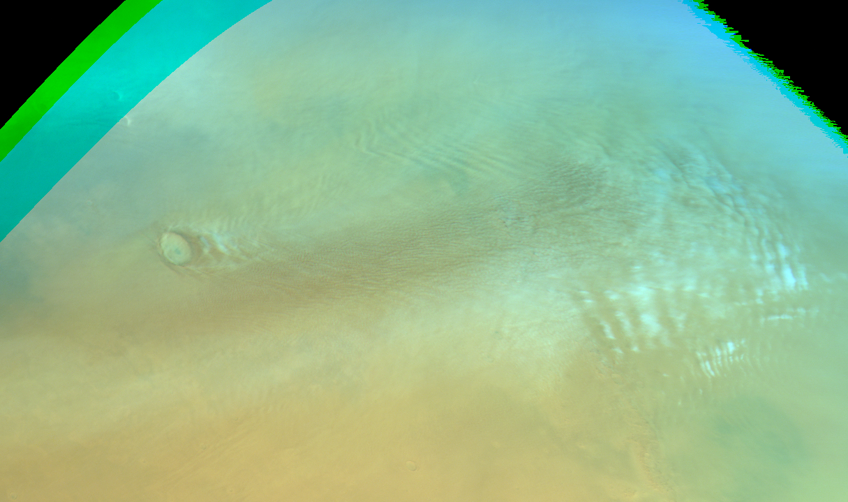
Gravity clouds in Utopia Planitia; partially loaded with dust; textured dust storm?. Map.
| Orbit Number | 21478 |
|---|---|
| Latitude | 50.06 |
| Longitude [E/W] | -50.71 |
| Longitude [E] | 309.29 |
| Ls | 339.2 |
| Date | 2020-12-29 00:00:00 |
| Local time | 23:13:32 |
| dust storm | dust storm |
| cyclone | |
| frontal cloud |
SP-15 #
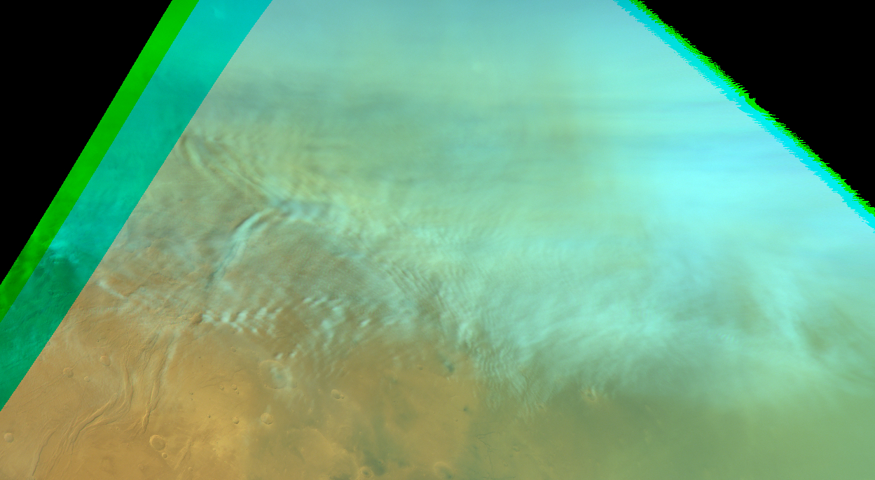
Gravity clouds in Acidalia Planita + dust storm residual?. Map.
| Orbit Number | 21480 |
|---|---|
| Latitude | 48.05 |
| Longitude [E/W] | -51.21 |
| Longitude [E] | 308.79 |
| Ls | 339.5 |
| Date | 2020-12-29 00:00:00 |
| Local time | 12:34:55 |
| dust storm | dust storm |
| cyclone | |
| frontal cloud |
SP-16 #
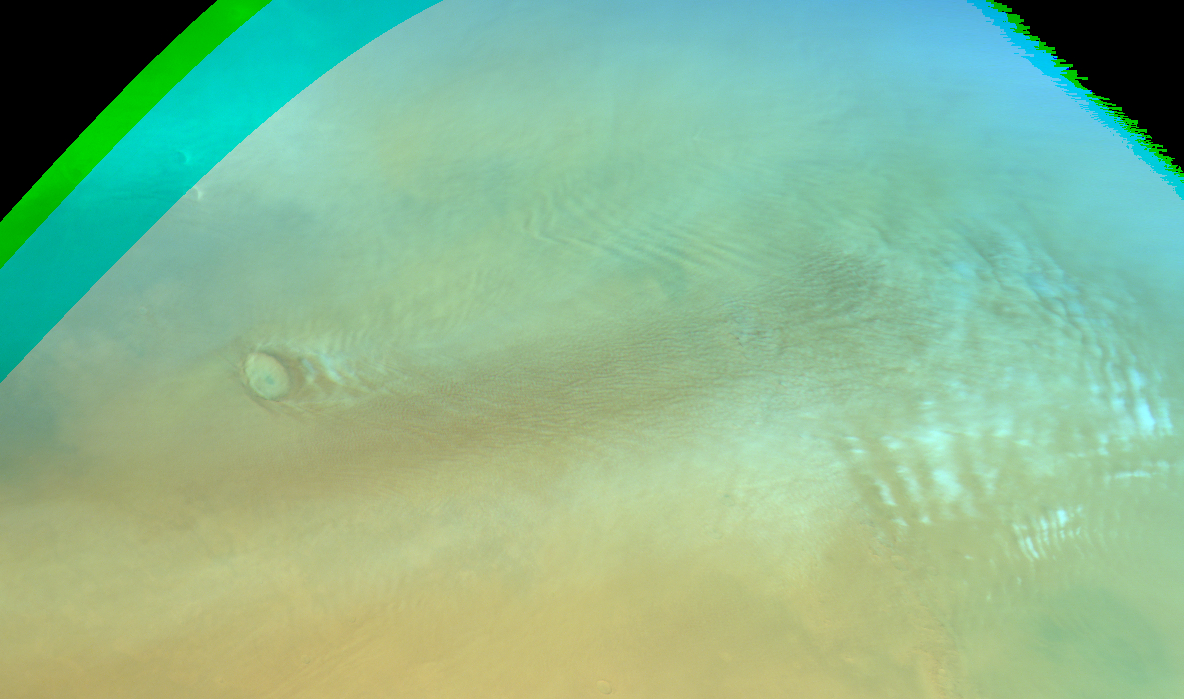
Gravity clouds + dust storm residual?. Map.
| Orbit Number | 21478 |
|---|---|
| Latitude | 49.5 |
| Longitude [E/W] | 161.83 |
| Longitude [E] | 161.83 |
| Ls | 340.6 |
| Date | 2020-12-29 00:00:00 |
| Local time | 02:33:53 |
| dust storm | dust storm |
| cyclone | |
| frontal cloud |
SP-17 #
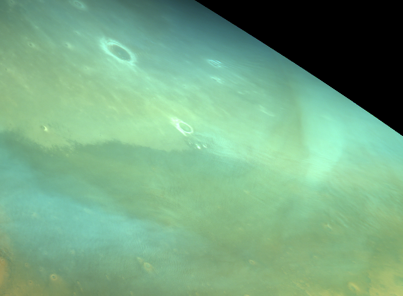
Residual arc-shaped dust storm?. Map.
| Orbit Number | 21536 |
|---|---|
| Latitude | 52.62 |
| Longitude [E/W] | -0.139999999999986 |
| Longitude [E] | 359.86 |
| Ls | 348.1 |
| Date | 2021-01-15 00:00:00 |
| Local time | 13:58:11 |
| dust storm | dust storm |
| cyclone | |
| frontal cloud |
SP-18 #
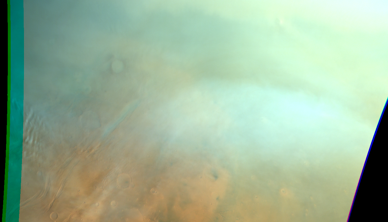
Residual dust storm?. Map.
| Orbit Number | 21596 |
|---|---|
| Latitude | 51.66 |
| Longitude [E/W] | -52.8 |
| Longitude [E] | 307.2 |
| Ls | 357.0 |
| Date | 2021-02-01 00:00:00 |
| Local time | 09:27:55 |
| dust storm | dust storm |
| cyclone | |
| frontal cloud |
SP-19 #
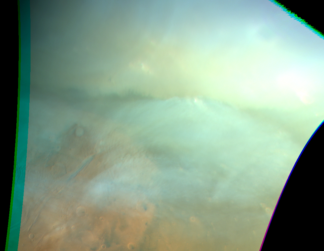
Dust storm?. Map.
| Orbit Number | 21603 |
|---|---|
| Latitude | 57.37 |
| Longitude [E/W] | -47.63 |
| Longitude [E] | 312.37 |
| Ls | 358.0 |
| Date | 2021-02-03 00:00:00 |
| Local time | 09:34:42 |
| dust storm | dust storm |
| cyclone | |
| frontal cloud |
SP-20 #

Faint frontal dust storm?. Map.
| Orbit Number | 21626 |
|---|---|
| Latitude | 57.02 |
| Longitude [E/W] | 120.62 |
| Longitude [E] | 120.62 |
| Ls | 1.4 |
| Date | 2021-02-10 00:00:00 |
| Local time | 09:00:28 |
| dust storm | dust storm |
| cyclone | |
| frontal cloud | frontal cloud |
SP-21 #

Faint frontal dust storm?. Map.
| Orbit Number | 21718 |
|---|---|
| Latitude | 57.52 |
| Longitude [E/W] | 95.1 |
| Longitude [E] | 95.1 |
| Ls | 14.4 |
| Date | 2021-03-09 00:00:00 |
| Local time | 09:22:00 |
| dust storm | dust storm |
| cyclone | |
| frontal cloud |
SP-22 #
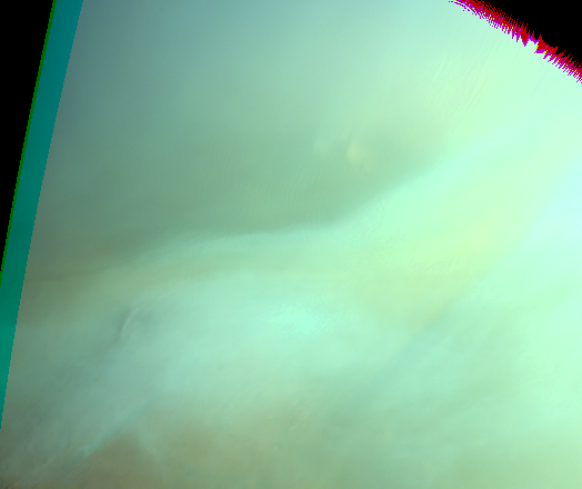
Faint frontal dust storm?. Map.
| Orbit Number | 21751 |
|---|---|
| Latitude | 57.59 |
| Longitude [E/W] | -52.96 |
| Longitude [E] | 307.04 |
| Ls | 19.0 |
| Date | 2021-03-18 00:00:00 |
| Local time | 07:46:43 |
| dust storm | dust storm |
| cyclone | |
| frontal cloud | frontal cloud |
SP-23 #
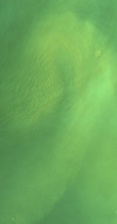
Spiral dust storm & gravity waves at Acidalia Planitia. Map.
| Orbit Number | 21822 |
|---|---|
| Latitude | 55.08 |
| Longitude [E/W] | -40.05 |
| Longitude [E] | 319.95 |
| Ls | 28.5 |
| Date | 2021-04-08 00:00:00 |
| Local time | 07:16:59 |
| dust storm | dust storm |
| cyclone | |
| frontal cloud |
SP-24 #
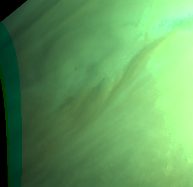
Upper & lower right saturated, dust storm (?) in upper left, middle may be usable. Map.
| Orbit Number | 21828 |
|---|---|
| Latitude | 72.15 |
| Longitude [E/W] | 43.51 |
| Longitude [E] | 43.51 |
| Ls | 29.3 |
| Date | 2021-04-09 00:00:00 |
| Local time | 05:21:29 |
| dust storm | dust storm |
| cyclone | |
| frontal cloud |
SP-25 #
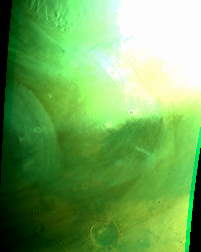
Part of cyclone? at Vastitas (near Lyot crater); partly saturated terminator obervation. Map.
| Orbit Number | 21846 |
|---|---|
| Latitude | 63.25 |
| Longitude [E/W] | 10.1 |
| Longitude [E] | 10.1 |
| Ls | 31.7 |
| Date | 2021-04-15 00:00:00 |
| Local time | 05:58:00 |
| dust storm | |
| cyclone | cyclone |
| frontal cloud |
SP-26 #
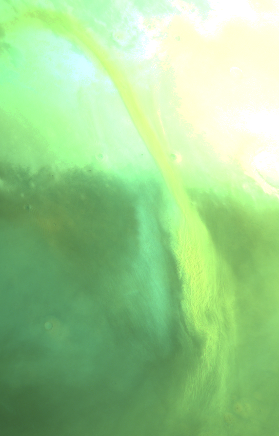
Dust storm (frontal cloud) & gravity waves at Acidalia Planitia (residual of 21822?). Map.
| Orbit Number | 21882 |
|---|---|
| Latitude | 65.76 |
| Longitude [E/W] | -23.32 |
| Longitude [E] | 336.68 |
| Ls | 36.5 |
| Date | 2021-04-25 00:00:00 |
| Local time | 08:36:14 |
| dust storm | dust storm |
| cyclone | |
| frontal cloud | frontal cloud |
SP-27 #
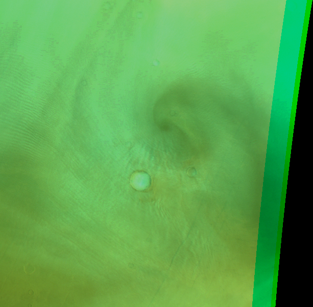
Faint spiral dust storm or cyclone?? at Vastitas. Map.
| Orbit Number | 21893 |
|---|---|
| Latitude | 60.73 |
| Longitude [E/W] | -76.19 |
| Longitude [E] | 283.81 |
| Ls | 37.9 |
| Date | 2021-04-28 00:00:00 |
| Local time | 08:07:29 |
| dust storm | |
| cyclone | cyclone |
| frontal cloud |
SP-28 #
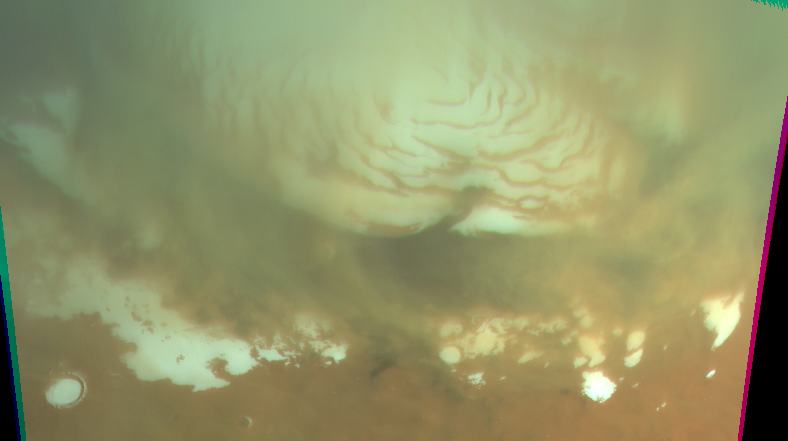
North pole shrouded in dust. Map.
| Orbit Number | 24849 |
|---|---|
| Latitude | 86.58 |
| Longitude [E/W] | 152.09 |
| Longitude [E] | 152.09 |
| Ls | 114.8 |
| Date | 2023-09-06 00:00:00 |
| Local time | 05:11:00 |
| dust storm | dust storm |
| cyclone | |
| frontal cloud |
SP-29 #
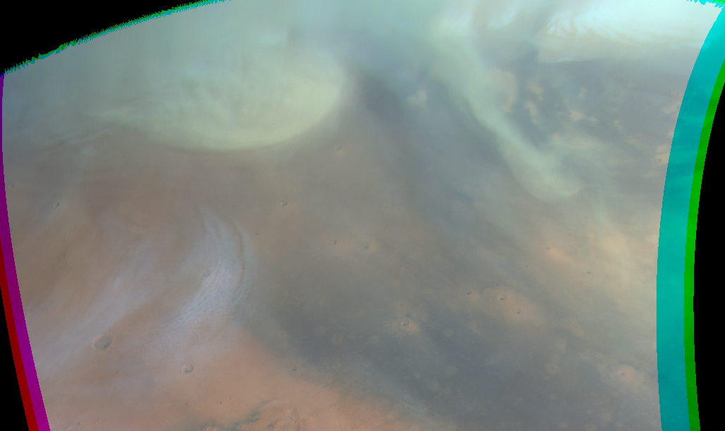
Cyclone?? / dust-loaded arc-shaped front at Vastitas. Map.
| Orbit Number | 24855 |
|---|---|
| Latitude | 70.65 |
| Longitude [E/W] | -89.86 |
| Longitude [E] | 270.14 |
| Ls | 115.6 |
| Date | 2023-08-07 00:00:00 |
| Local time | 06:17:00 |
| dust storm | dust storm |
| cyclone | cyclone |
| frontal cloud |
SP-30 #
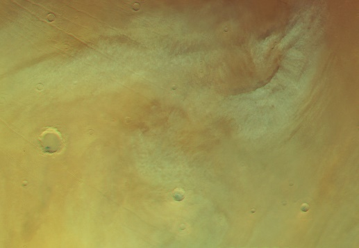
Arc-shaped storm? / part of cyclone?. Map.
| Orbit Number | 24954 |
|---|---|
| Latitude | 63.08 |
| Longitude [E/W] | -87.34 |
| Longitude [E] | 272.66 |
| Ls | 129.1 |
| Date | 2023-10-06 00:00:00 |
| Local time | 06:33:00 |
| dust storm | |
| cyclone | cyclone |
| frontal cloud |
SP-31 #
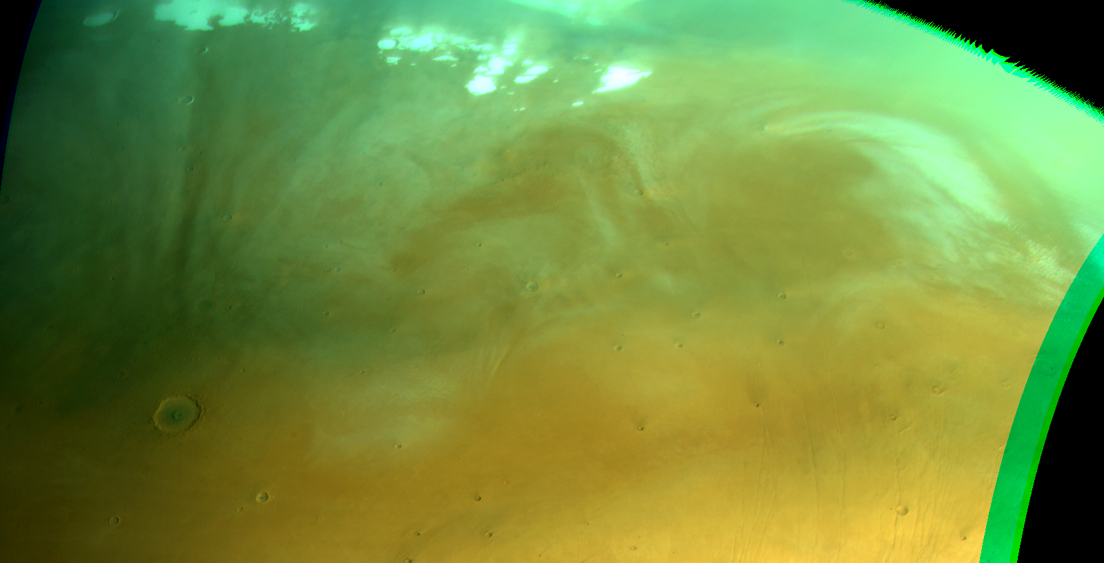
Arc-shaped front and cyclone ? at Vastitas. Map.
| Orbit Number | 24972 |
|---|---|
| Latitude | 68.7 |
| Longitude [E/W] | -81.69 |
| Longitude [E] | 278.31 |
| Ls | 131.7 |
| Date | 2023-10-11 00:00:00 |
| Local time | 11:06:00 |
| dust storm | |
| cyclone | cyclone |
| frontal cloud |
SP-32 #
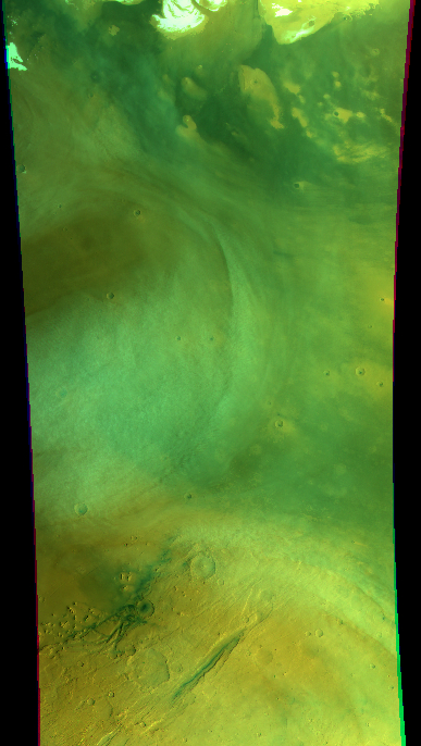
Double-annular cyclone at Vastitas. Map.
| Orbit Number | 24975 |
|---|---|
| Latitude | 59.75 |
| Longitude [E/W] | -68.53 |
| Longitude [E] | 291.47 |
| Ls | 132.1 |
| Date | 2023-10-12 00:00:00 |
| Local time | 06:55:00 |
| dust storm | |
| cyclone | cyclone |
| frontal cloud |
SP-33 #
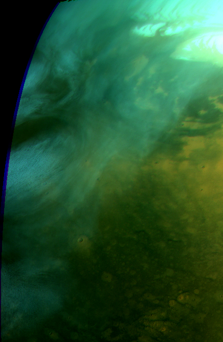
Double-annular cyclone at Vastitas. Map.
| Orbit Number | 24978 |
|---|---|
| Latitude | 62.79 |
| Longitude [E/W] | -55.22 |
| Longitude [E] | 304.78 |
| Ls | 132.5 |
| Date | 2023-10-13 00:00:00 |
| Local time | 05:33:00 |
| dust storm | |
| cyclone | cyclone |
| frontal cloud |
SP-34 #
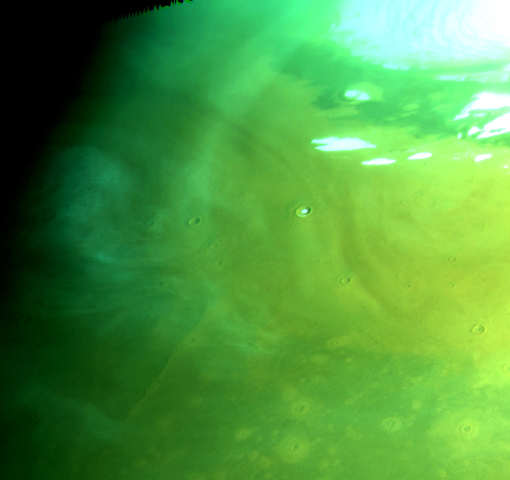
Residual (?) cyclone at Vastitas (near terminator). Map.
| Orbit Number | 24987 |
|---|---|
| Latitude | 66.52 |
| Longitude [E/W] | 77.42 |
| Longitude [E] | 77.42 |
| Ls | 133.8 |
| Date | 2023-10-16 00:00:00 |
| Local time | 03:37:00 |
| dust storm | |
| cyclone | cyclone |
| frontal cloud |
SP-35 #
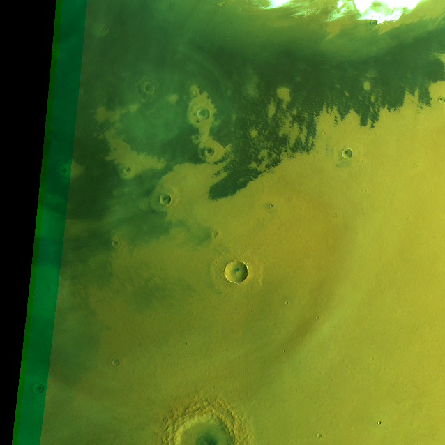
Resudial ? cyclone at Vastitas (double broom - same as in 24992_0001). Map.
| Orbit Number | 24992_0000 |
|---|---|
| Latitude | 68.69 |
| Longitude [E/W] | -1.43000000000001 |
| Longitude [E] | 358.57 |
| Ls | 134.5 |
| Date | 2023-10-17 00:00:00 |
| Local time | 06:57:00 |
| dust storm | |
| cyclone | cyclone |
| frontal cloud |
SP-36 #
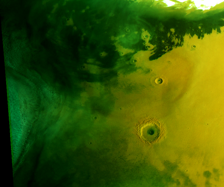
Cyclone at Vastitas (double broom - same as in 24992_0000). Map.
| Orbit Number | 24992_0001 |
|---|---|
| Latitude | 65.1 |
| Longitude [E/W] | -36.74 |
| Longitude [E] | 323.26 |
| Ls | 134.5 |
| Date | 2023-10-17 00:00:00 |
| Local time | 05:11:00 |
| dust storm | |
| cyclone | cyclone |
| frontal cloud |
SP-37 #
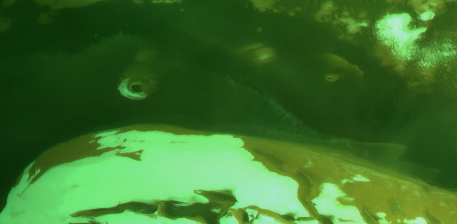
Cloud front at North Pole (double broom - same as in 24992_0001). Map.
| Orbit Number | 24992_0000 |
|---|---|
| Latitude | 82.46 |
| Longitude [E/W] | 166.13 |
| Longitude [E] | 166.13 |
| Ls | 134.5 |
| Date | 2023-10-17 00:00:00 |
| Local time | 18:09:00 |
| dust storm | |
| cyclone | |
| frontal cloud | frontal cloud |
SP-38 #
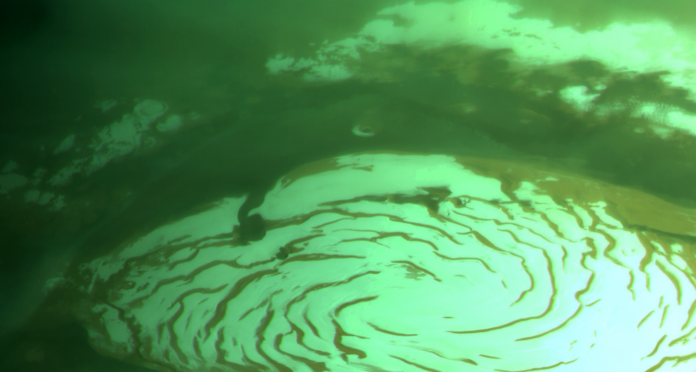
Cloud front at North Pole (double broom - same as in 24992_0000). Map.
| Orbit Number | 24992_0001 |
|---|---|
| Latitude | 82.08 |
| Longitude [E/W] | 171.39 |
| Longitude [E] | 171.39 |
| Ls | 134.5 |
| Date | 2023-10-17 00:00:00 |
| Local time | 19:03:00 |
| dust storm | |
| cyclone | |
| frontal cloud | frontal cloud |
SP-39 #
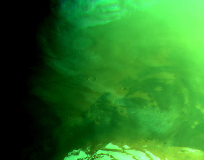
Arc-shaped cloud front (cyclone?) from North Pole to Vastitas (see also level 2) (double broom). Map.
| Orbit Number | 25001_0000 |
|---|---|
| Latitude | 71.56 |
| Longitude [E/W] | -8.52999999999997 |
| Longitude [E] | 351.47 |
| Ls | 135.8 |
| Date | 2023-10-20 00:00:00 |
| Local time | 05:19:00 |
| dust storm | |
| cyclone | cyclone |
| frontal cloud |
SP-40 #
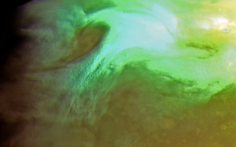
Hammer-shaped textured (dust?) storm at Vastitas. Map.
| Orbit Number | 25006 |
|---|---|
| Latitude | 59.59 |
| Longitude [E/W] | -43.07 |
| Longitude [E] | 316.93 |
| Ls | 136.5 |
| Date | 2023-10-21 00:00:00 |
| Local time | 05:28:00 |
| dust storm | dust storm |
| cyclone | |
| frontal cloud |
SP-41 #
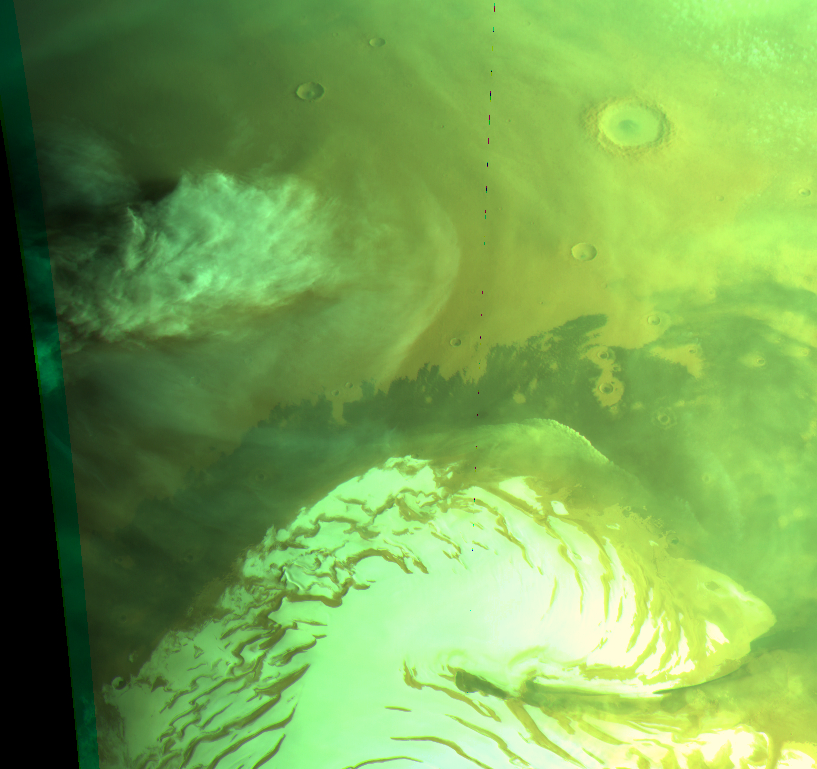
Giant cumulus cloud or unique (dust?) storm event. Map.
| Orbit Number | 25036 |
|---|---|
| Latitude | 68.87 |
| Longitude [E/W] | 22.26 |
| Longitude [E] | 22.26 |
| Ls | 140.8 |
| Date | 2023-10-30 00:00:00 |
| Local time | 19:40:00 |
| dust storm | dust storm |
| cyclone | |
| frontal cloud |
SP-42 #
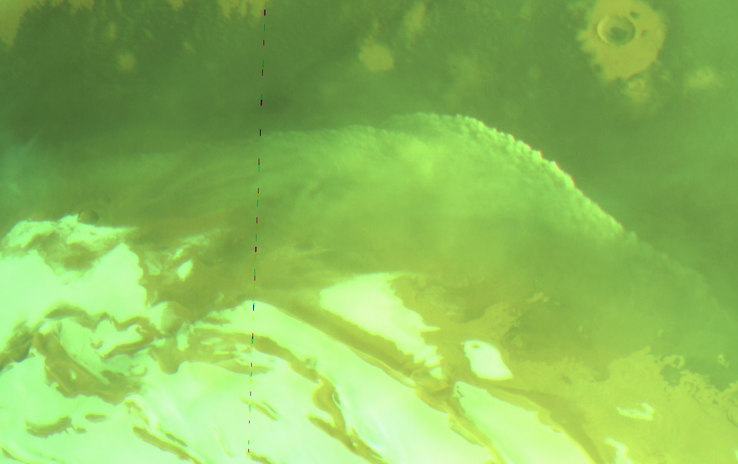
Well developed cumulus cloud front at North Pole. Map.
| Orbit Number | 25036 |
|---|---|
| Latitude | 76.39 |
| Longitude [E/W] | -10.81 |
| Longitude [E] | 349.19 |
| Ls | 140.8 |
| Date | 2023-10-30 00:00:00 |
| Local time | 17:28:00 |
| dust storm | |
| cyclone | |
| frontal cloud | frontal cloud |
SP-43 #
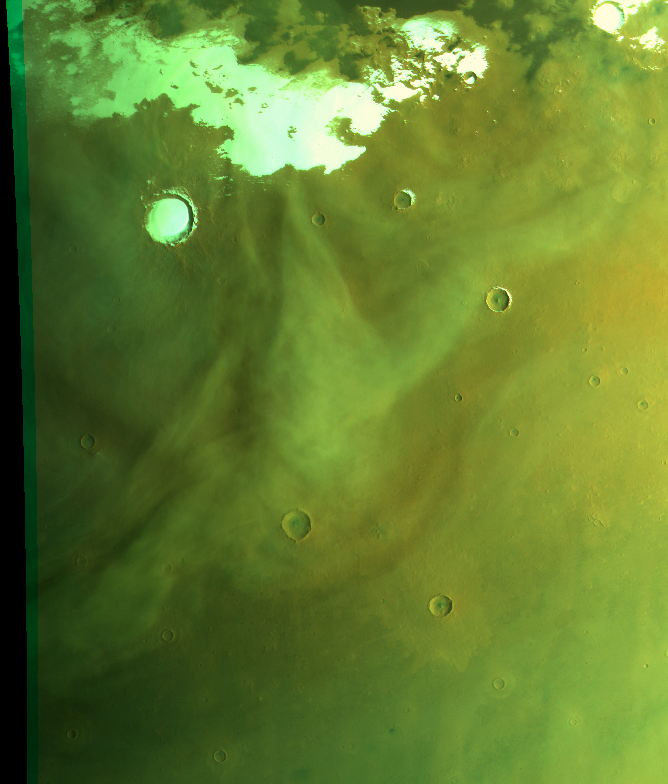
Drop-shaped dust storm at Vastitas. Map.
| Orbit Number | 25036 |
|---|---|
| Latitude | 69.34 |
| Longitude [E/W] | 178.18 |
| Longitude [E] | 178.18 |
| Ls | 140.8 |
| Date | 2023-10-30 00:00:00 |
| Local time | 06:04:00 |
| dust storm | dust storm |
| cyclone | |
| frontal cloud |
SP-44 #
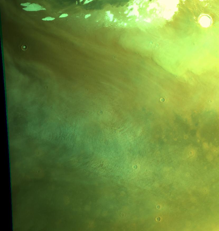
Cyclone with cumulus clouds at Vastitas/Utopia; thick cloud sheet at outer rim towards North Pole. Map.
| Orbit Number | 25040 |
|---|---|
| Latitude | 62.22 |
| Longitude [E/W] | 128.79 |
| Longitude [E] | 128.79 |
| Ls | 141.4 |
| Date | 2023-10-31 00:00:00 |
| Local time | 06:09:00 |
| dust storm | |
| cyclone | cyclone |
| frontal cloud |
SP-45 #
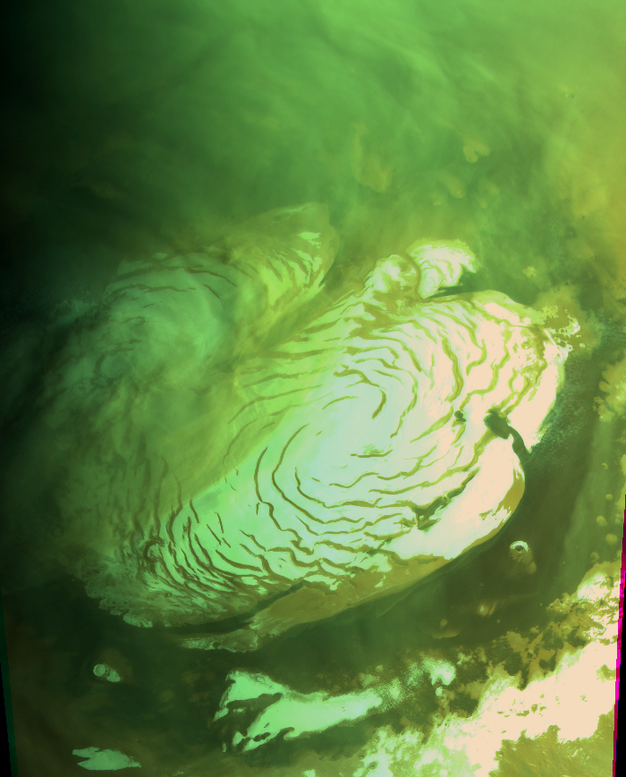
Large dust storm above North Pole (same as in 25036?). Map.
| Orbit Number | 25040 |
|---|---|
| Latitude | 62.22 |
| Longitude [E/W] | 128.79 |
| Longitude [E] | 128.79 |
| Ls | 141.4 |
| Date | 2023-10-31 00:00:00 |
| Local time | 06:09:00 |
| dust storm | dust storm |
| cyclone | |
| frontal cloud |
SP-46 #
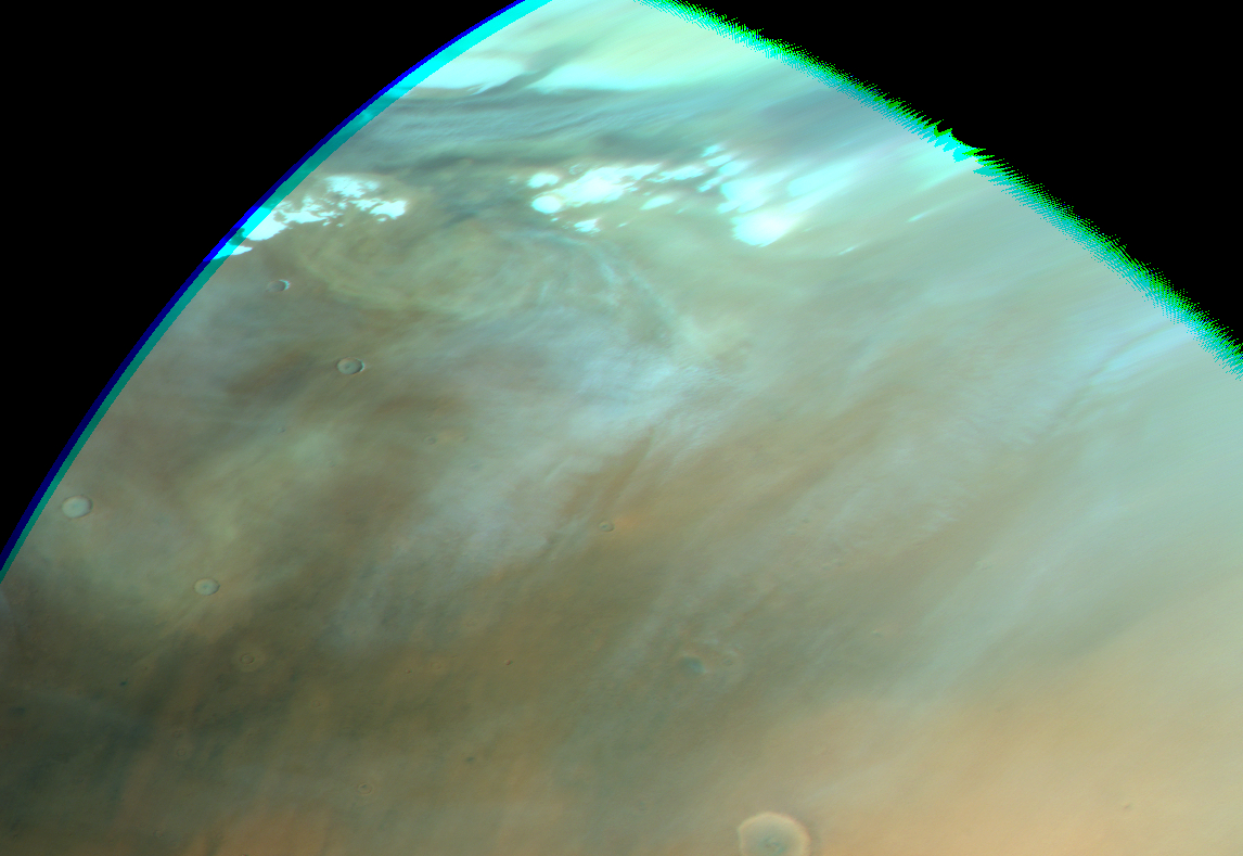
Spiral dust storm (or cyclone?)? at Vastitas. Map.
| Orbit Number | 25043 |
|---|---|
| Latitude | 73.87 |
| Longitude [E/W] | -153.68 |
| Longitude [E] | 206.32 |
| Ls | 141.8 |
| Date | 2023-11-01 00:00:00 |
| Local time | 09:26:00 |
| dust storm | dust storm |
| cyclone | |
| frontal cloud |
SP-47 #
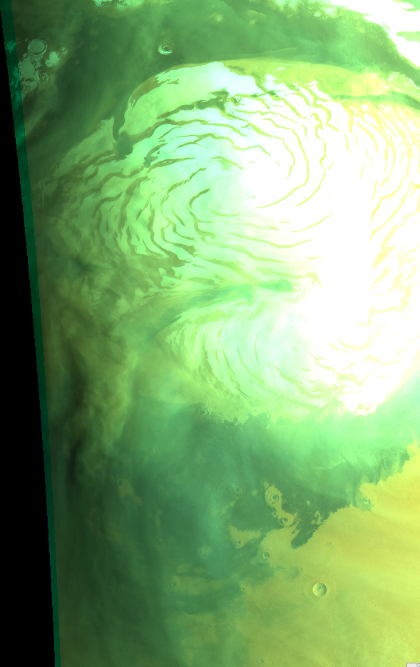
Large dust storm in twilight at North Pole (same as in 25040 and 25036?). Map.
| Orbit Number | 25045 |
|---|---|
| Latitude | 77.6 |
| Longitude [E/W] | -50.64 |
| Longitude [E] | 309.36 |
| Ls | 142.1 |
| Date | 2023-11-02 00:00:00 |
| Local time | 04:00:00 |
| dust storm | dust storm |
| cyclone | |
| frontal cloud |
SP-48 #
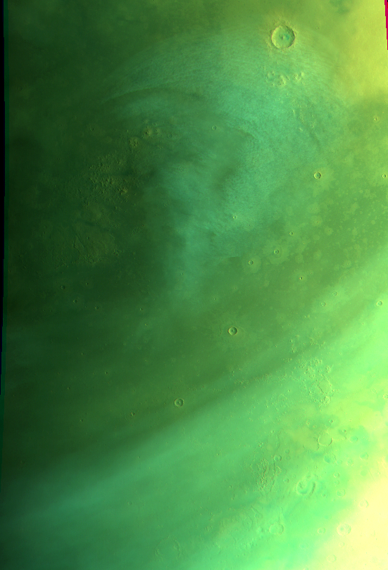
Cyclone at N Acidalia Planitia. Map.
| Orbit Number | 25045 |
|---|---|
| Latitude | 53.04 |
| Longitude [E/W] | -12.08 |
| Longitude [E] | 347.92 |
| Ls | 142.1 |
| Date | 2023-11-02 00:00:00 |
| Local time | 06:32:00 |
| dust storm | |
| cyclone | cyclone |
| frontal cloud |
SP-49 #
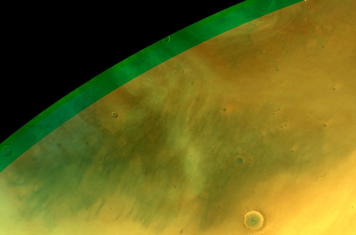
Cyclone at Vastitas Planitia. Map.
| Orbit Number | 25054 |
|---|---|
| Latitude | 68.98 |
| Longitude [E/W] | -156.94 |
| Longitude [E] | 203.06 |
| Ls | 143.4 |
| Date | 2023-11-04 00:00:00 |
| Local time | 09:56:00 |
| dust storm | |
| cyclone | cyclone |
| frontal cloud |
SP-50 #
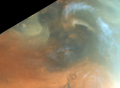
Dust-loaded cyclone and spiral storm at Vastitas. Map.
| Orbit Number | 25057 |
|---|---|
| Latitude | 69.88 |
| Longitude [E/W] | -60.02 |
| Longitude [E] | 299.98 |
| Ls | 143.8 |
| Date | 2023-11-05 00:00:00 |
| Local time | 12:55:00 |
| dust storm | dust storm |
| cyclone | cyclone |
| frontal cloud |
Dust Lifting Events #
DLE-1 #
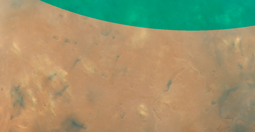
Several small local dust lifting events at Lunae Planum. Map.
| Orbit Number | 24647 |
|---|---|
| Latitude | 6.23 |
| Longitude [E/W] | -55.11 |
| Longitude | 304.89 |
| Ls | 88.3 |
| Date | 2023-07-09 00:00:00 |
| Local time | 10:59:00 |
DLE-2 #
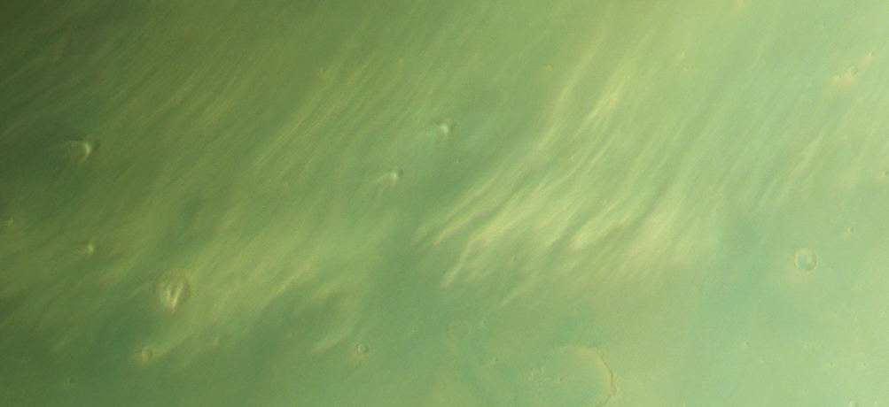
“hair clouds”-like DLE at Acidalia Colles. Map.
| Orbit Number | 23835 |
|---|---|
| Latitude | 50.0 |
| Longitude [E/W] | -20.0 |
| Longitude | 340.0 |
| Ls | 338.5 |
| Date | 2022-11-14 00:00:00 |
| Local time | 08:58:22 |
DLE-3 #
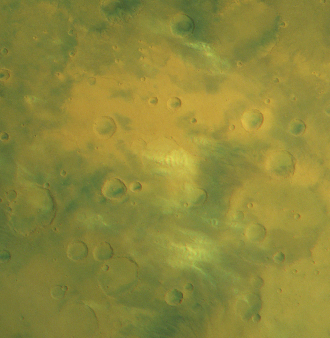
Several local dust lifting events at S Arabia Terra. Map.
| Orbit Number | 22750 |
|---|---|
| Latitude | -16.98 |
| Longitude [E/W] | -1.37 |
| Longitude | 358.63 |
| Ls | 151.8 |
| Date | 2022-01-03 00:00:00 |
| Local time | 09:30:04 |
DLE-4 #
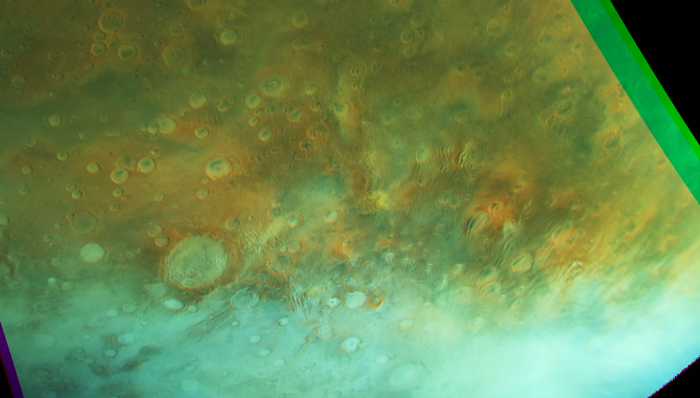
Dust lifting event at Terra Sirenum (small local dust storm?). Map.
| Orbit Number | 22731 |
|---|---|
| Latitude | -43.5 |
| Longitude [E/W] | -105.59 |
| Longitude | 254.41 |
| Ls | 149.0 |
| Date | 2021-12-28 00:00:00 |
| Local time | 17:27:16 |
DLE-5 #
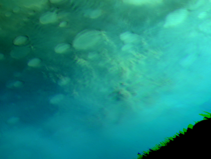
Dust lifting event at S Promethei Terra. Map.
| Orbit Number | 21736 |
|---|---|
| Latitude | -64.66 |
| Longitude [E/W] | 110.6 |
| Longitude | 110.6 |
| Ls | 16.6 |
| Date | 2021-03-14 00:00:00 |
| Local time | 11:50:00 |